• Typhoon Dolphin strengthens near Okinawa, 5 injured as China braces for landfall

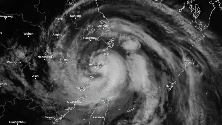
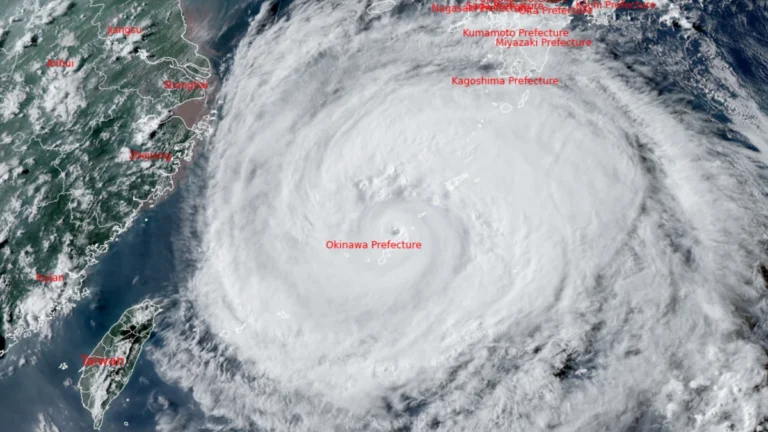
    Typhoon Dolphin re-intensified while passing close to northwestern Okinawa on August 7, 2026, leaving at least five people injured, five homes partially damaged and 16 920 households without power. China’s National Meteorological Center (NMC) said the typhoon could strengthen further before making landfall between Zhejiang and northern Fujian from the afternoon of August 9 to the morning of August 10, with eastern Zhejiang potentially receiving more than 600 mm (23.6 inches) of rain through August 10.
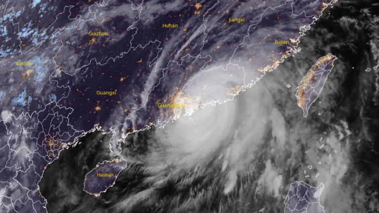
  • Typhoon Noul makes landfall in Guangdong, prompting Level II emergency response across southern China

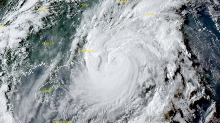
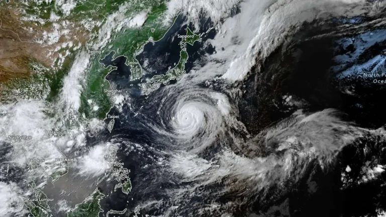
    Typhoon Noul made landfall in Huidong County, Huizhou City, China’s Guangdong Province, at 03:50 HKT (19:50 UTC on July 25) on July 26, 2026, as a severe typhoon with 10-minute maximum sustained winds of 149-165 km/h (93-103 mph). The storm prompted Chinese authorities to raise the national emergency response for major meteorological disasters to Level 2, while more than 700 000 people were relocated across Guangdong. Rail services were suspended, hundreds of flights were canceled, and the central government allocated CNY 100 million (USD 14.8 million) to support post-typhoon recovery and reconstruction.

  • Over 20 000 evacuated as Typhoon Noul approaches Guangdong, up to 600 mm (24 inches) of rain forecast, China

    Typhoon Noul is forecast to make landfall over eastern Guangdong by July 26, 2026, bringing a significant threat of flooding across southern China. More than 20 000 people have been evacuated Guangdon with rainfall totals of 500 to 600 mm (20 to 24 inches) forecast as the storm approaches. Authorities have raised Guangdong’s emergency response for flood and typhoon control to Level III on July 25 as Typhoon Noul approached the province, while activating a Level IV flood emergency response for Jiangxi and Hunan.

  • Severe floods hit eastern and northern China after Typhoon Bavi’s double landfall

    Typhoon Bavi battered eastern China after making two landfalls in Zhejiang Province late Saturday, July 11, 2026. More than 2.68 million people were relocated in Zhejiang alone ahead of landfall, while rainfall exceeded 300 mm (12 inches) in some areas. As the system moved northward, severe flooding submerged roads under more than 2 m (6.6 feet) of water in parts of Hebei, stranded approximately 1 800 people and disrupted railway services in Liaoning, while 46 rivers nationwide exceeded warning levels.

  • Typhoon Bavi makes landfall in Zhejiang, China, after triggering mass evacuations

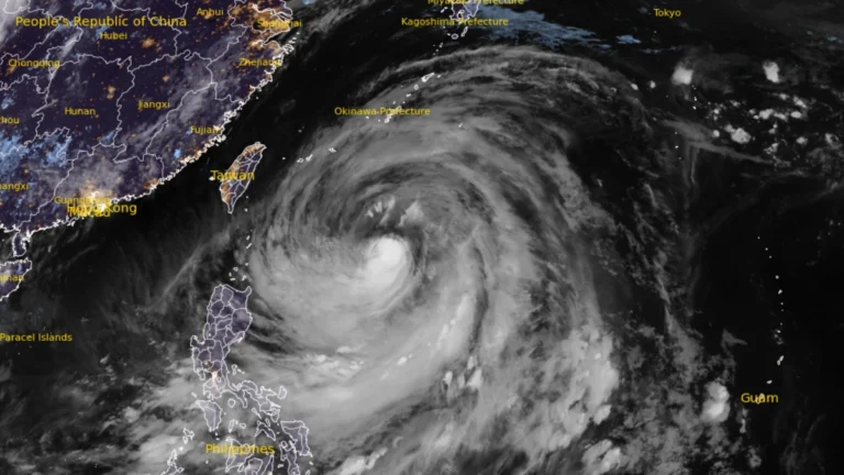
    Typhoon Bavi made landfall in Zhejiang Province, eastern China, at 23:20 local time (LT) on July 11, 2026, with 10-minute maximum sustained winds of 144 km/h (90 mph). The storm prompted the evacuation of more than 1.7 million people across eastern China. Bavi passed north of Taiwan before reaching the mainland and enhanced the southwest monsoon over the Philippines, where flooding and landslides caused fatalities.

  • Typhoon Bavi to bring extreme rain to Taiwan before landfall in eastern China

    Typhoon Bavi continued to weaken gradually on July 9, 2026, while tracking toward northern Taiwan and eastern China. Taiwan’s Central Weather Administration warned of up to 900 mm (35 inches) of rain in northern mountainous areas through Sunday, while Chinese authorities forecast landfall along the Fujian–Zhejiang coast on the evening of July 11.

  • Super Typhoon Bavi weakens slightly as Taiwan, Yaeyama Islands and eastern China brace for impacts

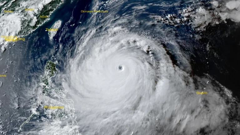
    Super Typhoon Bavi maintained Category 4-equivalent intensity over the Philippine Sea on July 8, 2026, with maximum sustained winds of 250 km/h (155 mph) and higher gusts. The cyclone is forecast to weaken gradually before passing near Taiwan and Japan’s Yaeyama Islands around July 11 and making a possible landfall along the eastern coast of China around July 12.

  • Super Typhoon Bavi strengthens into Category 5 as Guam, Northern Mariana Islands brace for possible catastrophic impacts

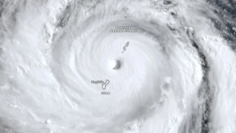
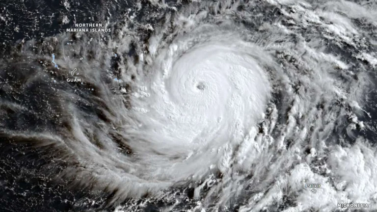
    Super Typhoon Bavi reached Category 5 strength over the western North Pacific on Saturday, July 4, 2026 as it tracked toward the Mariana Islands. Forecasters expect the cyclone to pass very near Rota before moving between Guam and Saipan on Monday morning. Typhoon warnings have been issued for Guam, Rota, Tinian, and Saipan amid forecasts of destructive winds, life-threatening coastal inundation, widespread flash flooding and catastrophic damage early next week.