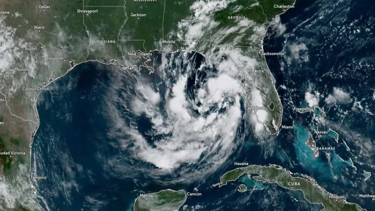
• Tropical Storm and Storm Surge watches expanded from Florida to Louisiana as Gulf depression strengthens

    Tropical Depression Two became better organized over the northeastern Gulf of Mexico on July 20, 2026, prompting the National Hurricane Center (NHC) to expand the Tropical Storm Watch from the Florida Panhandle westward to southeastern Louisiana and issue a Storm Surge Watch for parts of the northern Gulf Coast. The depression had maximum sustained winds of 55 km/h (35 mph) at 15:00 UTC and is expected to become a tropical storm later today, followed by gradual strengthening through Tuesday.
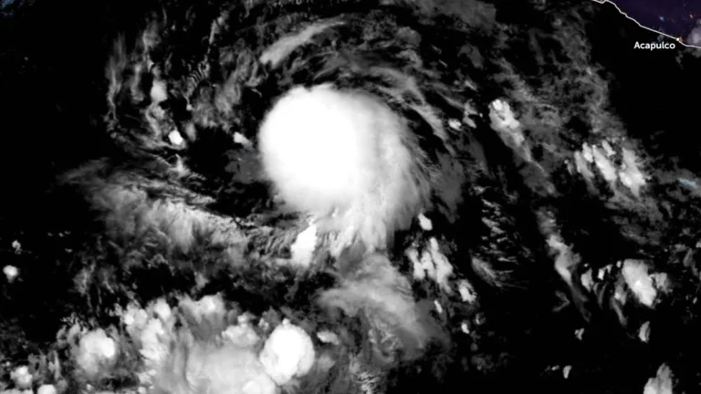
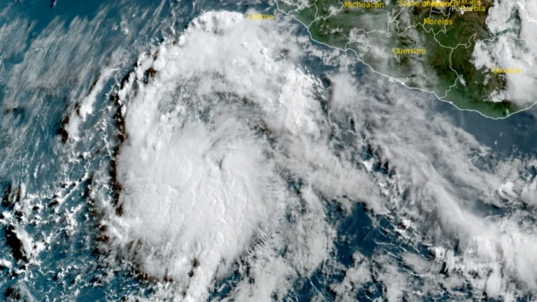
  • Tropical Storm Elida forms off Mexico, forecast to intensify into a hurricane

    Tropical Depression Five-E formed over the eastern Pacific Ocean south of Baja California, Mexico, on July 14, 2026, and intensified into Tropical Storm Elida at 09:00 UTC on July 15. The National Hurricane Center (NHC) said the system is forecast to steadily strengthen over the next several days and become a hurricane by the night of July 16, with peak winds expected to reach 161 km/h (100 mph) by July 17.

  • NHC designates 100% chance of cyclone formation for EP96

    The National Hurricane Center (NHC) assigned a 100% probability of tropical cyclone formation within the next seven days to disturbance EP96 at 05:00 PDT (12:00 UTC) on July 14, 2026, while raising the 48-hour probability to 90%. A low-pressure circulation with an estimated minimum central pressure of 1 007 hPa had already developed by 08:00 PDT (15:00 UTC), and a tropical depression or tropical storm is expected to form later on July 14 as the system moves west-northwest offshore of southwestern Mexico

  • 20 reported dead, 16 missing as Bavi-enhanced monsoon triggers floods and landslides, Philippines

    The combined effects of Typhoon Bavi, locally named Inday, and the enhanced southwest monsoon left 20 people reported dead and 16 missing across the Philippines as of 08:00 LT (00:00 UTC) on Monday, July 13, 2026, while the National Disaster Risk Reduction and Management Council (NDRRMC) continued validating most casualty reports. About 654 000 people were affected nationwide, with flooding, landslides, damaged houses, disrupted roads, bridges and seaports, and about 20 100 people in evacuation centers.

  • Severe floods hit eastern and northern China after Typhoon Bavi’s double landfall

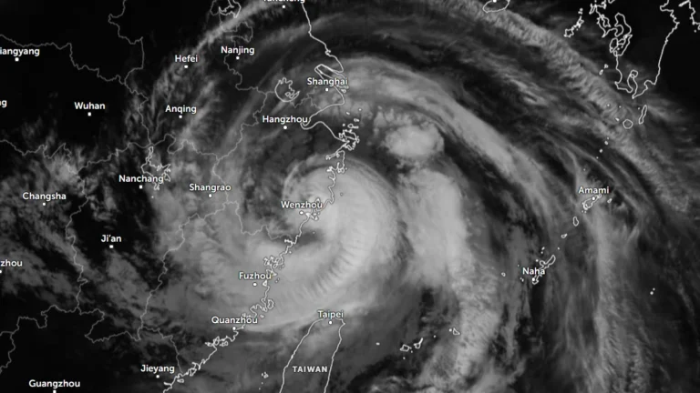
    Typhoon Bavi battered eastern China after making two landfalls in Zhejiang Province late Saturday, July 11, 2026. More than 2.68 million people were relocated in Zhejiang alone ahead of landfall, while rainfall exceeded 300 mm (12 inches) in some areas. As the system moved northward, severe flooding submerged roads under more than 2 m (6.6 feet) of water in parts of Hebei, stranded approximately 1 800 people and disrupted railway services in Liaoning, while 46 rivers nationwide exceeded warning levels.

  • Typhoon Bavi makes landfall in Zhejiang, China, after triggering mass evacuations

    Typhoon Bavi made landfall in Zhejiang Province, eastern China, at 23:20 local time (LT) on July 11, 2026, with 10-minute maximum sustained winds of 144 km/h (90 mph). The storm prompted the evacuation of more than 1.7 million people across eastern China. Bavi passed north of Taiwan before reaching the mainland and enhanced the southwest monsoon over the Philippines, where flooding and landslides caused fatalities.

  • Typhoon Bavi to bring extreme rain to Taiwan before landfall in eastern China

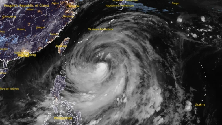
    Typhoon Bavi continued to weaken gradually on July 9, 2026, while tracking toward northern Taiwan and eastern China. Taiwan’s Central Weather Administration warned of up to 900 mm (35 inches) of rain in northern mountainous areas through Sunday, while Chinese authorities forecast landfall along the Fujian–Zhejiang coast on the evening of July 11.

  • Super Typhoon Bavi weakens slightly as Taiwan, Yaeyama Islands and eastern China brace for impacts

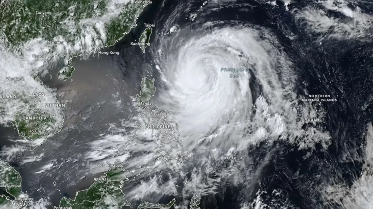
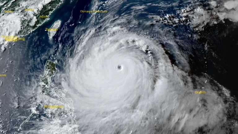
    Super Typhoon Bavi maintained Category 4-equivalent intensity over the Philippine Sea on July 8, 2026, with maximum sustained winds of 250 km/h (155 mph) and higher gusts. The cyclone is forecast to weaken gradually before passing near Taiwan and Japan’s Yaeyama Islands around July 11 and making a possible landfall along the eastern coast of China around July 12.

  • Reservoir breaches and Maysak floods leave 6 dead, 11 missing in Guangxi, China

    Severe flooding caused by Tropical Cyclone Maysak left 2 people dead in Nanning, Guangxi, on July 6, 2026, after extreme rainfall caused Liulan and Yunbiao reservoirs in Hengzhou to overtop and develop breaches. The Nanning flood-control briefing reported about 55 000 people affected and 48 000 evacuated, as of late Monday, July 7.