
Tropical Storm Watch issued for Florida Panhandle as new Gulf system strengthens
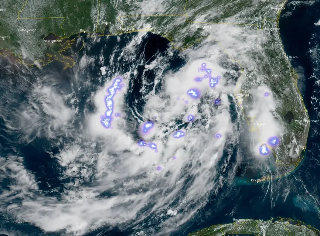
Tropical Depression Two formed over the northeastern Gulf of Mexico by 15:00 UTC on July 19, 2026, prompting the National Hurricane Center (NHC) to issue a Tropical Storm Watch for the Florida Panhandle from the Ochlockonee River to the Florida/Alabama border. Gradual strengthening is forecast, and the depression is expected to become a tropical storm tonight or Monday
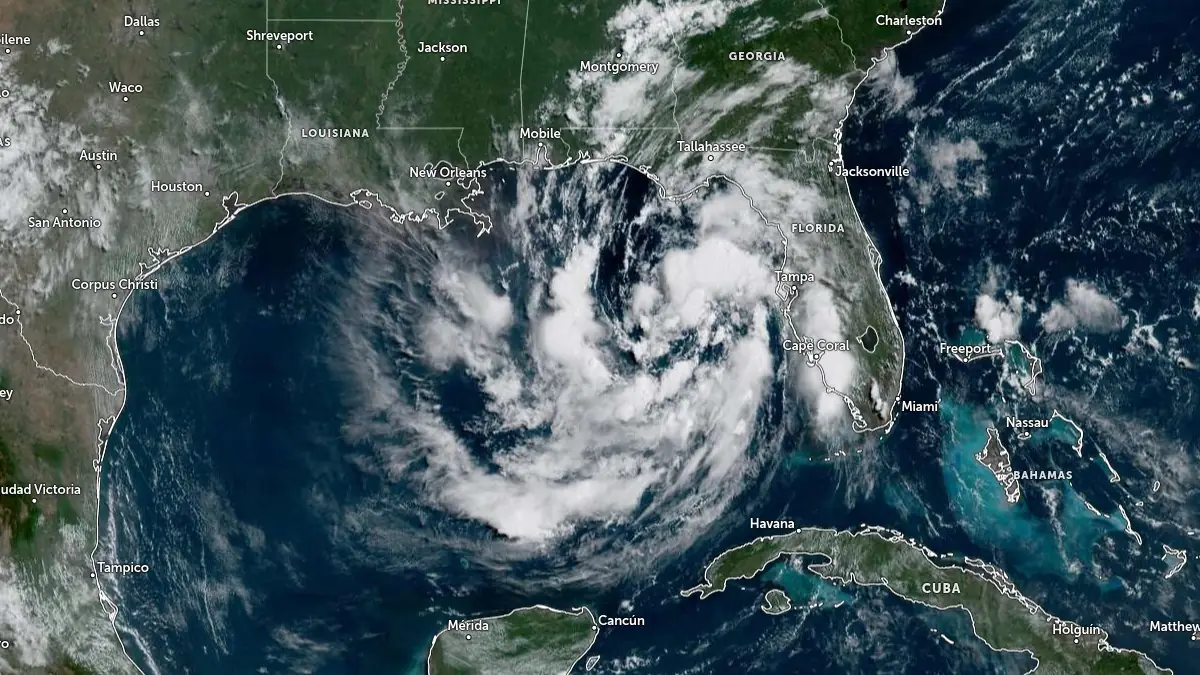
Satellite image of Tropical Depression Two at 15:00 UTC on July 19, 2026. Credit: NOAA/GOES-East, Zoom Earth, The Watchers
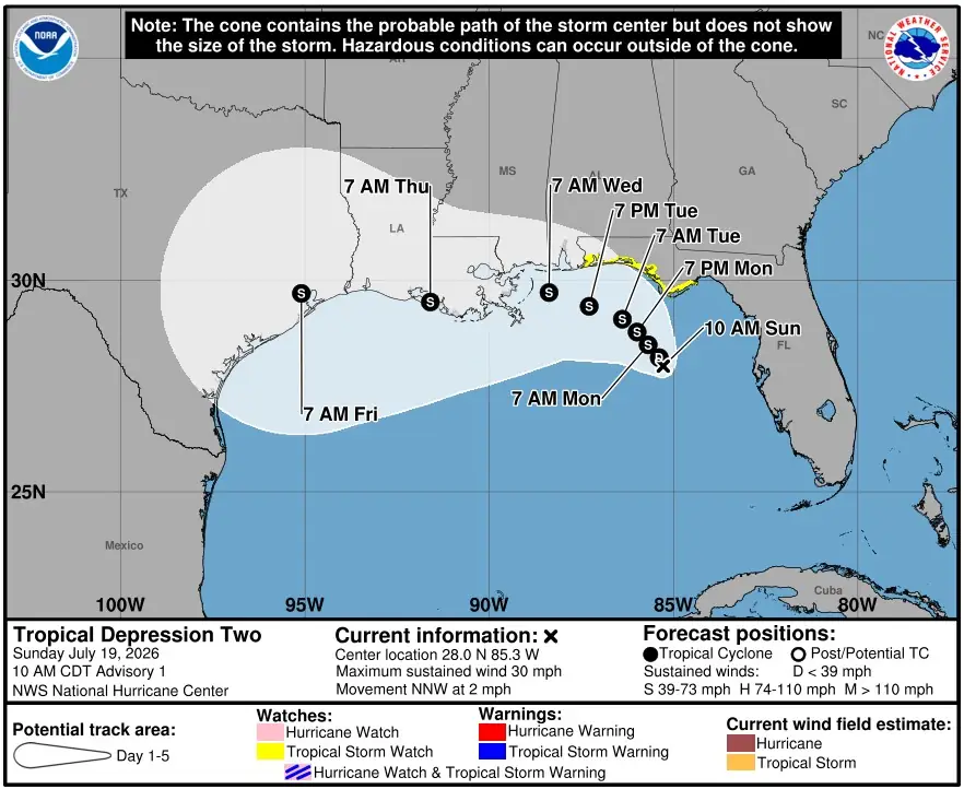
At 15:00 UTC, the center of the depression was located about 250 km (155 miles) south of Panama City, Florida. Maximum sustained winds were 45 km/h (30 mph), and the system was moving north-northwest at 4 km/h (2 mph). The estimated minimum central pressure was 1 011 mb.
NHC said tropical storm conditions are possible within the watch area by late Monday, July 20. A Tropical Storm Watch means tropical storm conditions are possible within the watch area, in this case, in the next 36 to 48 hours.
The depression is forecast to move slowly northwestward or north-northwestward during the next day or two, followed by a turn toward the west. On the forecast track, the system is expected to move near or along the northern Gulf Coast during the next several days.
Gradual strengthening is forecast, and the depression is expected to become a tropical storm tonight or Monday. The NHC forecast advisory initialized the system at 45 km/h (30 mph) and brings it to 95 km/h (60 mph) by 72–96 hours, before weakening inland by 120 hours.
The system developed a well-defined low-level circulation after being monitored as Invest 91L. NHC described convection as patchy because of dry air from the northeast, but persistent enough near the center and in bands northeast and southwest of the center to classify the system as a tropical depression.
The storm surge forecast calls for 0.3 to 0.9 m (1 to 3 feet) of inundation above ground level from Indian Pass, Florida, to Chassahowitzka, Florida, if peak surge occurs at high tide. The deepest water will occur along the immediate coast.
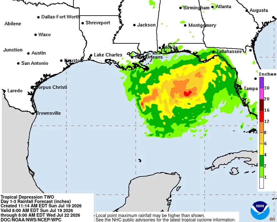
Rainfall totals of 50 to 100 mm (2 to 4 inches), with locally higher amounts near 200 mm (8 inches), are forecast through Thursday, July 23, along the eastern and central Gulf Coast from western Florida to southern Alabama, Mississippi, and Louisiana. This rainfall may produce flash flooding, especially in urban areas.
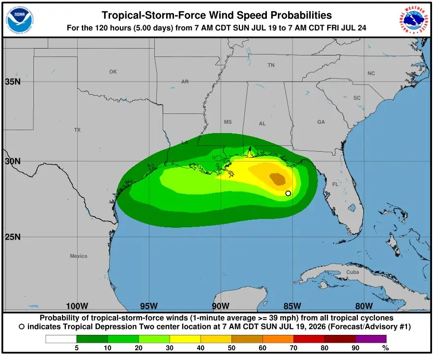
Additional watches will likely be required over the next day or two. NHC advised residents in the affected region to monitor products from local National Weather Service forecast offices for storm information specific to their area, including possible inland watches and warnings.
Forecast confidence remains limited by weak steering currents and possible land interaction.
The depression is embedded between ridging over the western Atlantic, ridging over the south-central and southwestern United States, and a trough over the northeastern United States, leaving the system in a slow-motion pattern near the northern Gulf Coast.
References:
1 Tropical Depression Two Advisory Number 1 – NWS/NHC – 15:00 UTC on July 19, 2026

I'm a dedicated researcher, journalist, and editor at The Watchers. With over 20 years of experience in the media industry, I specialize in hard science news, focusing on extreme weather, seismic and volcanic activity, space weather, and astronomy, including near-Earth objects and planetary defense strategies. You can reach me at teo /at/ watchers.news.

Commenting rules and guidelines
We value the thoughts and opinions of our readers and welcome healthy discussions on our website. In order to maintain a respectful and positive community, we ask that all commenters follow these rules.