
Coastal flooding forecast at Hooper Bay as Bering Sea storms continue, Alaska
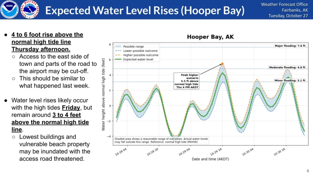
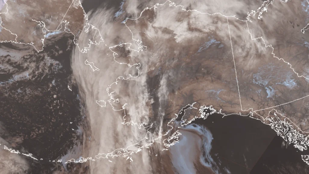
A Bering Sea storm associated with the remnants of Typhoon Champi is forecast to raise water levels at Hooper Bay, Alaska, by 0.6–1.2 m (2–4 feet) above normal high tide from October 29 into early October 31, 2026. A Coastal Flood Advisory is in effect, while state officials reported that power had been mostly restored in Kivalina after an earlier storm damaged a powerline and prompted residents to shelter at a school.
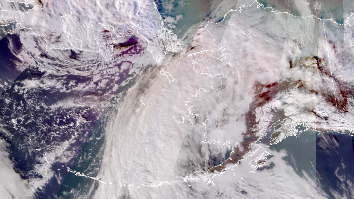
Satellite image of Alaska at 07:28 UTC on October 28, 2026. Credit: JPSS/SNPP/N20, RAMMB/CIRA, The Watchers
NWS Fairbanks issued the Hooper Bay advisory at 03:47 AKDT (11:47 UTC) on October 28. It covers 07:00 AKDT (15:00 UTC) on October 29 through 01:00 AKDT (09:00 UTC) on October 31.
Elevated water levels during high tides through October 29 and 30 could threaten beachside properties, the lowest buildings, and the community access road, with repeated high tides also causing localized beach erosion. Elsewhere along the Yukon Delta coast, the advisory forecasts water levels 0.3–0.9 m (1–3 feet) above normal high tide.
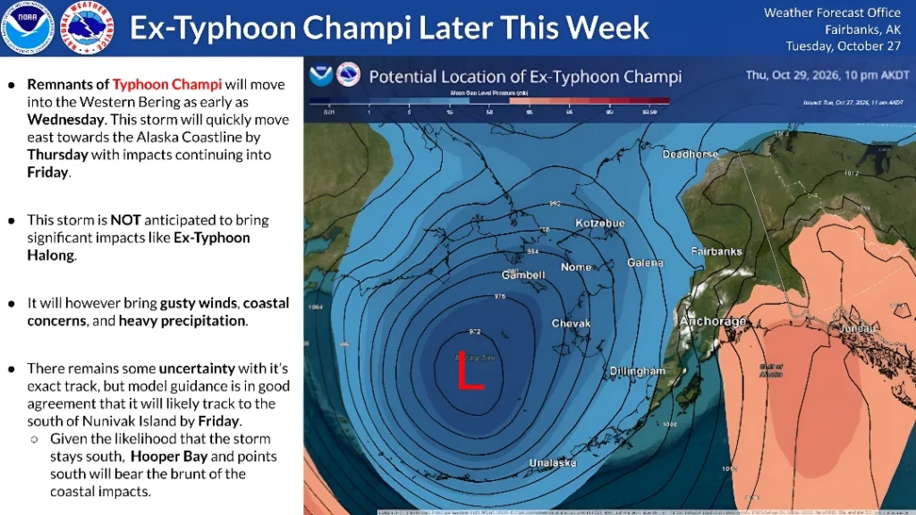
The next storm is associated with the remnants of Typhoon Champi. In its forecast discussion issued at 06:29 AKDT (14:29 UTC) on October 28, NWS Fairbanks said a southward shift in the expected track toward Bristol Bay had reduced the coastal threat compared with earlier forecasts. Minor flooding remained a threat at Hooper Bay, while the more southerly track was forecast to limit water-level rises elsewhere along the coast.
In Kivalina, Alaska’s Division of Homeland Security and Emergency Management reported on October 27 that electricity had been restored. About 25 people sheltered at the school overnight on October 26. Supplies and an on-site medical provider were available; no additional shelter support had been requested. Officials expected the shelter to remain open for several more days.
The outage followed wind damage at approximately 18:00 AKDT on October 23 (02:00 UTC on October 24). An NWS preliminary local storm report, issued October 24, relayed a local official’s account of gusts around 95 km/h (60 mph) damaging a power line and interrupting service to a large part of Kivalina.
The same report said about 175 people stayed at the new school on October 23. Medical supplies were being prepared in case injured residents needed transport to Kotzebue.
Farther south, NWS Anchorage’s October 28 High Surf Advisory covered the Kuskokwim Delta coast and Nunivak Island through 10:00 AKDT (18:00 UTC), with water levels 0.3–0.6 m (1–2 feet) above the normal highest tide line.
The agency identified nuisance flooding and possible erosion around communities including Kipnuk, Kwigillingok and Kongiganak. A separate Wind Advisory ran through the same time, forecasting southeasterly winds of 50–65 km/h (30–40 mph), gusting to 90 km/h (55 mph).
Another rise in coastal water levels is possible later in the week. NWS Anchorage’s 04:50 AKDT (12:50 UTC) forecast discussion on October 28 said persistent southerly to southwesterly winds could raise water levels around Kipnuk and Kwigillingok by 0.3–0.9 m (1–3 feet) above the normal highest tide line on October 29 and 30.
The October 27 state report placed the State Emergency Operations Center at Level 2 of 4, Enhanced Watch, with that status expected to continue throughout the week. Officials said successive storms left limited time for coastal water levels to recede.
Earlier, Typhoon Champi brought strong winds, heavy rain, and high waves from October 22 to 24, claiming one life and leaving hundreds injured in Taiwan.
References:
1 Coastal Flood Advisory – NOAA/NWS – October 28, 2026
2 Northern Alaska Forecast Discussion – NOAA/NWS Fairbanks – October 28, 2026
3 Coastal Hazard Message and Wind Advisory – NWS Anchorage – October 28, 2026

Rishav Kothari is Editor-in-Chief of The Watchers, where he runs the newsroom and covers earthquakes, volcanoes, severe weather and space weather.
Published in the last 24 hours
- CPC posts a slight risk of heavy rain from the Gulf Coast to the Northeast urban corridor November 25-29, and a moderate risk of West Coast wind and Sierra snow on November 25
- Florida's east coast faces a moderate flash flood risk Wednesday through Friday, with 4 to 8 inches of rain forecast and the St. Johns River near Cocoa already in major flood at 17.13 feet
- Cyclone Akvan to make landfall between Nellore and Visakhapatnam around noon on November 20, IMD forecasts 120-130 km/h winds gusting to 145
- Radio pulses every 7.9 minutes reveal binary with white dwarf and Sun-like star Epicenter
