
New Mexico’s Navajo Reservoir rose nearly 60 feet in seven weeks this fall, after a winter with almost no snow, as storms flooded the San Juan River
Navajo Reservoir in northern New Mexico and southern Colorado rose nearly 18 m (60 feet) between September 20 and November 7, 2026, after a winter snow drought produced relatively little spring growth. Successive autumn storms flooded the San Juan River basin and pushed October inflow to more than 10 times its monthly average, while reduced releases from Navajo Dam also contributed to the rapid storage increase.
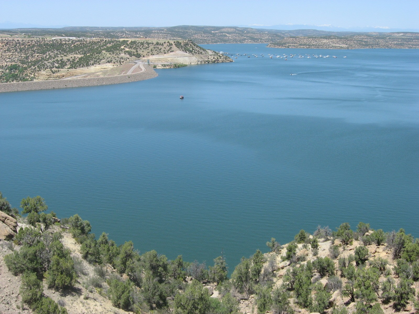
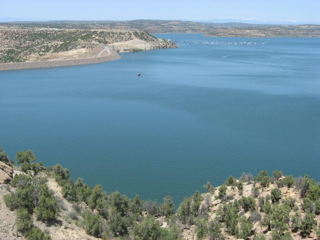
NavajoLake. Credit: Timthefinn at English Wikipedia (public domain), via Wikimedia Commons.
Landsat 9 images acquired on September 20 and November 7 show water spreading far into the branching arms of Navajo Reservoir during the seven-week rise. NASA Earth Observatory, citing U.S. Army Corps of Engineers data, reported that the lake gained nearly 18 m (60 feet) over that interval.
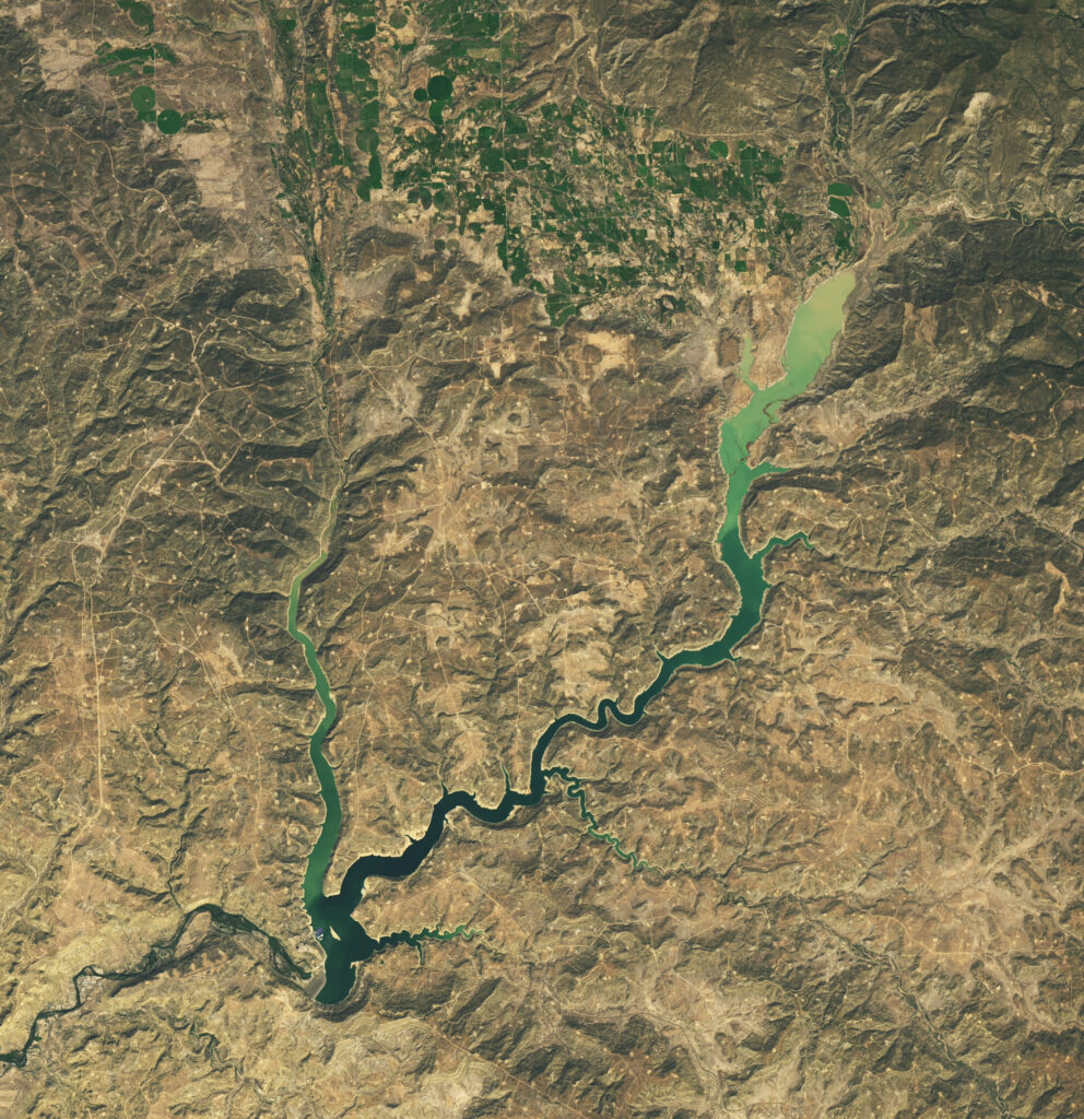
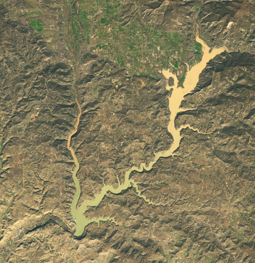
By November 7, the reservoir stood at its highest level since August 2019 and held 108% of its average capacity for that date, compared with 60% of average on September 20. The rapid rise followed the 2025–26 Western snow drought, which had produced relatively little reservoir growth during spring, when mountain snowmelt normally raises water levels.
The Bureau of Reclamation recorded the same rapid refill over a different measurement window. Reservoir elevation increased from 1 835.49 m (6 021.95 feet) on October 21 to 1 850.49 m (6 071.16 feet) on November 12, a gain of nearly 14.9 m (49 feet). NASA’s nearly 18 m figure and Reclamation’s nearly 14.9 m figure describe different periods and should not be treated as measurements of the same interval.
October’s preliminary modified unregulated inflow reached about 515.6 million m3 (418 000 acre-feet), or 1 088% of the monthly average, according to Reclamation. Navajo Reservoir recorded a net October storage increase of about 408.3 million m3 (331 000 acre-feet).
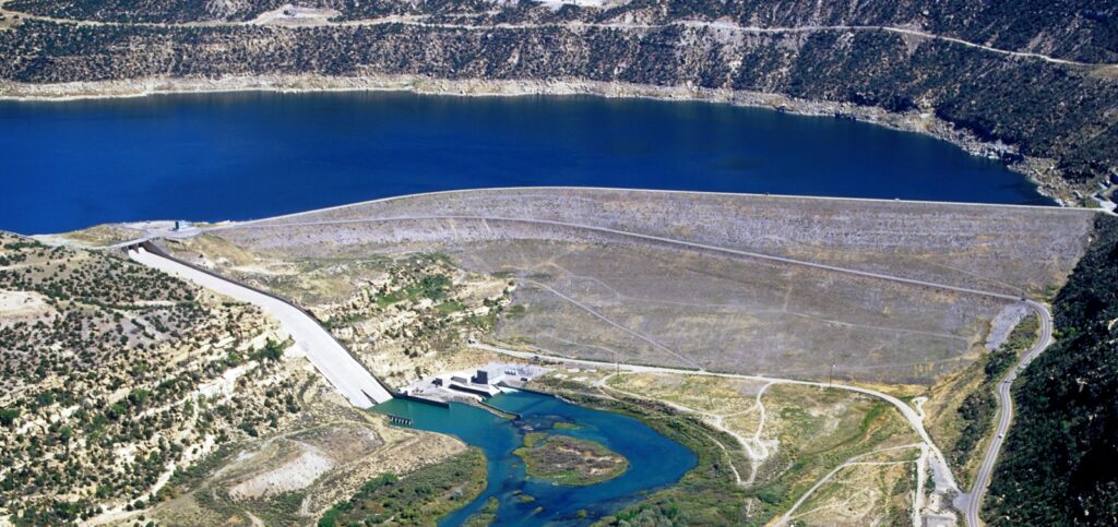
As of November 12, the reservoir’s live storage stood at about 1.78 billion m3 (1.44 million acre-feet), equivalent to 87% of live-storage capacity. Active storage was about 1.01 billion m3 (816 000 acre-feet), or 80% of active-storage capacity.
Reservoir inflow on November 12 averaged about 84.95 m3/s (3 000 cfs), while the daily average release from Navajo Dam was about 7.65 m3/s (270 cfs). Reclamation said inflow remained high but was slowly decreasing.
Reservoir operations were also part of the storage increase. NASA notes that Reclamation reduced releases from Navajo Dam on September 16 and 17, before the Landsat comparison began. Reclamation later kept releases below the San Juan River Recovery Implementation Program’s recommended downstream baseflow range of about 14.2 to 28.3 m3/s (500 to 1 000 cfs) because river-channel capacity remained low.
The water arrived after successive rounds of heavy autumn rainfall across the Four Corners and San Juan basin. Pagosa Springs, Colorado, about 64 km (40 miles) northeast of Navajo Reservoir along the San Juan River, received about 128 mm (5.05 inches) during the first major round. The river reached major flood stage there on October 23 before rising sharply again after another period of heavy rain on November 1.
The November rise at Pagosa Springs approached the historic level associated with the 1911 flood but did not establish a new 1911 benchmark. NASA described the crest as nearly reaching the historical record.
Farther downstream, the same regional storm sequence produced severe flooding in northwestern New Mexico along the San Juan and Animas rivers. State officials reported hundreds of water rescues between Farmington and Bloomfield after storms beginning October 22 pushed rivers to historic levels.
The San Juan River at Farmington crested at about 4.4 m (14.5 feet), above the 3.7 m (12-foot) major-flood threshold. Evacuated neighborhoods remained closed as crews checked homes and infrastructure for structural damage, contaminated water, downed power lines and possible gas leaks.
The federal government approved an emergency declaration on October 26 covering San Juan, Rio Arriba, Cibola and Sandoval counties as well as Acoma Pueblo, the Jicarilla Apache Nation, San Ildefonso Pueblo, Zia Pueblo and Laguna Pueblo. The declaration authorized direct federal assistance for the flood response.
The hydrologic reversal extended across the Four Corners. NASA reported that precipitation from early September through early November reached two to four times average across the region, which had already been affected by long-term drought, the 2025–26 snow drought and high temperatures earlier in the year.
The autumn rainfall brought substantial short-term drought relief without eliminating the longer-term deficit. NASA, citing the U.S. Drought Monitor’s November 3 assessment, reported that short-term drought had ended across the Southwest and Great Basin while long-term drought persisted in parts of the region.
NASA placed the wet autumn within the broader atmospheric setting of El Niño. The low-pressure system responsible for the heavy rainfall tracked unusually far south for the time of year and drew energy from unusually warm ocean temperatures. El Niño can favor moisture-bearing storms reaching the interior Southwest, but the climate pattern should not be treated as the sole cause of Navajo Reservoir’s rise.
Reclamation’s November outlook kept reservoir inflow well above normal beyond the main flood period. Its most probable modified unregulated inflow forecast called for about 419.4 million m3 (340 000 acre-feet) in November, or 1 275% of average.
The corresponding forecast was about 86.3 million m3 (70 000 acre-feet), or 338% of average, for December and about 61.7 million m3 (50 000 acre-feet), or 249% of average, for January. Those values are forecasts rather than observed future totals.
Actual reservoir levels will depend on subsequent precipitation, inflow and operating decisions. Reclamation considers river-channel capacity, flood control, water rights, endangered-species requirements, hydropower, recreation, fish and wildlife management and reservoir conditions when developing Navajo Reservoir operating plans.
References:
1 Water Surges Into Navajo Reservoir – NASA Earth Observatory – November 11, 2026
2 Navajo Reservoir Current Status – U.S. Bureau of Reclamation – accessed November 17, 2026
3 Flooding Resources – Office of the Governor of New Mexico – updated October 27, 2026

I’m a science journalist and researcher at The Watchers, contributing to the Epicenter edition, where I cover peer-reviewed scientific research and emerging discoveries across Earth and space sciences. With a background in astronomy and a passion for environmental science, I’ve worked in shark and coral conservation in Fiji, conducting reef and shark-behavior research, contributing to mangrove restoration, and earning PADI Open Water and Coral Reef Certifications. I bring a blend of scientific rigor and storytelling to illuminate the discoveries shaping our planet and beyond.
Published in the last 24 hours
- A Kansas farmer looked straight up into a tornado in 1928 and saw a hollow tube at least half a mile tall, its walls lit by constant flashes of lightning Epicenter
- Malawi continues Bris AI weather forecasting tests ahead of operational integration Epicenter
- The storms drenching California this week are fed by a river in the sky, a band of water vapor that can carry up to 15 times the flow of the Mississippi River, and this winter’s near-record El Niño could keep aiming more of them at the West Coast
- Right about now, Voyager 1 is crossing a line no human-made object has ever reached, a full light-day from Earth, which means a message NASA sends tonight won't arrive until tomorrow night, and the spacecraft's answer won't make it home until the night after that
