
A Kansas farmer looked straight up into a tornado in 1928 and saw a hollow tube at least half a mile tall, its walls lit by constant flashes of lightning
On June 22, 1928, Kansas farmer Will Keller reported looking straight up into a tornado as one of three funnels passed over his storm cellar near Greensburg. He described a hollow, lightning-lit opening about 15–30 m (50–100 feet) across and at least 0.8 km (0.5 miles) high, while making clear that the dimensions were visual estimates made under extraordinary conditions. Weather Bureau meteorologist Alonzo A. Justice preserved the account in Monthly Weather Review in 1930.
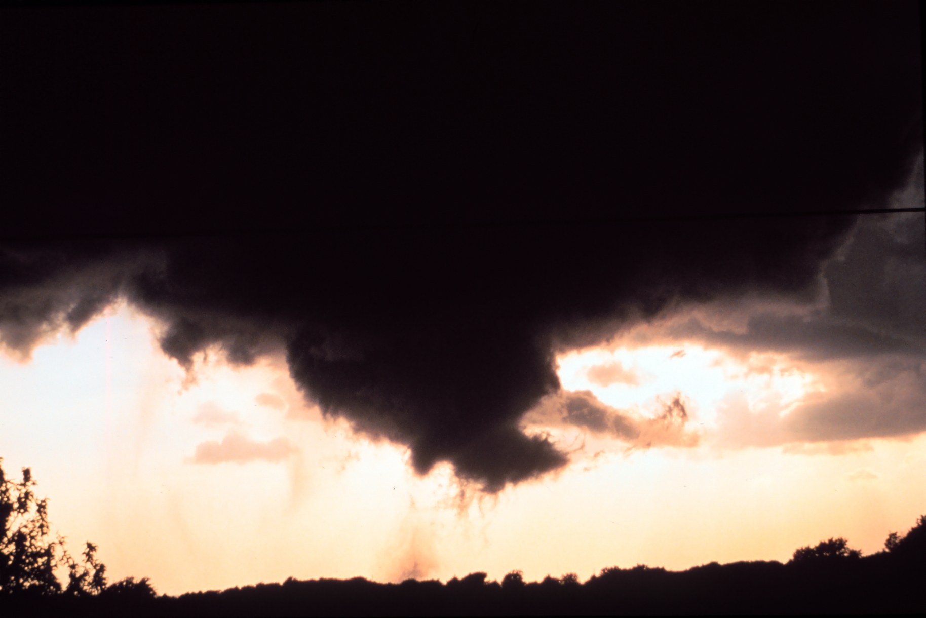
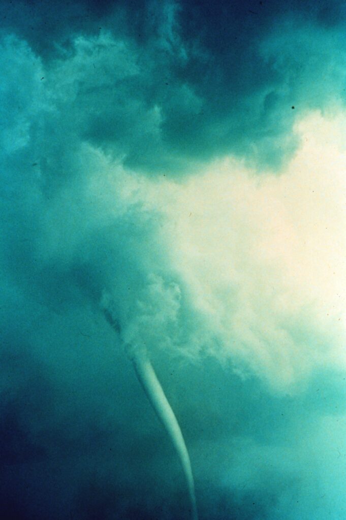
A backlit funnel cloud and tornado during Project VORTEX-99 about 19 km (12 miles) southwest of Minco, Oklahoma, on May 3, 1999. The photograph is illustrative and does not show Keller's 1928 tornado. Credit: OAR/ERL/National Severe Storms Laboratory (NSSL), NOAA. Public domain.
Justice published Keller’s account as “Seeing the Inside of a Tornado” in the May 1930 issue of Monthly Weather Review. Justice worked at the Weather Bureau office in Dodge City, Kansas, and the two-page article placed Keller’s description in the agency’s scientific record nearly two years after the observation.
The dimensions require particular care because Keller did not make an instrumental measurement. He estimated the circular opening at about 15–30 m (50–100 feet) in diameter and said it extended upward at least 0.8 km (0.5 miles). The larger figure therefore described the estimated vertical extent of the opening, not the width of the tornado, and Keller qualified the dimensions as his best judgment under the circumstances.
Keller’s observation began after hail damaged his wheat crop. He and his family were outside examining the field when he noticed an umbrella-shaped cloud to the west and southwest. Three tornado funnels subsequently became visible beneath the dark cloud base, and the family moved into a storm cellar.
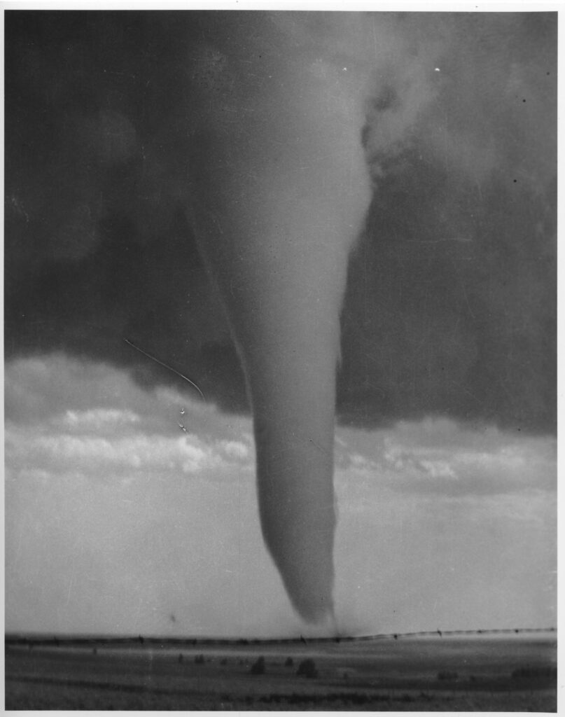
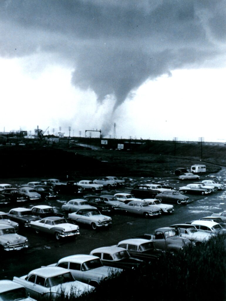
A photograph from Hardtner, Kansas, taken the following year illustrates the kind of visual record available during the same period. Photography could preserve the exterior shape of a tornado, but Keller’s account concerned something much harder to document: what an observer believed he could see while a funnel passed directly overhead.
One of the 1928 funnels approached Keller’s position while its lower end was raised from the ground. He remained at the cellar doorway as it passed overhead. Keller reported an abrupt stillness beneath the funnel, a strong gassy odor, difficulty breathing and a screaming or hissing sound associated with the lower part of the vortex.
Looking upward, Keller described a circular opening surrounded by rapidly rotating cloud. He said the opening was hollow except for an indistinct feature moving within it and that repeated flashes of lightning zigzagged across the opening, illuminating the cloud walls strongly enough for him to see upward.
Keller also described small rotating funnels forming and breaking away around the lower rim of the larger circulation. He reported that the main circulation turned counterclockwise while the smaller features appeared to rotate in both directions. The observation is notable because modern tornadoes are known to develop multiple smaller structures, called subvortices, within a larger parent circulation, although Keller’s unaided observation cannot establish that the features he saw were identical to what meteorologists now classify as subvortices.
Modern tornado science also places an important limit on descriptions of a hollow interior. NOAA’s National Severe Storms Laboratory states that a tornado does not have an “eye” comparable with the eye of a hurricane. Tornado circulation can contain complex internal structures and areas of downward motion, but direct observations inside a tornado remain difficult because instruments placed in the strongest part of the circulation often do not survive.
That observational difficulty continued long after Keller’s report. On May 24, 1973, a tornado near Union City, Oklahoma, became the first tornado captured by National Severe Storms Laboratory Doppler radar and NSSL chase personnel. Doppler radar allowed researchers to examine tornado-related winds remotely, providing measurements that were impossible for an observer standing at a cellar doorway in 1928.
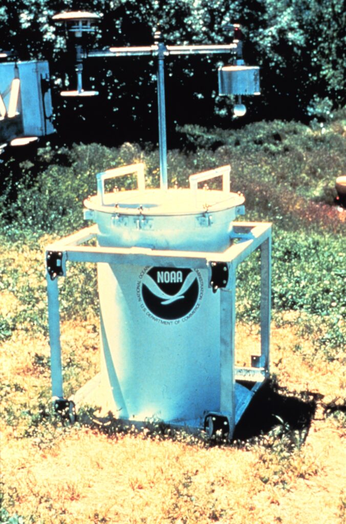
Researchers also tried to obtain measurements much closer to the circulation. During the early 1980s, NSSL and University of Oklahoma scientists used the TOtable Tornado Observatory (TOTO), a portable instrument package intended to measure temperature, pressure and relative humidity near or inside a tornado. NSSL says crews tried for several years to place TOTO in the path of approaching tornadoes but achieved only limited success, illustrating the practical difficulty of making measurements where the strongest winds occur.
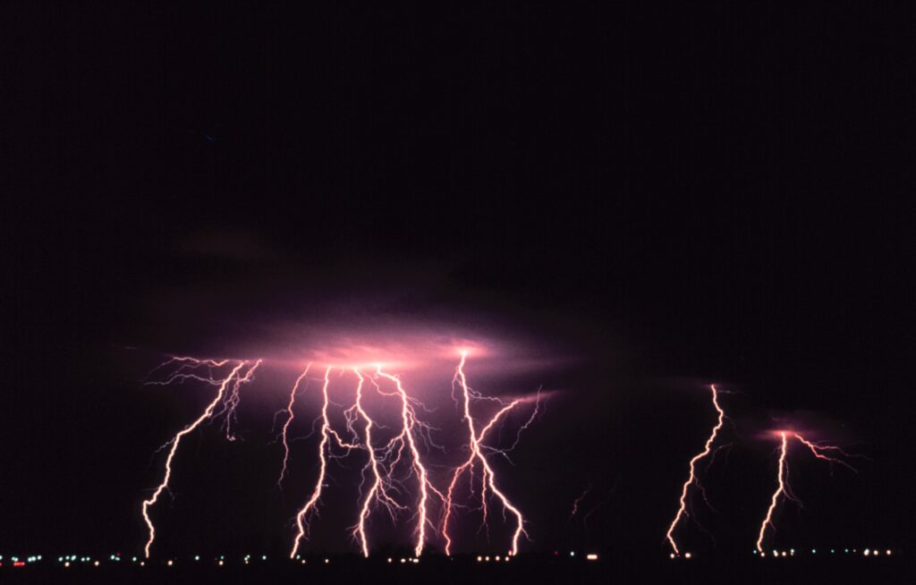
Keller’s description of constant lightning later became part of a separate scientific discussion about tornado electricity. Bernard Vonnegut cited Justice’s 1930 paper in his 1960 Journal of Geophysical Research article “Electrical theory of tornadoes.” Vonnegut proposed that an intense thunderstorm might contain enough electrical energy to power a tornado and that electrification might produce strong winds through electrical heating or acceleration of charged air.
Vonnegut’s proposal was a hypothesis, not confirmation of Keller’s interpretation. Current NOAA/NSSL guidance states that tornadoes are understood to form and persist through thermodynamic and fluid-dynamical processes and that researchers have not found evidence supporting electricity or magnetism as the mechanism that sustains a tornado. Lightning can occur in tornadic thunderstorms without supplying the energy that maintains the vortex.

The distinction leaves Keller’s account valuable without turning it into a measurement it was never capable of being. The record establishes that a farmer near Greensburg described looking upward into a tornado on June 22, 1928, reported a hollow-looking opening illuminated by repeated lightning and supplied approximate dimensions that Justice considered worth preserving in the Weather Bureau’s journal.
What the account cannot establish is the exact three-dimensional structure Keller saw, whether the illuminated opening persisted through the vortex or whether similar structures occur in other tornadoes. Modern radar, mobile observing systems and field instruments have transformed tornado research, but NOAA still describes direct measurements of a tornado’s internal properties as difficult. Keller’s report therefore remains most useful as a carefully documented historical observation at the boundary between eyewitness meteorology and measurements that would only become possible decades later.
References:
1 Justice, A. A. (1930). Seeing the inside of a tornado. Monthly Weather Review, 58(5), 205–206. DOI: 10.1175/1520-0493(1930)58<205:STIOAT>2.0.CO;2
2 Vonnegut, B. (1960). Electrical theory of tornadoes. Journal of Geophysical Research, 65(1), 203–212. DOI: 10.1029/JZ065i001p00203
3 Severe Weather 101: Tornado FAQ – NOAA National Severe Storms Laboratory – accessed November 17, 2026

I’m a science journalist and researcher at The Watchers, contributing to the Epicenter edition, where I cover peer-reviewed scientific research and emerging discoveries across Earth and space sciences. With a background in astronomy and a passion for environmental science, I’ve worked in shark and coral conservation in Fiji, conducting reef and shark-behavior research, contributing to mangrove restoration, and earning PADI Open Water and Coral Reef Certifications. I bring a blend of scientific rigor and storytelling to illuminate the discoveries shaping our planet and beyond.
Published in the last 24 hours
- New Mexico’s Navajo Reservoir rose nearly 60 feet in seven weeks this fall, after a winter with almost no snow, as storms flooded the San Juan River Epicenter
- Malawi continues Bris AI weather forecasting tests ahead of operational integration Epicenter
- The storms drenching California this week are fed by a river in the sky, a band of water vapor that can carry up to 15 times the flow of the Mississippi River, and this winter’s near-record El Niño could keep aiming more of them at the West Coast
- Right about now, Voyager 1 is crossing a line no human-made object has ever reached, a full light-day from Earth, which means a message NASA sends tonight won't arrive until tomorrow night, and the spacecraft's answer won't make it home until the night after that
