
Kīlauea’s north vent threw lava about 660 feet (200 m) high for six hours on 5 November 2026; the summit is now reinflating, with the next episode forecast for 16 to 21 November.
The summit of Kīlauea is reinflating after episode 56 produced nearly six hours of lava fountaining from the north vent on November 5, 2026, and the U.S. Geological Survey Hawaiian Volcano Observatory (HVO) now places the forecast window for episode 57 between November 17 and 22. Episode 56 sent lava about 200 m (660 feet) above the vent and an eruption plume to 5.5 km (18 000 feet) above sea level, while all lava flows from the current eruption remain confined to Halemaʻumaʻu crater.
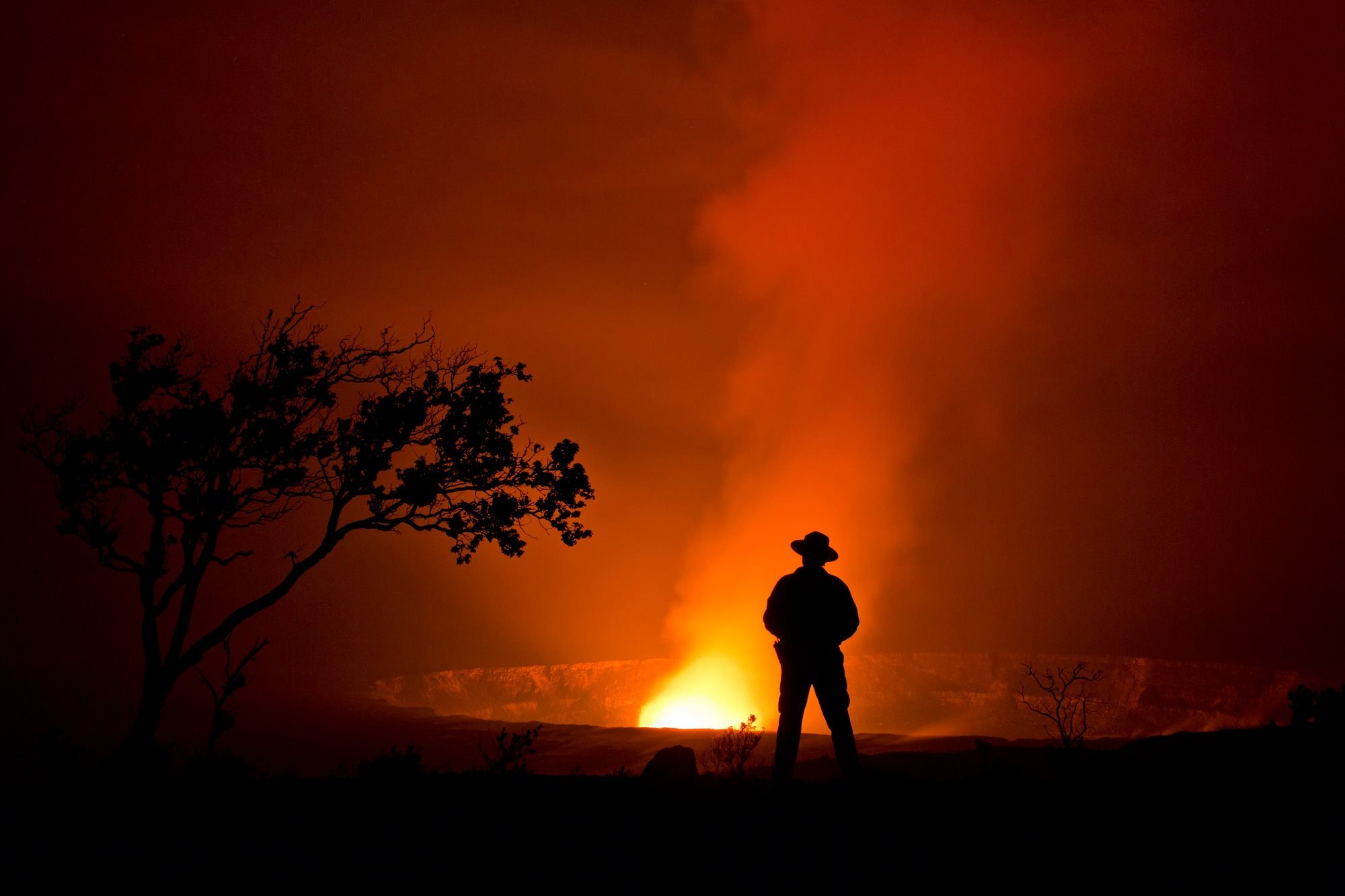
Hawaii Volcanoes eruption. Credit: National Park Service (public domain), via Wikimedia Commons.
The Halemaʻumaʻu eruption remained paused in HVO’s November 13 update, with Kīlauea’s summit continuing to reinflate after episode 56. The steady inflationary trend slowed during the preceding day and flattened for several hours overnight before continuing upward at a slower rate, prompting HVO to move its forecast window for episode 57 from November 16–21 to November 17–22. Another fountaining episode remains likely based on previous episodes, the ongoing tilt trend and glow within the eruptive vents, but the dates remain a forecast window rather than a fixed eruption schedule.
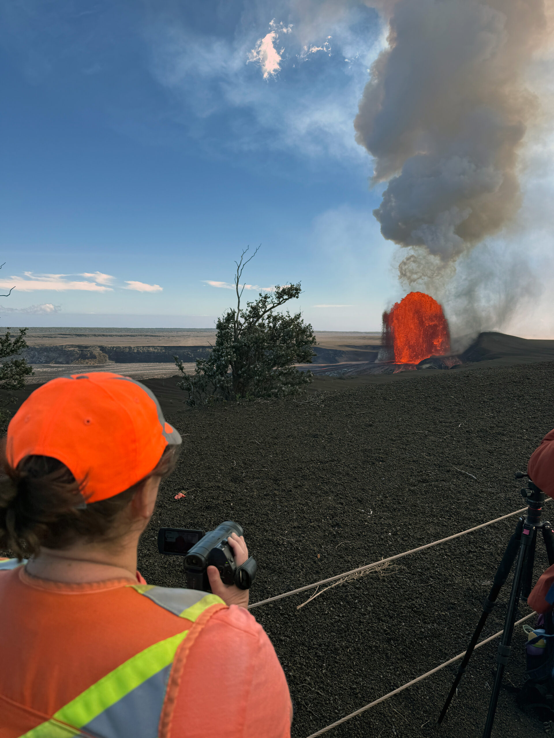
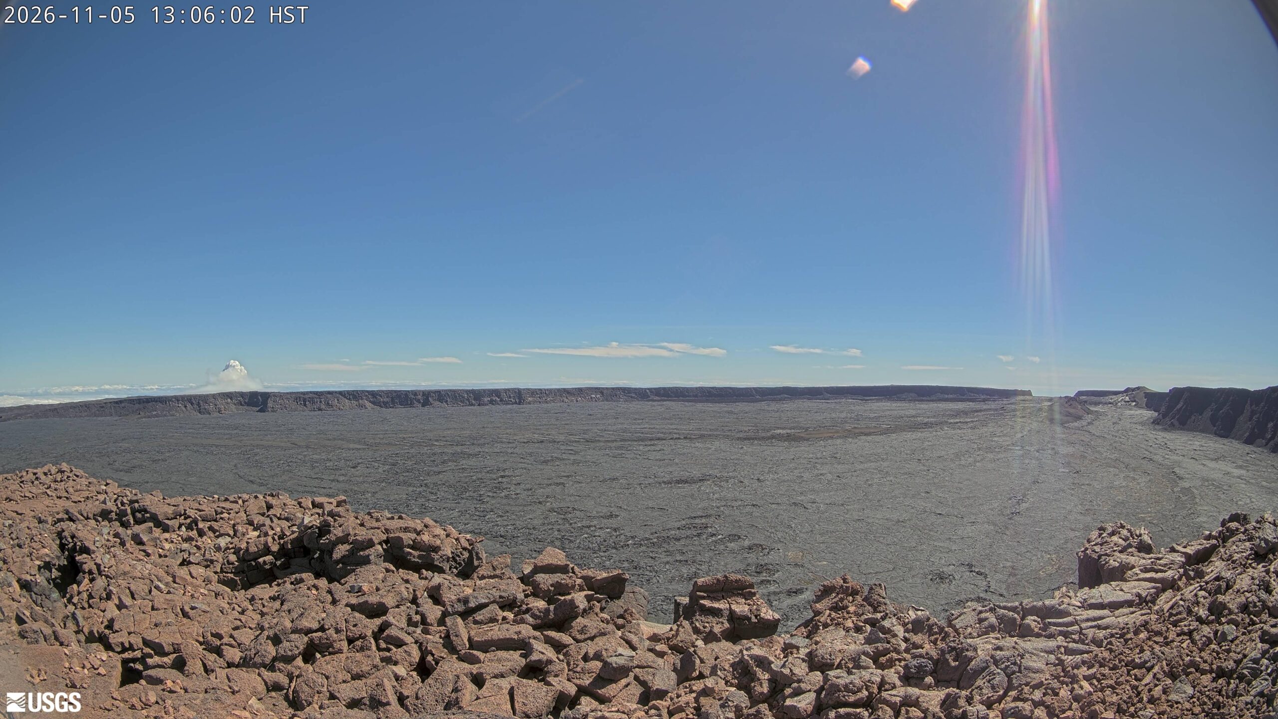
Episode 56 began at 12:10 HST (22:10 UTC) on November 5 and ended at 18:01 HST (04:01 UTC on November 6), giving a duration of 5 hours and 51 minutes. Sustained high fountaining came from the north vent. HVO’s real-time maximum estimate reached about 200 m (660 feet), while smaller fountains and spattering occurred from the southwest vent during the early part of the episode.
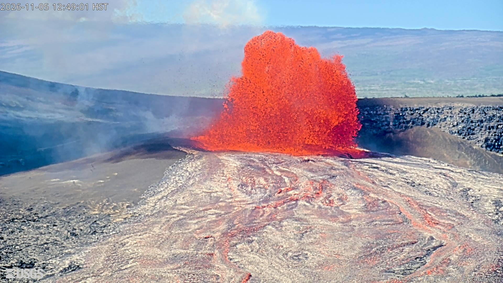
The fountain increased rapidly after the episode began. HVO reported the north-vent fountain above 50 m (160 feet) at 12:49 HST and above 100 m (330 feet) minutes later. By 13:51 HST, the fountain was around 200 m (650 feet) high and National Weather Service radar was measuring the eruptive plume at approximately 5.5 km (18 000 feet) above sea level.
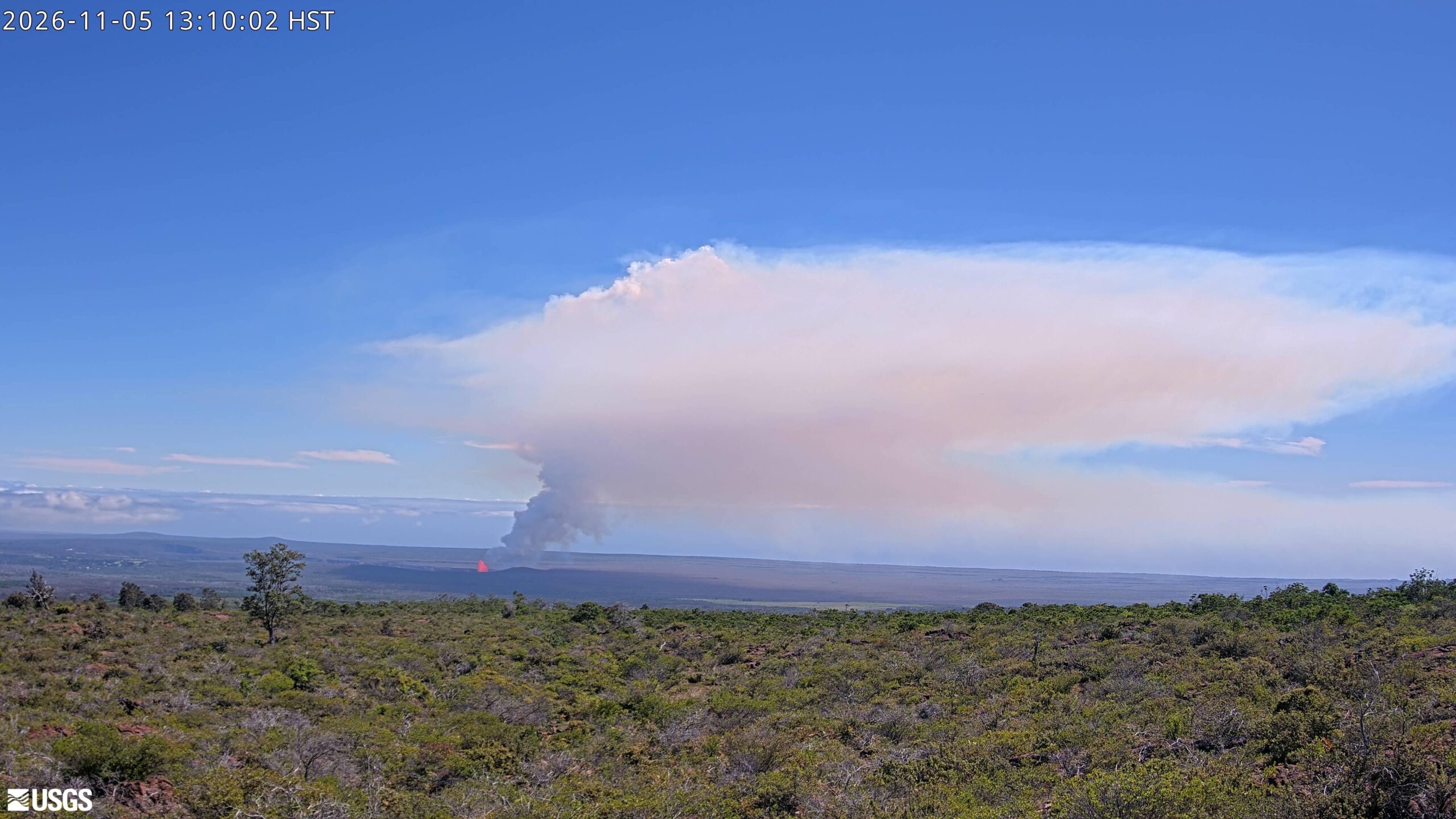
The plume developed in two different wind layers. Near the surface, north-northeast to northeast winds carried tephra and the lower plume south-southwest to southwest across closed areas of Hawaiʻi Volcanoes National Park. Higher in the atmosphere, winds from the east and southeast transported the upper plume west-northwest to northwest toward Mauna Loa.
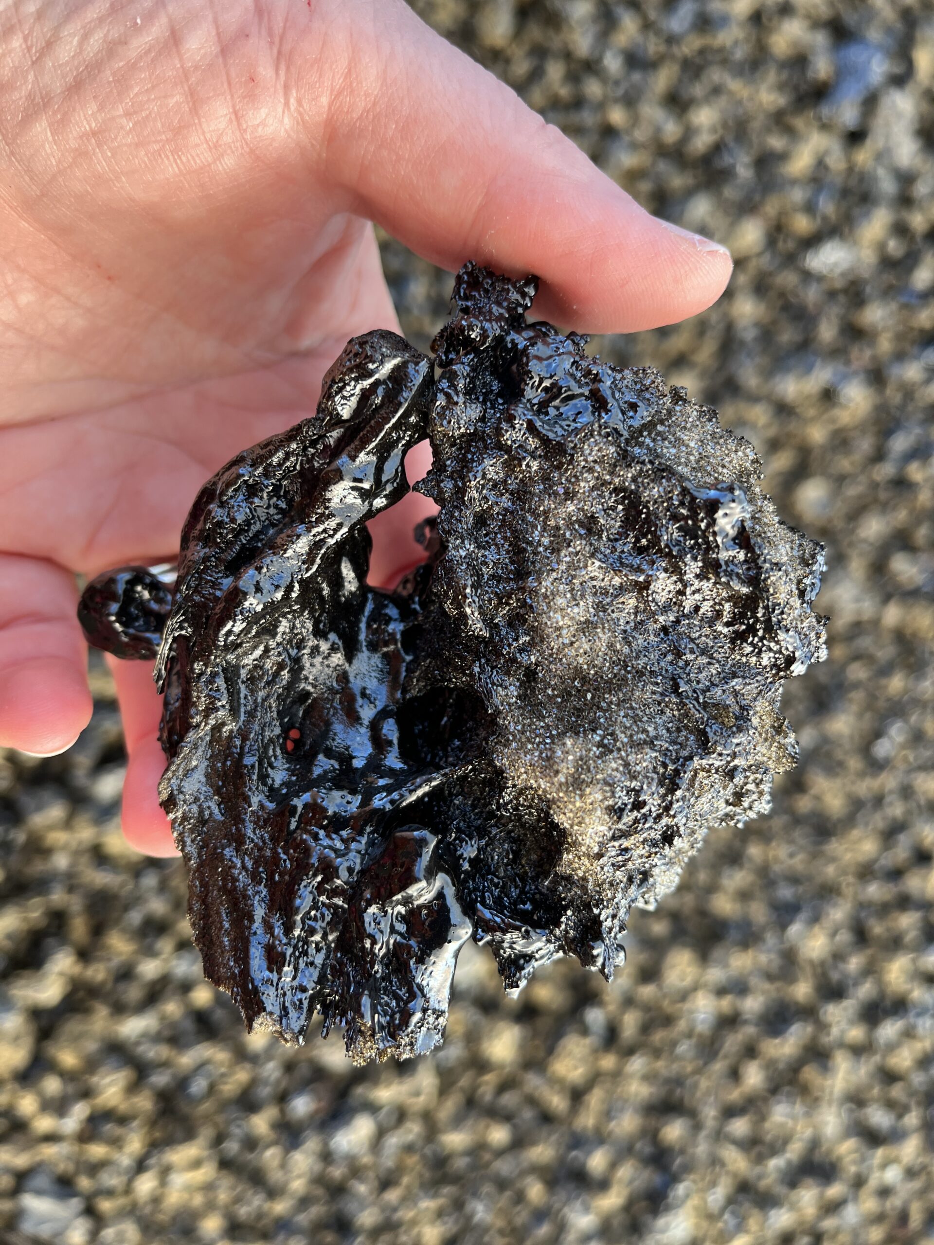
Tephra fallout was concentrated mainly southwest of the vents within areas of Hawaiʻi Volcanoes National Park closed to the public. HVO reported trace fallout along Highway 11 and light tephra at the Footprints area and Pāhala. Fine ash and Pele’s hair, thin strands of volcanic glass formed from stretched molten droplets, were found west of the summit along part of Highway 11.
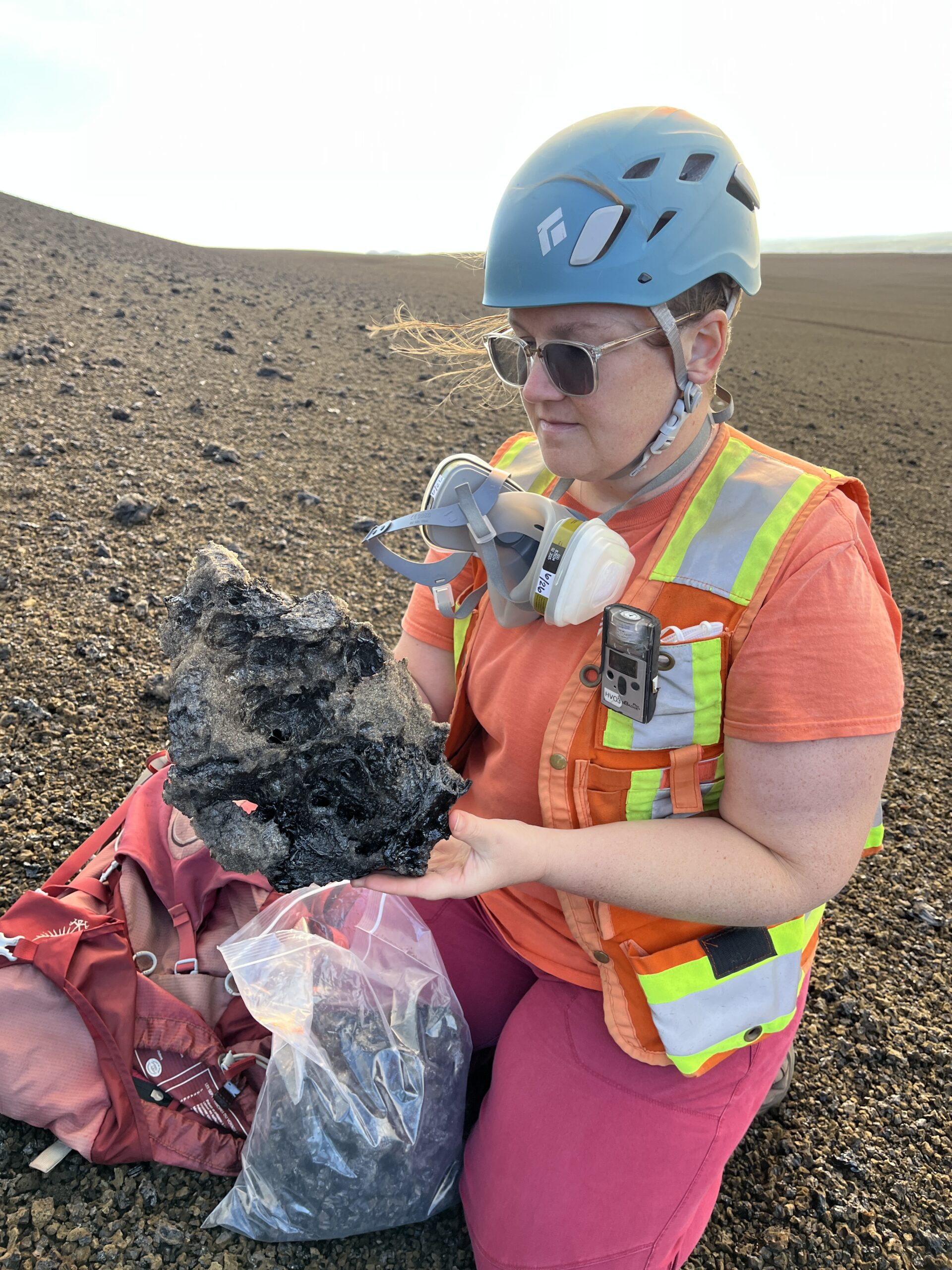
The larger fragments deposited near the vent preserve information about conditions inside the fountain. HVO field crews collected episode-56 material for laboratory analysis after the eruption, including highly vesicular fragments more than 50 cm (20 inches) long and clasts containing both dense and frothy material.
Tiltmeter measurements indicate that approximately 6 million m³ (8 million cubic yards) of lava erupted during episode 56. HVO calculated an average eruption rate of about 200 m³/s (260 cubic yards per second). The peak rate reached approximately 530 m³/s (690 cubic yards per second) around 14:00 HST (00:00 UTC on November 6).
The Uēkahuna tiltmeter recorded 17 microradians of deflationary tilt during episode 56. Inflationary tilt resumed immediately after fountaining ended, beginning another cycle of summit reinflation during the eruptive pause.
By 07:53 HST (17:53 UTC) on November 13, the Uēkahuna tiltmeter had recovered about 11 microradians of inflationary tilt since episode 56. HVO reported moderate to strong glow from the southwest vent and moderate glow from the north vent overnight. Seismic tremor remained elevated during the pause, while only one small summit earthquake was located during the preceding day.
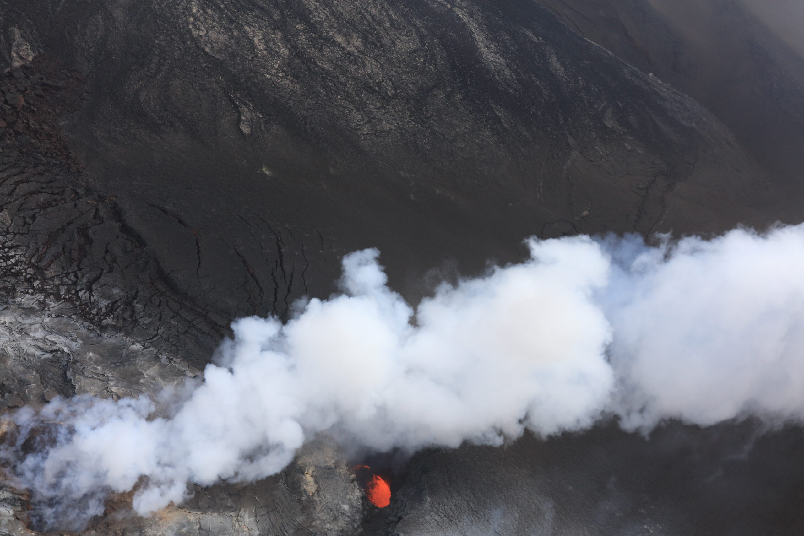
A November 10 helicopter overflight provided direct observations inside the vent system during the pause. Volcanic gas obscured the vents for much of the flight, but temporary openings in the plume allowed HVO scientists to observe roiling incandescent lava in both conduits about 40–50 m (130–165 feet) below their rims. No surface lava overflow was reported during the overflight.
The combination of continuing inflation, elevated tremor and persistent vent glow forms the observational basis for HVO’s expectation of another fountaining episode. The rate of inflation slowed during the 24 hours before the November 13 update and temporarily flattened for several hours, which moved the forecast window approximately one day later to November 17–22.
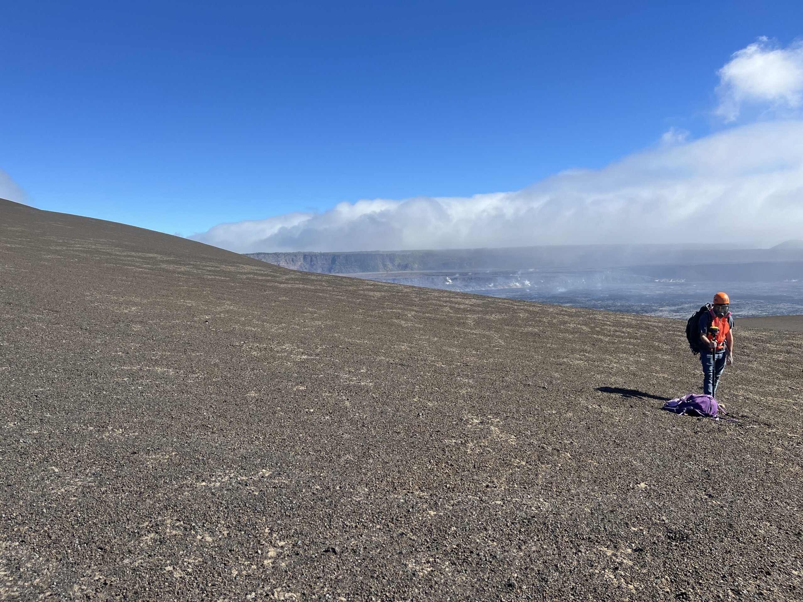
Field measurements continued while the eruption was paused. On November 13, HVO geologists repeated GPS measurements across the puʻu built by accumulated tephra southwest of the vents, collecting data at fixed survey points to track changes in its elevation and shape between eruptive episodes.
HVO measured an average summit sulfur dioxide emission rate of about 3 000 tonnes per day (3 300 short tons per day) on November 12. Trade winds carried volcanic gases southwest on November 13. Kīlauea remained at Volcano Alert Level ADVISORY and Aviation Color Code YELLOW.
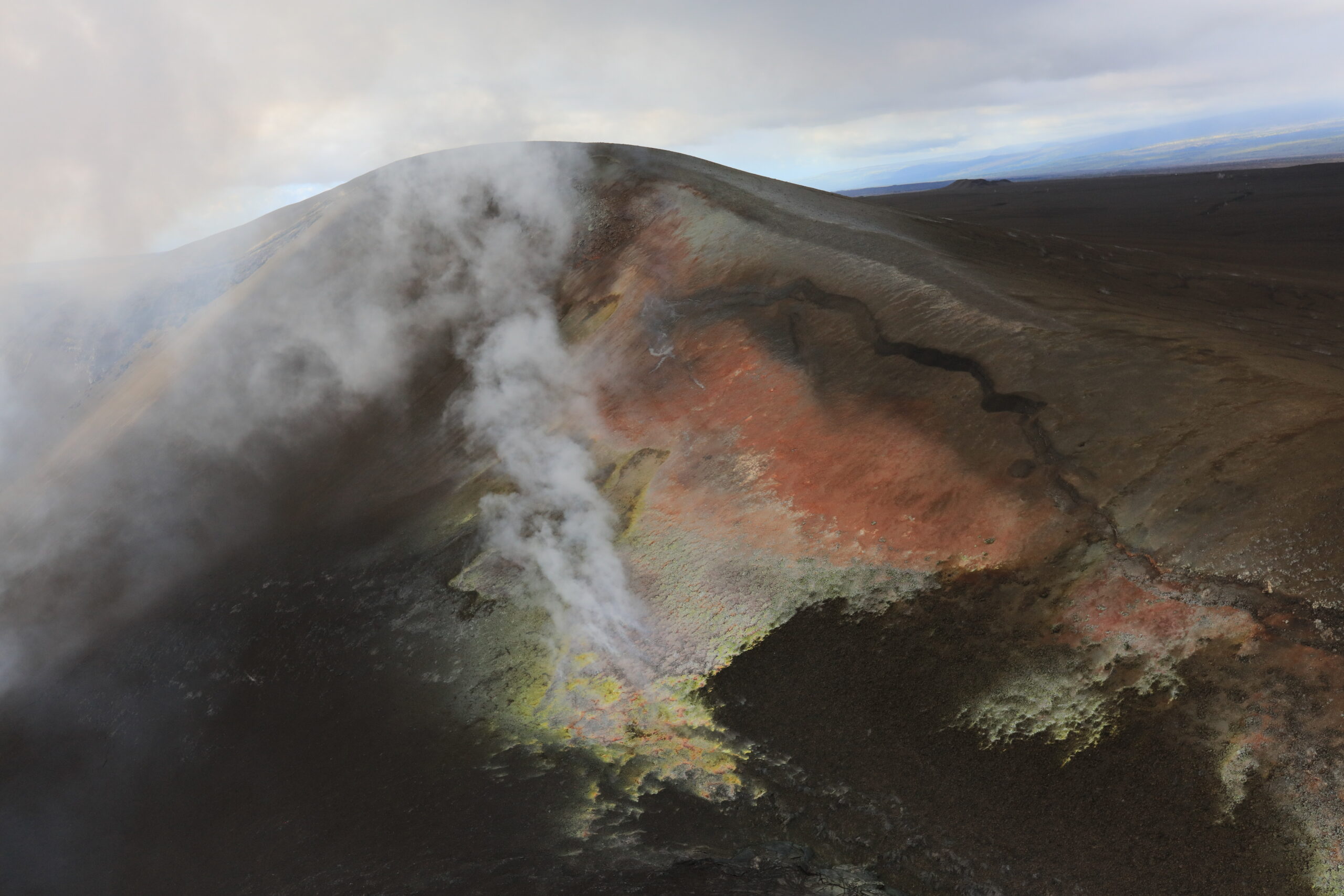
The puʻu is the cumulative result of repeated high-fountaining episodes rather than a product of episode 56 alone. Tephra falling predominantly southwest of the vents has progressively buried parts of the former crater wall, building a substantial deposit immediately downwind of the vent complex.
All eruptive vents and lava flows from the current summit eruption remain within Halemaʻumaʻu crater in a closed part of Hawaiʻi Volcanoes National Park. Episode-56 lava was not reported threatening populated areas. Outside the immediate crater, volcanic gas and windblown tephra remain the principal eruptive hazards.
HVO cautions that confinement of the current lava flows does not establish where future magma movement must occur. Recent intrusions show that magma can migrate beneath other parts of the summit region, where intrusive activity can produce earthquakes, ground cracks and small landslides even without a surface eruption.

The present vent terminology reflects changes in the crater between episodes. HVO scientists re-examined summit webcam imagery after episode 55 and determined that the features previously described as separate south and west vents had merged. The combined feature is now referred to as the southwest vent, alongside the separate north vent that produced the sustained episode-56 fountain.
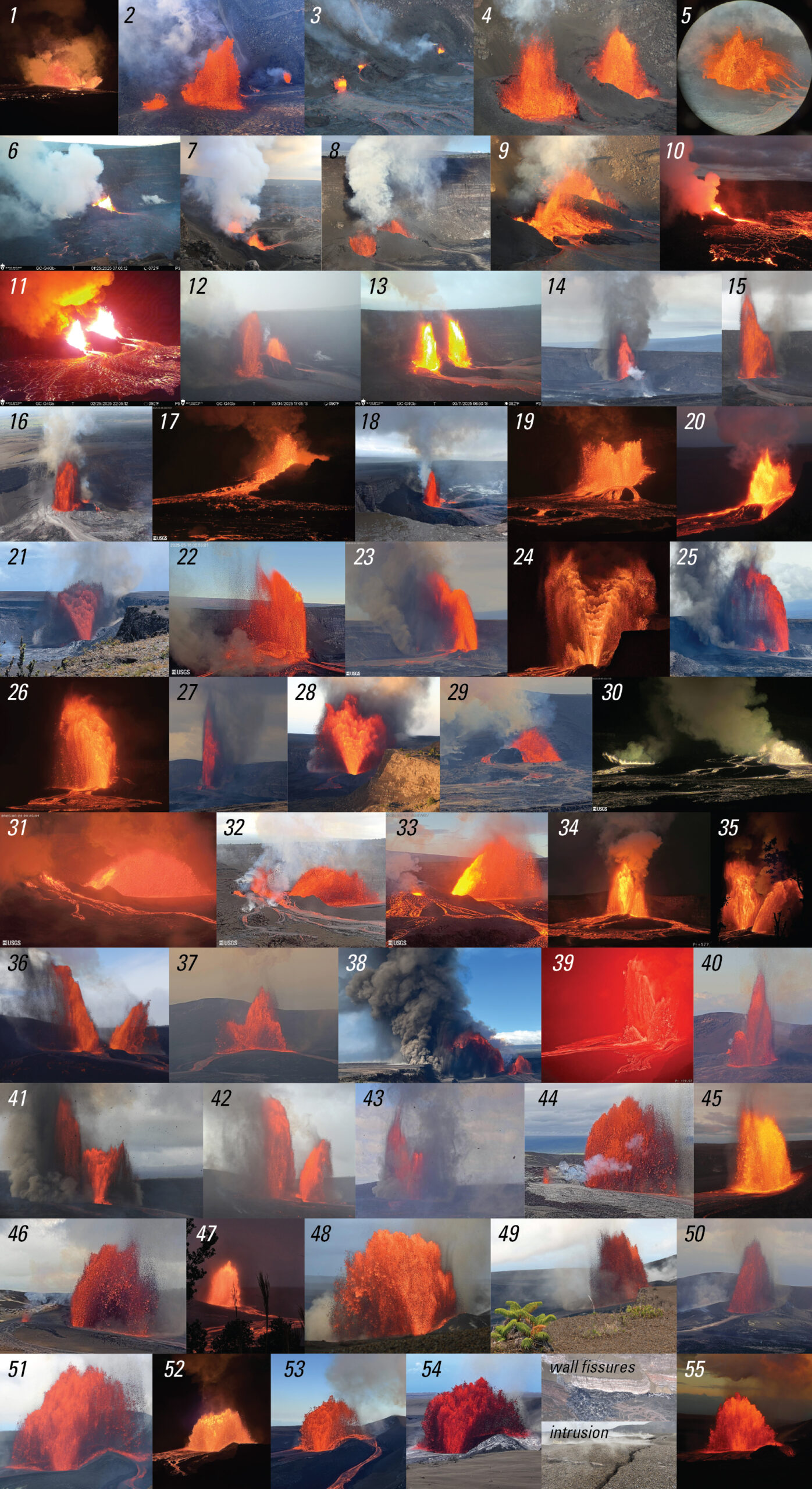
The approximately 200 m (660 feet) maximum fountain height reported for episode 56 remains a real-time operational estimate rather than a final calibrated scientific measurement. During an active episode, HVO scientists estimate fountain heights from webcam imagery using scale overlays and known camera geometry so that values can be included quickly in status messages and daily updates.
More detailed measurements are made after individual episodes using fixed-lens timelapse cameras with calibrated fields of view. HVO scientists identify the top of the continuous body of the fountain in successive images and exclude sparse incandescent particles that rise above it. The known distance between the camera and vent is then used to convert the image measurement into physical height.
The method makes the scientific measurement more reproducible but can produce a lower value than a visual estimate that includes the highest isolated glowing fragments. HVO therefore distinguishes the rapid height estimates used during eruptions from the measurements later prepared for scientific analysis.
A USGS data release published on September 22, 2026 contains calibrated fountain-height measurements and associated timelapse imagery for episodes 1–50 of the ongoing eruption. Cameras generally acquired images every 0.5–1 minute, and fountain heights were commonly measured at one-minute intervals through each episode.
Episode 56 is not included in that version of the dataset. Its approximately 200 m (660 feet) maximum should therefore continue to be identified as HVO’s real-time estimate unless a later version of the scientific dataset provides a calibrated episode-56 measurement.
Kīlauea has been erupting episodically from summit vents within Halemaʻumaʻu since December 23, 2024. HVO reports that the fountaining episodes generally last less than 12 hours and are separated by pauses of two or more weeks. Monitoring during those pauses combines deformation measurements, seismic tremor, sulfur dioxide observations, webcams, helicopter surveys and direct field measurements around the vents.
The November 17–22 window for episode 57 remains conditional on how those observations evolve. A change in the rate of summit inflation can shift the forecast, as occurred between the November 12 and November 13 HVO updates.
References:
1 Kīlauea Volcano Updates – U.S. Geological Survey Hawaiian Volcano Observatory – November 13, 2026, 17:53 UTC
2 Photo & Video Chronology — Episode 56 of lava fountaining at the summit of Kīlauea – U.S. Geological Survey Hawaiian Volcano Observatory – November 5, 2026
3 Patrick, M. R., & Adams, R. G. (2026). Lava fountain heights and associated timelapse images for the summit eruption of Kīlauea volcano, Island of Hawaiʻi, 2024–2026 (continuing). U.S. Geological Survey data release. DOI: 10.5066/P14MLKCX

I’m a science journalist and researcher at The Watchers, contributing to the Epicenter edition, where I cover peer-reviewed scientific research and emerging discoveries across Earth and space sciences. With a background in astronomy and a passion for environmental science, I’ve worked in shark and coral conservation in Fiji, conducting reef and shark-behavior research, contributing to mangrove restoration, and earning PADI Open Water and Coral Reef Certifications. I bring a blend of scientific rigor and storytelling to illuminate the discoveries shaping our planet and beyond.
Published in the last 24 hours
- A crack up to 6 m (20 ft) wide is splitting the summit of the Hochvogel in the Allgäu Alps; 12 years of measurements now put the loose block at about 400,000 cubic metres, half the peak. Epicenter
- Hayli Gubbi in Ethiopia's Afar erupted on 23 November 2025, its first historically documented eruption; a year later scientists have traced it to magma from Erta Ale that travelled more than 30 km underground. Epicenter
- Typhoon Cempaka spun up over the western North Pacific on 7 November 2026; it is now the 32nd typhoon of the year, more than any year this century, one past the 31 counted in 2013. Epicenter
- A school bus driver in Paradise, California, drove 22 children through the 2018 Camp Fire for about five hours, and when the smoke thickened, he and two teachers tore his shirt into wet strips for them to breathe through Epicenter
