
Typhoon Cempaka spun up over the western North Pacific on 7 November 2026; it is now the 32nd typhoon of the year, more than any year this century, one past the 31 counted in 2013.
Cempaka became the 32nd named tropical cyclone of 2026 in the western North Pacific on November 7, pushing the annual total above the 31 recorded in 2013 and to its highest level of the 21st century. The count is the first to reach 32 since 1994, but it is not an all-time record: Japan Meteorological Agency (JMA) statistics list 39 systems in 1967 and 36 in both 1994 and 1971.
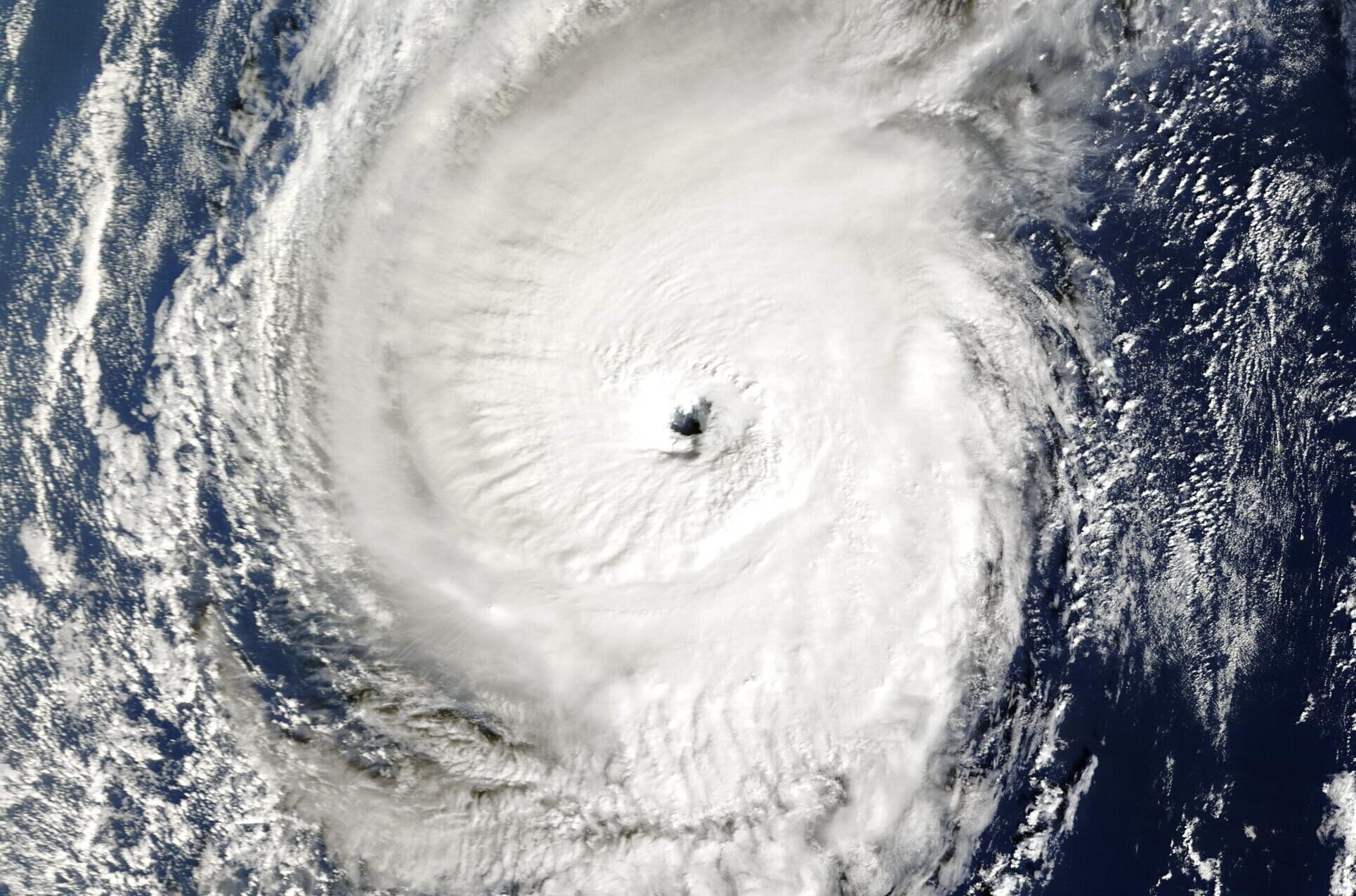
Typhoon Cempaka at peak intensity over the western North Pacific on November 9, 2026, observed by the MODIS instrument aboard NASA’s Terra satellite. Credit: NASA Terra/MODIS, via Wikimedia Commons (public domain).
The China Meteorological Administration (CMA) said Cempaka formed over the western North Pacific at 14:00 China Standard Time (06:00 UTC) on November 7 and became the season’s No. 32 system. CMA described the total as the highest since the beginning of the 21st century, surpassing the 31 systems counted in 2013.
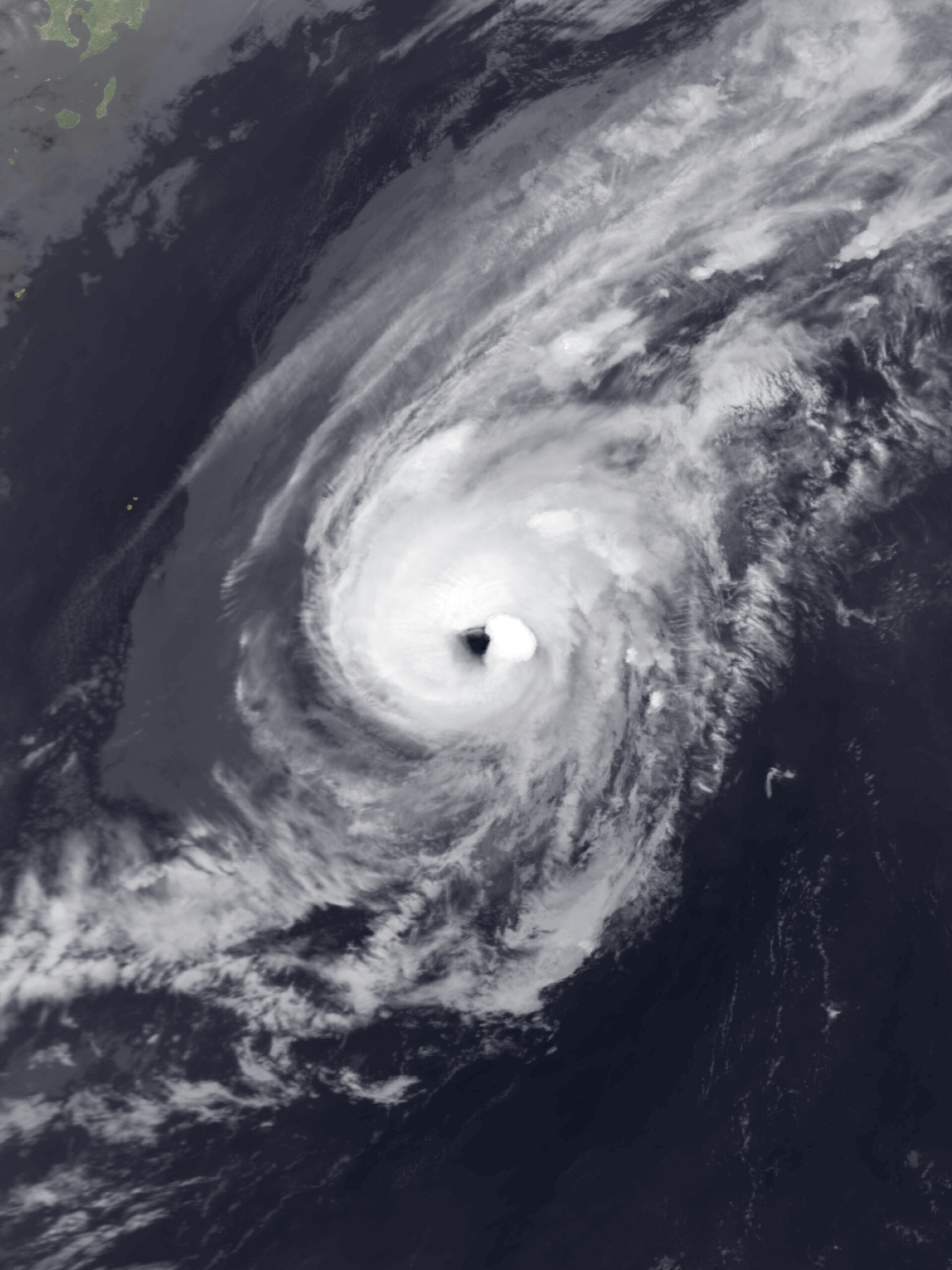
By 14:00 China Standard Time (06:00 UTC) on November 9, NMC placed Cempaka near 24.0°N, 134.9°E, approximately 1 570 km (975 miles) northwest of Guam. Maximum winds near the center were 35 m/s, approximately 125 km/h (80 mph), with a minimum central pressure of 970 hPa. The cyclone was moving east-northeast at 10–15 km/h (6–9 mph), and CMA said it would not affect China’s seas.
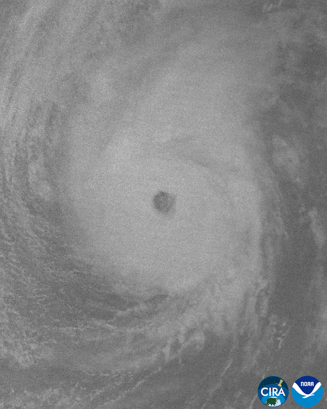
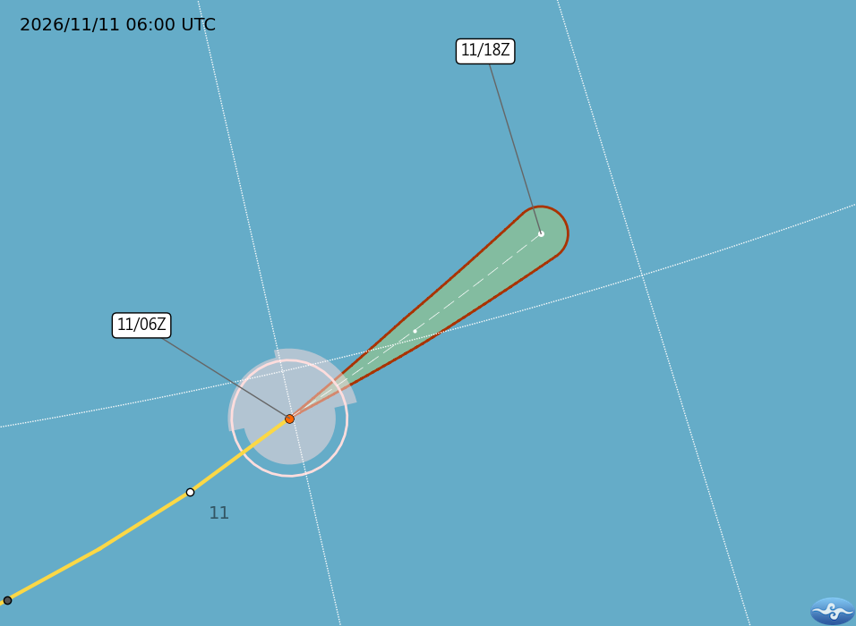
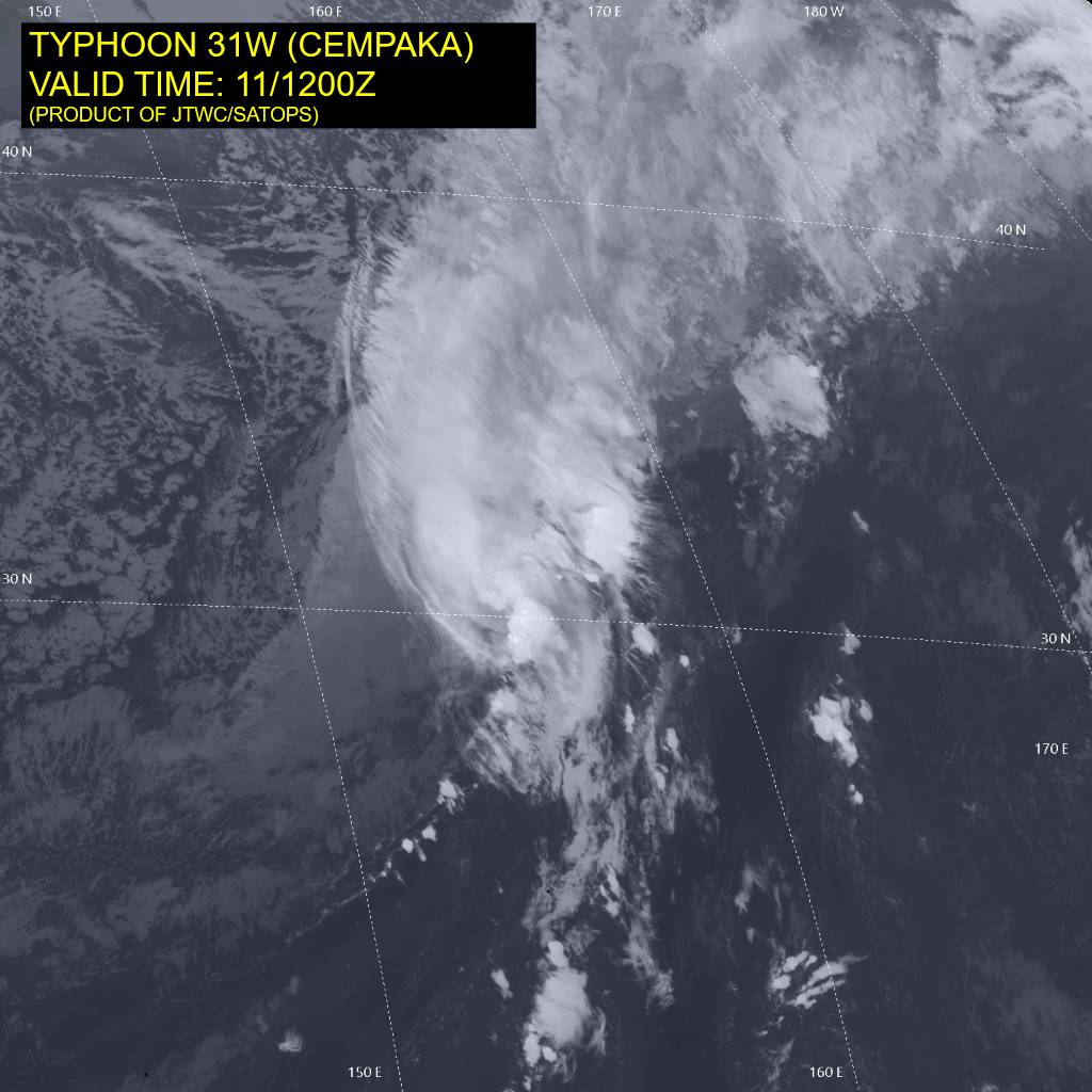
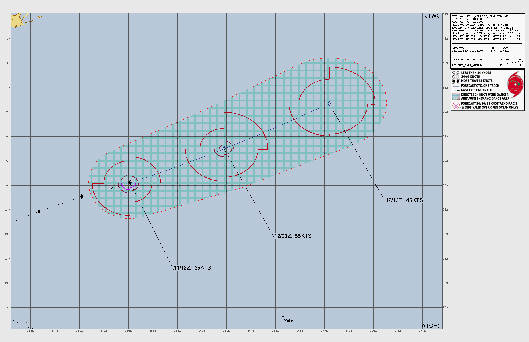
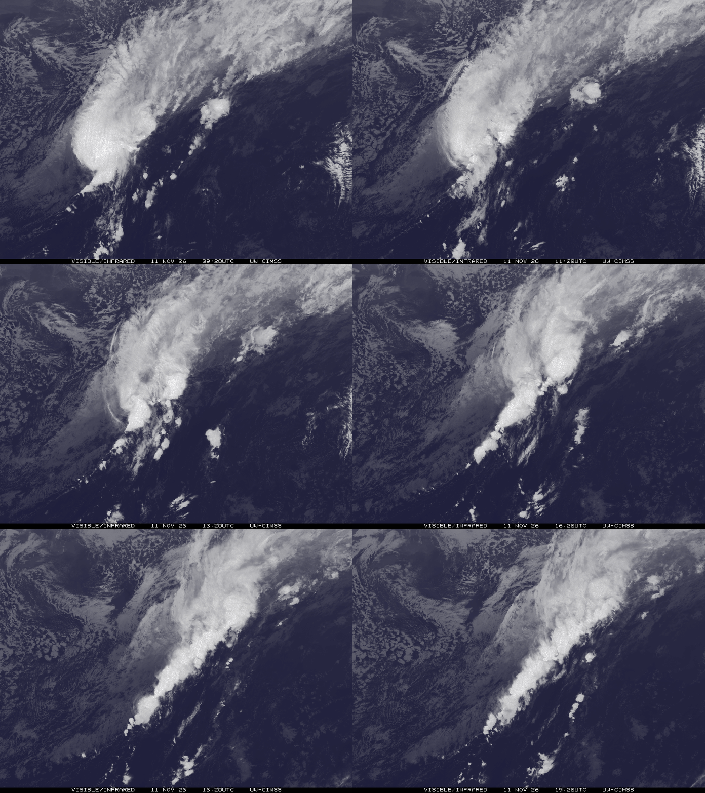
Cempaka continued eastward before losing its tropical structure. NMC reported that the system had transitioned into an extratropical cyclone over waters southeast of Japan by 20:00 China Standard Time (12:00 UTC) on November 11 and ended its official numbering at that time.
The seasonal count requires an important terminology distinction. JMA’s domestic Japanese classification uses the term taifu once a tropical cyclone reaches about 17 m/s, or 60 km/h (40 mph), while the agency’s international English classification reserves “Typhoon” for systems with maximum winds of at least 33 m/s, about 120 km/h (75 mph). Tropical Storm and Severe Tropical Storm are separate international categories below that threshold.
The No. 32 designation therefore describes the annual sequence of named or numbered systems that reached the basin’s tropical-storm threshold. It does not mean that all 32 reached typhoon intensity under the international classification. Cempaka itself did reach that higher category, including the 35 m/s winds reported by NMC on November 9.
JMA’s historical statistics show why the “this century” qualifier is essential. The agency lists 39 tropical cyclones in 1967, the highest annual count in its 1951–2025 ranking, followed by 36 in 1994 and 1971 and 35 in 1966. The years 1989, 1974 and 1965 each produced 32, while 2013 recorded 31.
CMA gives a 21st-century average of 24.3 systems per year for the western North Pacific and South China Sea. JMA’s separate 1991–2020 climatology gives an annual normal of 25.1 tropical cyclones with maximum winds of at least 17.2 m/s forming over the western North Pacific. The different figures use different reference periods and should not be treated as interchangeable baselines.
JMA’s climatology averages 2.2 such tropical cyclones forming during November. Cempaka’s occurrence in November was therefore not outside the basin’s normal seasonal envelope; the unusual feature was that its formation raised the accumulated 2026 annual count to 32
CMA’s National Climate Center attributed the high 2026 storm count partly to the developing El Niño and to the position of the western Pacific subtropical high. According to the center, the subtropical high remained farther north than normal from summer onward and averaged about 2° of latitude north of its usual August–October position, a configuration favorable for tropical cyclone formation.
CMA counted 23 tropical cyclones from July through October. It also reported nine systems forming between September 1 and November 9, six of which reached its super-typhoon category. None of those nine autumn systems made landfall in China.
The seasonal explanation remains an attributed assessment rather than a single-cause claim. CMA described El Niño as part of the background conditions and separately identified the persistent northward position of the subtropical high as favorable for cyclone formation. The observed record is the 32-system annual total for the 21st century; the atmospheric mechanisms offered to explain that activity remain those identified by the National Climate Center.
References:
1 今年台风个数创21世纪新高 – China Meteorological Administration via Xinhua – November 9, 2026, 08:20 UTC
2 発生数 / Categorization of tropical cyclones in the western North Pacific / Normal statistics for tropical cyclones – Japan Meteorological Agency – accessed November 14, 2026. Classification · 1991–2020 climatology
3 “查帕卡”停止编号 – National Meteorological Center, China Meteorological Administration – November 11, 2026, 12:00 UTC

I’m a science journalist and researcher at The Watchers, contributing to the Epicenter edition, where I cover peer-reviewed scientific research and emerging discoveries across Earth and space sciences. With a background in astronomy and a passion for environmental science, I’ve worked in shark and coral conservation in Fiji, conducting reef and shark-behavior research, contributing to mangrove restoration, and earning PADI Open Water and Coral Reef Certifications. I bring a blend of scientific rigor and storytelling to illuminate the discoveries shaping our planet and beyond.
Published in the last 24 hours
- Hayli Gubbi in Ethiopia's Afar erupted on 23 November 2025, its first historically documented eruption; a year later scientists have traced it to magma from Erta Ale that travelled more than 30 km underground. Epicenter
- A school bus driver in Paradise, California, drove 22 children through the 2018 Camp Fire for about five hours, and when the smoke thickened, he and two teachers tore his shirt into wet strips for them to breathe through Epicenter
- Mount Pinatubo in the Philippines sits about 7,000 miles from California, yet after it erupted in 1991 the whole planet cooled by about 1°F for nearly two years, because the sulfur it blasted into the sky formed a thin haze that bounced sunlight back into space Epicenter
- A tangled sunspot cluster about 93 million miles away doubled in size in a single weekend earlier this month and fired 20 solar flares in one day, and forecasters gave it a small chance of producing an X-class flare, the most powerful kind the Sun is known to unleash
