
So much water builds up in the Amazon each April that it shifts Earth’s center of mass toward South America
Each April, the Amazon River basin reaches a seasonal maximum of about 2 400 gigatons (about 2.6 trillion US tons) of rainwater, enough redistributed mass to shift Earth’s center of mass 2.2 mm (0.09 inches) toward South America relative to the planet’s geometric center. Argus et al. (2026) developed a satellite-tracking method that brings estimates of this annual geocenter motion into much closer agreement with GRACE gravity observations and places the seasonal movement at roughly half the magnitude inferred from older satellite-based solutions.
Earth’s center of mass (CM) is the balance point of the solid planet together with its fluid envelope — the atmosphere, oceans, continental water, snow and ice — and satellites orbit around it. Earth’s center of figure (CF), by contrast, represents the mean position of points across the solid Earth’s surface. The 2.2 mm (0.09 inches) Amazon displacement therefore describes movement of CM relative to CF, not Earth as a whole travelling 2.2 mm through space toward South America.
Seasonal geocenter motion has been studied for decades, but different geodetic techniques have produced substantially different estimates of its size. The international solutions released in 2017 and 2023 differed by 7 mm (0.28 inches), a discrepancy nearly as large as the seasonal displacement scientists were attempting to measure. Argus and colleagues addressed that problem by changing how seasonal deformation of the ground stations used to establish Earth’s geometric reference frame is treated.
The study calculates that about 6.3 × 10¹⁵ kg, or 6 300 gigatons (about 6.9 trillion US tons), of water moves between the continents and oceans through the annual cycle. That exchange produces an annual oscillation in global mean sea level of about 17.3 mm (0.68 inches) and is identified by the researchers as the main cause of the seasonal oscillation between Earth’s center of mass and its solid-Earth center of figure.
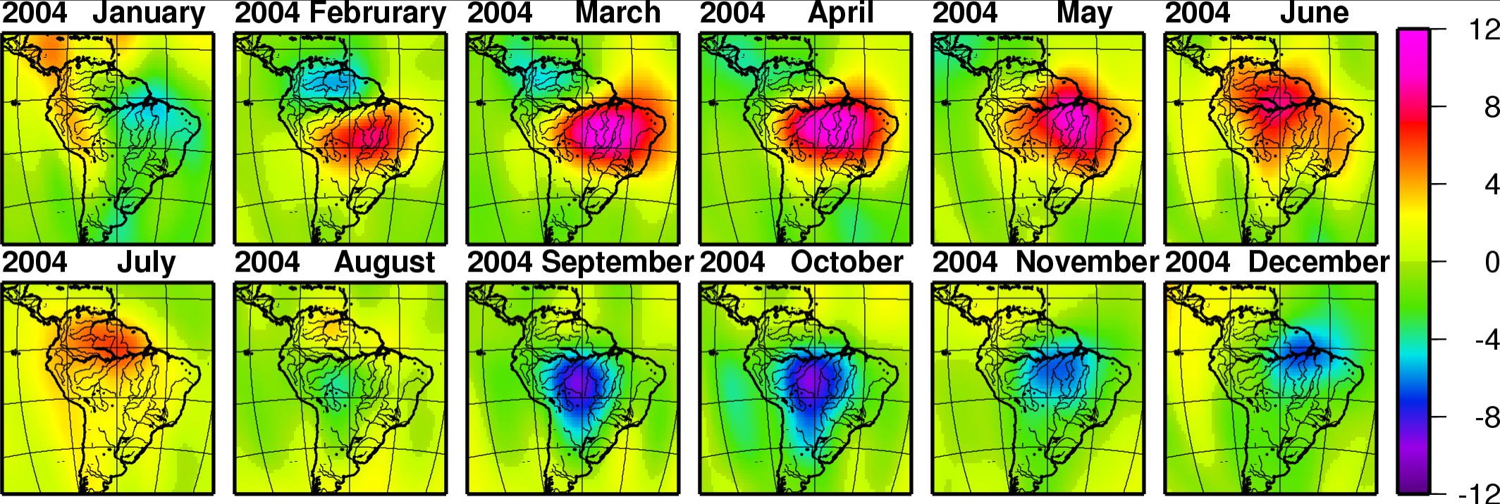
Continental water reaches its annual maximum in April after snow accumulation across Eurasia and North America peaks in March and the Amazon basin reaches its seasonal water maximum a month later. The paper estimates the Amazon contribution at about 2.4 × 10¹⁵ kg, or 2 400 gigatons (about 2.6 trillion US tons), and calculates that this concentration moves CM about 2.2 mm (0.09 inches) toward the negative Y direction, corresponding geographically to a shift toward South America.
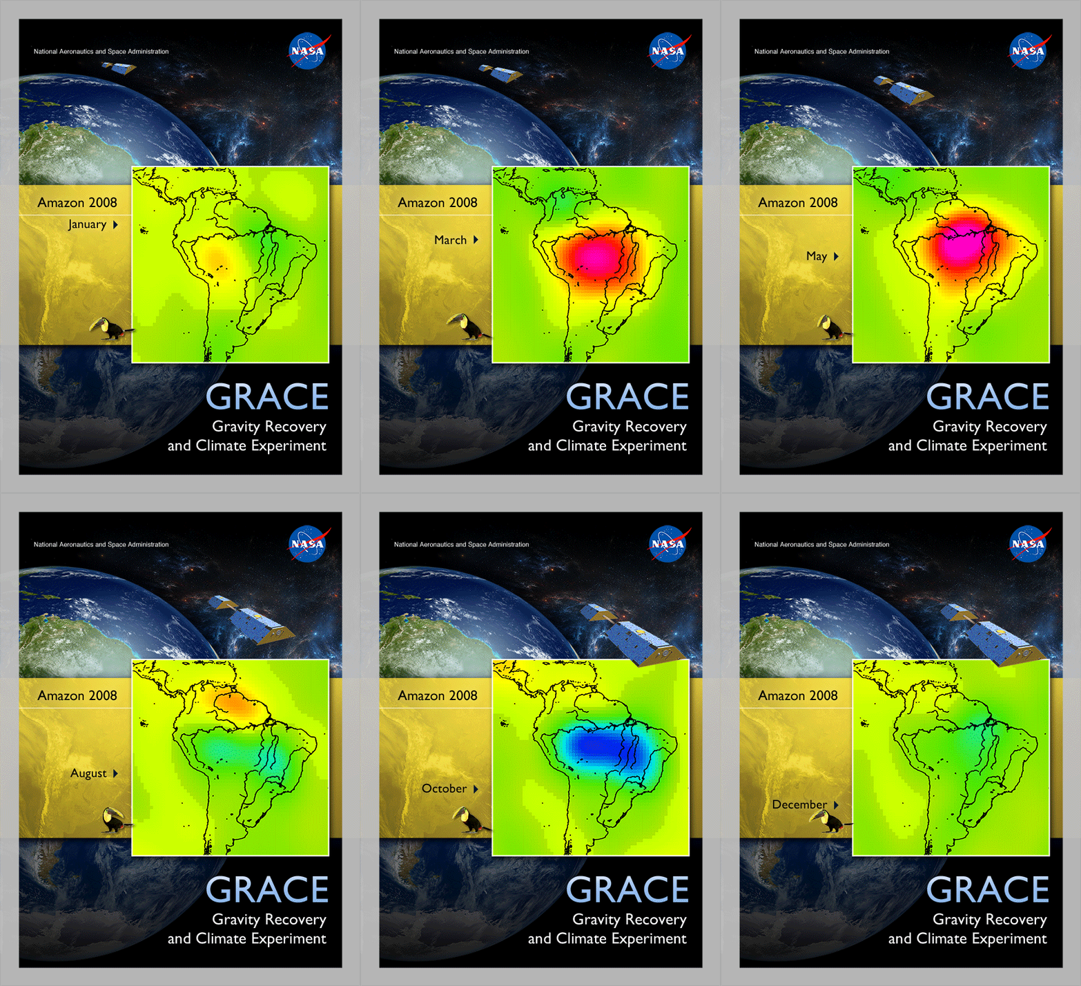
The Amazon is one part of a larger annual redistribution rather than the sole control on the geocenter. Northern Hemisphere snow accumulation reaches about 3 600 gigatons (about 4.0 trillion US tons) at its March maximum. Under the distribution assumed in the study, that snow load contributes about 3.3 mm (0.13 inches) of displacement toward the North Pole. Ocean water, atmospheric mass and monsoon water make additional contributions at other stages of the year.
The seasonal motion also differs by direction. The paper estimates a 6.0 mm (0.24 inches) peak-to-peak annual oscillation in the Y component, 3.2 mm (0.13 inches) in the X component and about 4.25 mm (0.17 inches) in the Z component from the total-water GRACE solution. Those components describe motion along three geocentric axes rather than three separate physical shifts that can simply be added together.
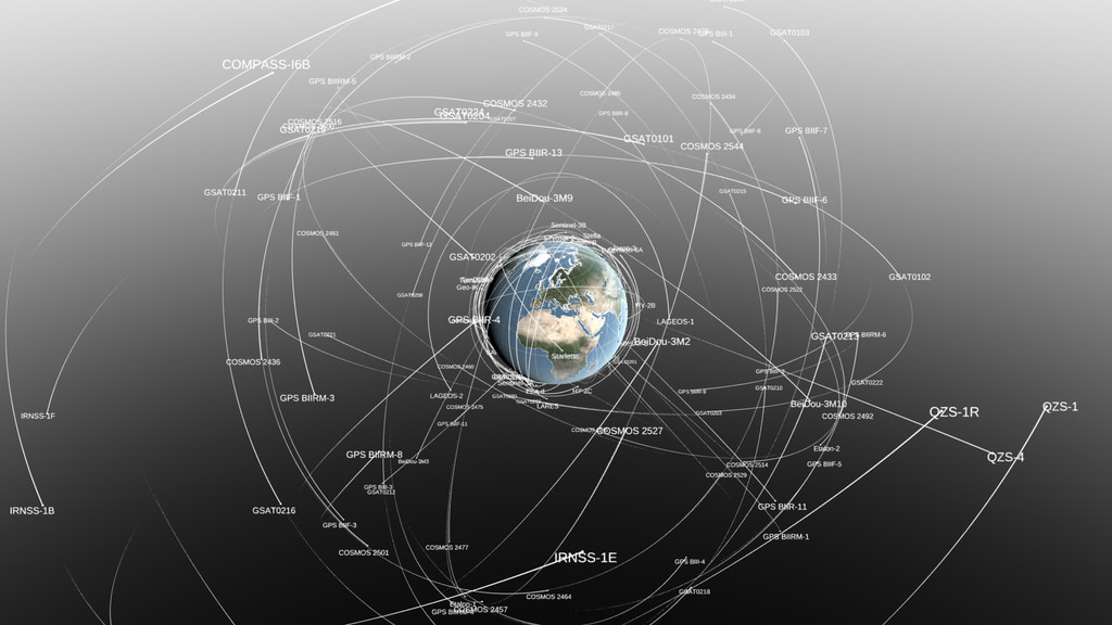
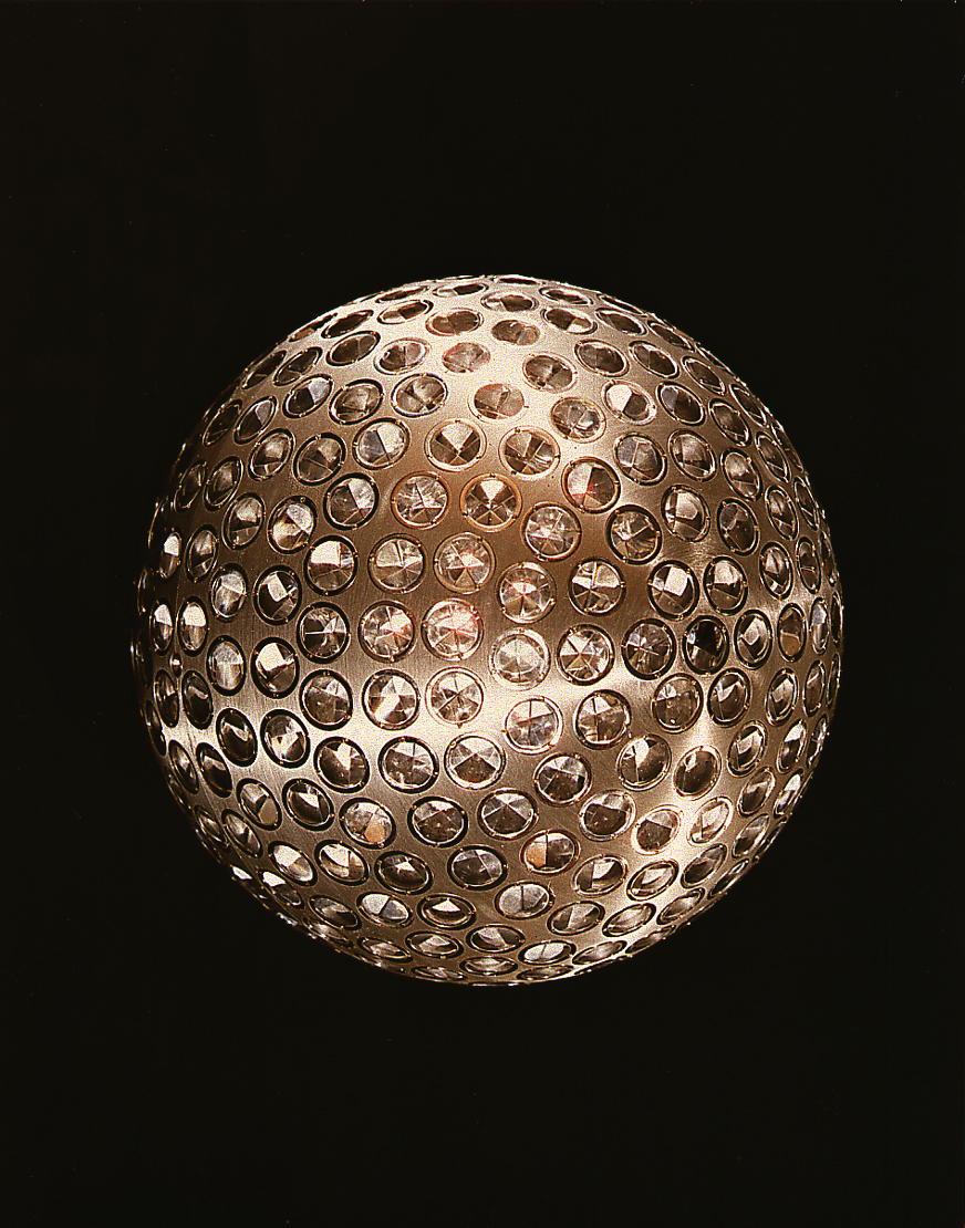
Satellite laser ranging provides the traditional direct link to Earth’s center of mass. Ground stations fire laser pulses at passive satellites fitted with retroreflectors and determine their distance from the round-trip travel time. LAGEOS 1 and LAGEOS 2, dense spherical satellites launched in 1976 and 1992, orbit around CM and have been tracked by laser-ranging stations distributed internationally.
The difficulty is that the ground stations making those measurements do not sit on a perfectly rigid shell. Seasonal additions and losses of water, snow, ice and atmospheric mass load the crust and deform the solid Earth elastically. The stations therefore move at the same time researchers are using their positions to estimate the location of Earth’s center of figure.
Earlier geodetic approaches often used the mean displacement of a station network as an approximation of CF. That approximation is imperfect because stations are not evenly distributed around the planet and because seasonal loading produces different elastic movement at different sites. Roughly half of the satellite laser-ranging sites considered in the paper are concentrated in Europe and North America.
Argus and colleagues instead predict the elastic deformation produced by changes in atmospheric mass, ocean mass and continental water, subtract that deformation from each station’s position time series and then estimate CF from the corrected positions. Atmospheric loading is represented with European Centre for Medium-Range Weather Forecasts data, non-barystatic ocean loading with the Max Planck Institute Ocean Model, and continental-water and barystatic-ocean changes with GRACE and GRACE-FO observations.
The ILRS2020 part of the analysis contains position estimates from 35 satellite laser-ranging sites between 2002 and 2020. The researchers began the analysis in 2002, the first year of GRACE observations, and restricted it to sites with more than 100 weekly position estimates and more than 26 weeks of data in most years. A second solution integrated GPS, satellite laser ranging and low-Earth-orbit satellite tracking, giving the researchers a more globally distributed set of observations.
The resulting solutions bring techniques that had previously disagreed much closer together. The two estimates produced in the study are within 2.5 mm (0.10 inches) of both the ITRF2020 estimate and the value inferred from GRACE. The paper reports that estimates of the elastic-corrected center derived from satellite tracking are also highly consistent with the seasonal atmosphere, ocean and continental-water variations represented in the geophysical models.

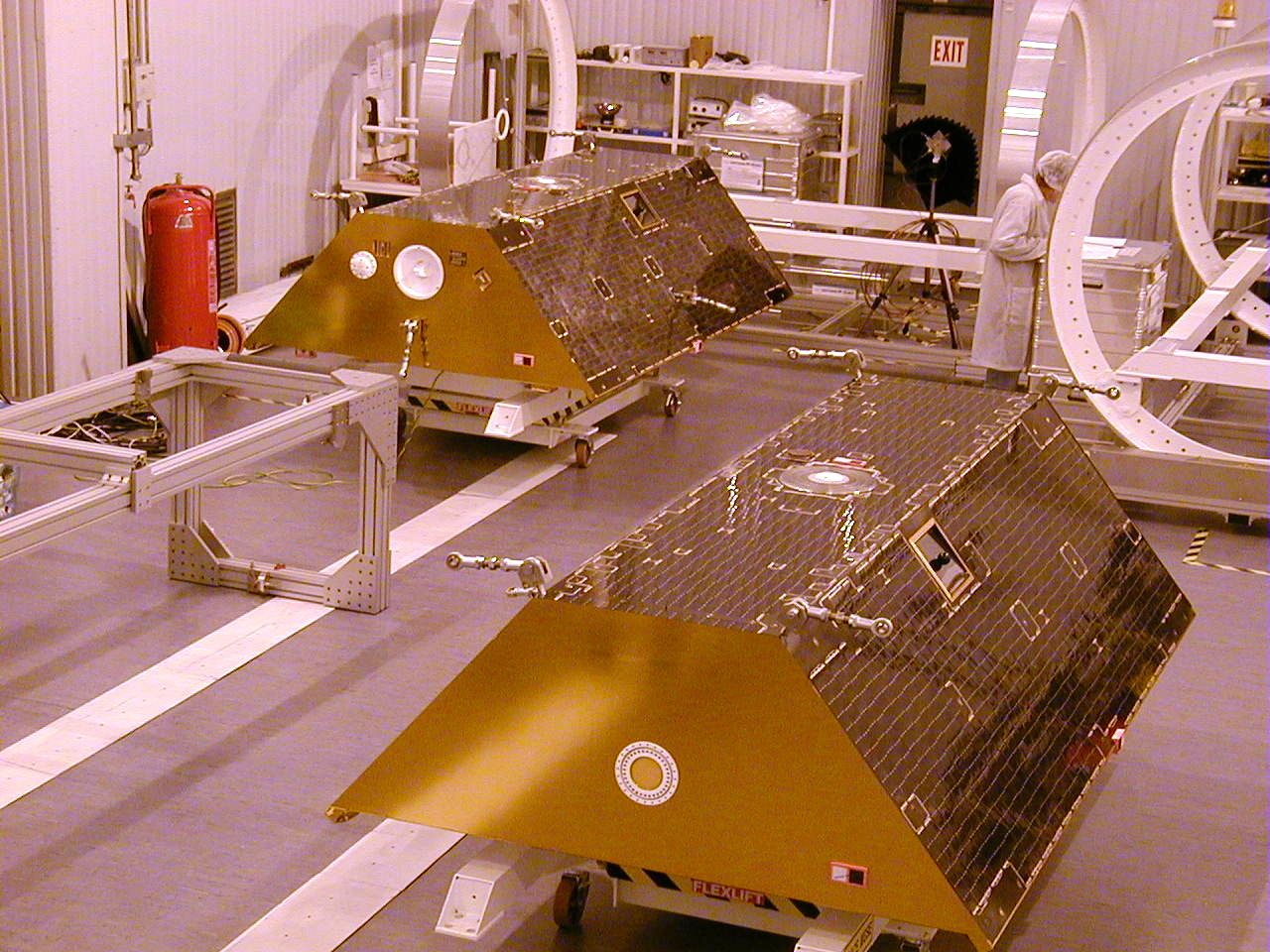
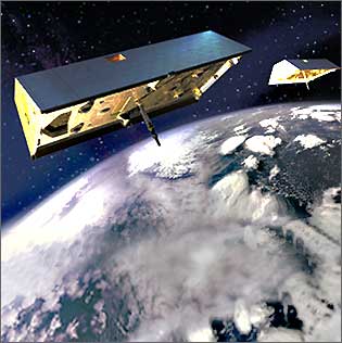
GRACE and GRACE Follow-On approach changing mass from another direction. The paired spacecraft map variations in Earth’s gravity field by measuring tiny changes in the separation between the satellites as they pass over regions with different mass. A water-loaded river basin exerts a slightly different gravitational pull from the surrounding region, allowing changes in stored water to be recovered from the satellites’ observations.


GRACE observations are especially useful for the Amazon because the mission measures mass rather than only visible surface water. River water, soil moisture, groundwater and other forms of terrestrial water storage all contribute to the changing gravitational signal. The monthly maps therefore provide an independent way to observe the large seasonal accumulation and loss of water that contributes to the geocenter cycle.

The revised geocenter estimate does not mean seasonal center-of-mass motion has only now been discovered. Satellite laser-ranging studies have been estimating CM–CF displacement since the 1990s. The 2026 paper instead changes how the geometric reference point is estimated, reduces a major disagreement between satellite-tracking and gravity-derived solutions and demonstrates that GPS and low-Earth-orbit tracking can provide an independent estimate of CM.
Millimeter-scale errors matter because Earth’s terrestrial reference frame underpins precise positioning, mapping and measurements of elevation and surface motion. NASA/JPL said improved understanding of processes that alter these reference systems can strengthen applications ranging from global shipping logistics to precision agriculture. The physical movement is too small to be felt, but it is large enough to matter when measurements depend on millimeter-level stability.
The method still depends on geophysical models of the loads responsible for seasonal deformation. The researchers assume that changes in atmospheric, oceanic and continental-water mass account for the seasonal elastic response they remove from the station records. Their independent comparison shows that the corrected satellite-orbit estimates are highly consistent with the mass variations represented in those models, but the calculation remains a model-assisted geodetic estimate rather than a direct physical measurement of the geometric center itself.
The gravity record used to test the result is continuing. GRACE-FO has operated since 2018, while NASA and the German Research Centre for Geosciences are developing the GRACE-Continuity mission to extend the series. NASA currently lists GRACE-C for launch in December 2028, providing a future record against which seasonal mass redistribution and geocenter estimates can continue to be tested.
References:
1 Argus, D. F., Gaastra, K. M., Haines, B. J., Heflin, M. B., Landerer, F. W., Peidou, A., Wiese, D. N., Blewitt, G., Kreemer, C., Dobslaw, H., & Swarr, M. J. (2026). Estimation and cause of the seasonal oscillation between Earth’s centre of mass and centre of figure. Geophysical Journal International, 247(2), ggag314. DOI: 10.1093/gji/ggag314
2 NASA Watches Earth’s Weight, Finds Center of Mass – NASA Jet Propulsion Laboratory – September 16, 2026
3 GRACE-C – NASA Science – accessed November 12, 2026

I’m a science journalist and researcher at The Watchers, contributing to the Epicenter edition, where I cover peer-reviewed scientific research and emerging discoveries across Earth and space sciences. With a background in astronomy and a passion for environmental science, I’ve worked in shark and coral conservation in Fiji, conducting reef and shark-behavior research, contributing to mangrove restoration, and earning PADI Open Water and Coral Reef Certifications. I bring a blend of scientific rigor and storytelling to illuminate the discoveries shaping our planet and beyond.
Published in the last 24 hours
- A fish filmed 600 meters below the Pacific has a transparent head, and its eyes rotate inside it to follow prey Epicenter
- In 1927, Louisiana dynamited a Mississippi River levee to save New Orleans, flooding the homes of about 10,000 people downstream, and the city turned out never to need it Epicenter
- Hurricane Katrina swept eight aquarium dolphins out to sea in Mississippi in 2005, and 12 days later they were found still swimming together Epicenter
- Antarctic moss began growing again after at least 1,530 years frozen in permafrost Epicenter
