
Huge waves pummel California coast during strong El Niño, flooding streets and closing piers from Pacifica to San Diego
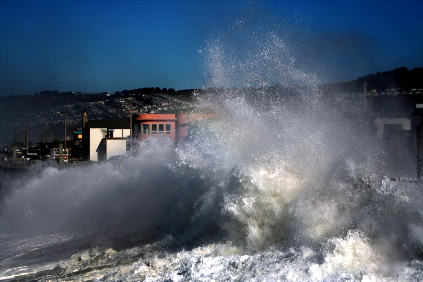
Powerful swells from storms in the North Pacific battered the California coast from November 14 to 16, 2026, flooding streets and parking lots, cracking a seawall in Pacifica and closing piers from Ventura to San Diego. Waves above 15 m (50 feet) were recorded in San Mateo County, south of San Francisco, and the National Weather Service (NWS) says more rounds of large surf will reach the coast this week.
The swell arrives as one of the strongest El Niño events on record warms the Pacific and keeps sea levels along the coast higher than normal, which lets storm surf push farther inland at high tide.
Northern California takes the brunt
NWS San Francisco Bay Area kept a High Surf Warning in place from 18:00 PT on Friday, November 13, to 04:00 PT on Sunday, November 15, for breaking waves of 7.6 to 10.7 m (25 to 35 feet), with occasional 40- to 50-foot (12 to 15 m) sets at favored break points. A High Surf Advisory replaced it and remains in effect until 04:00 PT on Tuesday, November 17, for 6 to 7.6 m (20 to 25 feet) breakers and sets of 25 to 35 feet at favored spots. The office warned that high tides would flood low-lying infrastructure, close some roads and erode the coast.
NWS Bay Area meteorologist Rachel Kennedy said waves at major break points such as Mavericks reached 15 to 18 m (50 to 60 feet) on Saturday, November 14, and that a buoy off Point Reyes measured a 9.5 m (31.2 feet) wave that morning, the highest there since 2015. She said the surf came largely from a storm with hurricane-force winds near the Gulf of Alaska. “The beach is not your friend this weekend,” Kennedy said, speaking to the Los Angeles Times.
In Pacifica, waves broke over the seawall along Beach Boulevard at the midday high tide on Saturday, pushing water across parking lots, sidewalks and streets. Resident Savannah Peterson said a concrete plate on the seawall near Salada Avenue lifted and buckled overnight, and the city closed off the area around the damage. Sandbags placed in advance held back some of the water.
In Santa Cruz, waves broke over the bluffs along West Cliff Drive and sent water across the road. The city had closed its beaches and wharf ahead of the swell. The Santa Cruz County Sheriff’s Office issued an evacuation warning for a stretch of coast near Capitola, which took some of the heaviest surf.
Farther north, NWS Eureka had a High Surf Advisory for 6.7 to 8.5 m (22 to 28 feet) breakers in Del Norte, Humboldt and Mendocino counties until 04:00 PT on Monday, November 16.
Piers closed in Southern California
Piers in Ventura, Manhattan Beach, Hermosa Beach, Huntington Beach and Pacific Beach in San Diego closed over the weekend as waves slammed into them. Several inches of water covered the strand in Seal Beach and flooded beachfront homes, and at La Jolla Cove water poured over the beach and up a staircase.
Warnings in effect on Monday, November 16
- San Luis Obispo and Santa Barbara Central Coast beaches: High Surf Advisory until 15:00 PT Tuesday for 3 to 4.6 m (10 to 15 feet) breakers increasing to 4.6 to 5.5 m (15 to 18 feet), with local sets to 6 m (20 feet). A Coastal Flood Advisory runs from 06:00 to 21:00 PT Monday. NWS Los Angeles/Oxnard says moderate flooding of beach parking lots, bike paths and harbor walkways is likely around high tide.
- Ventura County beaches: High Surf Advisory until 15:00 PT Tuesday for 2.4 to 3.7 m (8 to 12 feet) breakers on Monday.
- Malibu and Los Angeles County beaches: High Surf Advisory until 15:00 PT Tuesday for 2.1 to 2.7 m (7 to 9 feet) breakers on Monday, with minor tidal overflow during morning high tides.
- Orange and San Diego county coasts: High Surf Advisory until 04:00 PT Wednesday, November 18. NWS San Diego says a fresh swell arriving Monday afternoon will bring 1.8 to 2.7 m (6 to 9 feet) breakers with sets to 3.4 m (11 feet) on west-facing beaches.
- San Francisco, Marin, San Mateo and Monterey Bay coasts: High Surf Advisory until 04:00 PT Tuesday, November 17.
NWS Los Angeles/Oxnard expects a series of strong west-northwesterly swells this week, with the highest surf and greatest impacts peaking again on Monday, Wednesday and Thursday. Advisories may be extended through Wednesday, and another round of larger surf is expected on Thursday and Friday, November 19 and 20. The swells overlap with two storms and an atmospheric river forecast to bring heavy rain and flood risk to California from late Tuesday into Thursday.
The El Niño factor
The swells came from North Pacific storms, and El Niño is raising the water they break on. According to NOAA’s National Ocean Service, El Niño-driven Kelvin waves, slow-moving pulses of warm water moving up the West Coast, can temporarily raise sea level by 15 to 30 cm (6 to 12 inches) or more for several weeks. A marine heatwave adds to this, because warmer water expands. From October 24 to 30, tide gauges in San Diego, La Jolla, Los Angeles and Santa Barbara recorded their highest water levels ever, with San Diego reaching 0.85 m (2.80 feet) above Mean Higher High Water. Watchers covered that flooding, which led Huntington Beach to declare an emergency.
Scientists at the Scripps Institution of Oceanography describe El Niño as a “triple threat” for the California coast. Coastal geomorphologist Adam Young said heavier rain triggers landslides, powerful waves speed up erosion of beaches, cliffs and bluffs, and strong El Niño conditions can raise local sea level by 15 to 30 cm (6 to 12 inches). Physical oceanographer Mark Merrifield said the shift in tropical storm activity during El Niño changes North Pacific storm tracks and leads to higher waves along California. The largest waves measured by the Coastal Data Information Program came during the strong 2015–16 El Niño, when individual waves topped 19 m (63 feet) off Mendocino and 16.8 m (55 feet) off Point Reyes in December 2015.
Costas Synolakis, a coastal engineer at the University of Southern California, said storms that arrive one after another are the most damaging, because beaches have no time to rebuild before the next one hits. He said this winter’s waves would not need to match the heights of 1983 to cause similar damage, because mean sea level is already higher than it was then.
NOAA’s index put El Niño at 2.0 °C earlier this month, just behind 1997–98 at the same point, and its winter outlook favors a wetter season across the southern U.S. NOAA also predicts above-normal high tides from November 22 to 27 and from December 22 to 26, 2026, when the risk of coastal flooding will rise again.
NWS advises people to stay out of the water, keep off rocks, jetties and piers, and never turn their back on the ocean. Sneaker waves can run far up the beach without warning.
Featured image: Storm waves in Pacifica, California (file photo, 2006). Credit: Brocken Inaglory / Wikimedia Commons, CC BY-SA 3.0
Sources: NWS San Francisco Bay Area, NWS Los Angeles/Oxnard, NWS San Diego, NWS Eureka, U.S. Coast Guard, NOAA National Ocean Service, Scripps Institution of Oceanography, AP, NBC Bay Area, Los Angeles Times

The Watchers Staff covers earthquakes, volcanoes, severe weather, space weather and other natural events. Published since 2011, The Watchers reports on a changing planet and the science behind it.
Published in the last 24 hours
- 2 atmospheric rivers to bring heavy Sierra snow and California flood risk
- A fireball over northern China on 6 November 2026 punched a crater into a wheat field at Beigucheng village in Hebei; the Institute of Geochemistry has now classified the fallen stones as L6 ordinary chondrites. Epicenter
- The interstellar comet 3I/ATLAS is thought to be about twice as old as Earth, and the James Webb Space Telescope has now found that its ice looks less like any comet from our own solar system than like the frozen worlds beyond Neptune, a sign it formed somewhere its star’s light could barely reach Epicenter
- Mount Everest is the highest point above sea level, but because the Earth bulges at the equator, the summit of a volcano in Ecuador sits farther from the centre of the planet, making it the closest piece of land on Earth to outer space Epicenter
