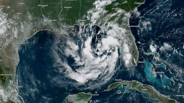
• Tropical Storm and Storm Surge watches expanded from Florida to Louisiana as Gulf depression strengthens

    Tropical Depression Two became better organized over the northeastern Gulf of Mexico on July 20, 2026, prompting the National Hurricane Center (NHC) to expand the Tropical Storm Watch from the Florida Panhandle westward to southeastern Louisiana and issue a Storm Surge Watch for parts of the northern Gulf Coast. The depression had maximum sustained winds of 55 km/h (35 mph) at 15:00 UTC and is expected to become a tropical storm later today, followed by gradual strengthening through Tuesday.
  • Enhanced risk of severe thunderstorms issued for parts of the Northeast, Mid-Atlantic, and Lower Great Lakes on July 18

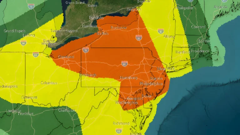
    An enhanced risk of severe thunderstorms has been issued for portions of the Northeast, Mid-Atlantic, and Lower Great Lakes on Saturday, July 18, 2026, as an unusually strong upper-level storm system brings the threat of widespread damaging winds, large hail, and several tornadoes through the afternoon and evening.

  • M7.3 earthquake hits offshore Chiapas, Mexico, small tsunami waves recorded

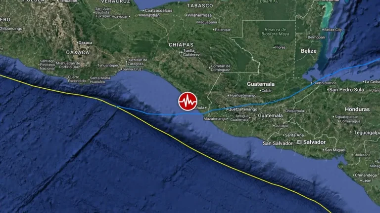
    A major earthquake registered by the USGS as M7.3 struck offshore Chiapas, Mexico at 14:48 UTC on July 17, 2026. The agency is reporting a depth of 15.2 km (9.4 miles). EMSC is reporting M7.3 at a depth of 25 km (15.5 miles). According to the Pacific Tsunami Warning Center (PTWC), hazardous tsunami waves are forecast for some coasts.

  • Two killed and 230 rescued as catastrophic flash floods strike Texas

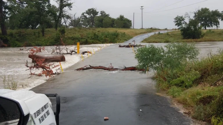
    At least two people were killed and 230 rescued after repeated thunderstorms produced catastrophic flash flooding across the Texas Hill Country and south-central Texas on July 16, 2026. Up to 711 mm (28 inches) of rain fell in northern Uvalde County over three days, while the Guadalupe River at Comfort rose more than 9 m (30 feet) in under three hours and crested near 11.3 m (37 feet). Texas deployed more than 2 350 emergency responders and over 1 400 response assets as flood waves moved through several river basins.

  • Minnesota sets new air pollution record, Superior National Forest reports the worst wildfire conditions in 20 years

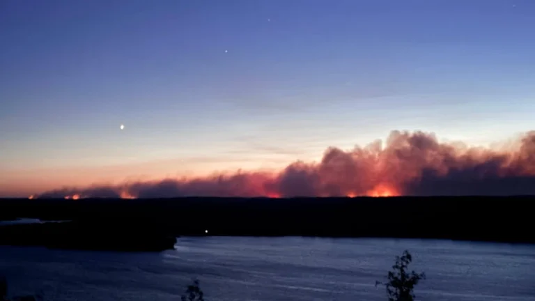
    Record-breaking wildfire smoke has reduced air quality across much of Minnesota, with pollution levels becoming so high that they exceeded the Minnesota Pollution Control Agency’s routine quality-control limits. The smoke is being generated from wildfires burning across Minnesota and parts of southern Canada. The Superior National Forest is experiencing the worst wildfire conditions in 20 years. Officials warn that hazardous smoke, extreme fire behavior, and additional wildfire growth are expected to continue as crews respond to 15 active fires across the Forest.

  • Large Guadalupe River flood wave prompts Flash Flood Emergency after confirmed EF1 tornado in San Antonio, Texas

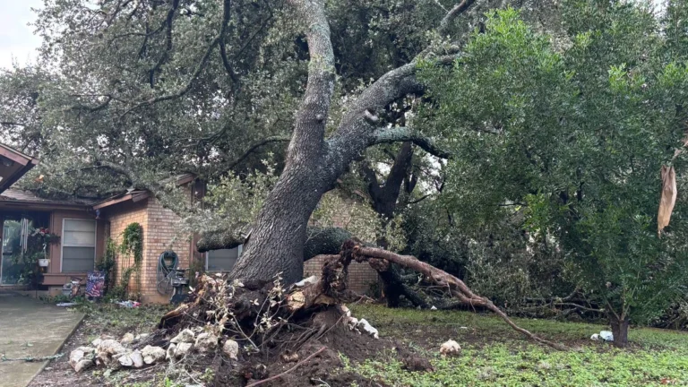
    A large flood wave moved downstream along the Guadalupe River through the Texas Hill Country on July 16, 2026, prompting a Flash Flood Emergency from Center Point to Bergheim as emergency crews expanded rescues across south-central and western Texas. The event followed a preliminary EF1 tornado confirmed in northwest San Antonio on July 15, but the main active hazard had shifted to life-threatening flash flooding across the Guadalupe basin and Uvalde County.

  • Texas flash flooding prompts water rescues near Uvalde, tornado reported in San Antonio

    High-water rescues, road closures, and shelter operations were reported across parts of South-Central Texas on July 14, 2026, after heavy rain produced flash flooding west of San Antonio. Governor Greg Abbott issued a disaster declaration for 59 counties, and the National Weather Service (NWS) warned that dangerous flash-flood conditions would continue across affected areas through the end of the week.

  • Moderate Risk of excessive rainfall issued, life-threatening flash floods forecast for south-central Texas

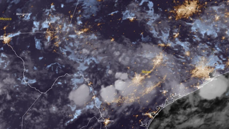
    A Moderate Risk (Level 3 of 4) of excessive rainfall is in effect for parts of south-central Texas through Tuesday morning, July 14, 2026. Repeated thunderstorms threaten are expected to produce life-threatening flash flooding across portions of southwest Texas. Forecast guidance shows a greater than 70% chance of rainfall exceeding 76 mm (3 inches) and a more than 50% chance of totals above 127 mm (5 inches) within the Moderate Risk area, while the National Water Center (NWC) expects considerable flooding impacts to last through Thursday, July 16

  • 20 reported dead, 16 missing as Bavi-enhanced monsoon triggers floods and landslides, Philippines

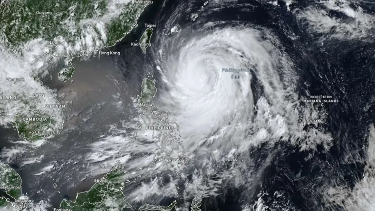
    The combined effects of Typhoon Bavi, locally named Inday, and the enhanced southwest monsoon left 20 people reported dead and 16 missing across the Philippines as of 08:00 LT (00:00 UTC) on Monday, July 13, 2026, while the National Disaster Risk Reduction and Management Council (NDRRMC) continued validating most casualty reports. About 654 000 people were affected nationwide, with flooding, landslides, damaged houses, disrupted roads, bridges and seaports, and about 20 100 people in evacuation centers.