
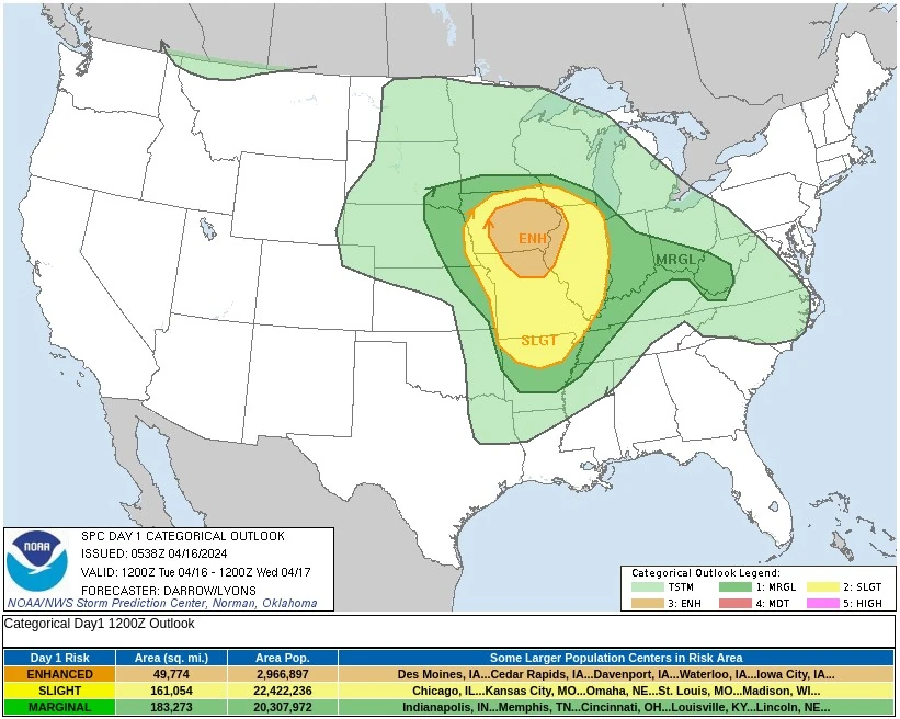
Enhanced Risk of Severe Weather (level 3/5) for portions of southern Iowa, northeastern Missouri, and far western Illinois
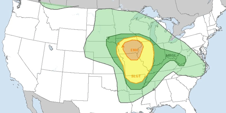
Image credit: NWS
There is an Enhanced Risk (Level 3 of 5) for severe thunderstorms on Tuesday, April 16, 2024, with threats for significant severe hail and tornado potential over southern Iowa into northern Missouri and west-central Illinois, the National Weather Service (NWS) warns.
A sustained arc of showers and thunderstorms wrapping around the low over the Northern Plains into the Upper Midwest this morning will continue to progress to the northeast, with more scattered storms extending southward through the central/southern Plains along an eastward advancing cold front, NWS forecaster Putnam noted.
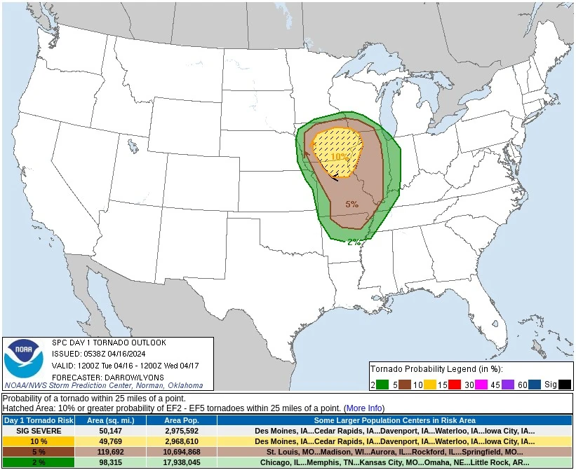
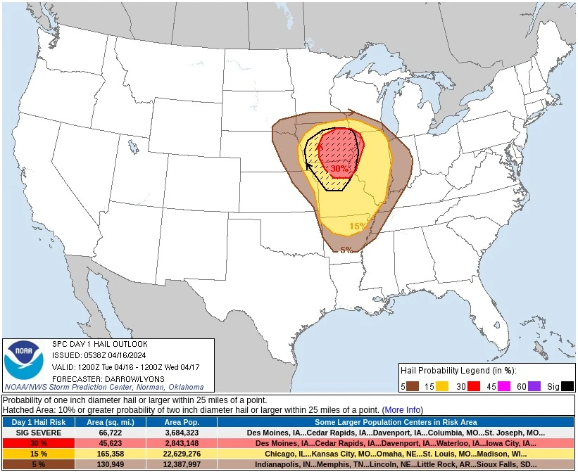
The Storm Prediction Center (SPC) has issued an Enhanced Risk of Severe Weather (level 3/5) for portions of southern Iowa, northeastern Missouri, and far western Illinois where these storms will pose a threat for very large hail, damaging winds, and tornadoes, including the risk for a strong tornado.
A broader Slight Risk (level 2/5) extends southward through Missouri into northern Arkansas where a more isolated threat for storms will exist, but will still pose the threat for all hazards.
In addition to severe weather, rounds of heavy rainfall from the more widespread storms over the Upper Midwest along with potentially more scattered but heavier downpours with storms to the south through the Middle Mississippi Valley will pose a threat for some isolated flash flooding.
The system will continue eastward on Wednesday, April 17, into the Great Lakes region and Ohio Valley.
Similar to Tuesday, storms will likely be ongoing overnight Tuesday into early Wednesday, especially to the north from the Upper Midwest into the Great Lakes. Some scattered storms may also continue along the cold front as it pushes into the Ohio Valley.
A renewed round of storm development is expected ahead of the front by Wednesday afternoon, with a Slight Risk of severe weather in place from eastern Indiana into southern Michigan and western Ohio for the threat of large hail, damaging winds, and a few tornadoes.
The storms are forecast to continue overnight Wednesday into the Mid-Atlantic. Again, similar to Tuesday, more widespread rainfall over the Great Lakes and the potential for some more potent downpours with storms further south will pose a threat for some isolated flash flooding.
Additionally, elevated to critical fire weather is possible Tuesday due to gusty winds and dry conditions over parts of the southern High Plains and northeastern Montana.
References:
1 Short Range Forecast Discussion – NWS Weather Prediction Center College Park MD – 405 AM EDT Tue Apr 16 2024
2 Day 1 Convective Outlook – NWS Storm Prediction Center Norman OK – 1238 AM CDT Tue Apr 16 2024
I'm a dedicated researcher, journalist, and editor at The Watchers. With over 20 years of experience in the media industry, I specialize in hard science news, focusing on extreme weather, seismic and volcanic activity, space weather, and astronomy, including near-Earth objects and planetary defense strategies. You can reach me at teo /at/ watchers.news.
Commenting rules and guidelines
We value the thoughts and opinions of our readers and welcome healthy discussions on our website. In order to maintain a respectful and positive community, we ask that all commenters follow these rules.