
Rain and hail cause flooding in parts of Cuajimalpa after one-hour rainfall exceeds 75 mm (3 inches), Mexico
Thunderstorms and possible hail are forecast across Mexico City on June 2, 2026, after parts of Cuajimalpa received more than 80 mm (3.15 inches) of rain during the previous 24 hours.
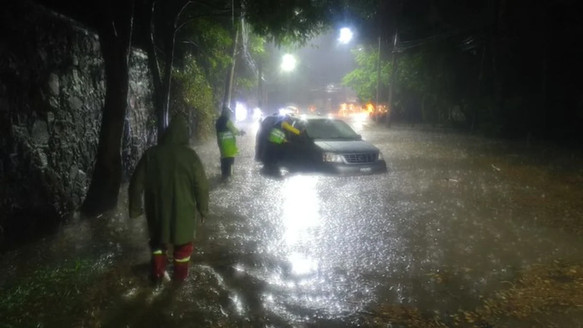
Stranded cars on Arteaga and Salazar Avenue due to flooding on June 2, 2026. Credit: Secretaría de Gestión Integral de Riesgos y PC
A severe storm brought intense rain and hail to Cuajimalpa, western Mexico City, on June 1, causing flooding, hail-clogged drains, and a reported overflow at Barranca Santa Rita.
The Mexico City Secretariat for Comprehensive Risk Management and Civil Protection (SGIRPC) activated a Purple Alert for the borough after rainfall exceeded 70 mm (2.76 inches), while the Mexico City Secretariat for Integrated Water Management (SEGIAGUA) deployed crews across the affected area.
SEGIAGUA rainfall data placed the highest total at Yaqui, where 80.25 mm (3.16 inches) was recorded. La Venta recorded 78.25 mm (3.08 inches), Desierto de los Leones 53.5 mm (2.11 inches), and Cartero 42.75 mm (1.68 inches) in Cuajimalpa. Río Magdalena recorded 43.5 mm (1.71 inches) and Monte Alegre 36.75 mm (1.45 inches) in La Magdalena Contreras. Total rainfall volume across Mexico City exceeded 10.3 million m³ between 06:00 and 22:00 LT on June 1.
The storm intensified rapidly at the two highest-reporting stations. Yaqui rose from 3 mm (0.12 inches) to 78.5 mm (3.09 inches) in one hour, while La Venta rose from 5.25 mm (0.21 inches) to 75.50 mm (2.97 inches) over the same period, according to SEGIAGUA data.
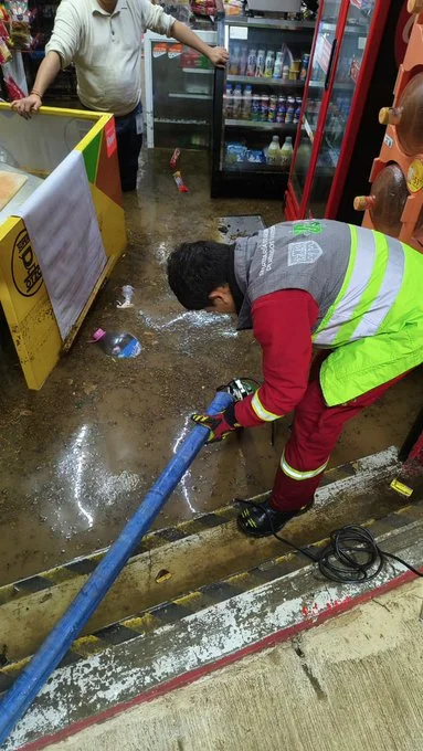
 Flooding in Mexico City on June 2, 2026. Credit: Secretaría de Gestión Integral de Riesgos y PC
- Flooding in Mexico City on June 2, 2026. Credit: Secretaría de Gestión Integral de Riesgos y PC
- Stranded cars on Arteaga and Salazar Avenue due to flooding on June 2, 2026. Credit: Secretaría de Gestión Integral de Riesgos y PC

SGIRPC issued Red Alerts for Álvaro Obregón and La Magdalena Contreras for 50–70 mm (1.97–2.76 inches) of rain and hail, and Orange Alerts for Miguel Hidalgo, Milpa Alta, Tlalpan, and Xochimilco for 30–49 mm (1.18–1.93 inches).
SEGIAGUA mapped response work to several ponding and flooding points in Cuajimalpa, including Juan de Dios at Miguel Romero in El Yaqui and José María Castorena at Antonio Ancona, while hail blocked storm-drain grates at Ébano and Jacaranda.
Infobae, citing SEGIAGUA operations, reported that 105 personnel and 31 equipment units were mobilized after the storm. The deployment included 10 emergency pumping vehicles, 15 hydropneumatic units, three Hércules units, and three pickup or sedan vehicles.
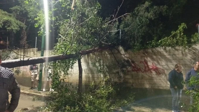
A landslide in Contadero brought down a tree about 15 m (49 feet) tall onto two vehicles, La Jornada reported, citing Mexico City fire chief Juan Manuel Pérez Cova. One person was rescued unharmed from one of the vehicles. The same report said two vehicles were stranded in El Yaqui, and crews installed a submersible pump at Prolongación Juárez and Callejón de la Vía in Lomas de Memetla after water entered four establishments.
For June 2, the National Meteorological Service (SMN) forecast showers of 5–25 mm (0.20–0.98 inches) in Mexico City and stronger rainfall of 25–50 mm (0.98–1.97 inches) in parts of the State of Mexico, accompanied by possible lightning and hail. The agency warned that stronger rainfall in other parts of Mexico could raise river and stream levels and cause landslides, ponding, and flooding in low-lying areas.
1 General Weather Forecast – SMN – June 2, 2026

I’m a science journalist and researcher at The Watchers, contributing to the Epicenter edition, where I cover peer-reviewed scientific research and emerging discoveries across Earth and space sciences. With a background in astronomy and a passion for environmental science, I’ve worked in shark and coral conservation in Fiji, conducting reef and shark-behavior research, contributing to mangrove restoration, and earning PADI Open Water and Coral Reef Certifications. I bring a blend of scientific rigor and storytelling to illuminate the discoveries shaping our planet and beyond.
Commenting rules and guidelines
We value the thoughts and opinions of our readers and welcome healthy discussions on our website. In order to maintain a respectful and positive community, we ask that all commenters follow these rules.