
El Niño strengthens, 81% chance of becoming one of the strongest on record by late 2026
El Niño has strengthened significantly over the past month and is expected to intensify through the end of 2026, with NOAA forecasters warning there is now an 81% chance the climate pattern could rank among the strongest El Niño events observed since records began in 1950.

Water expands as it warms, causing the surface of the ocean to rise. Higher-than-usual sea surfaces in the tropical Pacific Ocean, shown here from June 1--10, 2023, are a signature of El Niño. Credit: NASA/JPL-Caltech
El Niño has strengthened significantly over the past month and is expected to intensify through the remainder of 2026, according to the latest ENSO Diagnostic Discussion released by NOAA’s Climate Prediction Center (CPC) on July 9.
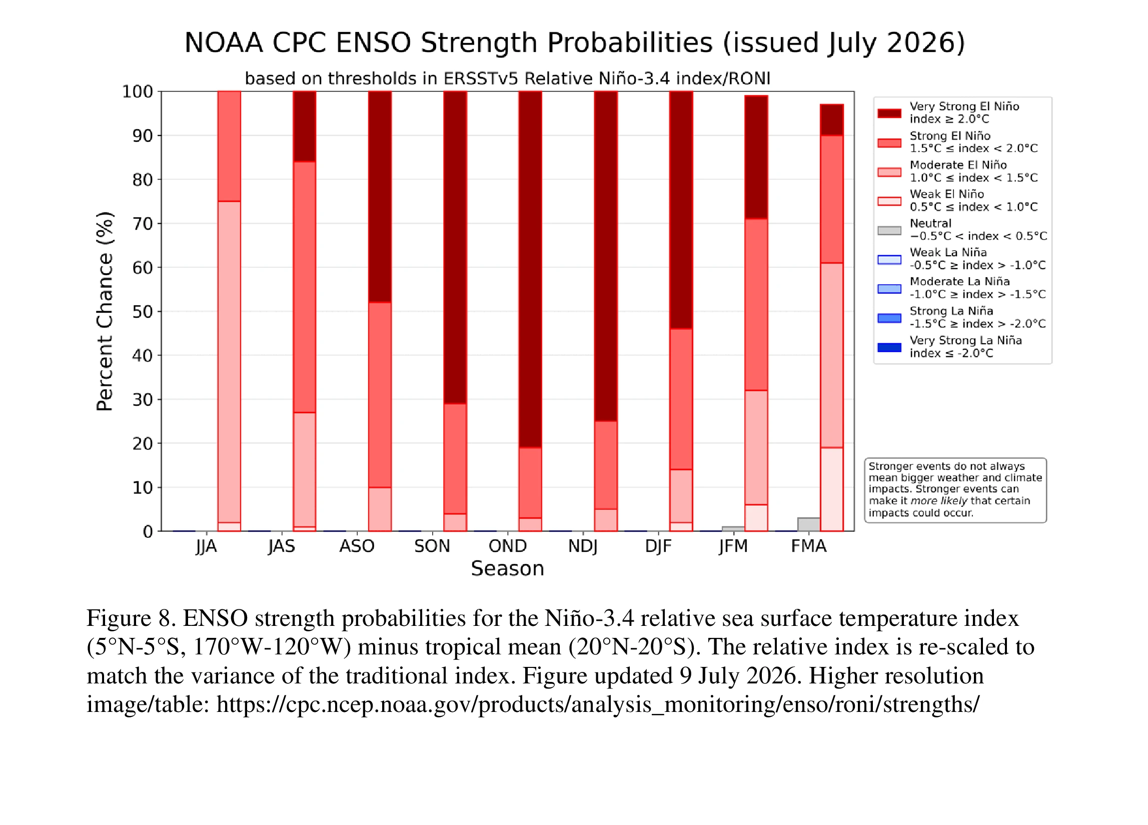
There is now a 97% chance that El Niño will persist through early spring 2027. Model guidance also indicates an 81% probability that the event will become a very strong El Niño during the October-December period, potentially placing it among the strongest events recorded since reliable records began in 1950.
Sea surface temperatures across the central and eastern equatorial Pacific continued warming during the past month. A broad region of the Pacific is now experiencing sea surface temperature anomalies exceeding +1.0°C (+1.8°F), while the latest weekly Niño-3.4 index reached +1.2°C (+2.2°F).
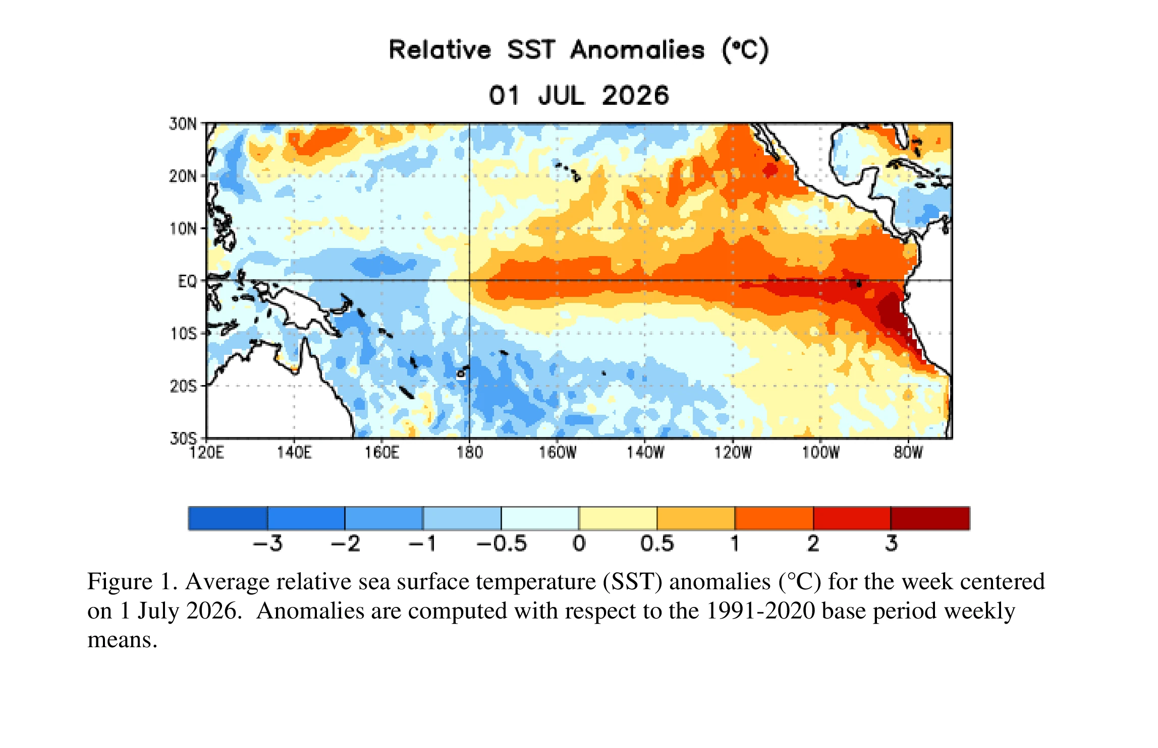
The strongest warming remains concentrated in the eastern Pacific, where the Niño-1+2 region registered +2.7°C (+4.9°F). Meanwhile, the Niño-4 region in the western Pacific measured +0.5°C (+0.9°F).
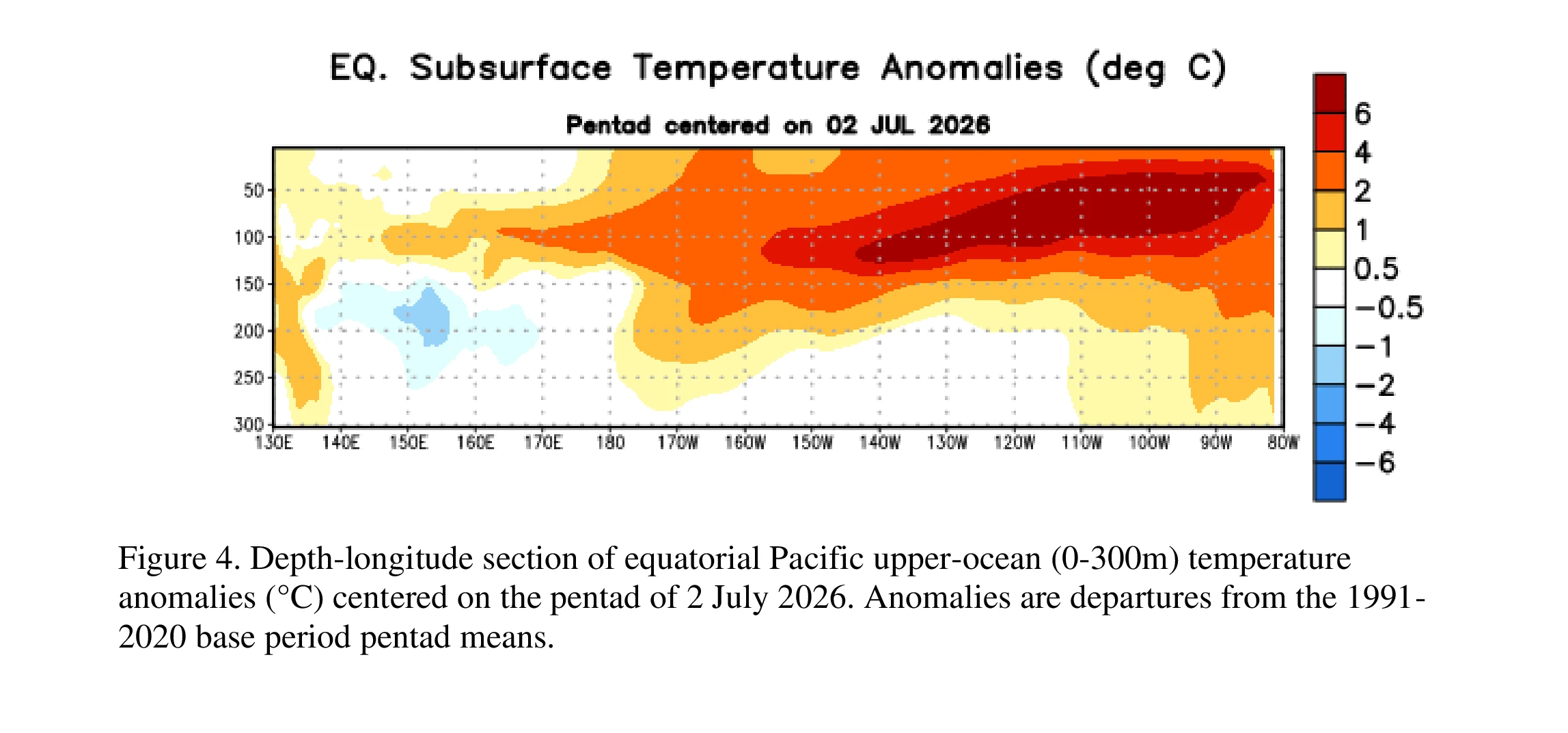
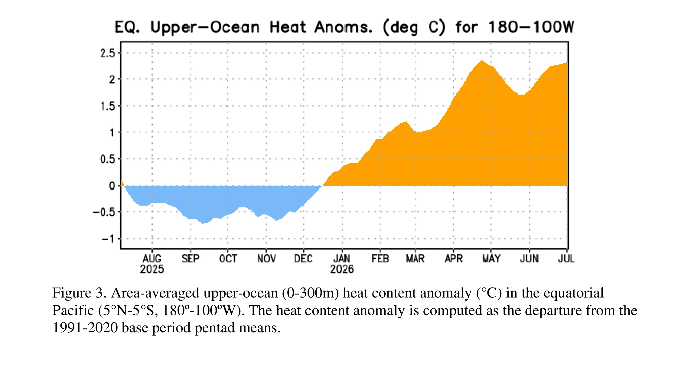
Warming beneath the ocean surface also increased as a recent downwelling Kelvin wave deepened the thermocline and transported warmer water eastward, reinforcing the ongoing El Niño.
Atmospheric conditions have strengthened alongside the ocean warming. Meteorologists observed low-level westerly wind anomalies across the western and central equatorial Pacific, upper-level easterly wind anomalies, enhanced thunderstorm activity over the central and east-central Pacific, and suppressed convection over Indonesia.
Traditional indicators of the Southern Oscillation also remained strongly negative, providing additional evidence that the ocean and atmosphere are now closely coupled—a hallmark of a strengthening El Niño.
Forecast models from the North American Multi-Model Ensemble (NMME), including NOAA’s Climate Forecast System Version 2 (CFSv2), consistently project further warming through the remainder of the year.
References:
1 El niño/southern oscillation (ENSO) diagnostic discussion – NOAA/CPC – July 9, 2026

I am an Assistant Editor and Severe Weather & Science Journalist at The Watchers, specializing in real-time severe weather coverage, geophysical event reporting, and research-driven scientific analysis. You can reach me at rishav(at)watchers(.)news.

Commenting rules and guidelines
We value the thoughts and opinions of our readers and welcome healthy discussions on our website. In order to maintain a respectful and positive community, we ask that all commenters follow these rules.