
Early El Niño signals seen in June forecasts for the United States and Canada
NOAA and long-range atmospheric forecast models are increasingly showing early El Niño-related circulation signals over North America as forecasters continue monitoring a developing transition away from ENSO-neutral conditions during summer 2026.
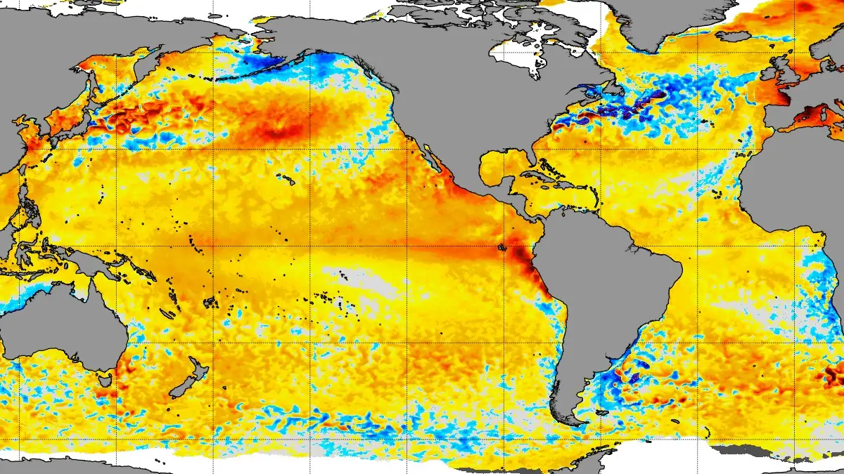
NOAA Coral Reef Watch daily 5 km (3.1 miles) sea surface temperature anomalies show above-average temperatures across parts of the tropical Pacific on May 26, 2026. Credit: NOAA Coral Reef Watch
Early signs of El Niño are beginning to appear in June weather forecasts across parts of the United States and Canada as NOAA continues monitoring a developing shift in the Pacific Ocean.
The latest ENSO Diagnostic Discussion from NOAA’s Climate Prediction Center (CPC) shows an 82% chance that El Niño will develop between May and July 2026. NOAA also forecasts a 96% chance that El Niño conditions will continue through the Northern Hemisphere winter of 2026–27.
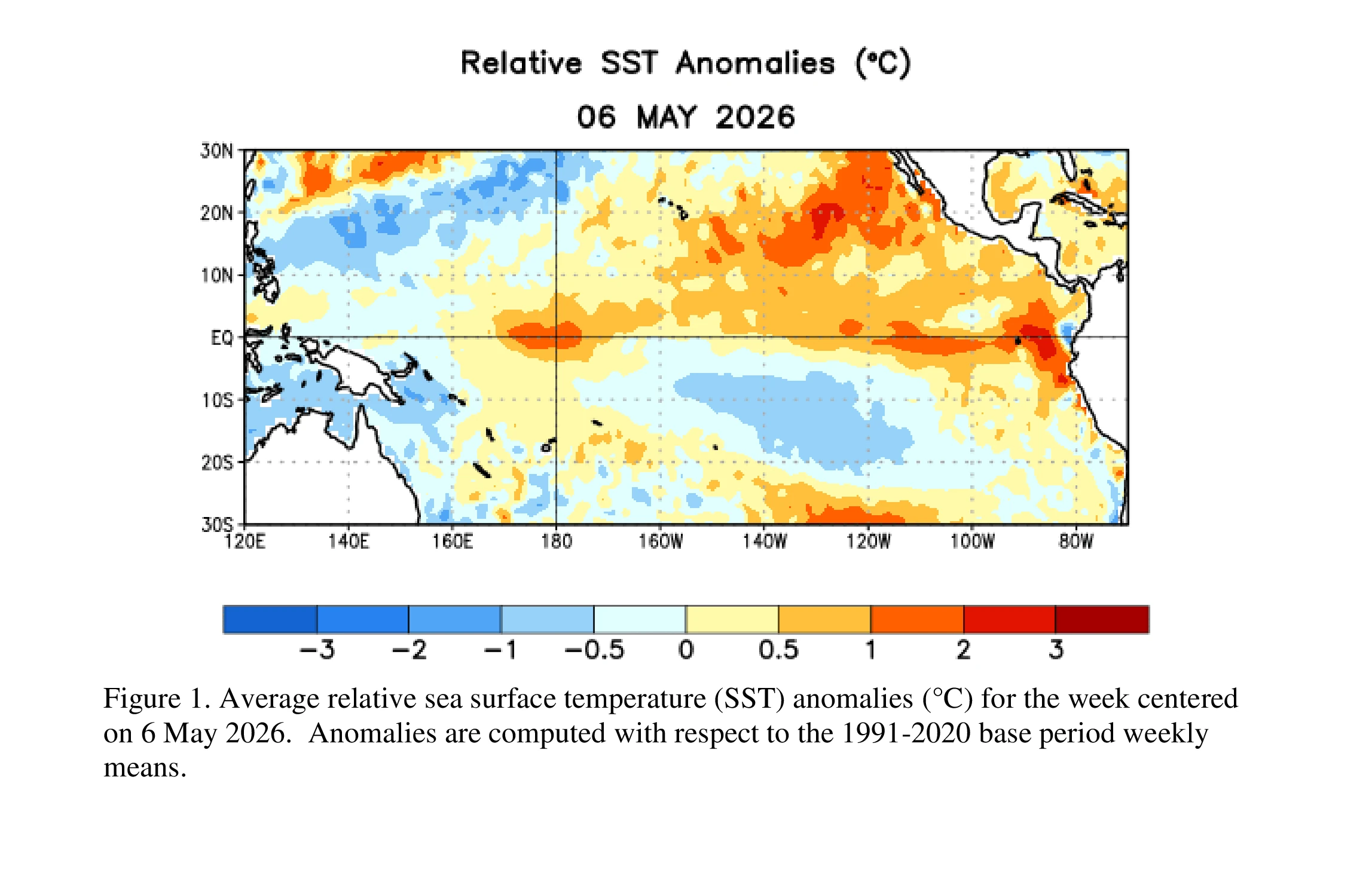
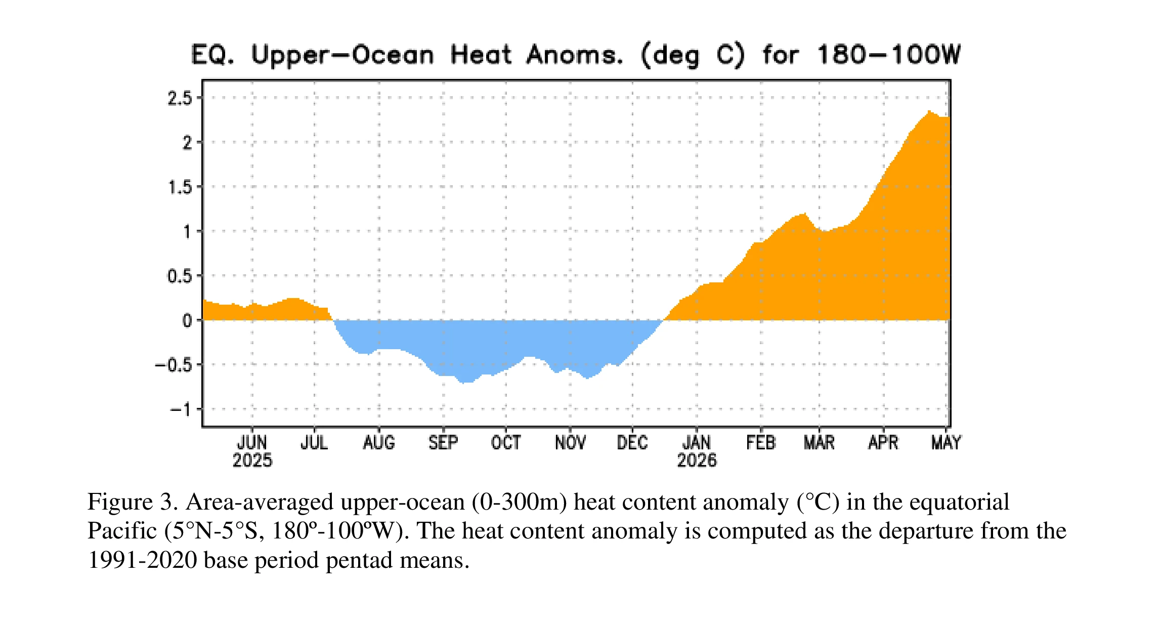
ENSO-neutral conditions continued during the past month, with near-average sea surface temperatures across the east-central equatorial Pacific Ocean. However, several important atmospheric and oceanic signals continued strengthening.
Forecast models are now beginning to show some of the first atmospheric changes linked to the developing El Niño pattern. Early June outlooks favor warmer-than-average temperatures across parts of western and central Canada, while some areas of the southern and eastern United States could experience more variable rainfall patterns.
The latest weekly Niño-3.4 index reached +0.4°C, while the Niño-4 and Niño-1+2 regions measured +0.5°C and +1.0°C, respectively. NOAA also reported that subsurface temperatures across the equatorial Pacific increased for the sixth consecutive month, with widespread warmer-than-average water developing below the ocean surface.
Forecasters also observed westerly wind anomalies over parts of the western and central equatorial Pacific, while thunderstorm activity remained suppressed near Indonesia. NOAA said the overall ocean-atmosphere system still reflected ENSO-neutral conditions, but the pattern increasingly supports El Niño development.
The North American Multi-Model Ensemble (NMME), including NOAA’s CFSv2 model, now favors El Niño formation by next month, with conditions likely persisting through winter 2026–27.
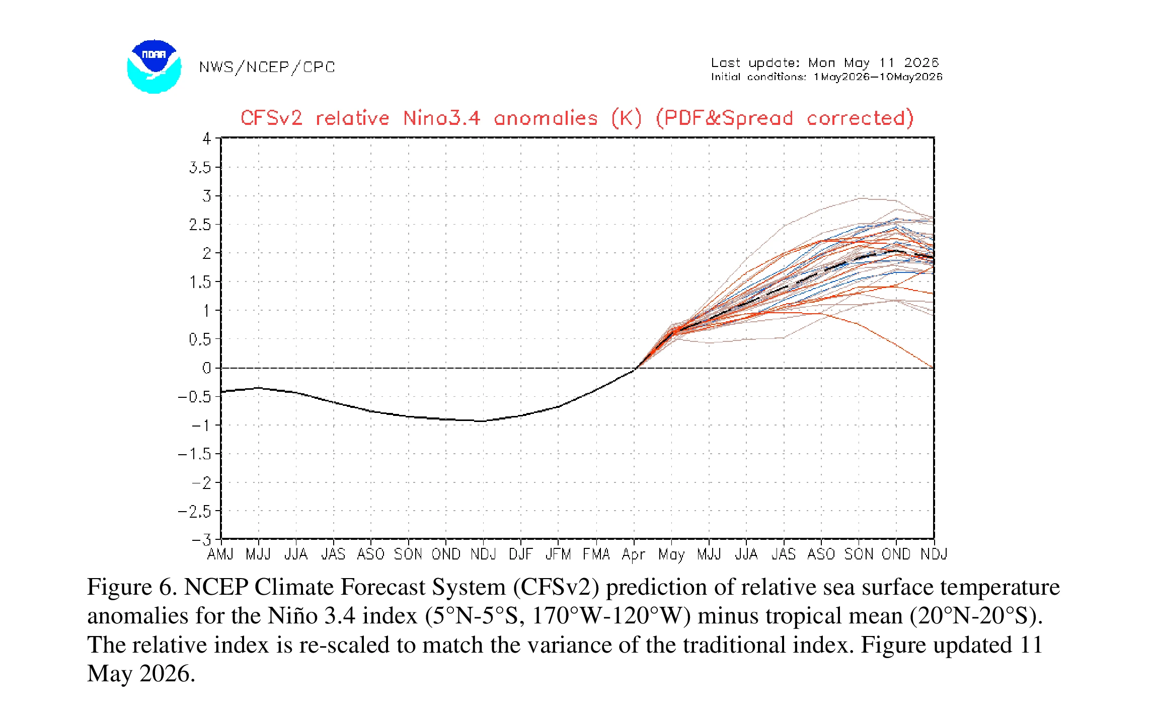
It shows a very strong El Niño developing, exceeding a Super El Niño threshold (+2 anomaly), and making a rapid impact. The development shows a similar signature to the previous strongest events, which is likely to be matched or exceeded this year.
Meteorologists are also observing early shifts in upper-level atmospheric circulation and jet stream positioning over North America. These changes are commonly linked to developing El Niño conditions, although forecasters stress that summer El Niño patterns are usually weaker and less predictable than those seen during winter.
The strongest early El Niño signal currently appears across parts of Canada and the northern United States, where forecast guidance increasingly supports warmer conditions during June and early summer.
Forecasters caution that many other weather factors still influence North American conditions during late spring and early summer. Soil moisture, regional pressure systems, and short-term jet stream changes can temporarily override developing El Niño patterns.
NOAA has also noted that stronger El Niño events can increase wind shear over parts of the tropical Atlantic later in hurricane season. Increased wind shear can make conditions less favorable for tropical cyclone development. However, NOAA has not linked the current June forecast pattern to any specific hurricane-season outcome for 2026.
References:
1 NOAA Climate Prediction Center ENSO Diagnostic Discussion – NOAA/CPC – May 14, 2026
2 First El Niño Impacts Now Detected in the June Weather Forecast for the United States and Canada – SWE – May 28, 2026

I am an Assistant Editor and Severe Weather & Science Journalist at The Watchers, specializing in real-time severe weather coverage, geophysical event reporting, and research-driven scientific analysis. You can reach me at rishav(at)watchers(.)news.
Commenting rules and guidelines
We value the thoughts and opinions of our readers and welcome healthy discussions on our website. In order to maintain a respectful and positive community, we ask that all commenters follow these rules.