
Tropical Storm Jangmi forecast to intensify into a typhoon over the Philippine Sea
Tropical Storm Jangmi was located 1 245 km (774 miles) east of southeastern Luzon at 17:00 LT (09:00 UTC) on May 28,2026 with PAGASA and JTWC forecasting continued intensification over the Philippine Sea during the next several days.
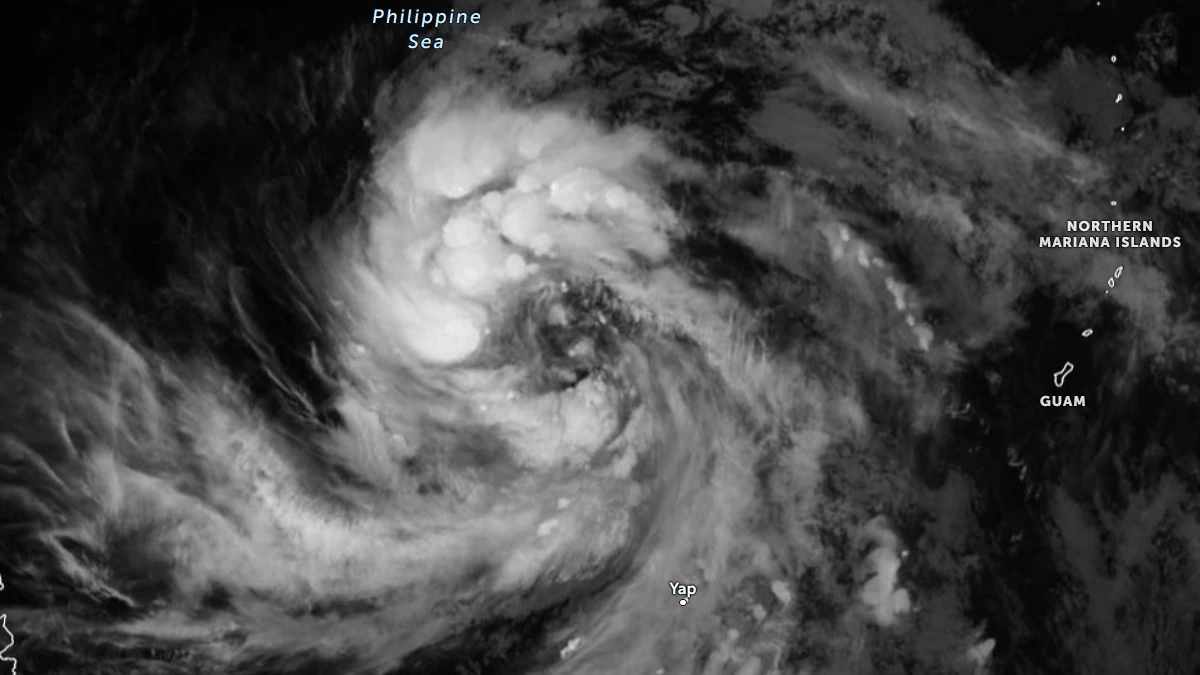
Satellite image of Tropical storm Jangmi at 11:00 UTC on May 28, 2026. Credit: JMA/Himawari-9, Zoom Earth, The Watchers
The Philippine Atmospheric, Geophysical and Astronomical Services Administration (PAGASA) began monitoring Tropical Storm Jangmi on May 28, as the storm strengthened outside the Philippines’ Area of Responsibility (PAR).
According to the weather update issued by PAGASA at 17:00 LT (09:00 UTC) on May 28, the system was located 1 245 km (774 miles) east of southeastern Luzon.
Maximum sustained winds averaged over 10 minutes reached 75 km/h (47 mph), with gusts of up to 90 km/h (56 mph). The storm was moving north-northeastward and affecting parts of Mindanao with cloudy skies and rain.
“This weather disturbance is less likely to make landfall over the country. Due to the eastward shift of the latest forecast track, the hoisting of tropical cyclone wind signals over Extreme Northern Luzon is becoming less likely, but not ruled out,” PAGASA said.
“Moderate to rough sea conditions may be experienced over the seaboards of Extreme Northern Luzon this weekend. Raising of gale warnings over the area is also possible. This tropical cyclone will likely enhance the southwesterly windflow starting on May 30,” they added.
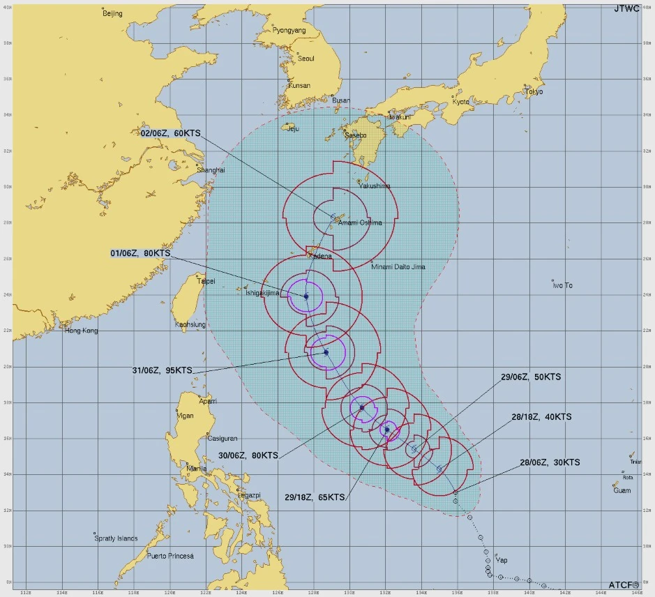
The system is forecast to enter PAR overnight into May 29, at which point it will be assigned the local name Domeng.
Jangmi is then forecast to continue moving northwestward over the Philippine Sea while intensifying into a typhoon by May 30, possibly reaching peak intensity on May 31. Based on current forecasts, the storm is expected to exit PAR by June 1 before weakening afterward.
According to the Joint Typhoon Warning Center (JTWC), the storm is forecast to track northeastward toward Japan under the influence of a weak subtropical ridge. The agency forecasts peak maximum sustained winds of more than 175 km/h (109 mph).
References:
1 Prognostic reasoning for Tropical Depression Jangmi – JTWC – May 28, 2026
2 Tropical Cyclone Advisory NR. 5 – PAGASA – May 28, 2026

I am an Assistant Editor and Severe Weather & Science Journalist at The Watchers, specializing in real-time severe weather coverage, geophysical event reporting, and research-driven scientific analysis. You can reach me at rishav(at)watchers(.)news.
Commenting rules and guidelines
We value the thoughts and opinions of our readers and welcome healthy discussions on our website. In order to maintain a respectful and positive community, we ask that all commenters follow these rules.