
Explosive strombolian eruptions at Mayon volcano, Philippines
Mayon volcano remained under Alert Level 3 on July 15, 2026, after PHIVOLCS recorded 187 volcanic earthquakes, 398 rockfalls, 10 pyroclastic density current signals, and SO2 emissions averaging 9 028 tonnes/day from the volcano in Albay, Philippines.
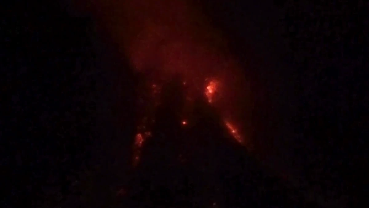
Lava effusions at the Mayon Volcano in Philippines on July 14, 2026. Credit: PHIVOLCS
Lava effusion, pyroclastic density currents (PDCs), volcanic tremors, and elevated sulfur dioxide (SO2) emissions continued at Mayon Volcano in Albay Province, Philippines, on July 15.
PHIVOLCS maintained Alert Level 3 over the volcano, with the LAVA bulletin for July 15 listing 187 volcanic earthquakes. These included 43 volcanic tremors lasting 5 to 45 minutes, 398 rockfall events, and 10 pyroclastic density currents. An ash plume rose 1 200 m (3 937 feet) above the summit crater, while SO2 emissions averaged 9 028 tonnes/day on July 14.
The eruption remained centered on slow lava effusion from the summit crater. DSWD’s July 13 situation report said lava flows had reached 4 km (2.5 miles) along Basud Gully, 3 km (2 miles) along Bonga Gully, and 1.6 km (1.0 mile) along Mi-isi Gully, while rockfall and PDC runouts remained confined within 3 km (1.9 miles) of the summit crater.
Entry has been prohibited within the Permanent Danger Zone with a radius of 6 km (4 miles) due to PDCs, lava flows, rockfalls, and other volcanic hazards.
Tokyo VAAC issued multiple advisories for Mayon on July 14 and 15. The center reported an eruption at 16:09 UTC on July 14, with volcanic ash extending south-southeast to 4 km (13 000 feet) above sea level, drifting southeast.
Tokyo VAAC reported another eruption at 03:22 UTC but said volcanic ash was not identifiable in satellite data and that no further advisory would be issued unless ash was detected in satellite imagery.
LOOK: Sped-up camera footages of lava effusion with Strombolian activity from the Mayon Volcano summit crater recorded at 08:09 PM, 09:13 PM, 10:27 PM and 10:48 PM yesterday, 14 July 2026, as captured by the PHIVOLCS Quick Response Team. Effusive eruption at Mayon Volcano… pic.twitter.com/9tjKpyDNWX
— PHIVOLCS-DOST (@phivolcs_dost) July 14, 2026
DSWD reported 71 552 families, or 293 974 persons, affected across 159 barangays in Region V as of 18:00 local time on July 13. The figure included both directly observed impacts and at-risk populations identified through local government hazard mapping.
A total of 1 088 families, or 3 976 persons, were staying in 12 evacuation centers, while 40 families, or 137 persons, were staying with relatives or friends. The total displaced population stood at 1 128 families, or 4 113 persons.
Mayon is a composite stratovolcano in the Eastern Philippine Volcanic Arc, with a summit elevation of 2 462 m (8 077 feet). The Smithsonian/USGS Global Volcanism Program lists Mayon’s most recent eruption as occurring in 2026 CE and describes it as the most active volcano in the Philippines, with historical eruptions since 1616 CE ranging from Strombolian to basaltic Plinian activity.
References:
1 DSWD DROMIC Report #92 on the Mayon Volcano Seismic Activities – DWSD – July 13, 2026
2 “Volcanic Ash Advisory Text” for Mayon Volcano – Tokyo VAAC – July 15, 2026
3 24 hour observation summary of Mayon Volcano – PHIVOLCS – July 15, 2026

I am an Assistant Editor and Severe Weather & Science Journalist at The Watchers, specializing in real-time severe weather coverage, geophysical event reporting, and research-driven scientific analysis. You can reach me at rishav(at)watchers(.)news.

Commenting rules and guidelines
We value the thoughts and opinions of our readers and welcome healthy discussions on our website. In order to maintain a respectful and positive community, we ask that all commenters follow these rules.