
Enhanced Risk of severe thunderstorms issued for northern New York and New England
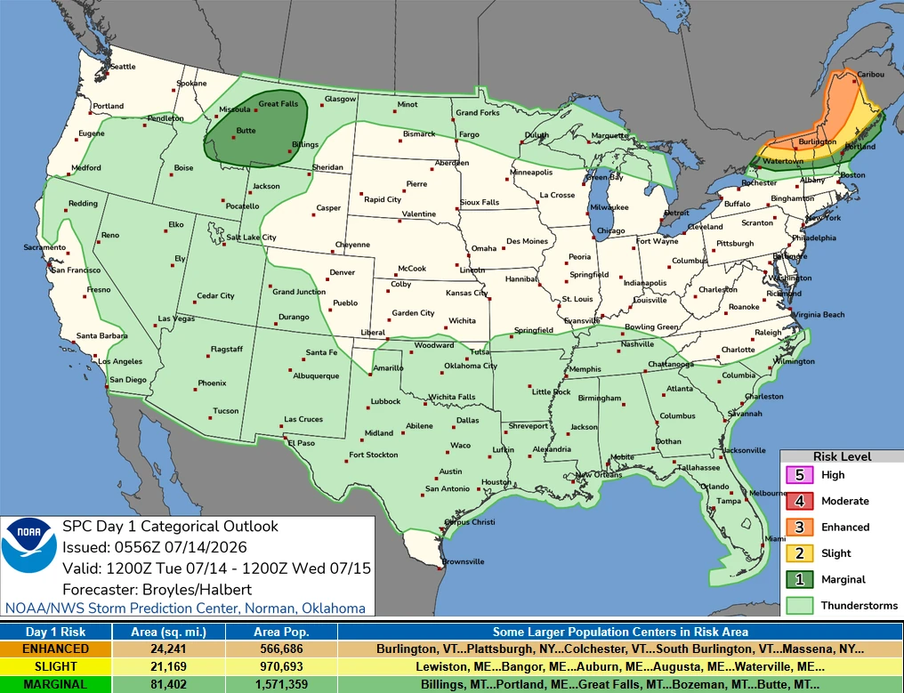
The Storm Prediction Center (SPC) has placed parts of the New England region under an Enhanced Risk (Level 3 of 5) for severe thunderstorms on Tuesday, July 14, 2026. The greatest threat covers northern New York and northern New England, where thunderstorms are expected to produce widespread damaging wind gusts, large hail, and a few tornadoes. Forecasters also say that one or two strong tornadoes are possible if conditions develop as expected.
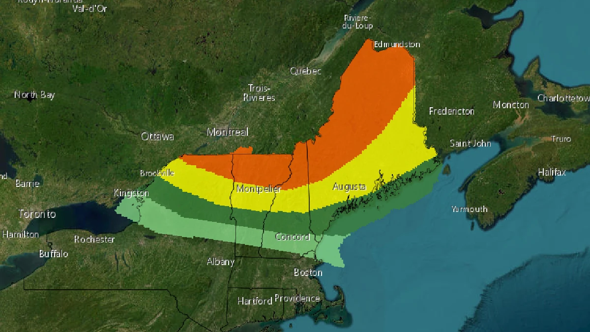
Image credit: NWS
An Enhanced Risk (Level 3 of 5) of severe thunderstorms has been issued for parts of the northeastern United States on Tuesday, July 14. Severe weather conditions capable of producing destructive winds, large hail, and a few tornadoes are expected.
The greatest threat will extend across northern New York and northern New England, where a strong tornado cannot be ruled out.
The severe weather threat is expected to increase during the afternoon as a fast-moving upper-level disturbance sweeps across southeastern Canada while warm, humid air remains firmly in place over the Northeast.
Daytime heating combined with surface dew points in the 21–29°C (70s°F) range will create an increasingly unstable atmosphere ahead of an approaching pre-frontal trough stretching from near Lake Ontario into southern Quebec.
Thunderstorms are forecast to develop along this boundary before tracking southeast into northern New York and northern New England through Tuesday afternoon and evening.
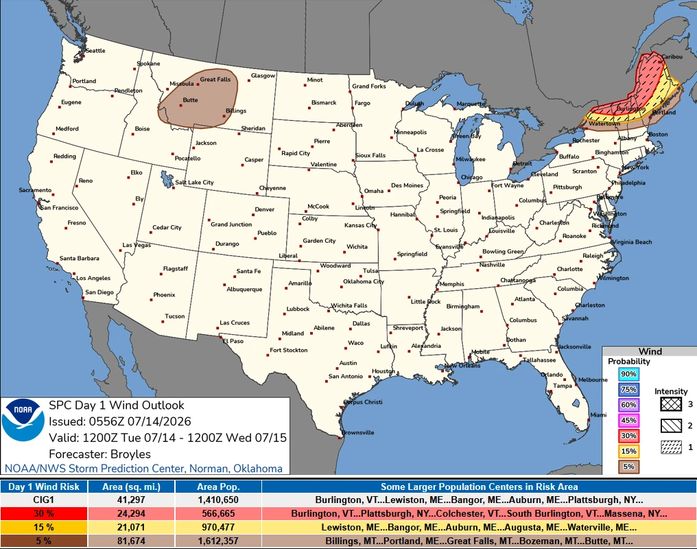
The environment will be capable of supporting both discrete supercell thunderstorms and organized lines of storms, according to the SPC. Strong wind shear and abundant instability will allow storms to become intense quickly, with damaging straight-line winds being the greatest threat.
Some of the strongest storms could produce wind gusts exceeding 113 km/h (70 mph), capable of downing trees, damaging structures, and causing scattered power outages.
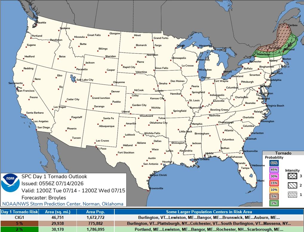
Large hail is also expected with the more intense storms, while the tornado risk will be highest where individual supercells are able to remain isolated. The greatest tornado potential will lie over the New England region, including northern New York, northern Vermont, and northwestern Maine.
The combination of atmospheric instability and low-level wind shear could support the development of a strong tornado in this region.
Outside the Northeast, isolated severe thunderstorms are also expected to develop across parts of the northern Rockies and northern High Plains.
Moist upslope flow and increasing instability over Montana will create favorable conditions for scattered thunderstorms capable of producing isolated damaging wind gusts and large hail during the late afternoon and evening.
References:
1 Day 1 Convective Outlook – NOAA/SPC – July 14, 2026

I am an Assistant Editor and Severe Weather & Science Journalist at The Watchers, specializing in real-time severe weather coverage, geophysical event reporting, and research-driven scientific analysis. You can reach me at rishav(at)watchers(.)news.

Commenting rules and guidelines
We value the thoughts and opinions of our readers and welcome healthy discussions on our website. In order to maintain a respectful and positive community, we ask that all commenters follow these rules.