
Moderate Risk of excessive rainfall issued, life-threatening flash floods forecast for south-central Texas
A Moderate Risk (Level 3 of 4) of excessive rainfall is in effect for parts of south-central Texas through Tuesday morning, July 14, 2026. Repeated thunderstorms threaten are expected to produce life-threatening flash flooding across portions of southwest Texas. Forecast guidance shows a greater than 70% chance of rainfall exceeding 76 mm (3 inches) and a more than 50% chance of totals above 127 mm (5 inches) within the Moderate Risk area, while the National Water Center (NWC) expects considerable flooding impacts to last through Thursday, July 16.
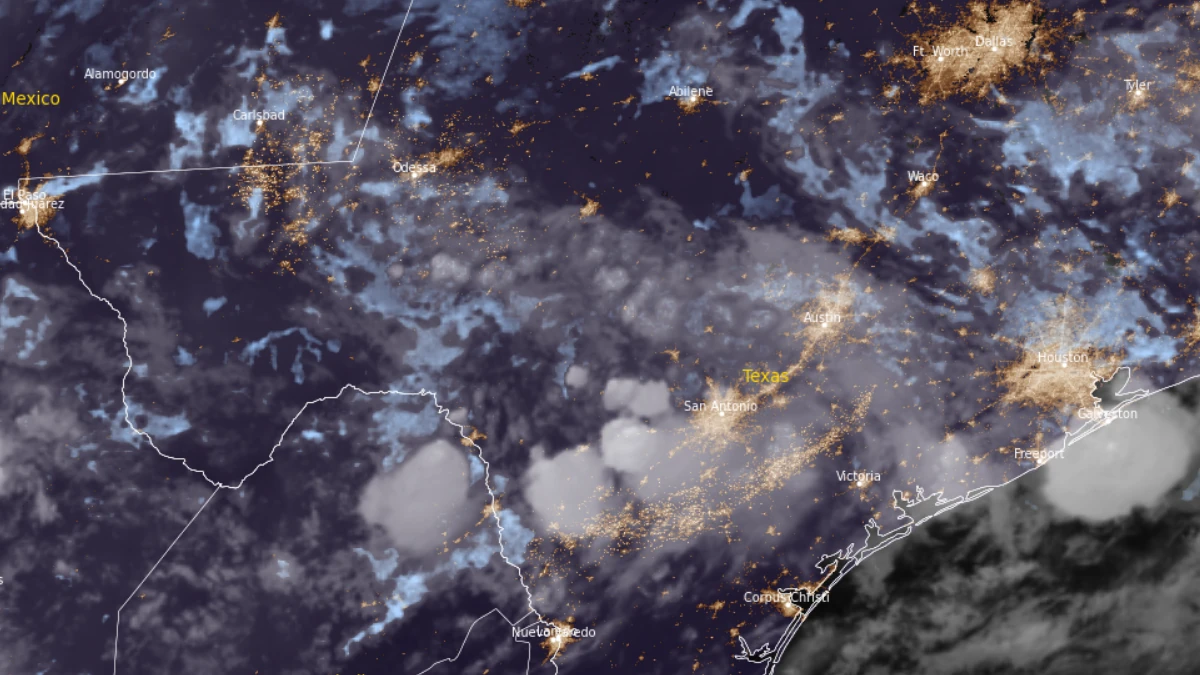
Satellite image of southern and central Texas at 08:10 UTC on July 14, 2026. Credit: NOAA/GOES-19, RAMMB/CIRA, The Watchers
A Moderate Risk (Level 3 of 4) of excessive rainfall has been issued for parts of south-central Texas through Tuesday morning, July 14, by the Weather Prediction Center (WPC).
Repeated thunderstorms are forecast to produce rainfall rates capable of triggering flash flooding. The National Water Center (NWC) warns that life-threatening flash flooding is possible across portions of southwest Texas as the event unfolds.
The Moderate Risk area includes portions of the southern Hill Country, the San Antonio metropolitan area, and areas extending west toward the Rio Grande.
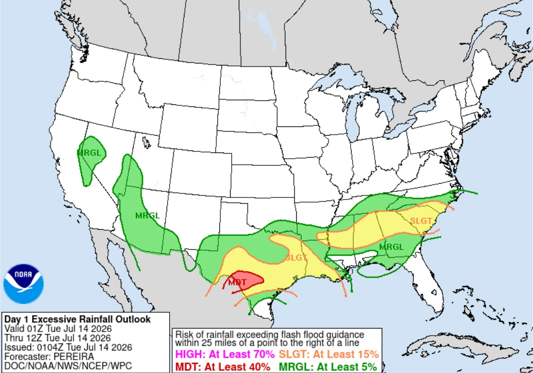
Weather models show more than 70% probablity of rainfall totals of over 76 mm (3 inches) while there is more than a 50% chance of totals exceeding 127 mm (5 inches) within the Moderate Risk area. Model runs also indicate rainfall could exceed local three-hour flash flood guidance during the early morning hours.
The event is being driven by a strengthening low-level jet transporting deep tropical moisture northward through the Rio Grande Valley into south-central Texas.
As this moisture reaches the southern edge of the Edwards Plateau, terrain-induced lift, atmospheric instability, and weak upper-level flow are expected to support storm formation through late evening and the overnight period.
Hydrologic conditions have become increasingly favorable for flash flooding. Portions of the forecast area received approximately 13 to 51 mm (0.5 to 2 inches) of rainfall over the last couple of days, leaving soils increasingly saturated, particularly along the Rio Grande near Del Rio.
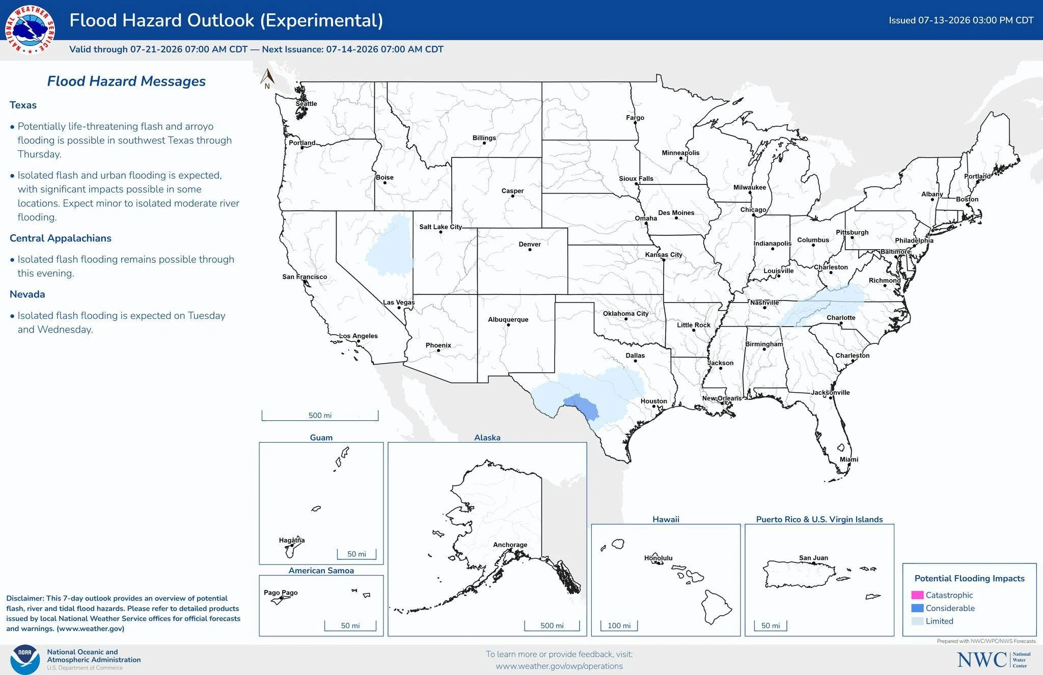
An experimental Area Hydrologic Discussion issued by the National Water Center identifies southwest Texas as the primary area of concern through early Tuesday morning.
Rainfall totals of 51 to 102 mm (2 to 4 inches), with locally higher amounts, are forecast through Tuesday. Meanwhile, rainfall rates of 51 to 76 mm (2 to 3 inches) per hour are expected. Isolated flash flooding is likely, with locally significant and potentially life-threatening impacts possible as slow-moving thunderstorms continue overnight.
The NWC warns that considerable flooding impacts are expected to last through Thursday, July 16, across parts of Texas. Rainfall totals of 102 to 203 mm (4 to 8 inches) are forecast for much of southwestern and south-central Texas through the end of the week, with locally higher amounts possible. The most intense thunderstorms may produce rainfall rates of 51 to 102 mm (2 to 4 inches) per hour in some areas.
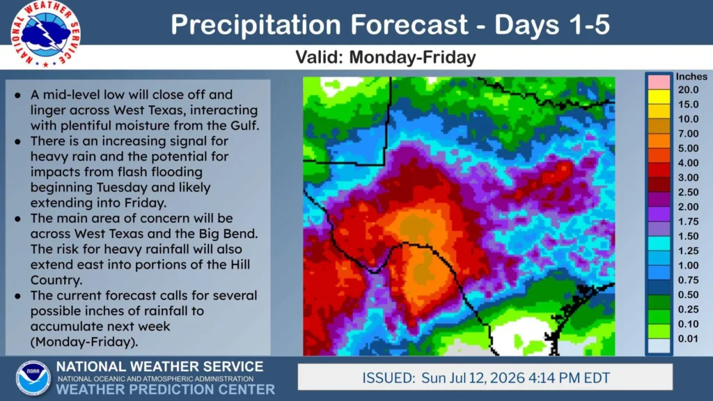
The National Water Model continues to identify isolated pockets of high-magnitude flows on smaller streams and washes within the Nueces, Guadalupe, and San Antonio River basins.
While confidence in the precise placement of the heaviest rainfall remains low, the NWC reports that confidence in the overall hydrologic threat has remained consistently high through successive forecast cycles. Peak flow forecasts support continued basin responses through early Tuesday, reinforcing the flash flood threat, although impacts are not expected to be widespread.
1 Day 1 Excessive Rainfall Outlook – NWS/WPC – July 14, 2026
2 Experimental: Area Hydrologic Discussion – NWS/NWC – July 14, 2026

I am an Assistant Editor and Severe Weather & Science Journalist at The Watchers, specializing in real-time severe weather coverage, geophysical event reporting, and research-driven scientific analysis. You can reach me at rishav(at)watchers(.)news.

Commenting rules and guidelines
We value the thoughts and opinions of our readers and welcome healthy discussions on our website. In order to maintain a respectful and positive community, we ask that all commenters follow these rules.