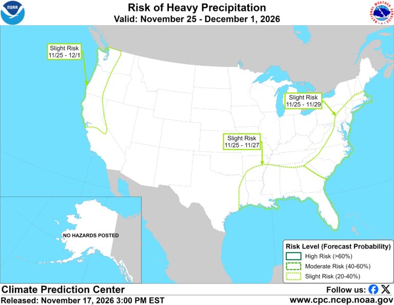
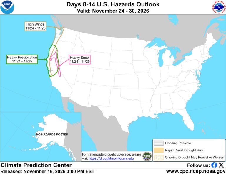
• CPC posts a slight risk of heavy rain from the Gulf Coast to the Northeast urban corridor November 25-29, and a moderate risk of West Coast wind and Sierra snow on November 25

    The Climate Prediction Center’s week-2 hazards outlook, issued November 17, posts a slight risk of heavy precipitation for the Gulf Coast, Tennessee and Lower Mississippi Valleys and the Southeast on November 25-27, and for the Mid-Atlantic and Northeast urban corridor on November 25-29. A moderate risk of high winds and heavy Sierra and Klamath snow is posted for November 25 on the West Coast.
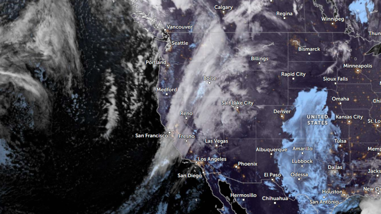
  • The storms drenching California this week are fed by a river in the sky, a band of water vapor that can carry up to 15 times the flow of the Mississippi River, and this winter’s near-record El Niño could keep aiming more of them at the West Coast

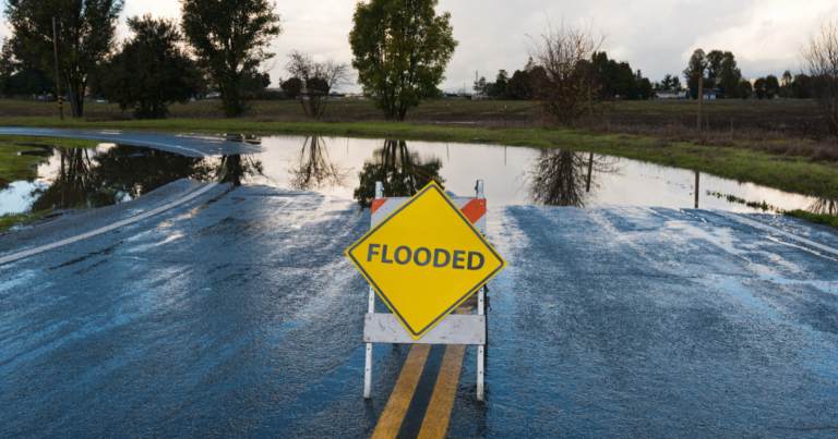
    Across California this week, people are clearing gutters, filling sandbags and checking road closures. Forecasters expect flooding rain from the Bay Area to San Diego, heavy snow in the Sierra Nevada and strong winds, with the worst of it on Wednesday and Thursday. Behind the storm is a weather feature with a surprisingly poetic name:…

  • 2 atmospheric rivers to bring heavy Sierra snow and California flood risk

    Two Pacific storms will bring rain, mountain snow and gusty winds to the western U.S. during the week of November 16, 2026. The stronger storm is expected to reach California Tuesday night into Wednesday, raising the risk of flooding along central and southern parts of the coast and major travel disruption in the Sierra Nevada.

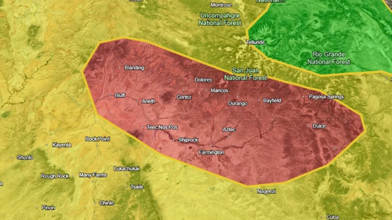
  • Flood watches cover the Southwest ahead of a Four Corners heavy-rainfall event, U.S.

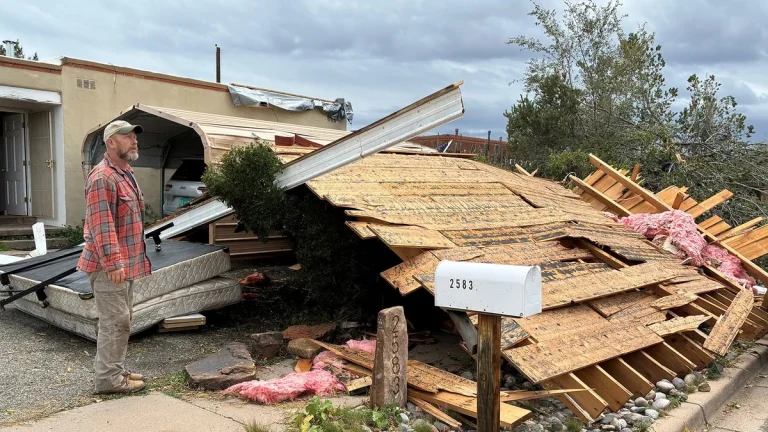
    Flood Watches are in effect across parts of Arizona, New Mexico, Utah and Colorado as successive Pacific moisture surges raise the flash-flood threat through early November 2, 2026. The Weather Prediction Center (WPC) has placed the Four Corners under a Moderate Risk of excessive rainfall for November 1, when it expects a high-impact heavy rainfall event over saturated ground.

  • Coastal flooding forecast at Hooper Bay as Bering Sea storms continue, Alaska

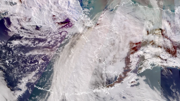
    A Bering Sea storm associated with the remnants of Typhoon Champi is forecast to raise water levels at Hooper Bay, Alaska, by 0.6–1.2 m (2–4 feet) above normal high tide from October 29 into early October 31, 2026. A Coastal Flood Advisory is in effect, while state officials reported that power had been mostly restored in Kivalina after an earlier storm damaged a powerline and prompted residents to shelter at a school.

  • New Mexico seeks federal emergency after record San Juan River flooding, United States

    New Mexico requested a federal emergency declaration on October 24, 2026, after record San Juan River flooding prompted hundreds of water rescues and affected communities around Farmington and Bloomfield. The request covered four counties and five Tribal nations, seeking assistance for debris removal and emergency protective measures. The San Juan River at Farmington reached 4.3 m (14.1 feet) on October 23, breaking its previous record of 3.75 m (12.3 feet) set in September 1909. The gauge subsequently stopped operating, leaving the final crest unconfirmed. Hundreds of water rescues were reported between Farmington and Bloomfield as flooding affected nearby communities.

  • Nor’easter keeps N.C. 12 closed as coastal flood warnings continue in the Outer Banks, U.S.

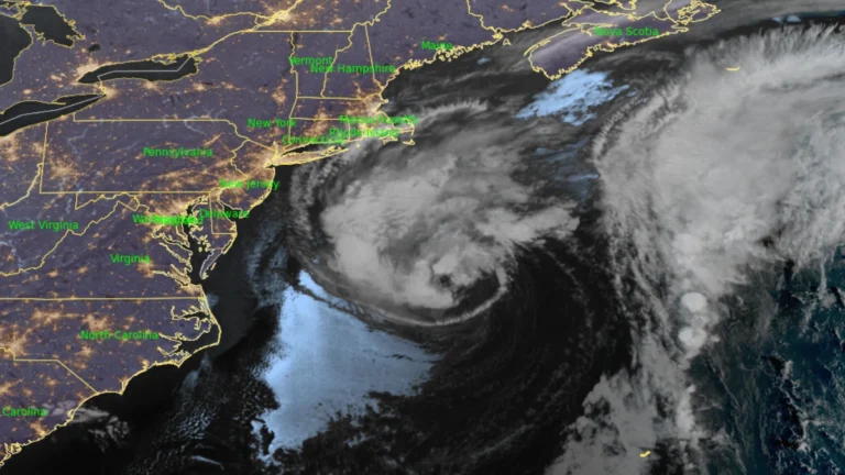
    Coastal Flood Warnings remain in effect for Hatteras and Ocracoke islands on October 21 as a nor’easter continues offshore of the U.S. Mid-Atlantic coast. The National Weather Service forecasts 0.6–1.2 m (2–4 feet) of inundation in vulnerable shoreline areas, while N.C. Highway 12 remains closed between the Marc Basnight Bridge and Rodanthe.