
Strong M6.2 earthquake hits Mindanao, Philippines
A strong earthquake registered by the USGS as M6.2 struck Mindanao, Philippines at 15:49 UTC (23:49 LT) on July 14, 2026. The agency is reporting a depth of 67.9 km (42.2 miles). EMSC is reporting the same magnitude and depth.
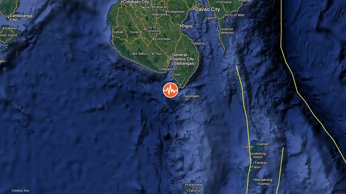
Epicenter of M6.2 earthquake in Mindanao, Philippines on July 14, 2026. Credit: TW/SAM, Google
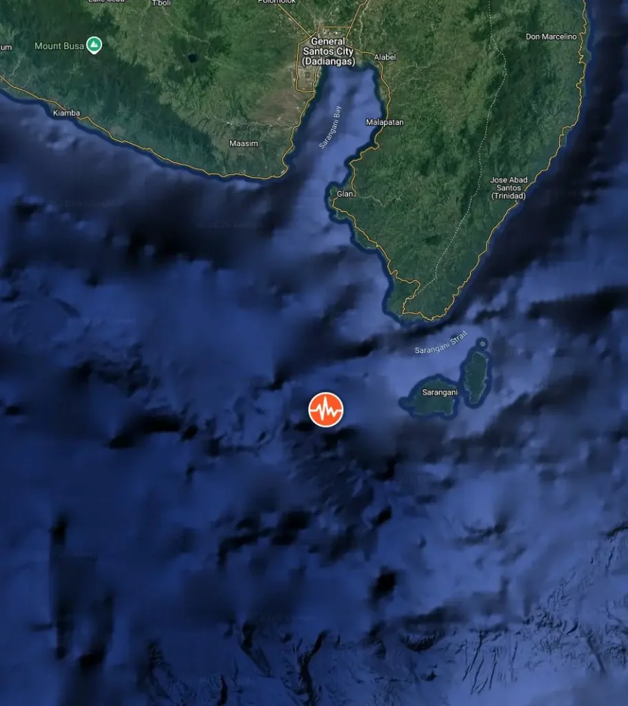
The epicenter was located 34 km (21 miles) WSW of Sarangani (population 7 506), 55 km (34 miles) S of Glan (population 24 256), 73 km (45 miles) S of Malapatan (population 19 439), and 80 km (50 miles) S of Lun Pequeño (population 11 541), Philippines.
There is no tsunami threat from this earthquake. According to USGS estimates, little or no area is expected to be affected by liquefaction or landsliding, with little or no population exposed.
The earthquake struck the same general area of southern Mindanao affected by the destructive M7.8 Offshore Sarangani earthquake on June 8, 2026. That earthquake occurred about 32 km (20 miles) south of Maasim at a depth of 33 km (20.5 miles), triggered tsunami warnings, and was followed by a vigorous aftershock sequence that included an M6.7 event.
The June earthquake caused widespread damage across Sarangani Province and General Santos City, including collapsed and damaged buildings, landslides, disrupted power and water supplies, and damage to schools, hospitals, houses, and other infrastructure.
The latest consolidated government figures show that the June 8 earthquake left 94 people dead, 1 316 injured and 18 missing as of July 8, according to NDRRMC Situation Report No. 28.
A DSWD assessment dated July 13 reported 391 891 families, or 1 655 313 people, affected across 650 barangays in the Zamboanga Peninsula, Davao Region, Soccsksargen and BARMM. Of these, 95 629 people remained displaced, including 31 463 in 80 evacuation centers and 64 166 staying with relatives or friends.
The DSWD recorded 121 426 damaged houses, including 19 305 destroyed and 102 121 partially damaged.
Today’s M6.2 earthquake was located only about 34 km (21 miles) WSW of Sarangani and approximately 87 km (54 miles) south of General Santos, although at a considerably greater depth of about 68 km (42 miles), compared with 33 km (20.5 miles) for the June mainshock.
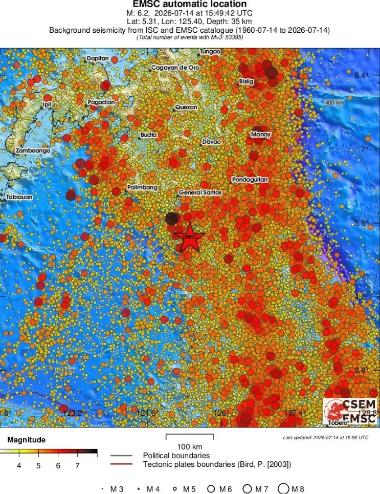
Regional seismicity
References:
1 M6.2 earthquake Mindanao, Philippines – USGS – July 14, 2026
2 M6.2 earthquake Mindanao, Philippines – EMSC – July 14, 2026

I'm a dedicated researcher, journalist, and editor at The Watchers. With over 20 years of experience in the media industry, I specialize in hard science news, focusing on extreme weather, seismic and volcanic activity, space weather, and astronomy, including near-Earth objects and planetary defense strategies. You can reach me at teo /at/ watchers.news.

Commenting rules and guidelines
We value the thoughts and opinions of our readers and welcome healthy discussions on our website. In order to maintain a respectful and positive community, we ask that all commenters follow these rules.