
M6.0 earthquake hits northwest of Port-Olry, Vanuatu
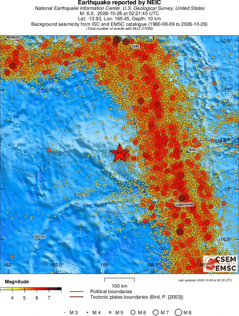
A strong earthquake registered by the USGS as M6.0 struck 214 km (133 miles) NW of Port-Olry, Vanuatu, at 02:21 UTC on October 28, 2026. The agency is reporting a depth of 10 km (6 miles). EMSC is reporting the same magnitude and depth.
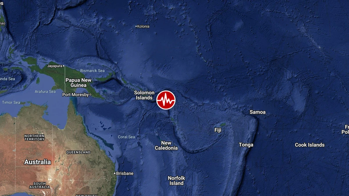
Epicenter of M6.0 earthquake in Port-Olry, Vanuatu on October 28, 2026. Credit: TW/SAM, Google
The epicenter was located 215 km (134 miles) NW of Port-Olry (population 1 951), 228 km (141 miles) W of Sola (population 1 171), 256 km (159 miles) NW of Luganville (population 13 397), and 523 km (325 miles) NW of Port-Vila (population 35 901), Vanuatu. It was also located 780 km (485 miles) SE of Honiara (population 56 298), Solomon Islands.
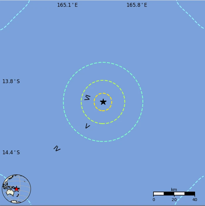
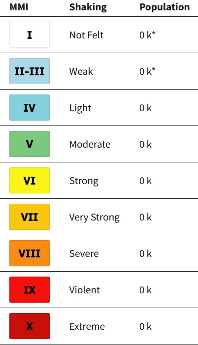
The USGS issued a Green alert for shaking-related fatalities and economic losses. There is a low likelihood of casualties and damage. Overall, the population in this region resides in structures that are highly vulnerable to earthquake shaking, although some resistant structures exist.
The predominant vulnerable building types are unknown/miscellaneous types and wood construction. Recent earthquakes in this area have caused secondary hazards such as landslides that might have contributed to losses.
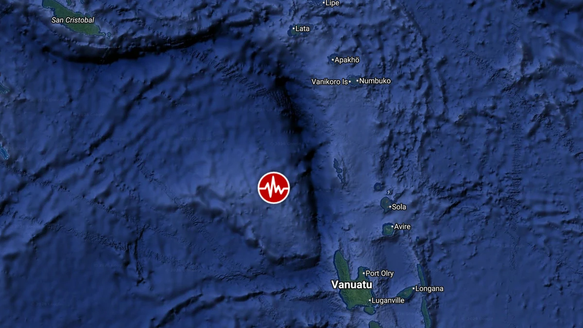
The M6.0 earthquake was preceded by an M5.5 event at 12:39 LT (01:39 UTC) on October 28, approximately 221 km (137 miles) northwest of Port-Olry. An M5.2 earthquake followed at 13:17 LT (02:17 UTC), about 220 km (137 miles) northwest of the settlement and approximately four minutes and 30 seconds before the M6.0 event.
Activity continued with an M5.6 earthquake at 13:59 LT (02:59 UTC), approximately 174 km (108 miles) northwest of Port-Olry, about 38 minutes after the M6.0 earthquake. An M5.0 event followed at 15:31 LT (04:31 UTC), approximately 200 km (124 miles) west of Sola.
Including the M6.0 earthquake, the USGS recorded five events of M5.0 or greater over approximately two hours and 52 minutes. All five were listed at a depth of approximately 10 km (6 miles).
This same area was struck by M6.9 and M6.3 on October 24.
Estimated population exposure to earthquake shaking
Regional seismicity
References:
1 M6.0 earthquake Vanuatu – USGS – October 28, 2026
2 M6.0 earthquake Vanuatu – EMSC – October 28, 2026

Rishav Kothari is Editor-in-Chief of The Watchers, where he runs the newsroom and covers earthquakes, volcanoes, severe weather and space weather.
Published in the last 24 hours
- M6.6 earthquake hits the Banda Sea 148 km west-southwest of Tual, Indonesia, at 68 km depth, USGS issues Green alert
- The storms drenching California this week are fed by a river in the sky, a band of water vapor that can carry up to 15 times the flow of the Mississippi River, and this winter’s near-record El Niño could keep aiming more of them at the West Coast
- Malawi continues Bris AI weather forecasting tests ahead of operational integration Epicenter
- Right about now, Voyager 1 is crossing a line no human-made object has ever reached, a full light-day from Earth, which means a message NASA sends tonight won't arrive until tomorrow night, and the spacecraft's answer won't make it home until the night after that
