
AI cyclone model gains at least a day of forecast lead time against leading operational models
WeatherNext Cyclones, an artificial intelligence weather model evaluated on tropical cyclones from 2023 to 2025, reduced five-day ensemble-mean track error to 230 km (143 miles), compared with 370 km (230 miles) for ECMWF ENS and 335 km (208 miles) for GenCast. Across track, intensity and wind-radius forecasts, the 2026 Nature study reported an average lead-time advantage of one day or more over leading operational models.
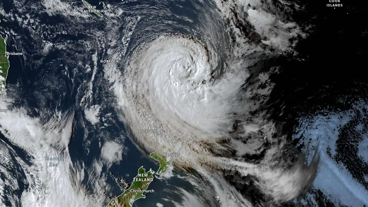
Satellite image of Cyclone Vaianu at 04:30 UTC on April 10, 2026. Credit: JMA/Himawari-9, Zoom Earth, The Watchers
Tropical cyclone forecasting has long been divided across two physical scales. Global weather models resolve the broad atmospheric circulation that steers a cyclone, while specialized regional models use much finer grids to represent the storm-core processes that determine maximum winds and structure. Earlier global AI weather models faced the same limitation because the coarse atmospheric analyses used for training do not fully represent the strongest winds inside tropical cyclones.
Alet et al. (2026) developed WeatherNext Cyclones (WN-C) to address that gap by training the model on two types of information at the same time. The system uses global atmospheric analyses together with the International Best Track Archive for Climate Stewardship (IBTrACS), an expert-curated database containing nearly 5 000 observed tropical cyclones and information on their position, intensity and wind radii.
WN-C generates ensembles of possible global weather and tropical-cyclone evolutions extending 15 days into the future. An ensemble produces multiple possible forecasts rather than a single deterministic solution, allowing the spread of the predictions to represent uncertainty in cyclone track, intensity and structure.
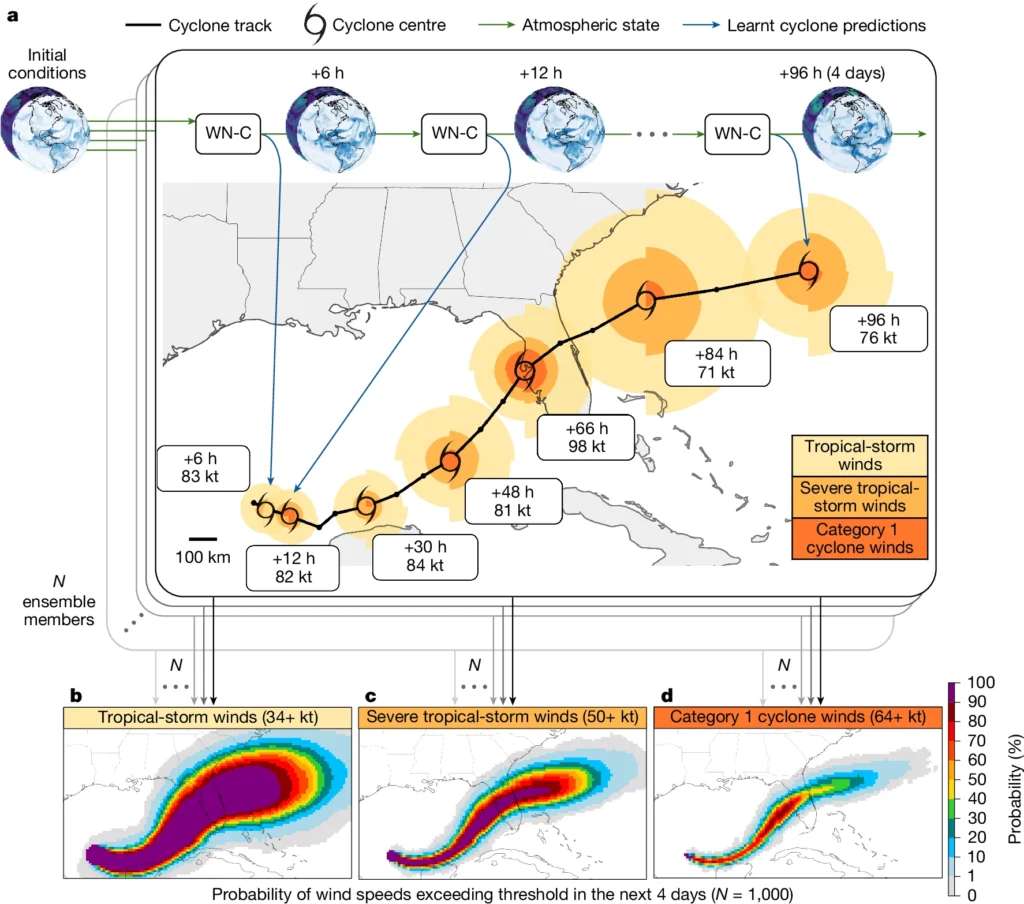
The researchers evaluated the system on tropical cyclones from 2023 through 2025 and compared its forecasts with operational numerical weather prediction systems and other AI models. Across track, intensity and wind-radius prediction, WN-C produced an average lead-time advantage of one day or more over the leading operational systems included in the evaluation.
Track prediction produced one of the clearest quantitative differences. At a five-day forecast lead time, the WN-C ensemble-mean position error was 230 km (143 miles), compared with 370 km (230 miles) for ECMWF’s ENS and 335 km (208 miles) for GenCast. At the 230 km (143 miles) error level, WN-C provided just over 30 hours of additional lead time compared with ENS and about 24 hours compared with GenCast.
Cyclone intensity presents a different forecasting problem because maximum sustained winds depend on smaller-scale processes near the storm core. Global forecasting systems operate at resolutions that are better suited to large-scale atmospheric circulation, while specialized regional systems such as NOAA’s Hurricane Analysis and Forecast System (HAFS) resolve the cyclone at much finer spatial scales.
WN-C used atmospheric inputs that were orders of magnitude coarser than those used by specialized regional intensity models. Despite the difference in resolution, the researchers reported lower intensity errors than HAFS across the evaluated forecast horizons, with statistically significant improvements from 0.5 to 3.25 days of lead time.
The result does not establish that fine spatial resolution is unnecessary for tropical-cyclone forecasting. The authors interpret the performance as evidence that coarse global atmospheric analyses contain more information about cyclone intensity than previous global AI systems had been able to extract. Training the model simultaneously on historical cyclone observations gives it a direct learning signal for storm properties that are poorly represented in the coarse atmospheric fields alone.
WN-C also produces probabilistic forecasts. Individual ensemble members represent different possible cyclone tracks, intensities and structures, allowing probabilities to be calculated for conditions such as wind speeds exceeding a defined threshold at a particular location. The study reports that the system can generate ensembles containing as many as 1 000 members.
Larger ensembles provide more samples of the range of possible future atmospheric states, which becomes relevant when forecasters are examining outcomes with relatively low probability. The number of ensemble members alone does not guarantee reliable probabilities, and the forecast distribution must remain calibrated against observations. The researchers reported that WN-C’s track and intensity ensembles were both skillful and well calibrated during the evaluation.
The researchers also tested WN-C as part of a consensus forecast rather than as a standalone replacement for existing guidance. Adding its forecasts to a weighted combination of other models improved the skill of that consensus, according to the study.
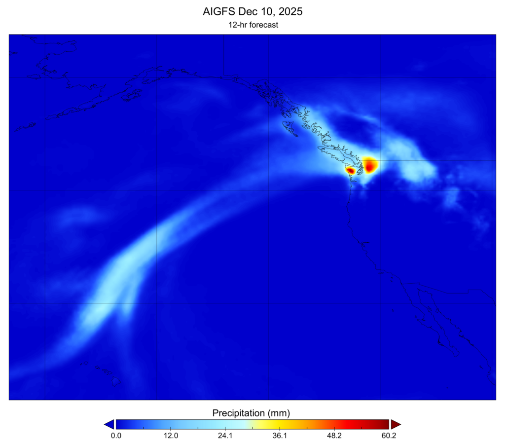
Operational weather centers are already using AI forecasting alongside physics-based numerical models. NOAA deployed the Artificial Intelligence Global Forecast System (AIGFS), Artificial Intelligence Global Ensemble Forecast System (AIGEFS) and Hybrid Global Ensemble Forecast System (HGEFS) in December 2025. NOAA said a 16-day AIGFS forecast requires about 0.3% of the computing resources used by its operational Global Forecast System.
AIGEFS consists of 31 AI ensemble members and requires about 9% of the computing resources used by NOAA’s operational Global Ensemble Forecast System. HGEFS combines those 31 AI members with 31 physics-based GEFS members, producing a 62-member hybrid ensemble. NOAA reported that the combined system performs better across most major verification measures than either component ensemble operating alone.
NOAA’s operational results also show why performance cannot be generalized from one AI model or one forecast variable. The first operational version of AIGFS reduced tropical-cyclone track errors at longer lead times but produced weaker intensity forecasts, leaving intensity prediction as an area for further model development.
ECMWF has retained the same parallel approach between AI and physics-based forecasting. Its deterministic AIFS Single model has operated since February 25, 2025, and the AIFS ensemble since July 1, 2025. Both AI systems were upgraded to version 2 on May 12, 2026, at the same time as an upgrade of ECMWF’s physics-based Integrated Forecasting System.
WeatherNext Cyclones was evaluated as forecast guidance rather than as an autonomous warning system. The model produces possible atmospheric and cyclone evolutions that can be assessed alongside other forecast information, while the study does not test the separate institutional process through which official cyclone watches and warnings are issued.
The evaluation also has defined limits. Its tropical-cyclone tests cover the 2023–2025 period, and the reported advantages depend on the models, observations, verification methods and forecast variables used in the comparison. Results from WN-C cannot establish that AI forecasting performs better for every atmospheric variable, hazard or geographical region.
How consistently the reported gains persist during rare atmospheric states outside the evaluation period remains unresolved. The 2023–2025 results show that an AI system trained with coarse global weather analyses and historical cyclone observations can improve track, intensity and wind-radius forecasting within the tested configuration, while the operational systems at NOAA and ECMWF show that AI models are increasingly being used beside, and in NOAA’s hybrid ensemble directly combined with, physics-based numerical weather prediction.
References:
1 Alet, F., Andersson, T. R., Price, I., Markou, S., El-Kadi, A., Masters, D., Li, A., Merchant, S., Williams, N., Thornton, G., MacKay, K., Graham, O., Uddin, A., Gaiarin, B., Shah, D., Kruse, E., Hogsett, W., Zelinsky, D., Cangialosi, J., Martinez, J., Franklin, J., DeMaria, M., Musgrave, K., Bain, C. L., Titley, H., Stott, J., Lam, R., Bell, A., Komarek, P., Willson, M., Sanchez-Gonzalez, A., & Battaglia, P. (2026). Operational tropical cyclone forecasting with AI. Nature, 657(8132), 680–688. DOI: 10.1038/s41586-026-10953-2
2 NOAA deploys new generation of AI-driven global weather models – National Oceanic and Atmospheric Administration – December 17, 2025; updated February 17, 2026
3 Significant update to ECMWF’s key forecasting systems IFS and AIFS goes live – European Centre for Medium-Range Weather Forecasts – May 12, 2026

I’m a science journalist and researcher at The Watchers, contributing to the Epicenter edition, where I cover peer-reviewed scientific research and emerging discoveries across Earth and space sciences. With a background in astronomy and a passion for environmental science, I’ve worked in shark and coral conservation in Fiji, conducting reef and shark-behavior research, contributing to mangrove restoration, and earning PADI Open Water and Coral Reef Certifications. I bring a blend of scientific rigor and storytelling to illuminate the discoveries shaping our planet and beyond.
