
Strong El Niño reinforces above-normal winter precipitation outlook across southern and eastern U.S.
NOAA increased the probability of above-normal precipitation across California, the Desert Southwest and the East Coast in its November 19 outlook for December 2026 through February 2027, with a historically strong El Niño expected to remain the primary influence on U.S. winter conditions.
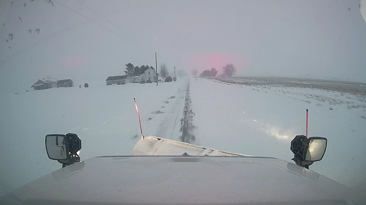
Heavy snow cover in Ohio on January 25, 2026. Credit: ODOT
Compared with its October 15 forecast, NOAA’s Climate Prediction Center (CPC) raised above-normal precipitation probabilities across California, the Desert Southwest and the East Coast after incorporating updated dynamical-model guidance.
The outlook shows a greater than 40% probability of above-normal precipitation across a broad area extending from southwestern Oregon and California through the Southwest, central and southern Great Plains, Gulf Coast and much of the East Coast.
Below-normal precipitation is favored across parts of the northern Rockies, northern Great Plains, Great Lakes and mainland Alaska. CPC said the historically strong El Niño and its associated southward shift in the storm track are expected to be the main influences on the winter precipitation pattern across the contiguous United States.
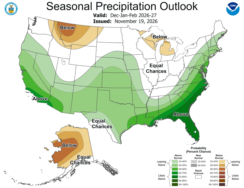
Probabilities exceed 60% in southern California and southwestern Arizona and 70% across Florida, southern Georgia and the coastal Carolinas.
CPC said the historically strong El Niño, a predicted active southern stream and enhanced subtropical moisture contributed to greater confidence in the winter precipitation outlook than in the temperature outlook.
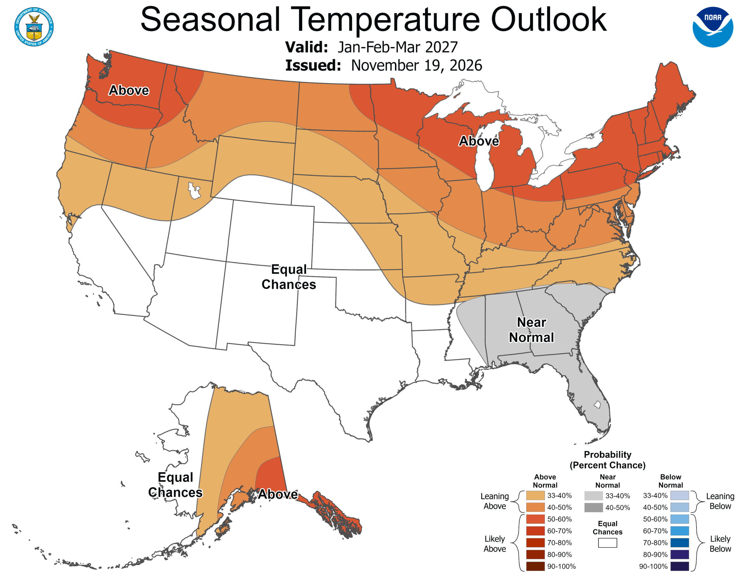
Above-normal December–February temperatures are favored across central and eastern Alaska and much of the northern two-thirds of the contiguous United States.
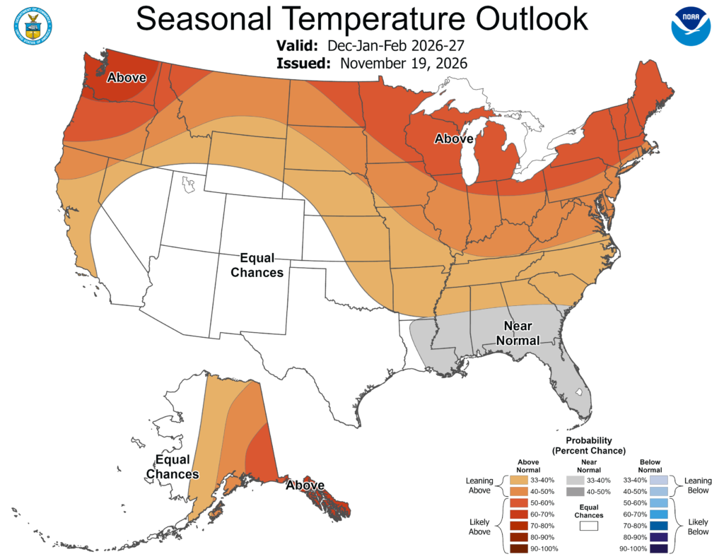
Probabilities exceed 50% across the Northeast, Great Lakes, Upper Mississippi Valley and Pacific Northwest and 60% from northwestern Oregon and Washington into southeastern Alaska.
Temperature uncertainty is greater across the Southwest, southern Great Plains, Gulf Coast and Southeast. Near-normal seasonal temperatures are favored in parts of the Southeast, while equal chances apply across the Southwest, meaning no temperature category is favored over the others.
An unusual November sudden stratospheric warming adds uncertainty to the shorter-term temperature forecast. CPC’s November 19 outlook said models indicated possible coupling between the stratosphere and lower atmosphere and a possible negative Arctic Oscillation, which could increase the potential for below-normal temperatures across parts of the eastern United States during the following weeks.
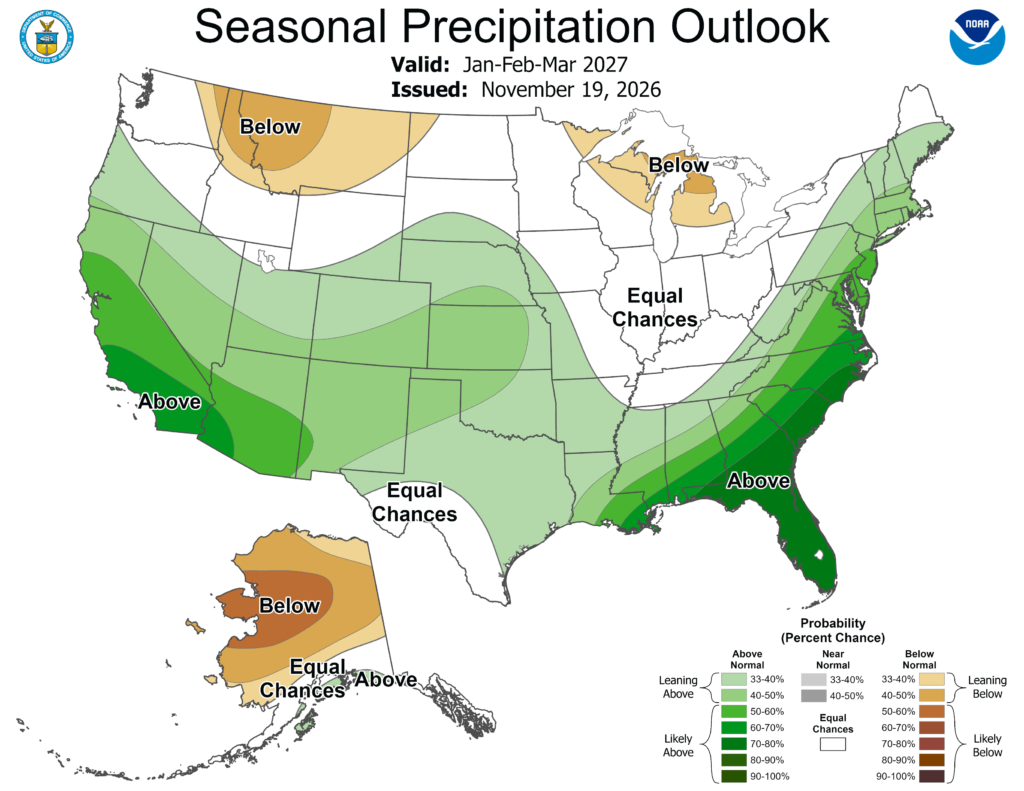
CPC’s Week 3–4 outlook issued on November 20, valid from December 5 to 18, continued to favor above-normal precipitation across the southern tier of the United States, with the highest probabilities along the East Coast. Forecasters said El Niño remained the primary driver, while guidance showed a negative Arctic Oscillation trend likely linked to the mid-November sudden stratospheric warming.
In its November 19 December outlook, CPC said ECMWF guidance showed only modest cooling over the Southeast in early December. The outlook continued to favor above-normal temperatures across much of the northern half of the contiguous United States, with probabilities exceeding 60% in parts of the north-central states.
Below-normal December temperatures are favored along the central Gulf Coast, while equal chances apply across much of the Southwest.
For precipitation, the December outlook favors above-normal conditions from Southern California into southwestern Oregon and eastward across much of the southern tier and Southeast. Above-normal precipitation is also favored from the eastern Gulf Coast through southern New England, while below-normal precipitation is favored from the northern Rockies into parts of the northern Plains.
In a preliminary Week-2 Hazards Outlook issued on November 21, CPC identified a slight risk of heavy snow across parts of the southern Cascades, Klamath Mountains and Sierra Nevada from November 29 to December 1. A separate slight risk of heavy precipitation was identified across the Tennessee and Lower Mississippi valleys and adjacent areas from December 1 to 3.
NOAA’s November 12 El Niño/Southern Oscillation Diagnostic Discussion said El Niño continued strengthening. Sea-surface temperature anomalies reached +2.5°C (+4.5°F) in Niño-3.4, +3.6°C (+6.5°F) in Niño-3 and +4.4°C (+7.9°F) in Niño-1+2, while subsurface anomalies exceeded +10°C (+18°F) in the eastern equatorial Pacific.
CPC also reported wind, convection and rainfall patterns consistent with a coupled El Niño response. NOAA assesses a greater than 79% probability that strong-to-very-strong El Niño conditions will continue through January–March 2027, with further strengthening expected before the event begins weakening.
NOAA now places the probability that the three-month Relative Oceanic Niño Index will reach at least +2.5°C (+4.5°F) at approximately 60% for both October–December and November–January. Reaching that threshold would exceed previous El Niño events in NOAA’s record dating to 1950.
The updated probabilities are lower than those issued in October, when NOAA placed the likelihood at 83% for October–December and 70% for November–January. The agency nevertheless reported that El Niño strengthened between its October and November assessments.
By mid-November, the weekly Niño-3.4 anomaly stood at +2.2°C (+4°F), while the August–October Relative Oceanic Niño Index was +2°C (+3.6°F), compared with +2.1°C (+3.8°F) during the corresponding period in 1997.
NOAA’s sea-surface temperature consolidation forecast shows Niño-3.4 anomalies peaking above +2.5°C (+4.5°F) during November–January before declining later in winter and spring.
Seasonal outlooks describe the probability that average temperature or accumulated precipitation will fall within one of three climatological categories. They do not predict the timing or intensity of individual storms, floods, snowfall events or cold outbreaks, and characteristic El Niño impacts are not guaranteed.
El Niño influences are expected to persist into spring 2027. NOAA forecasts declining Niño-3.4 anomalies later in winter and spring, with ENSO-neutral conditions becoming more probable during April–May–June 2027.
References:
- Prognostic Discussion for Long-Lead Seasonal Outlooks — NOAA/NWS Climate Prediction Center —November 19, 2026.
- El Niño/Southern Oscillation Diagnostic Discussion — NOAA/NWS Climate Prediction Center — November 12, 2026.
- Official NOAA Relative Oceanic Niño Index Outlook — NOAA/NWS Climate Prediction Center — November 2026.

Rishav Kothari is Editor-in-Chief of The Watchers, where he runs the newsroom and covers earthquakes, volcanoes, severe weather and space weather.
