
A broad low over southeastern Florida and the northwestern Bahamas has a 30 percent chance of subtropical or tropical development within 48 hours and a 50 percent chance within 7 days, the National Hurricane Center says
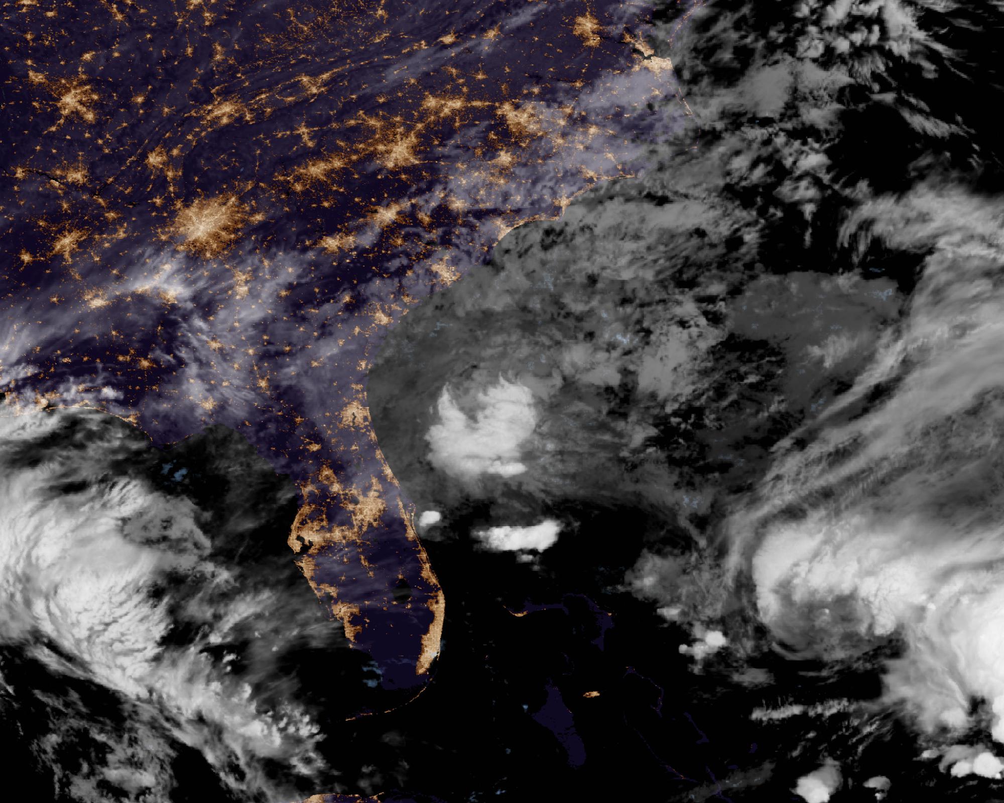
The National Hurricane Center said a broad low pressure area has formed over southeastern Florida, the northwestern Bahamas and the adjacent waters, and that the system has a 30 percent chance of becoming a subtropical or tropical cyclone within 48 hours and a 50 percent chance within 7 days. The Atlantic Tropical Weather Outlook, issued at 1:00 a.m. EST on Friday, November 20, 2026, rated those odds as low and medium, respectively.
Surface observations showed the low was producing disorganized showers and thunderstorms from the central Florida peninsula east-southeastward over the Atlantic. The Miami-based center said the system could acquire subtropical or tropical characteristics while it moves generally northward to north-northeastward near or just offshore of the southeastern United States coast through the weekend.
Regardless of whether the low becomes a named storm, the Hurricane Center said it is expected to produce strong, gusty winds, dangerous surf, rip currents and coastal flooding along portions of the southeast and mid-Atlantic U.S. coasts into early next week. Heavy rainfall and the threat of flash flooding will continue across portions of the Florida peninsula on Friday, the outlook said, and those threats may spread northward toward coastal portions of the Carolinas and the mid-Atlantic over the weekend. The center said people along the eastern coast of the United States should continue to monitor the system.
The National Weather Service office in Melbourne, in a discussion issued at 2:42 a.m. EST Friday, posted a high risk, level 4 of 4, of excessive rainfall and dangerous flash flooding for parts of Brevard and Volusia counties on Friday, with slight to moderate risks farther south and over the interior. A flood watch remained in effect into Friday evening, and a high surf advisory was in effect through Saturday, with a high risk of life-threatening rip currents at area beaches. The office also issued a wind advisory for coastal Volusia and northern Brevard from 7:00 a.m. Friday to 7:00 a.m. Saturday, forecasting gusts of 35 to 40 mph in those areas, and said a gale warning was in effect for parts of the coastal waters.
NWS Jacksonville, in a discussion issued at 5:39 a.m. EST Friday, warned of flooding rainfall along the I-95 corridor through Saturday, a high risk of rip currents and high surf at all area beaches, a coastal flood advisory for parts of the coast, and a coastal flood warning for Putnam County because of drainage from heavy rain. It said gale warnings were in effect mainly through Saturday, and that breakers of 6 to 10 feet were expected at northeast Florida beaches. The Charleston office said the threat of coastal flooding would increase with morning high tides this weekend into next week, and that Saturday’s and Sunday’s morning tide cycles were forecast to peak near minor coastal flood thresholds of 7.0 feet MLLW in the Charleston Harbor area.
The Hurricane Center pointed to High Seas Forecasts issued by the National Weather Service for additional information, including gale warnings. The Ocean Prediction Center forecast issued at 10:30 UTC on Friday listed an Atlantic gale warning for a low near 26°N, 80°W, with east winds of 30 to 35 knots (35 to 40 mph) and seas of 4.0 to 5.0 meters (13 to 16 feet) in part of that area.
Featured image: Clouds associated with a broad low over southeastern Florida, the northwestern Bahamas and adjacent waters at 06:00 UTC (01:00 EST) on November 20, 2026, seen by GOES-East. Credit: NASA Worldview / NOAA GOES-East ABI GeoColor, public domain
Sources: NHC Atlantic Tropical Weather Outlook (issued 1:00 a.m. EST, November 20), NWS High Seas Forecast for METAREA IV (issued 10:30 UTC, November 20), NWS Melbourne Area Forecast Discussion, NWS Jacksonville Area Forecast Discussion, NWS Charleston Area Forecast Discussion

The Watchers Staff covers earthquakes, volcanoes, severe weather, space weather and other natural events. Published since 2011, The Watchers reports on a changing planet and the science behind it.
Published in the last 24 hours
- High Risk of excessive rainfall covers Florida’s Space Coast as St. Johns River near Cocoa reaches 5.67 m
- Asteroid 2026 WJ to pass Earth at 1.7 lunar distances at 04:20 UTC on November 22, with 2026 WD following at 4.4 lunar distances on November 23
- Cyclone Akvan crossed the north Andhra Pradesh and south Odisha coasts close to Gopalpur on November 20 with 70-80 km/h winds gusting to 90, and has weakened into a deep depression
- A Virginia park ranger was struck by lightning seven times and lived, even though three of the strikes set his hair on fire Epicenter
