
High Risk of excessive rainfall covers Florida’s Space Coast as St. Johns River near Cocoa reaches 5.67 m
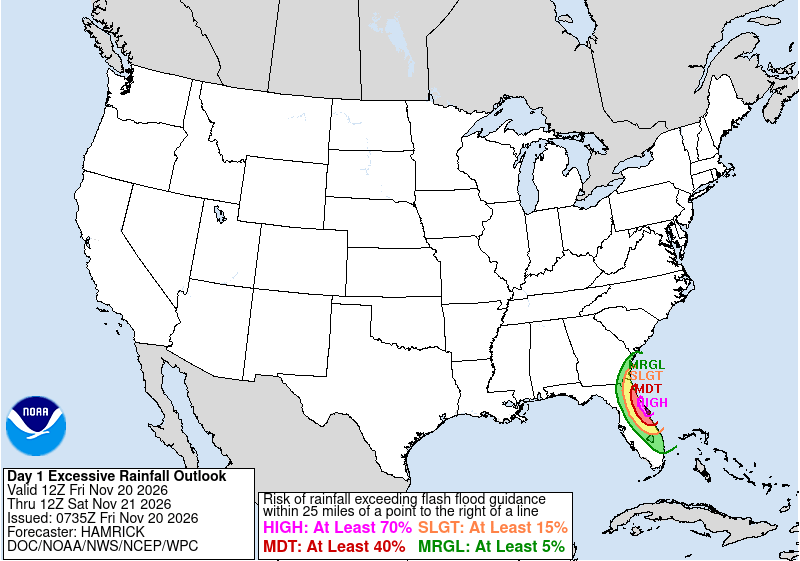
Parts of Florida’s east coast between Daytona Beach and Melbourne face a High Risk of excessive rainfall from 12:00 UTC Friday, November 20, through 12:00 UTC Saturday, November 21, after multiple reports of 152–305 mm (6–12 inches) of rain in Brevard County. The St. Johns River near Cocoa reached 5.67 m (18.6 feet) early Friday, well into major flood stage.
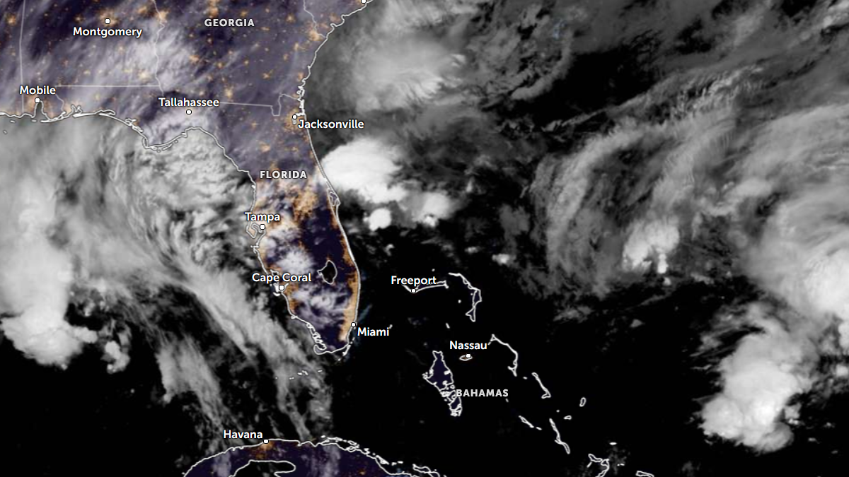
Satellite image of Florida at 11:00 UTC on Nov 20, 2026. Credit: NOAA/GOES-19, Zoom Earth
The Weather Prediction Center (WPC) placed the greatest near-term concern over central and northern Brevard County, where a band of heavy rain was expected to persist into Friday morning. It forecast that the band could slowly shift toward southern Volusia County later in the day. Rainfall rates may exceed 76 mm (3 inches) per hour, with a model signal for an additional 102–203 mm (4–8 inches) in the affected area through 12:00 UTC Saturday.
At 07:15 UTC Friday, the St. Johns River near Cocoa stood at 5.67 m (18.6 feet), according to a National Weather Service (NWS) flood statement. Major flood stage is 5.18 m (17.0 feet). The statement forecast a crest near 5.70 m (18.7 feet); that crest was forecast, not an observed peak.
NWS Melbourne said heavy rain on saturated ground was aggravating flooding along the Brevard and Volusia coasts. Its forecast allowed for another 51–102 mm (2–4 inches) across much of its area through Saturday, with 102–152 mm (4–6 inches) along those two counties’ coasts.
River flood warnings also covered the St. Johns River at Geneva, Astor, DeLand and Sanford in NWS Melbourne’s Friday morning discussion. The office said Geneva was in major flood stage and forecast further rises at several points along the river.
A broad area of low pressure near southeastern Florida and the northwestern Bahamas was expected to move north or northeast near the Southeast coast. For the period from 12:00 UTC Saturday to 12:00 UTC Sunday, WPC placed coastal sections of the Southeast under a Slight Risk of excessive rainfall and extended that risk north to the Wilmington, North Carolina, area.
WPC said the heaviest Saturday rain may remain over coastal waters. A track closer to land could bring heavier rain farther inland, but the low’s path and the inland extent of flooding remain uncertain.
References:
Excessive Rainfall Discussion — NWS Weather Prediction Center, issued 08:27 UTC November 20, 2026; Day 1 and Day 2 outlooks.
Flood Statement for the St. Johns River near Cocoa — NWS Melbourne, issued 08:10 UTC November 20, 2026; event
Area Forecast Discussion — NWS Melbourne, issued 07:42 UTC November 20, 2026; product
River Forecast — NWS Southeast River Forecast Center, issued 01:12 UTC November 20, 2026; Cocoa gauge

Rishav Kothari is Editor-in-Chief of The Watchers, where he runs the newsroom and covers earthquakes, volcanoes, severe weather and space weather.
Published in the last 24 hours
- A broad low over southeastern Florida and the northwestern Bahamas has a 30 percent chance of subtropical or tropical development within 48 hours and a 50 percent chance within 7 days, the National Hurricane Center says
- Asteroid 2026 WJ to pass Earth at 1.7 lunar distances at 04:20 UTC on November 22, with 2026 WD following at 4.4 lunar distances on November 23
- Cyclone Akvan crossed the north Andhra Pradesh and south Odisha coasts close to Gopalpur on November 20 with 70-80 km/h winds gusting to 90, and has weakened into a deep depression
- A Virginia park ranger was struck by lightning seven times and lived, even though three of the strikes set his hair on fire Epicenter
