
Florida’s east coast faces a moderate flash flood risk Wednesday through Friday, with 4 to 8 inches of rain forecast and the St. Johns River near Cocoa already in major flood at 17.13 feet
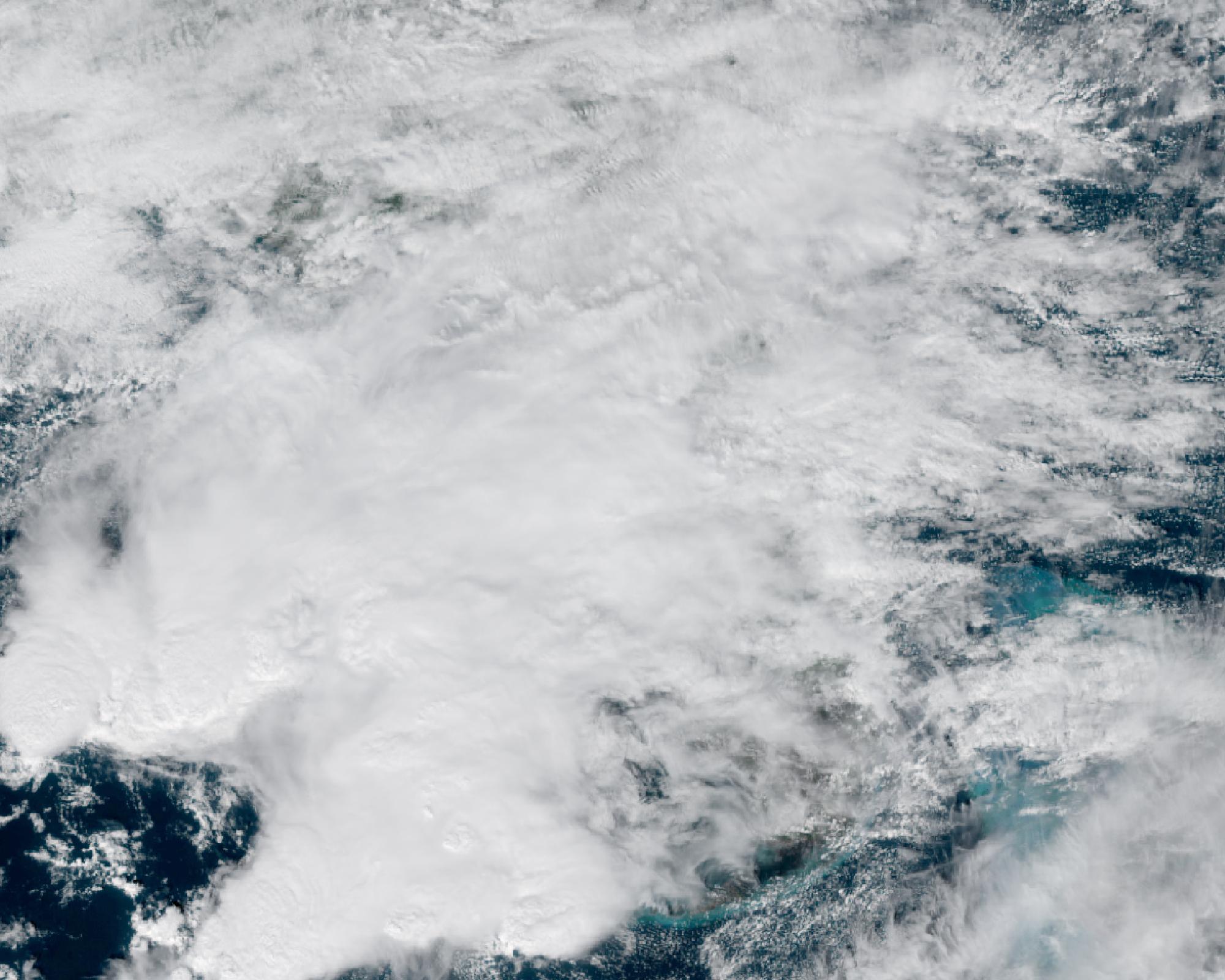
Florida’s east coast is under a multi-day flash flood threat through Saturday, November 21, 2026, as slow-moving rainbands train ashore ahead of a Gulf low. The Weather Prediction Center has a moderate risk, level 3 of 4, of rainfall exceeding flash flood guidance on parts of the east-central and northeast coast from Wednesday, November 18, through Friday, November 20, inside a broader slight risk, level 2 of 4, along the east coast. Flood watches are in effect from Duval County south to Miami-Dade County.
The Florida Division of Emergency Management’s Tuesday outlook said widespread amounts of 4 to 8 inches are expected along the immediate coast through Saturday, and that isolated totals in any one place could exceed 12 to 16 inches, especially from Martin County north to Duval County. The division said grounds across most of east-central Florida are already saturated after heavy rain two weeks ago, and that it is highly unusual, outside tropical systems, to see multiple days of moderate flash flood risk in Florida.
An area of low pressure over the central Gulf is moving slowly toward the peninsula, while high pressure remains over the Mid-Atlantic, producing strong easterly low-level flow and repeated coastal showers and thunderstorms. WPC’s Day 2 outlook, valid from 12:00 UTC Wednesday to 12:00 UTC Thursday, places the moderate risk over parts of the east-central coast from around Stuart to New Smyrna Beach. The Day 3 moderate risk, valid from 12:00 UTC Thursday to 12:00 UTC Friday, shifts north along a corridor from near Vero Beach and Cape Canaveral to Flagler County and St. Augustine. The overnight Day 1 period through 12:00 UTC Wednesday was outlined only at slight and marginal risk. The National Weather Service office in Jacksonville said WPC raised the risk to moderate for coastal St. Johns and Flagler counties on Thursday and Friday. WPC also introduced a moderate risk for northeast Florida on Day 4, Friday, in its extended forecast discussion.
NWS Jacksonville is forecasting 4 to 8 inches east of U.S. 301 in northeast Florida, with locally 12 inches or more possible along the immediate coast where training rainbands stall. Its flood watch covers Duval, St. Johns, Flagler, Clay and Putnam counties through Friday evening. NWS Melbourne expects widespread 4 to 6 inches, locally 8 to 12 inches closer to the coast, and a small chance of highly localized amounts of 12 inches or more over parts of Volusia or Brevard counties, with a flood watch through Friday evening. NWS Miami has a flood watch for all of southeast Florida through Thursday evening and said the most likely totals along the southeast east coast are 2 to 4 inches through Friday, with a 10 percent chance of more than 6 to 10 inches.
The St. Johns River near Cocoa was already in major flood, at 17.13 feet at 21:15 EST on Tuesday, November 17, according to the official NOAA gauge. Major flood stage there is 17.0 feet. That reading was 0.42 feet below the record of 17.55 feet set on October 11, 1953, which NOAA lists on an older datum, and 0.30 feet below the 17.43-foot crest of October 6, 2017, the highest on the current datum. FDEM’s Tuesday outlook said the river was 0.4 feet below its historical record and was forecast to rise. The Southeast River Forecast Center’s latest forecast, issued Tuesday evening, takes the Cocoa gauge to 17.2 feet by 07:00 EST on Thursday, November 19, still in major flood, and holds it near 17.2 feet through Sunday. Those river forecasts only account for rain expected about 48 hours ahead. FDEM noted that Tuesday’s river forecasts captured rainfall only through early Thursday, or about a quarter of the rain expected in the full event.
River flood warnings also remain in effect at Geneva and Astor on the St. Johns. NWS Melbourne said DeLand and Sanford are forecast to reach minor flood stage if additional rain this week pushes those levels higher.
WPC said a surface low may form off the Florida coast by Saturday and could carry more rain and wind up the East Coast this weekend, but that the track of that low remains uncertain and the impacts depend on how close it stays to shore. Atlantic beaches also face a high risk of life-threatening rip currents and high surf through the period.
Featured image: Clouds associated with a Gulf low and onshore flow over Florida at 18:00 UTC (13:00 EST) on November 17, 2026, seen by GOES-East. Credit: NASA Worldview / NOAA GOES-East ABI GeoColor, public domain
Sources: FDEM 5-day weather outlook (November 17), WPC Excessive Rainfall Outlook, WPC Day 2 ERO, WPC Day 3 ERO, NWS Jacksonville AFD, NWS Melbourne AFD, NWS Miami AFD, NOAA gauge COCF1, St. Johns River near Cocoa

The Watchers Staff covers earthquakes, volcanoes, severe weather, space weather and other natural events. Published since 2011, The Watchers reports on a changing planet and the science behind it.
Published in the last 24 hours
- The storms drenching California this week are fed by a river in the sky, a band of water vapor that can carry up to 15 times the flow of the Mississippi River, and this winter’s near-record El Niño could keep aiming more of them at the West Coast
- CPC posts a slight risk of heavy rain from the Gulf Coast to the Northeast urban corridor November 25-29, and a moderate risk of West Coast wind and Sierra snow on November 25
- Cyclone Akvan to make landfall between Nellore and Visakhapatnam around noon on November 20, IMD forecasts 120-130 km/h winds gusting to 145
- Radio pulses every 7.9 minutes reveal binary with white dwarf and Sun-like star Epicenter
