• Tropical Storm Elida forms off Mexico, forecast to intensify into a hurricane

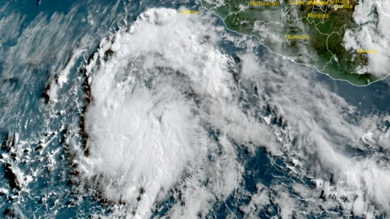
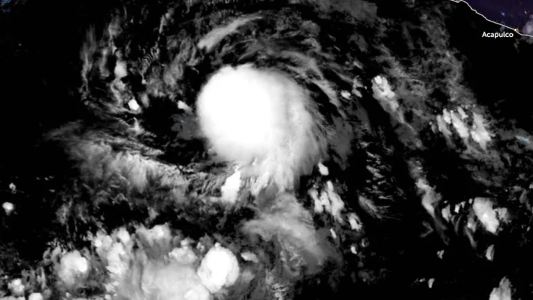
    Tropical Depression Five-E formed over the eastern Pacific Ocean south of Baja California, Mexico, on July 14, 2026, and intensified into Tropical Storm Elida at 09:00 UTC on July 15. The National Hurricane Center (NHC) said the system is forecast to steadily strengthen over the next several days and become a hurricane by the night of July 16, with peak winds expected to reach 161 km/h (100 mph) by July 17.


  • Texas flash flooding prompts water rescues near Uvalde, tornado reported in San Antonio

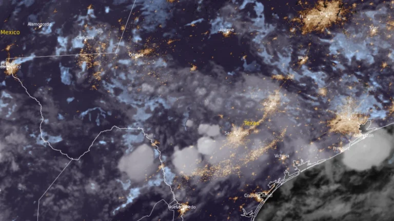
    High-water rescues, road closures, and shelter operations were reported across parts of South-Central Texas on July 14, 2026, after heavy rain produced flash flooding west of San Antonio. Governor Greg Abbott issued a disaster declaration for 59 counties, and the National Weather Service (NWS) warned that dangerous flash-flood conditions would continue across affected areas through the end of the week.

  • NHC designates 100% chance of cyclone formation for EP96

    The National Hurricane Center (NHC) assigned a 100% probability of tropical cyclone formation within the next seven days to disturbance EP96 at 05:00 PDT (12:00 UTC) on July 14, 2026, while raising the 48-hour probability to 90%. A low-pressure circulation with an estimated minimum central pressure of 1 007 hPa had already developed by 08:00 PDT (15:00 UTC), and a tropical depression or tropical storm is expected to form later on July 14 as the system moves west-northwest offshore of southwestern Mexico

  • Enhanced Risk of severe thunderstorms issued for northern New York and New England

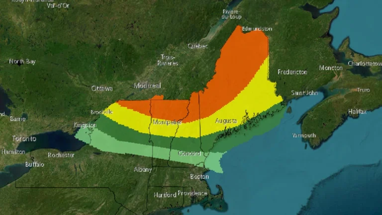
    The Storm Prediction Center (SPC) has placed parts of the New England region under an Enhanced Risk (Level 3 of 5) for severe thunderstorms on Tuesday, July 14, 2026. The greatest threat covers northern New York and northern New England, where thunderstorms are expected to produce widespread damaging wind gusts, large hail, and a few tornadoes. Forecasters also say that one or two strong tornadoes are possible if conditions develop as expected.

  • Moderate Risk of excessive rainfall issued, life-threatening flash floods forecast for south-central Texas

    A Moderate Risk (Level 3 of 4) of excessive rainfall is in effect for parts of south-central Texas through Tuesday morning, July 14, 2026. Repeated thunderstorms threaten are expected to produce life-threatening flash flooding across portions of southwest Texas. Forecast guidance shows a greater than 70% chance of rainfall exceeding 76 mm (3 inches) and a more than 50% chance of totals above 127 mm (5 inches) within the Moderate Risk area, while the National Water Center (NWC) expects considerable flooding impacts to last through Thursday, July 16

  • Dust storm reduces visibility to near zero across Phoenix and central Arizona

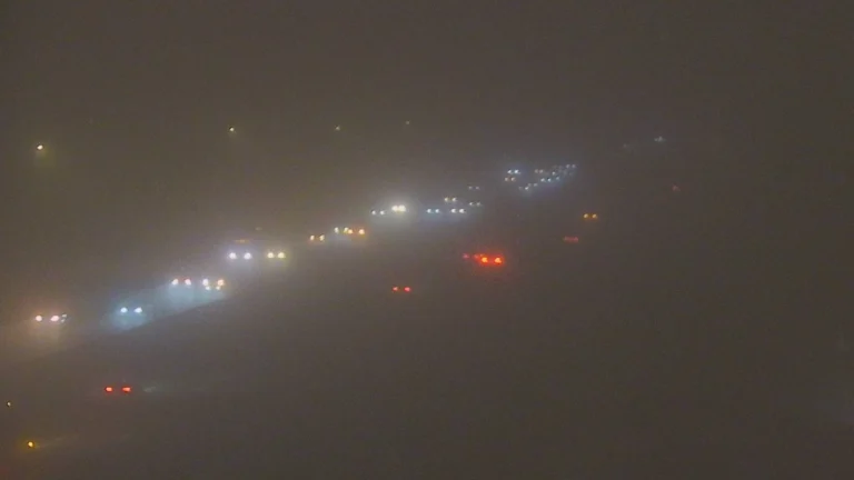
    A massive dust storm swept across Phoenix and parts of Arizona through Saturday and Sunday, July 11 and 12, 2026. Near zero visibility conditions were reported along the I-10, I-70, and the U.S. 60, creating life threatening travel conditions. The National Weather Service (NWS) issued multiple Dust Storm Warnings and severe weather alerts as winds of up to 64 km/h (40 mph) drove the wall of dust across central Arizona.

  • 20 reported dead, 16 missing as Bavi-enhanced monsoon triggers floods and landslides, Philippines

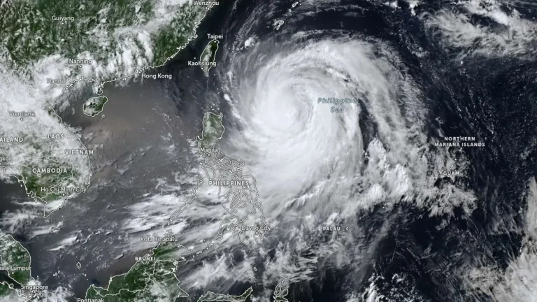
    The combined effects of Typhoon Bavi, locally named Inday, and the enhanced southwest monsoon left 20 people reported dead and 16 missing across the Philippines as of 08:00 LT (00:00 UTC) on Monday, July 13, 2026, while the National Disaster Risk Reduction and Management Council (NDRRMC) continued validating most casualty reports. About 654 000 people were affected nationwide, with flooding, landslides, damaged houses, disrupted roads, bridges and seaports, and about 20 100 people in evacuation centers.

  • Severe floods hit eastern and northern China after Typhoon Bavi’s double landfall

    Typhoon Bavi battered eastern China after making two landfalls in Zhejiang Province late Saturday, July 11, 2026. More than 2.68 million people were relocated in Zhejiang alone ahead of landfall, while rainfall exceeded 300 mm (12 inches) in some areas. As the system moved northward, severe flooding submerged roads under more than 2 m (6.6 feet) of water in parts of Hebei, stranded approximately 1 800 people and disrupted railway services in Liaoning, while 46 rivers nationwide exceeded warning levels.