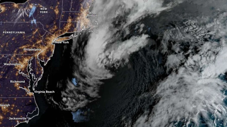
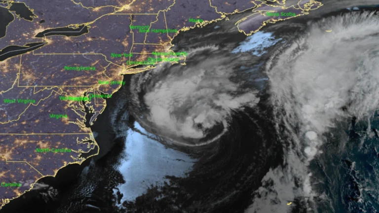
• Subtropical Storm Josephine forms off U.S. East Coast, forecast to become a hurricane-force extratropical cyclone

    Subtropical Storm Josephine was accelerating northeastward away from the U.S. East Coast at 05:00 AST (09:00 UTC) on October 22, 2026, with maximum sustained winds of 100 km/h (65 mph). The National Hurricane Center forecast Josephine to lose its subtropical characteristics later October 22 or overnight into October 23 while strengthening through interaction with an approaching upper-level trough, becoming a hurricane-force extratropical cyclone within 24 hours.
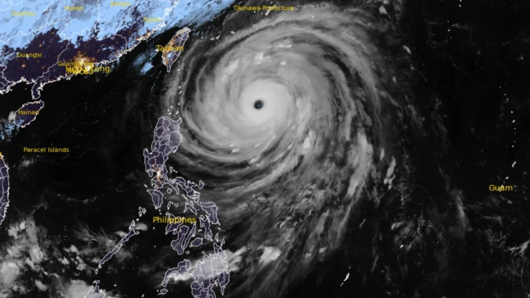
  • Super Typhoon Champi becomes the strongest tropical cyclone of 2026, Signal No. 2 remains over Batanes, Philippines

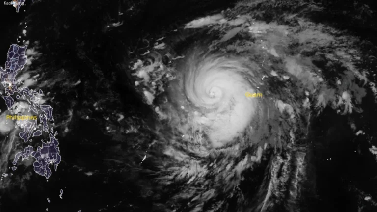
    Super Typhoon Champi, locally named Rosal, became the strongest tropical cyclone of 2026 by maximum sustained wind speed when it reached 296 km/h (185 mph) on October 20, according to NASA’s MODIS program. The cyclone weakened on October 21 while moving toward waters east of the northern Philippines, where PAGASA maintained Tropical Cyclone Wind Signal No. 2 over Batanes and warned of heavy rain and waves reaching 10 m (33 feet).

  • Nor’easter keeps N.C. 12 closed as coastal flood warnings continue in the Outer Banks, U.S.

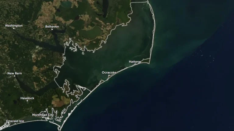
    Coastal Flood Warnings remain in effect for Hatteras and Ocracoke islands on October 21 as a nor’easter continues offshore of the U.S. Mid-Atlantic coast. The National Weather Service forecasts 0.6–1.2 m (2–4 feet) of inundation in vulnerable shoreline areas, while N.C. Highway 12 remains closed between the Marc Basnight Bridge and Rodanthe.

  • Flash-flood risk rises in Southern California, severe storms threaten Arizona

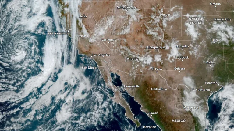
    Heavy rain and severe thunderstorms are forecast across the U.S. Southwest from October 21 into October 23, 2026, as a deep Pacific low draws tropical moisture inland. The Weather Prediction Center (WPC) placed parts of Southern California and the Southwest under a Slight Risk of excessive rainfall for October 21, while the Storm Prediction Center (SPC) placed parts of central and eastern Arizona under a separate Slight Risk of severe thunderstorms.

  • Four deaths reported as DANA Adam flooding prompts more than 1 000 rescues in eastern Spain

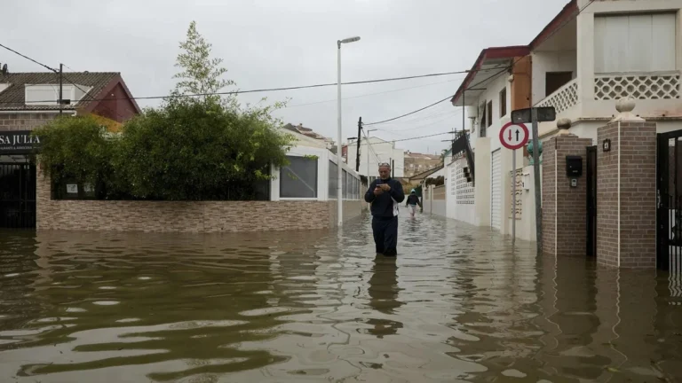
    DANA Adam brought torrential rain and severe flooding to eastern Spain from October 17 to 19, 2026, prompting restrictions across 145 municipalities in Valencia and Alicante. Emergency services carried out more than 1 000 rescues on October 19, while four deaths were reported during the wider storm episode and AEMET said Pego received 632 mm (24.9 inches) of rain in 36 hours.

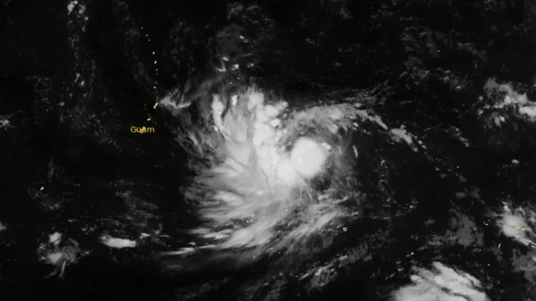
  • Champi briefly reaches super typhoon strength after its closest approach to Guam causes widespread outages

    Typhoon Champi passed about 16 km (10 miles) south of Merizo, Guam, at 04:26 ChST on October 18 (18:26 UTC on October 17) and was upgraded to a super typhoon about three hours later. The Joint Typhoon Warning Center (JTWC) post-analysis placed its 00:00 UTC intensity at 269 km/h (167 mph) before the cyclone weakened to 222 km/h (140 mph) by 12:00 UTC, while Guam authorities reported widespread power outages and disruptions to water services.

  • Visitors ordered to evacuate Hatteras Island as coastal storm threatens N.C. Highway 12, U.S.

    Dare County ordered all visitors to evacuate Hatteras Island beginning at 20:00 EDT on October 16 (00:00 UTC on October 17) after declaring a state of emergency ahead of a developing coastal nor’easter. A Coastal Flood Warning is valid from 17:00 EDT (21:00 UTC) on October 17 to 08:00 EDT (12:00 UTC) on October 20, with 0.6–1.2 m (2–4 feet) of inundation above ground level and 2.4–4.3 m (8–14 feet) breaking surf forecast in vulnerable areas.

  • Typhoon and Flood watches cover Mariana Islands as Tropical Storm Champi approaches

    Typhoon and Flood watches were in effect for Guam, Rota, Tinian and Saipan early October 16 as Tropical Storm Champi moved west toward the Mariana Islands. NWS Guam said damaging winds were likely late October 17 and on October 18, while storm-total rainfall of 152–305 mm (6–12 inches) could cause flooding in urban, low-lying and poorly drained areas.

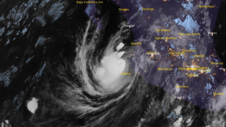
  • 5 deaths reported in Mexico due to Hurricane Simon and remnants of Rachel

    Hurricane Simon was drifting westward off Mexico’s west-central coast at 15:00 UTC on October 13, 2026, with maximum sustained winds of 150 km/h (90 mph), while the National Hurricane Center (NHC) shifted its forecast track substantially south and described confidence in both the track and intensity forecasts as very low. One death has been attributed to Simon in Guerrero. An Associated Press report separately counted four deaths from post-tropical Rachel in Baja California, bringing the combined toll from the two systems to five at the time of that report.

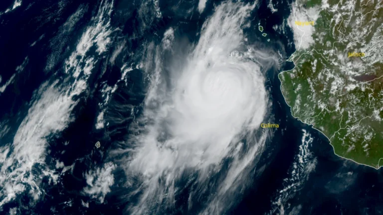
  • Category 3 Hurricane Simon remains off western Mexico after heavy rain floods Manzanillo

    Category 3 Hurricane Simon remained just offshore west-central Mexico at 03:00 LT (09:00 UTC) on October 12, with maximum sustained winds of 185 km/h (115 mph) and a minimum pressure of 958 hPa, after heavy rain flooded homes and streets in Manzanillo. The National Hurricane Center placed its center 75 km (50 miles) southwest of Cabo Corrientes and warned that dangerous winds, storm surge and additional rainfall could worsen flooding along the coast.