• Peru declares state of emergency ahead of 2026–2027 El Niño rains

    Peru has declared a 60-day state of emergency in 796 districts across 22 departments and the Constitutional Province of Callao on July 2, 2026, because of the imminent threat of intense rainfall associated with the 2026–2027 El Niño phenomenon, activating nationwide preparedness and disaster risk reduction measures.
  • Enhanced Risk of severe thunderstorms issued for eastern South Dakota, southwest Minnesota, and northwest Iowa

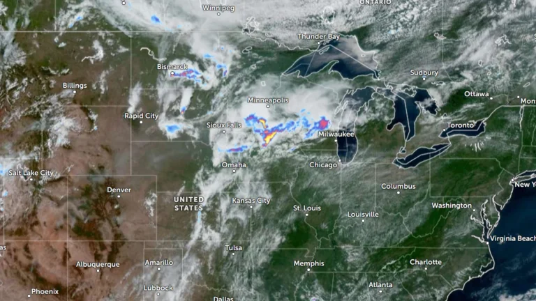
    The Storm Prediction Center (SPC) has placed parts of eastern South Dakota, southwest Minnesota and northwest Iowa under an Enhanced Risk of severe thunderstorms through Thursday, July 2, 2026. A broader Slight Risk extends from the Dakotas into the western Great Lakes and includes western Kansas, the Tennessee Valley and the southern Appalachians. Damaging wind gusts and large hail are expected to be the primary severe weather hazards across the affected regions.

  • Bavi forecast to intensify into super typhoon near Northern Mariana Islands

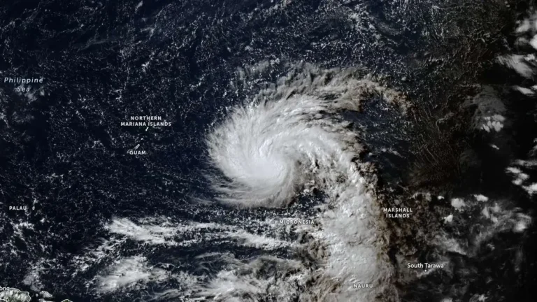
    Tropical Storm Bavi is forecast to undergo rapid intensification from late July 2, 2026, and become a super typhoon as it approaches the Northern Mariana Islands. The Joint Typhoon Warning Center (JTWC) forecast issued at 09:00 UTC calls for 1-minute sustained winds of 250 km/h (155 mph) near the system’s peak intensity around July 5.

  • Tropical Storm Douglas forms over the eastern Pacific, forecast to weaken into a remnant low by July 3

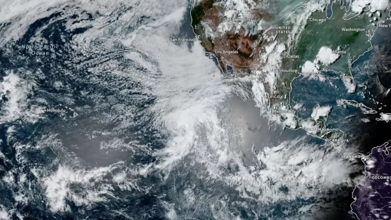
    Tropical Storm Douglas formed over the eastern North Pacific Ocean at 21:00 UTC on July 1, 2026, and became the fourth named storm of the 2026 eastern Pacific hurricane season. The cyclone is located well west-southwest of the southern tip of Baja California, Mexico, and is expected to remain over open waters while weakening into a post-tropical remnant low by July 3.

  • Enhanced Risk issued for severe thunderstorms across Midwest and Upper Great Lakes

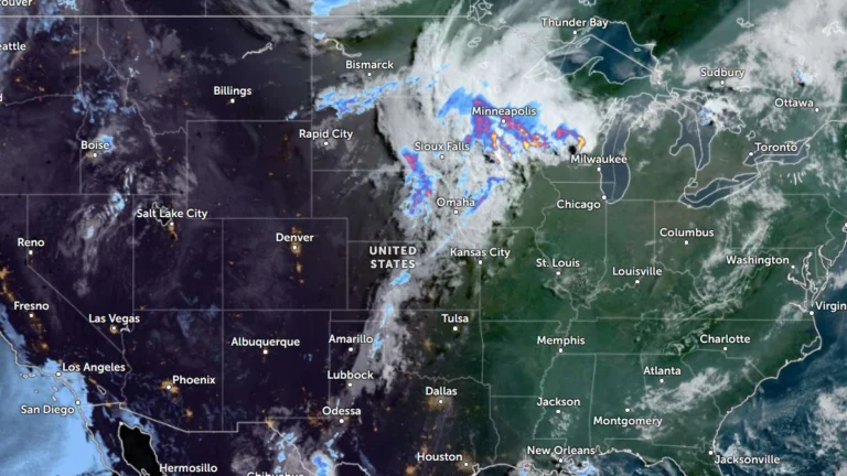
    Severe thunderstorms will affect portions of the Upper Midwest and Great Lakes through Wednesday, July 1, 2026, with damaging wind gusts of up to 130 km/h (80 mph), isolated large to very large hail and a few tornadoes possible. Parts of the region have been put under an Enhanced Risk of severe thunderstorms through Wednesday, while a Slight Risk extends across portions of the central High Plains and the Northeast.

  • Preliminary 211 km/h (131 mph) gust in South Dakota among the strongest thunderstorm winds in U.S.

    A wind gust of 211 km/h (131 mph) measured near Holabird, South Dakota, during severe thunderstorms on June 29, 2026, would rank as the 15th-strongest thunderstorm wind gust ever recorded in the United States if confirmed. The storms damaged grain bins, metal buildings, trees and other infrastructure across several counties with straight-line winds extending from south-southwest of Andover into the town.

  • Canyon County declares emergency after storms hit Nampa–Caldwell area, Idaho

    Canyon County, in southwest Idaho’s Treasure Valley west of Boise, declared a countywide disaster emergency on June 27, 2026, after severe thunderstorms moved through the Nampa–Caldwell area the previous evening, bringing strong winds, heavy rain, and hail. Preliminary National Weather Service (NWS) observations recorded gusts of 89 km/h (55 mph) at Boise Airport and 85 km/h (53 mph) at Caldwell Airport.

  • Floods kill 3 in Taiwan and Japan as Mekkhala and Higos fuel heavy rain and landslides

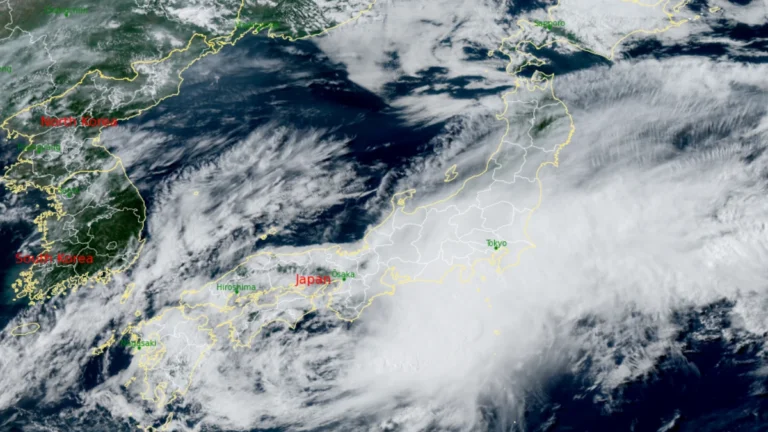
    Flooding triggered by Tropical Storm Mekkhala killed two people in Taiwan after nearly 1 m (3 ft) of rain inundated parts of the island on Friday, June 26, 2026.Meanwhile, one fatality was reported in Japan which remained on high alert for flooding and landslides as tropical moisture from Mekkhala and Tropical Storm Higos interacted with the seasonal Baiu rain front, prompting evacuations, transport disruptions and widespread weather warnings.

  • Winter Storm Warnings issued for Idaho and Montana mountains

    The National Weather Service (NWS) office in Missoula upgraded Winter Storm Watches to Winter Storm Warnings at 11:04 MDT (17:04 UTC) on June 26, 2026, for four high-elevation zones in central Idaho and southwest Montana, where 10-20 cm (4-8 inches) of heavy wet snow, with isolated amounts up to 30 cm (12 inches), is forecast above about 2 000 m (6 500 feet) over the weekend.