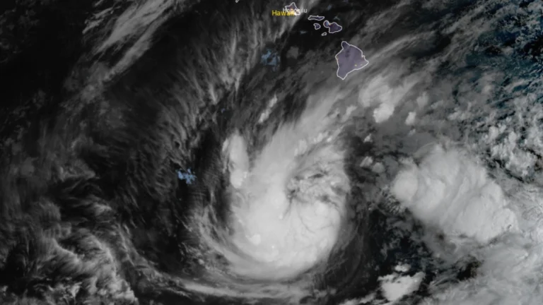
• Tropical Storm Nolo strengthens south of Hawaii, up to 890 mm (35 inches) of rain forecast

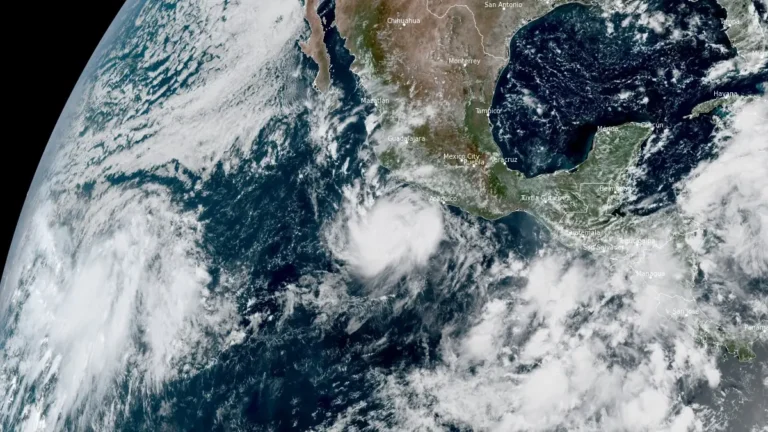
    Tropical Storm Nolo strengthened south of Hawaii on September 24, 2026, as forecasters warned of potentially life-threatening flooding across Hawaii Island. At 05:00 HST (15:00 UTC), the Central Pacific Hurricane Center (CPHC) reported maximum sustained winds of 95 km/h (60 mph) and placed Nolo approximately 460 km (285 miles) south of South Point. The CPHC forecast 380–510 mm (15–20 inches) of rain across Hawaii Island, with localized totals near 890 mm (35 inches).

  • Typhoon Dujuan leaves 12 dead and 3 missing, record rain, floods and landslides hit Japan

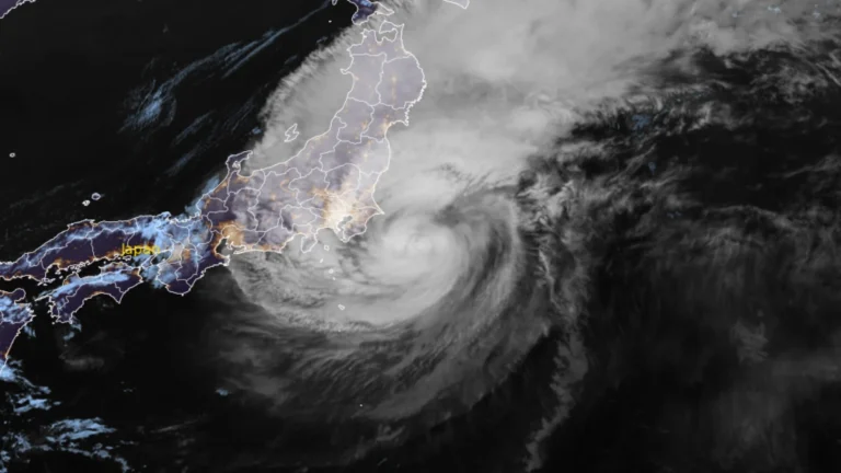
    Heavy rainfall from Typhoon Dujuan caused flooding and landslides across eastern Japan on September 21 and 22, 2026. Japan’s Fire and Disaster Management Agency (FDMA) reported 12 deaths and three people missing nationwide as of September 24. Seven deaths were recorded in Chiba, four in Kanagawa and one in Miyazaki, while searche and rescue operations continued in Chiba and Kanagawa.48-hour rainfall total reached 832 mm (32.76 inches) at Oshima, Tokyo setting an all time record for the station.

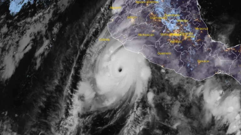
  • Hurricane Polo brings heavy rain to Mexico, NHC forecasts Baja California approach

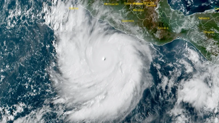
    Hurricane Polo’s outer rainbands brought heavy rain to southwestern Mexico on September 24, 2026, with a Tropical Storm Warning in effect from Tecpan de Galeana to Manzanillo. Mexico had extended the warning westward overnight as the Category 5 hurricane remained offshore, bringing a risk of flooding, mudslides and dangerous coastal conditions.Polo is forecast to approach the Baja California Peninsula as a hurricane early in the week beginning September 28.

  • Hurricane Polo intensifies to Category 5, heavy rainfall threatens southwestern Mexico

    Hurricane Polo intensified to Category 5 south of southwestern Mexico on September 22, 2026, reaching maximum sustained winds of 260 km/h (160 mph) at 12:00 UTC before strengthening further to 270 km/h (165 mph) by 15:00 UTC, according to the US National Hurricane Center (NHC). A Tropical Storm Warning was in effect for part of the southwestern Mexican coast, while heavy rainfall through September 24 threatened life-threatening flooding and mudslides in Guerrero and Michoacán.

  • Flood watches cover much of New Mexico as multi-day heavy rainfall event begins

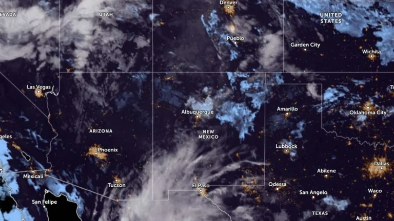
    Flood Watches cover much of New Mexico on September 22, 2026, as a multi-day surge of tropical and monsoon moisture is forecast to produce repeated rounds of heavy rain and thunderstorms through at least September 24. The Weather Prediction Center (WPC) placed portions of southern New Mexico under a Moderate Risk of excessive rainfall, level 3 of 4, for the first 24-hour period, with the Moderate Risk shifting into parts of eastern New Mexico during the following period. Flash flooding, river flooding and debris flows near recent burn scars are possible.

  • Rapidly intensifying Tropical Storm Polo forecast to become major hurricane near southwestern Mexico

    Tropical Storm Polo was rapidly intensifying off southwestern Mexico on September 21, 2026, with maximum sustained winds reaching 100 km/h (65 mph) at 09:00 CST (15:00 UTC), according to the National Hurricane Center (NHC). NHC forecasts Polo to become a hurricane later Monday and a major hurricane on Tuesday while moving near the southwestern Mexican coast, where a Tropical Storm Watch is already in effect.

  • Typhoon Dujuan brings record rainfall to eastern Japan, JMA issues Level 5 landslide warning for Oshima

    Rainfall on Oshima reached 600 mm (23.6 inches) in the 24 hours ending at 14:00 LT (05:00 UTC) on September 21, 2026, as Typhoon Dujuan passed the Izu Islands and approached eastern Japan. The record September rainfall prompted a Level 5 landslide special warning, while flooding, landslides and transport disruption affected parts of the Kanto region.

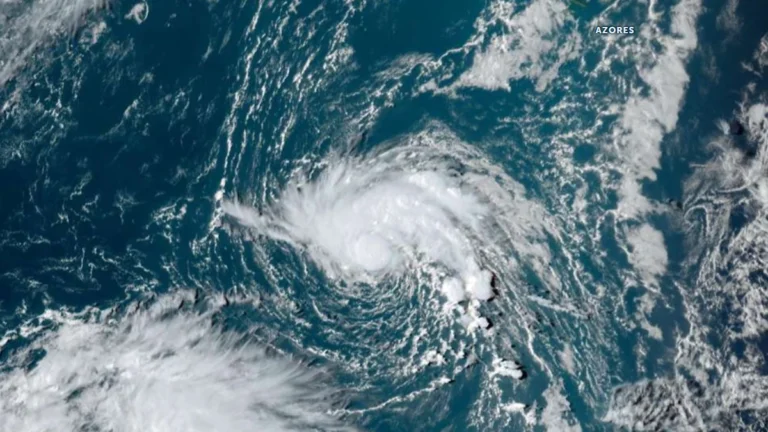
  • Tropical Depression Six forms over the North Atlantic, forecast to strengthen into Tropical Storm Fay

    Tropical Depression Six formed southwest of the Azores on September 19, 2026, with initial maximum sustained winds of 55 km/h (35 mph). The NHC forecast the depression to reach tropical-storm intensity by 00:00 UTC on September 20 and strengthen further to 75 km/h (45 mph) by 00:00 UTC on September 21. The system would receive the name Fay if upgraded to a tropical storm.

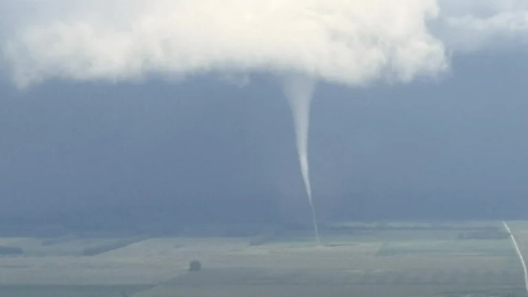
  • Tornado touches down near Francis Peak in Davis County, Utah

    A tornado touched down east of Fruit Heights, Utah, at approximately 13:52 LT (19:52 UTC) on September 18, 2026, as severe thunderstorms moved across Davis County and surrounding areas. Rain and damage was reported in the affected areas. The National Weather Service (NWS) had issued a tornado warning for portions of Davis, Weber and Morgan counties just eight minutes before the reported touchdown.