
Nor’easter keeps N.C. 12 closed as coastal flood warnings continue in the Outer Banks, U.S.
Coastal Flood Warnings remain in effect for Hatteras and Ocracoke islands on October 21, 2026 as a nor’easter continues offshore of the U.S. Mid-Atlantic coast. The National Weather Service forecasts 0.6–1.2 m (2–4 feet) of inundation in vulnerable shoreline areas, while N.C. Highway 12 remains closed between the Marc Basnight Bridge and Rodanthe.
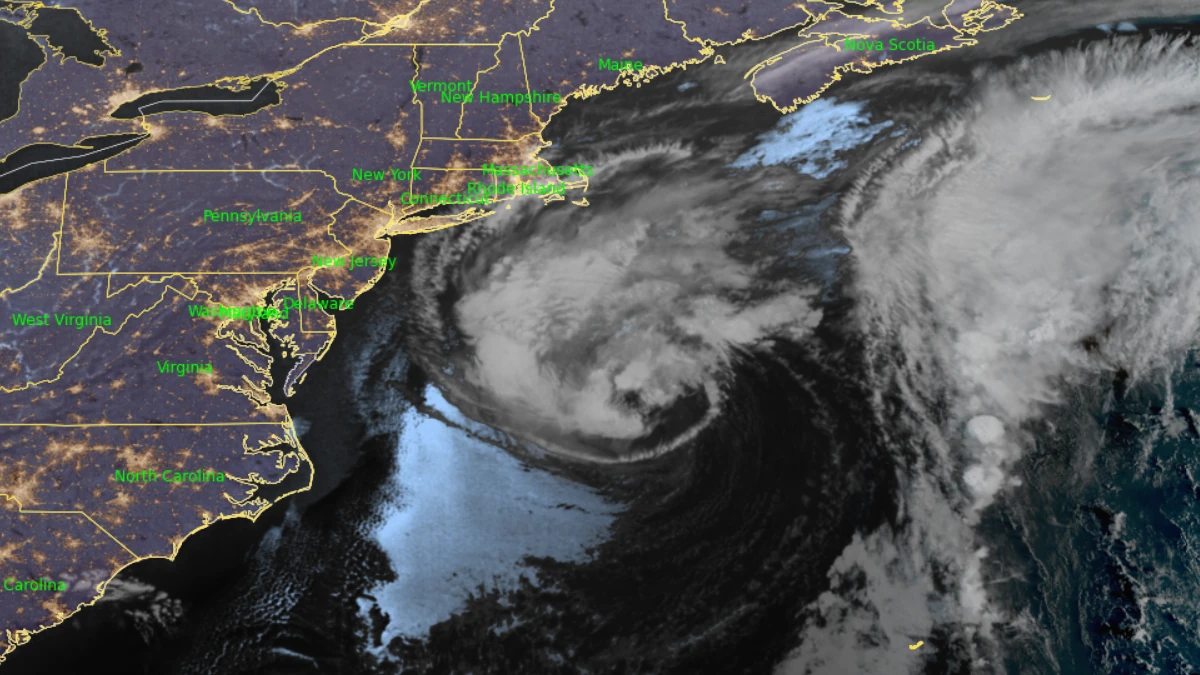
Satellite image of US east coast at 10:50 UTC on October 21, 2026. Credit: NOAA/GOES-19, RAMMB/CIRA, The Watchers
The National Hurricane Center (NHC) classified the offshore system at 02:00 EDT (06:00 UTC) on October 21 as a storm-force non-tropical low located a few hundred miles off the Mid-Atlantic coast. Satellite imagery indicated that the low remained frontal while moving slowly north-northeastward over the Gulf Stream.
The National Weather Service (NWS) office in Newport/Morehead City maintained Coastal Flood Warnings for Hatteras and Ocracoke islands through 20:00 EDT on October 21 (00:00 UTC on October 22). The warnings forecast 0.6–1.2 m (2–4 feet) of inundation above ground level in low-lying areas near shorelines and tidal waterways, with flooding threatening roads, homes, and businesses.
Hatteras Island remains under a High Surf Advisory through 20:00 EDT on October 22 (00:00 UTC on October 23), with breaking waves of 2.7–3.7 m (9–12 feet) forecast in the surf zone. NWS said significant ocean overwash would continue through multiple high-tide cycles and confirmed that N.C. 12 between the Marc Basnight Bridge and Rodanthe remained closed.
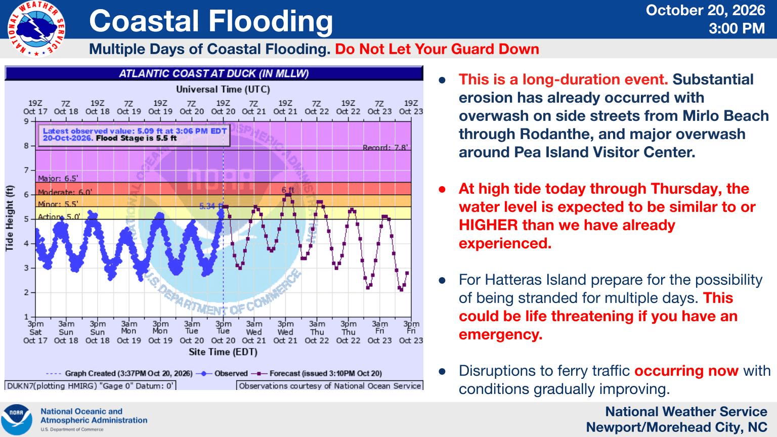
Dare County said in Bulletin #5, issued October 20, that the mandatory evacuation order for Hatteras Island visitors remained in effect while the highway closure restricted normal road access. NWS independently confirmed the closure on October 21.
NWS canceled the High Surf Advisory for Ocracoke Island at 04:11 EDT (08:11 UTC) on October 21. Its Coastal Flood Warning and Beach Hazards Statement remained in effect, with dangerous rip currents, large breaking waves, and strong longshore currents expected.
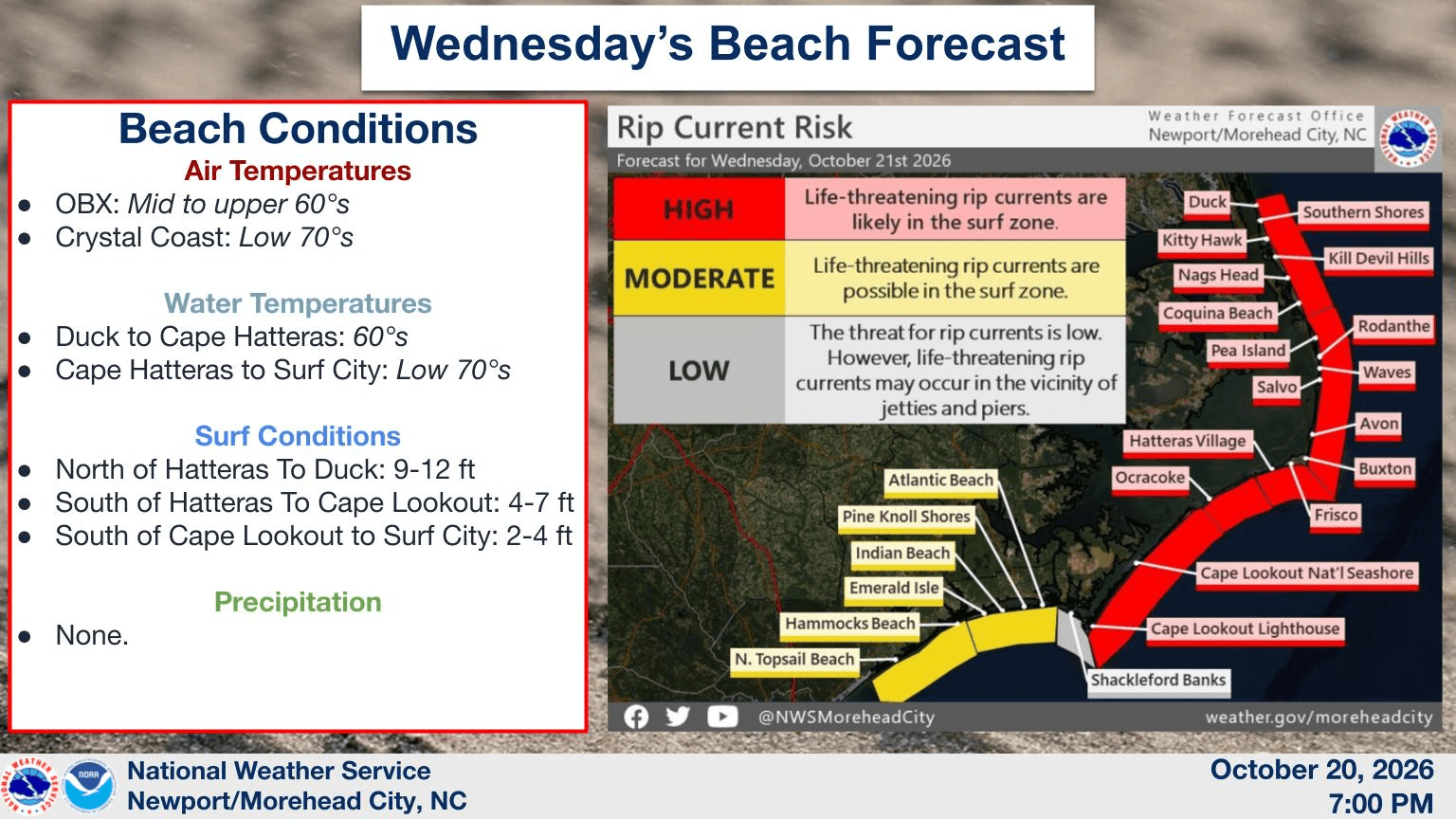
The Northern Outer Banks remain under a Coastal Flood Advisory through 20:00 EDT on October 21, with 0.3–0.9 m (1–3 feet) of inundation possible in low-lying shoreline areas. A High Surf Advisory remains in effect there through October 22, with breaking waves of 2.7–3.7 m (9–12 feet).
Marine conditions remain hazardous off the North Carolina coast. NWS forecast north winds of 37–56 km/h (23–35 mph), gusts near 65 km/h (40 mph) and seas of 4.3–5.5 m (14–18 feet) in offshore waters from Currituck Beach Light to Ocracoke Inlet. A Gale Warning remains in effect there until midnight EDT on October 21 (04:00 UTC on October 22).
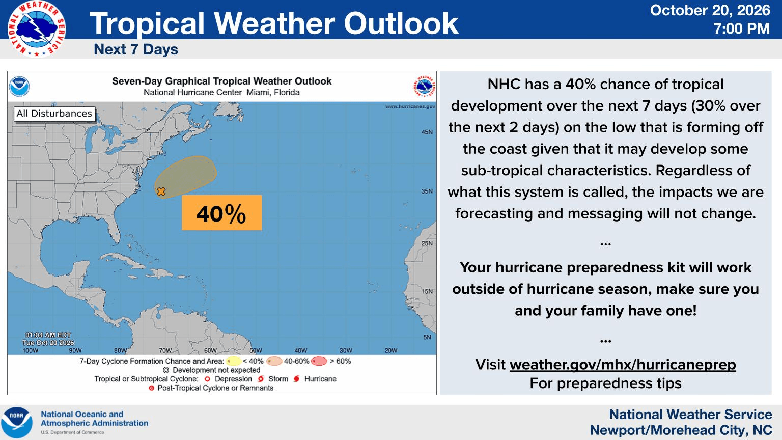
NHC assigned the low a 40% chance of subtropical or tropical cyclone formation through both 48 hours and seven days. Forecasters said it could briefly develop subtropical characteristics before accelerating northeastward late in the week, when conditions are expected to become unfavorable for further development.
NHC said high winds, coastal flooding and dangerous surf would continue along portions of the U.S. East Coast during the following several days regardless of the system’s classification.
References:
1 Coastal Hazard Message and Marine Weather Message – NWS Newport/Morehead City – October 21, 2026
2 Atlantic Tropical Weather Outlook – NOAA/NHC – October 21, 2026
3 Bulletin #5: N.C. Highway 12 Closed Between Marc Basnight Bridge and Rodanthe; Hatteras Island Visitor Evacuation Remains in Effect – Dare County – October 20, 2026

Rishav Kothari is Editor-in-Chief of The Watchers, where he runs the newsroom and covers earthquakes, volcanoes, severe weather and space weather.
Published in the last 24 hours
- In January 2000, chunks of ice weighing up to 6 pounds fell out of clear blue skies over Spain for 10 days. One smashed through a car windshield, and scientists still can’t fully explain where they came from Epicenter
- El Niño reaches 2.0°C on NOAA’s index, a tenth of a degree behind 1997–98 at the same point, as forecasters expect it to challenge the all-time record this winter
- The fastest wind gust ever measured on Earth, 253 mph, hit an oil island off Australia during Cyclone Olivia in 1996, and nobody noticed for more than a decade, until experts reading old data quietly took the record from New Hampshire's Mount Washington Epicenter
- In 1954, a grapefruit-sized meteorite crashed through a roof in Sylacauga, Alabama, and struck Ann Hodges as she napped on her couch Epicenter
