
Florida declares emergency after catastrophic flooding in southern Brevard County
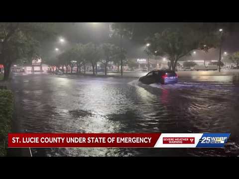
Up to 612 mm (24.10 inches) of rain was recorded near Malabar in southern Brevard County, Florida, from November 1 through late November 2, producing catastrophic flooding around Melbourne, Palm Bay and neighboring communities. Emergency crews carried out large-scale water rescues, Brevard Public Schools closed for November 2 and 3, and Governor Ron DeSantis declared a state of emergency in seven counties.

the Weather Prediction Center (WPC) said more than 610 mm (24 inches) of rain had fallen across parts of southern Brevard County since early November 1.
Rainfall totals reached 612 mm (24.10 inches) near Malabar, 523 mm (20.60 inches) near Palm Bay and 503 mm (19.80 inches) near Melbourne Beach from 07:00 EST on November 1 through 21:00 EST on November 2.
The National Weather Service (NWS) Melbourne declared a Flash Flood Emergency for West Melbourne and Palm Bay at 07:56 EST (12:56 UTC) on November 2. Radar and automated gauges indicated that 203–305 mm (8–12 inches) of rain had fallen, with another 102–152 mm (4–6 inches) possible at that time.

By 11:35 EST (16:35 UTC), the emergency included Grant-Valkaria. The NWS reported observed totals of 381–508 mm (15–20 inches), with another 51–102 mm (2–4 inches) possible, and classified the flash-flood damage threat as catastrophic.
Governor Ron DeSantis issued Executive Order 26-227 on November 2, declaring a state of emergency in Brevard, DeSoto, Hardee, Highlands, Indian River, Martin and St. Lucie counties.
The Florida Department of State subsequently listed temporary polling-place relocations made pursuant to the order and state law for voters assigned to affected locations.

Brevard Emergency Management spokesperson Don Walker reported that sheriff’s deputies helped more than 100 people caught in rising water on November 2. Airboats were used to remove at least seven residents from flooded homes in the Wingate subdivision of West Melbourne.
WFLA separately reported, citing the Florida Fish and Wildlife Conservation Commission (FWC), that agency crews completed more than 60 rescues. Officers used airboats, shallow-water vessels and a helicopter, while welfare checks continued in severely flooded neighborhoods.
In Melbourne, police used ropes to reach two of three Florida Institute of Technology students caught in a current near a flooded retention pond and Crane Creek, according to Police Commander Shawn Eising. An FWC helicopter airlifted the third student.
Palm Bay Fire Rescue deployed all three of its high-water rescue trucks as crews responded to stranded motorists and residents. Boats and other high-clearance vehicles were also used to reach flooded neighborhoods.
Brevard Public Schools closed all campuses and district offices on November 2 and 3. District crews continued inspecting campuses, and schools were expected to resume normal operations on November 4 if conditions allowed.
All four Eastern Florida State College campuses also closed and canceled classes on November 2, with the college initially planning to reopen on November 3.

Palm Bay issued a shelter-in-place advisory and asked residents to conserve water while emergency crews responded to flooded neighborhoods. Melbourne urged residents to remain indoors, avoid unnecessary travel and leave flooded roads clear for emergency personnel.
The Melbourne Police Department lobby and all city facilities were closed to the public during the emergency.
All Brevard County buildings and Clerk of Court offices closed on November 2, while all county libraries were scheduled to close by 14:00 EST (19:00 UTC). Severe flooding also suspended nine Space Coast Area Transit routes serving Melbourne and Palm Bay.
Flooding closed roads and intersections throughout Melbourne. City officials said lingering floodwater and abandoned vehicles continued to block routes and hinder emergency response after the heaviest rain subsided.
Flooding also disrupted water services. A water-main break along Port Malabar Boulevard temporarily interrupted service to some Palm Bay customers because crews could not safely reach the site, while Melbourne issued a precautionary boil-water notice for all water customers.
Brevard County Emergency Management said its American Red Cross partners opened a shelter at Parker Memorial Missionary Baptist Church in Cocoa on November 2.
In a 16:15 EST (21:15 UTC) update, county officials warned residents to stay off roads and out of floodwater as waters receded. The county said floodwater could contain bacteria, chemicals, debris, sharp objects and downed power lines.
At 01:16 EST (06:16 UTC) on November 3, NWS Melbourne said flooding remained ongoing in many locations. Saturated soils, high water tables and limited drainage capacity were expected to slow the recession of standing water, while areas affected by catastrophic flooding remained extremely sensitive to additional rainfall.
Rain chances were forecast to decrease to 50–60% on November 3, with most locations receiving less than 25 mm (1 inch). The NWS placed the probability of isolated totals of 38–64 mm (1.5–2.5 inches) through the evening at 5–10% and warned that even modest additional rainfall could raise water levels where flooding remained in progress.

An upper-air disturbance over the eastern Gulf interacted with unusually rich atmospheric moisture and persistent onshore flow from the Atlantic, producing heavy to extreme precipitation over parts of Florida during the preceding 48 hours. NWS Melbourne said the convergence and atmospheric forcing responsible for the extreme rainfall had diminished considerably by early November 3.
At 01:16 EST (06:16 UTC) on November 3, NWS Melbourne said flooding remained ongoing in many locations. Saturated soils, high water tables and limited drainage capacity were expected to slow the recession of standing water, while areas affected by catastrophic flooding remained extremely sensitive to additional rainfall.
Rain chances were forecast to decrease to 50–60% on November 3, with most locations receiving less than 25 mm (1 inch). The NWS placed the probability of isolated totals of 38–64 mm (1.5–2.5 inches) through the evening at 5–10% and warned that even modest additional rainfall could raise water levels where flooding remained in progress.
An upper-air disturbance over the eastern Gulf interacted with unusually rich atmospheric moisture and persistent onshore flow from the Atlantic, producing heavy to extreme precipitation over parts of Florida during the preceding 48 hours. NWS Melbourne said the convergence and atmospheric forcing responsible for the extreme rainfall had diminished considerably by early November 3.
References:
1 Storm Summary Number 1 for Florida Heavy Rainfall and Flash Flooding — NWS/WPC — November 3, 2026
2 Flash Flood Emergency for West Melbourne, Palm Bay and Grant-Valkaria — NWS Melbourne — November 2, 2026.
3 Executive Order 26-227 — Emergency Management — 2026 Fall Flooding — State of Florida — November 2, 2026.
4 60+ people rescued after catastrophic flooding in parts of Florida: FWC — WFLA — November 2, 2026
Featured image: Boats being used to conduct rescues in Brevard county on October 2, 2026 amid catastrophic flooding. Credit: FWC

Rishav Kothari is Editor-in-Chief of The Watchers, where he runs the newsroom and covers earthquakes, volcanoes, severe weather and space weather.
