
2 atmospheric rivers to bring heavy Sierra snow and California flood risk
Two Pacific storms will bring rain, mountain snow and gusty winds to the western U.S. during the week of November 16, 2026. The stronger storm is expected to reach California Tuesday night into Wednesday, raising the risk of flooding along central and southern parts of the coast and major travel disruption in the Sierra Nevada.
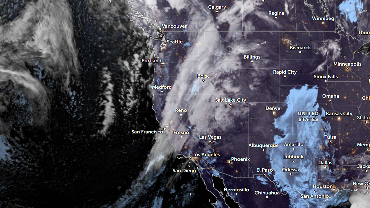
Satellite image of U.S. West Coast, at 10:00 UTC on November 16, 2026. Credit: NOAA/GOES-18, Zoom Eath ,The Watchers
The first storm is moving south through California, with mostly light rain expected in Southern California on Monday, November 16. The National Weather Service (NWS) Los Angeles/Oxnard office forecasts totals generally below 13 mm (0.5 inches), followed by a brief break before the stronger storm arrives.
Farther north, the first system will bring rain and higher-elevation snow to the Pacific Northwest through Monday morning before moving inland. Snow and lower-elevation rain will spread into the northern Intermountain West and western Rockies by Tuesday, according to the Weather Prediction Center (WPC).
The second storm is expected to reach California late Tuesday, November 17, and continue through Wednesday and Thursday. An accompanying atmospheric river, a concentrated stream of moisture from the Pacific, will supply heavier precipitation as the low-pressure system approaches the coast.
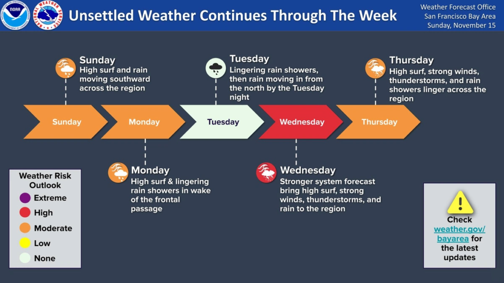
WPC has a Slight Risk of excessive rainfall for central coastal California on Wednesday, November 18, extending into the western Transverse Ranges. Thursday’s risk area includes the Transverse and Peninsular ranges and nearby coastal metropolitan areas, including Los Angeles and San Diego.
Across much of the San Francisco Bay Area and Central Coast, NWS forecasts storm totals of 51–76 mm (2–3 inches), rising to 76–127 mm (3–5 inches) in the coastal ranges. Rain from the preceding storms will leave soils wetter and increase concerns about rising creeks and streams.
The Los Angeles/Oxnard office forecasts 25–76 mm (1–3 inches) across its region, with 51–127 mm (2–5 inches) on favored south- and southwest-facing slopes and foothills. The main period of flooding risk could begin Wednesday afternoon on the Central Coast and Wednesday night farther south.
Peak rainfall rates could reach 13–25 mm/h (0.5–1 inch/h), especially if thunderstorms develop along the cold front. Potential impacts include flooded roads, rockslides along canyon routes, and debris flows near recent wildfire burn scars. The office considers river flooding unlikely, although water levels in normally dry channels could rise.
Wind gusts could reach 64–97 km/h (40–60 mph) in mountains and interior foothills within the Los Angeles/Oxnard forecast area. Strong winds combined with rain-loosened soil could bring down trees and cause power outages.
Heavy snow will create a separate travel hazard in the Sierra Nevada. NWS Sacramento forecasts 30–60 cm (1–2 feet) of snow above about 1 500 m (5 000 feet) in the northern Sierra and southern Cascades, with up to 90 cm (3 feet) at the highest peaks.
Farther south, the Hanford office has issued a Winter Storm Watch for the Sierra Nevada above about 1 500 m (5 000 feet) for the midweek storm. The office reports probabilities of 80–90% or higher for at least 61 cm (2 feet) of snow across much of the Sierra above about 1 800 m (6 000 feet) in its area.
Sacramento forecasters warn that mountain travel could become very difficult to impossible from Tuesday night into early Friday, November 20. Heavy snowfall and gusty winds could sharply reduce visibility, with chain controls and road closures possible. Drivers can check current restrictions through Caltrans QuickMap.
As the stronger system moves inland, WPC also expects heavy snow in parts of Utah and Colorado’s San Juan Mountains. Lesser amounts of rain and snow will spread across the rest of the Intermountain West before precipitation reaches the Plains later in the week.
References:
1 Short Range Forecast Discussion – NWS Weather Prediction Center – November 15, 2026, 19:18 UTC.
2 Excessive Rainfall Discussion – NWS Weather Prediction Center – November 15, 2026, 23:17 UTC.
4 Area Forecast Discussion – NWS San Francisco Bay Area/Monterey – November 16, 2026, 06:08 UTC.
5 Area Forecast Discussion – NWS Los Angeles/Oxnard – November 16, 2026, 04:30 UTC.
6 Area Forecast Discussion – NWS Sacramento – November 15, 2026, 22:01 UTC.

Rishav Kothari is Editor-in-Chief of The Watchers, where he runs the newsroom and covers earthquakes, volcanoes, severe weather and space weather.
Published in the last 24 hours
- Huge waves pummel California coast during strong El Niño, flooding streets and closing piers from Pacifica to San Diego
- A fireball over northern China on 6 November 2026 punched a crater into a wheat field at Beigucheng village in Hebei; the Institute of Geochemistry has now classified the fallen stones as L6 ordinary chondrites. Epicenter
- The interstellar comet 3I/ATLAS is thought to be about twice as old as Earth, and the James Webb Space Telescope has now found that its ice looks less like any comet from our own solar system than like the frozen worlds beyond Neptune, a sign it formed somewhere its star’s light could barely reach Epicenter
- Mount Everest is the highest point above sea level, but because the Earth bulges at the equator, the summit of a volcano in Ecuador sits farther from the centre of the planet, making it the closest piece of land on Earth to outer space Epicenter
