
Helicopters plucked almost 100 people from the Cornish village of Boscastle when a flash flood hit in 2004, and not one person died
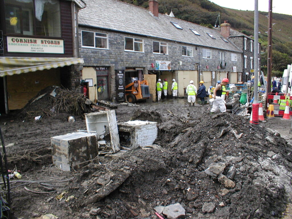
An extreme flash flood tore through Boscastle, Cornwall, on August 16, 2004, after exceptionally intense rainfall became concentrated over the small Valency catchment. Six military helicopters airlifted 97 people to safety and about 200 people were rescued overall by helicopters and people on the ground; eight minor injuries were reported, but no one was known to have died.
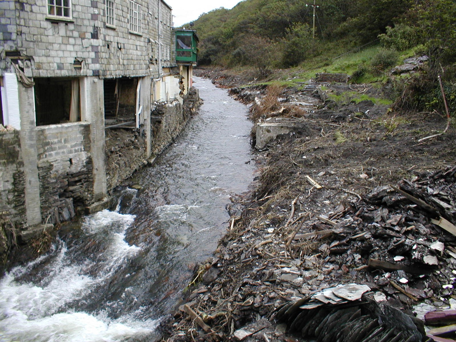
Boscastle 05. Credit: Benjamin Evans (public domain), via Wikimedia Commons.
The first rainfall above Boscastle was recorded at about 12:30 LT (11:30 UTC) on August 16, 2004, followed by hours of heavy rain over a concentrated area of north Cornwall. The River Valency, which runs through the village, rapidly became a torrent and overflowed as runoff from the steep catchment converged on Boscastle.
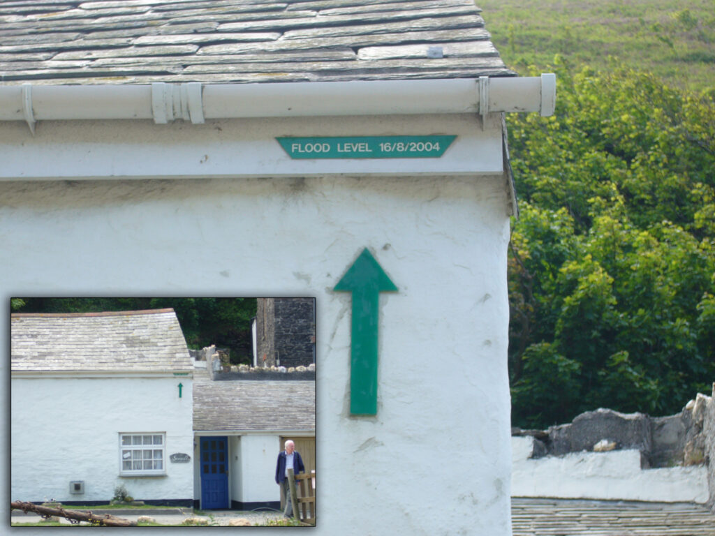
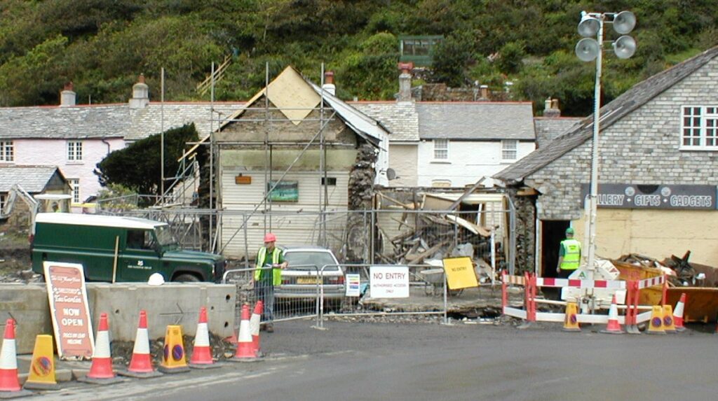
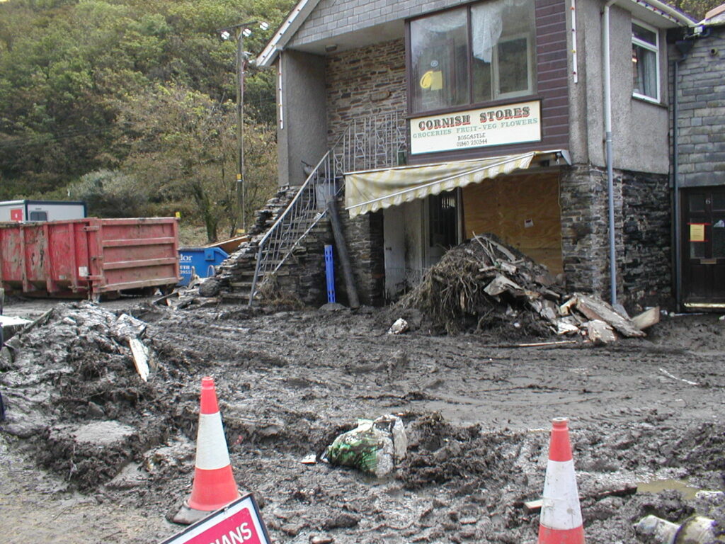
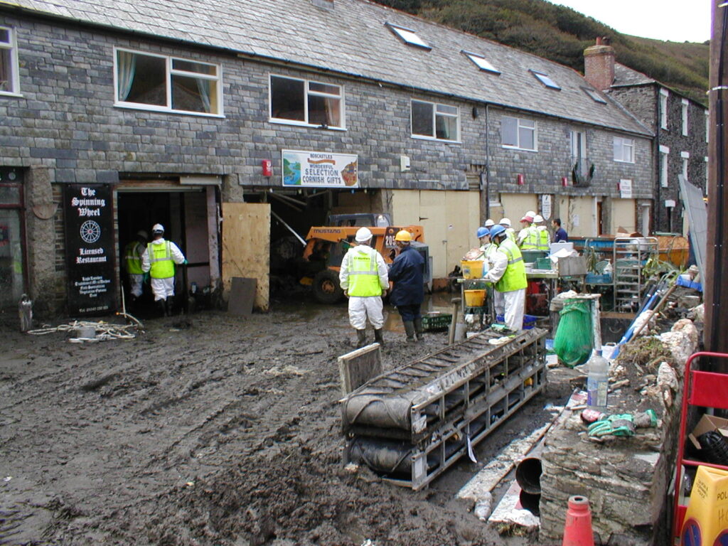
The official multi-agency debrief estimated that water reached a depth of about 3 m (9.8 feet) as it poured through the village, washing away vehicles, trapping residents and tourists and triggering a major rescue operation.
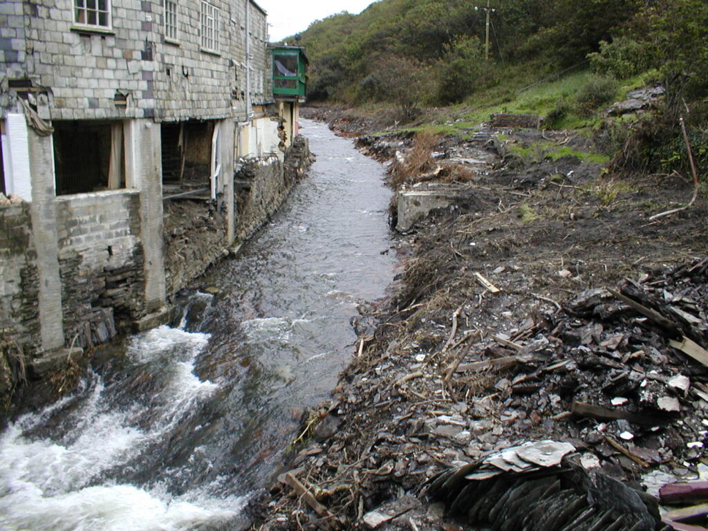
Rainfall measurements show how concentrated the storm became. After correction against a daily check gauge, the Lesnewth tipping-bucket gauge recorded 82 mm (3.2 inches) in one hour, 148 mm (5.8 inches) in three hours and 183 mm (7.2 inches) in five hours.
The gauge recorded an uncorrected peak rainfall rate of nearly 300 mm/h (11.8 inches/h) at about 16:35 LT (15:35 UTC). Because the tipping-bucket gauge under-read during the event, Golding, Clark and May concluded that the maximum rate may briefly have reached about 400 mm/h (15.7 inches/h). More than 200 mm (7.9 inches) of rain was recorded at the head of the Valency catchment above Boscastle.
The rainfall came from a sequence of small, intense convective cells rather than one thunderstorm remaining stationary over Boscastle. Golding et al. found that interaction between frictionally backed winds over land and a developing sea breeze generated a stationary sea-breeze front along the north Cornwall coast.
Storm cells approaching from the south intensified along that convergence zone and moved northeast, while new cells developed behind them. The arrangement repeatedly placed heavy rain over the same coast-facing catchments for several hours.
The Valency catchment above Boscastle covers approximately 20 km2 (7.7 mi2), rises to about 300 m (984 feet) above sea level and contains a main river branch about 7 km (4.3 miles) long. HR Wallingford described the river and its tributaries as steep, with generally thin soils over impermeable bedrock.
HR Wallingford reconstructed the flood using rainfall radar, hydrological modelling, hydraulic modelling, post-flood surveys, photographs, video, wrack marks and eyewitness accounts. The predicted peak discharge in central Boscastle was around 180 m3/s (6 360 ft3/s), compared with an estimated median annual flow of about 4 m3/s (141 ft3/s).
The reconstruction placed a Boscastle-scale flood at an annual exceedance probability of about 0.25%, equivalent to a return period of around 400 years. HR Wallingford stressed that the estimate was derived from sparse historical evidence, post-event reconstruction and modelling assumptions and therefore carried substantial uncertainty.
The flood was already producing emergency calls before the rescue operation expanded. The government debrief records the A39 flooded at Otterham Station at 14:33 LT (13:33 UTC), people trapped in vehicles there at 15:09 LT (14:09 UTC), and three people trapped in woodland above Boscastle at 15:31 LT (14:31 UTC).
At 15:46 LT (14:46 UTC), a local resident who served as an auxiliary Coastguard informed the Maritime Rescue Co-ordination Centre at Falmouth that the River Valency was rising significantly. Two search-and-rescue helicopters were initially dispatched, and additional aircraft were requested as reports from the first crews over the village established the scale of the emergency.
At 17:10 LT (16:10 UTC), the pilot of Rescue 193 from Royal Naval Air Station Culdrose requested every available standby aircraft and additional land-based emergency services, warning that rescuers were in danger of “losing Boscastle and all the people in it.”
Eight helicopters responded in total. Three were deployed from RNAS Culdrose, two from RMB Chivenor and one from RAF St Mawgan, together with an HM Coastguard helicopter from Portland and an air ambulance. The six military helicopters airlifted 97 people to safety.
The figure of 97 is narrower than the total rescue count. The same debrief states that about 200 people were rescued by helicopters and others on the ground. Eight minor injuries were reported and no one was known to have died.
A rest centre opened at Camelford Sports Centre to provide shelter for about 100 evacuees, mainly tourists and holidaymakers. Around 50 people and their pets remained there overnight while emergency crews continued operating in Boscastle and on surrounding roads.
The absence of fatalities did not mean the response was free of serious problems. The multi-agency debrief found that communications failed during the early stages of the emergency, both within responding organizations and between them.
Radio communications from Boscastle to police, fire and ambulance control rooms did not function effectively, while mobile coverage was limited to one service provider. Broadcast television pictures gave some control-room staff their first clear appreciation of the scale of the flooding because direct communication with personnel at the scene was inadequate.
The debrief found that those communication failures contributed to what it described as ineffective integrated emergency management for several hours. Coordination improved as the incident progressed, but the report identified the lack of reliable communications and the initially incomplete understanding of conditions on the ground as major weaknesses.
Hydraulic reconstruction later provided another explanation for the rapid changes in water level reported by witnesses. HR Wallingford could reproduce the observed peak water levels only when the main B3263 road bridge was modelled as substantially obstructed by flood-borne debris.
The modelling found that rapid blockage of the bridge could produce sharp increases in water level upstream and redirect a substantial part of the flow into Boscastle’s streets. The study treated this as a more plausible contributor to the abrupt local rises than failure of small temporary debris dams farther upstream, although the reconstruction could not remove all uncertainty from the sequence.
Post-event modelling also showed why the flood was difficult to reconstruct with conventional methods. HR Wallingford had to calibrate the hydrological and hydraulic models against wrack marks, photographs and eyewitness evidence because no direct river-flow record captured an event of this magnitude in the small ungauged catchment.
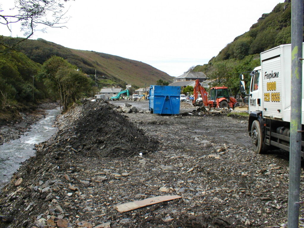
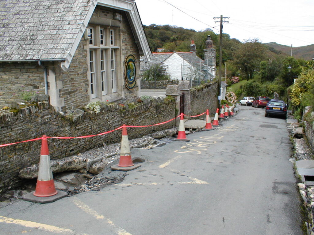
The flood altered channels throughout the Valency system through bank erosion, incision, debris jams and changes in flow paths. HR Wallingford recorded substantial damage to roads, bridges, drainage and other infrastructure and described the August 2004 flood as an exceptionally rare event whose quantitative reconstruction necessarily retained uncertainties.

The official debrief’s accounting remains the controlling record for the rescue numbers used here: 97 people were airlifted by six military helicopters, while about 200 people were rescued overall by helicopters and people on the ground. Its assessment credited the prompt deployment of military and Coastguard helicopters with preventing loss of life while also documenting the communications and coordination failures that complicated the response.
References:
1 Major Flooding North Cornwall – The Lessons Identified – South West Regional Resilience Forum / North Cornwall multi-agency debrief – March 17, 2006
2 Golding, B., Clark, P., & May, B. (2005). The Boscastle flood: Meteorological analysis of the conditions leading to flooding on 16 August 2004. Weather, 60(8), 230-235. DOI: 10.1256/wea.71.05
3 Fenn, C. R., Bettess, R., Golding, B., Farquharson, F. A., & Wood, T. (2005). The Boscastle flood of 16 August 2004: Characteristics, causes and consequences. Proceedings of the 40th Defra Flood and Coastal Management Conference, York, UK. HR Wallingford

I’m a science journalist and researcher at The Watchers, contributing to the Epicenter edition, where I cover peer-reviewed scientific research and emerging discoveries across Earth and space sciences. With a background in astronomy and a passion for environmental science, I’ve worked in shark and coral conservation in Fiji, conducting reef and shark-behavior research, contributing to mangrove restoration, and earning PADI Open Water and Coral Reef Certifications. I bring a blend of scientific rigor and storytelling to illuminate the discoveries shaping our planet and beyond.
Published in the last 24 hours
- Lightning killed 323 wild reindeer at once on a Norwegian mountain plateau in 2016, and the crows and ravens that came to eat them left droppings full of crowberry seeds that could still sprout, clustered around the bodies Epicenter
- A Kansas farmer looked straight up into a tornado in 1928 and saw a hollow tube at least half a mile tall, its walls lit by constant flashes of lightning Epicenter
- New Mexico’s Navajo Reservoir rose nearly 60 feet in seven weeks this fall, after a winter with almost no snow, as storms flooded the San Juan River Epicenter
- Malawi continues Bris AI weather forecasting tests ahead of operational integration Epicenter
