• ‘Historically rare’ tornado strikes Huanggang, causing extensive urban damage in Hubei Province, China

    A rare tornado struck the urban area of Huanggang, Hubei Province, between 20:10–20:30 LT on July 6, 2026, causing widespread destruction across residential neighborhoods, industrial facilities, and logistics parks. Huanggang’s on-site command headquarters said the tornado produced winds exceeding Force 15 on the Chinese wind scale during what it described as a historically rare event for the city. Still preliminary numbers mention up to 12 fatalities and hundreds injured.


  • Reservoir breaches and Maysak floods leave 6 dead, 11 missing in Guangxi, China

    Severe flooding caused by Tropical Cyclone Maysak left 2 people dead in Nanning, Guangxi, on July 6, 2026, after extreme rainfall caused Liulan and Yunbiao reservoirs in Hengzhou to overtop and develop breaches. The Nanning flood-control briefing reported about 55 000 people affected and 48 000 evacuated, as of late Monday, July 7.

  • Large wedge tornado strikes the Huanggang–Ezhou area in China’s Hubei Province, causing extensive damage

    A large wedge tornado struck the Huanggang–Ezhou area of Hubei Province, China, on July 6, 2026, during severe thunderstorms associated with the remnants of Typhoon Maysak. Numerous videos and photographs shared on Chinese social media appear to show a large condensation funnel moving through urban areas, while unconfirmed reports claim widespread damage, at least two fatalities, and hundreds of injuries.

  • Nearly one million lose power as severe storms sweep Midwest, Northeast and Ontario

    Severe thunderstorms driven by extreme heat and abundant moisture swept across the Midwest and Northeast on Friday and Saturday, July 3 and 4, 2026 toppling trees, damaging power infrastructure and disrupting holiday travel across one of the busiest weekends of the year. Utility crews continued restoration efforts after hundreds of thousands of customers lost electricity across multiple states and parts of Ontario.

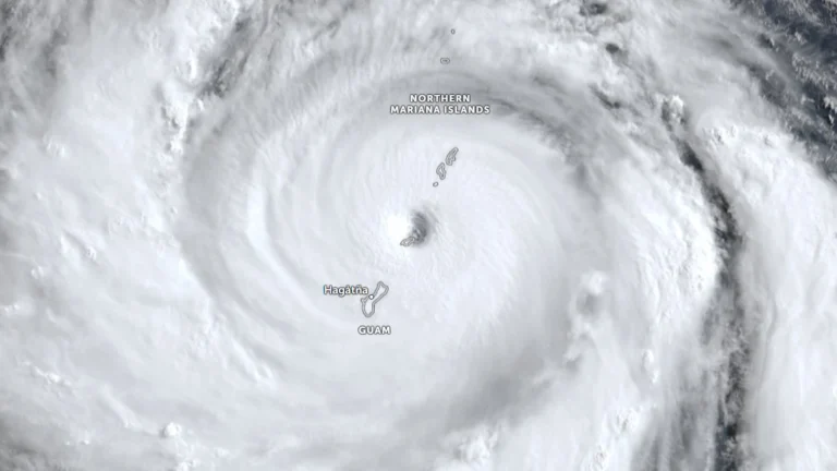
  • Super Typhoon Bavi strengthens into Category 5 as Guam, Northern Mariana Islands brace for possible catastrophic impacts

    Super Typhoon Bavi reached Category 5 strength over the western North Pacific on Saturday, July 4, 2026 as it tracked toward the Mariana Islands. Forecasters expect the cyclone to pass very near Rota before moving between Guam and Saipan on Monday morning. Typhoon warnings have been issued for Guam, Rota, Tinian, and Saipan amid forecasts of destructive winds, life-threatening coastal inundation, widespread flash flooding and catastrophic damage early next week.

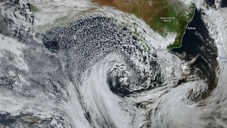
  • Adelaide hit by 70% of its July rainfall in one day as successive cold fronts bring flooding and damaging winds to South Australia

    Heavy rain from successive winter cold fronts flooded roads and properties across South Australia during July 2–3, 2026, prompting hundreds of State Emergency Service (SES) call-outs, disrupting transport, triggering a statewide Code Blue response for vulnerable people and delivering more than 100 mm (3.9 inches) of rain to parts of the Mount Lofty Ranges, according to the Bureau of Meteorology (BOM) and the SES.

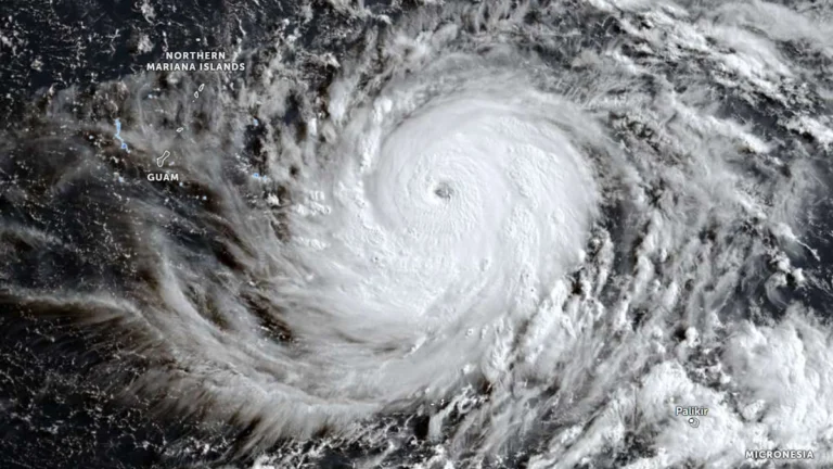
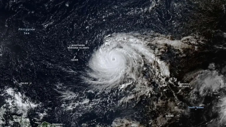
  • Typhoon Bavi forecast to approach the Mariana Islands as a Category 5 super typhoon

    Typhoon Bavi rapidly intensified over the western North Pacific on Friday, July 3, 2026, increasing from 157 km/h (98 mph) to 194 km/h (121 mph) within six hours. The storm is forecast continue strengthening potentially becoming a Category 5 equivalent super typhoon by Sunday, July 5. Typhoon, tropical storm and flood watches remained in effect Friday across Guam and the Commonwealth of the Northern Mariana Islands.