
M7.8 earthquake raised parts of the seabed by up to 2 m (6.6 feet) in the southern Philippines
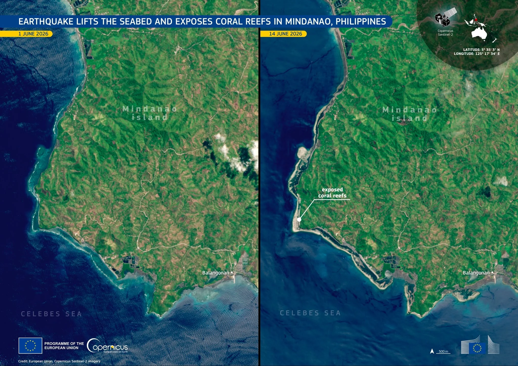
PHIVOLCS reported that the M7.8 earthquake off southern Mindanao, which caused dozens of fatalities and widespread damage, raised sections of the coastline in Sarangani and Davao Occidental provinces by as much as 2 m (6.6 feet). Shoreline has retreated by up to 200 m (656 feet) in some locations, exposing coral reefs and marine ecosystems that had previously remained underwater.
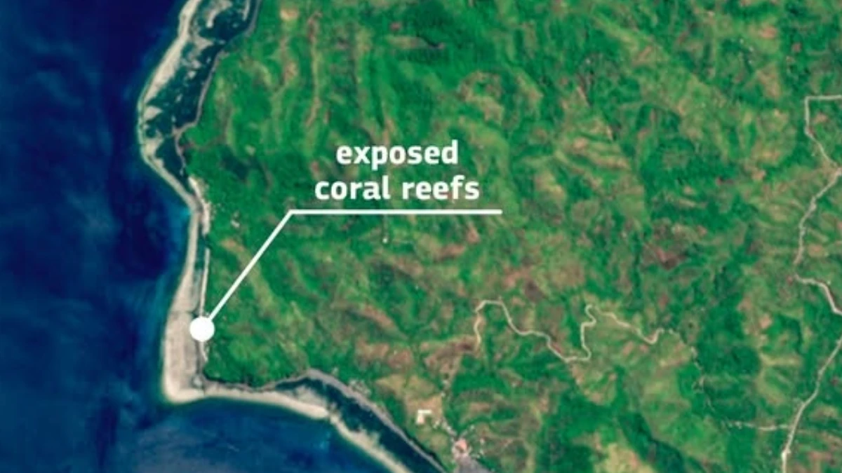
Exposed coral reefs after shoreline retreat in southern Philippines due to the M7.8 Mindanao earthquake. Credit: European Union, Copernicus Sentinel-2 imagery
A M7.8 earthquake struck offshore southern Mindanao, Philippines, along the Cotabato Trench system, causing widespread damage and triggering emergency operations across affected areas.
Authorities reported at least 61 fatalities and approximately 40 missing persons following the earthquake, according to assessments cited by multiple media reports.
The earthquake struck at 07:37 LT on June 8 (23:27 UTC on June 7), about 20 km (12.4 miles) off Sarangani province, and was felt strongly across Mindanao.
It produced significant vertical crustal deformation according to the Philippine Institute of Volcanology and Seismology (PHIVOLCS).
Sections of the seabed and adjacent coastline in parts of Sarangani and Davao Occidental provinces were uplifted by as much as 2 m (6.6 feet), raising previously submerged areas above sea level. Shoreline had retreated by up to 200 m (656 feet) in some locations after the earthquake.
Environmental assessment teams reported exposed coral reefs, seagrass beds, and other marine habitats that had previously remained underwater. Multiple marine animals had also died with their bodies being exposed out on shore due to the retreated shoreline.
PHIVOLCS attributed the uplift to movement associated with the earthquake rupture along the Cotabato Trench, a convergent plate boundary where tectonic strain accumulates over long periods before being released during major earthquakes.
Large subduction-zone earthquakes have produced similar coastal changes elsewhere around the Pacific Basin. The uplift documented in southern Mindanao provides a measurable example of the tectonic processes responsible for reshaping coastlines during major plate-boundary earthquakes.
Most of the damage was concentrated in General Santos, a city of about 700 000 people. Reuters reported damaged shops and buildings, broken signs and glass, and some structures reduced to concrete and rubble. One hospital in the city was evacuated because of cracks on higher floors, and one building at Notre Dame of Dadiangas University collapsed while empty.
AP reported collapsed buildings and key infrastructure damage in General Santos, while tsunami damage was reported in at least one coastal village. The quake also triggered a landslide in Glan, Sarangani, that killed 13 villagers, according to AP, citing provincial disaster official Rene Punzalan.
References:
1 Earthquake lifts the seabed and exposes coral reefs in Mindanao, Philippines – Copernicus EU – June 16, 2026

I am an Assistant Editor and Severe Weather & Science Journalist at The Watchers, specializing in real-time severe weather coverage, geophysical event reporting, and research-driven scientific analysis. You can reach me at rishav(at)watchers(.)news.
Commenting rules and guidelines
We value the thoughts and opinions of our readers and welcome healthy discussions on our website. In order to maintain a respectful and positive community, we ask that all commenters follow these rules.