
Major to extreme heat risk forecast across central and eastern U.S. through the July 4 holiday
A strengthening upper-level ridge is forecast to intensify a prolonged and dangerous heat wave across much of the central and eastern United States through at least July 10, 2026, with temperatures in the low to upper 30s°C (90s to lower 100s°F) and heat index values reaching 38–43°C (100–110°F), locally up to 46°C (115°F).
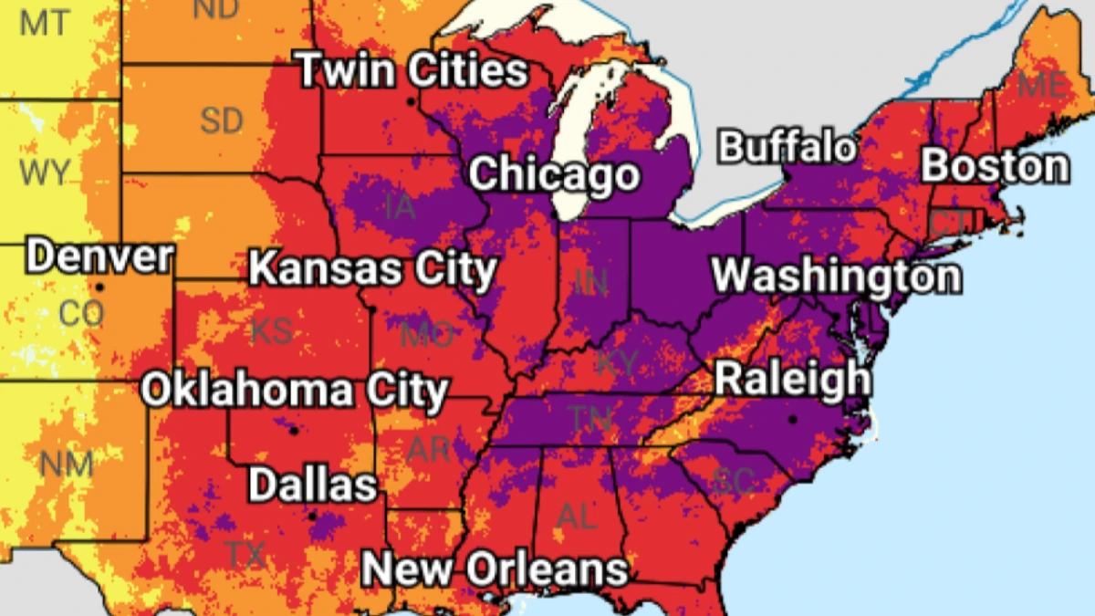
Image credit: NWS/WPC
A strengthening upper-level ridge is forecast to intensify a prolonged and dangerous heat wave across much of the central and eastern United States through at least July 10.
Temperatures in the low to upper 30s°C (90s to lower 100s°F), combined with high humidity, are forecast to produce heat index values of 38–43°C (100–110°F) across much of the region, with locally higher values reaching 46°C (115°F). The highest heat indices are expected across portions of the southern Plains, Mid-Mississippi Valley, and, by June 30, parts of the Mid-Atlantic.
Much of the central and eastern U.S. is forecast to experience Moderate to Major HeatRisk on June 29, increasing to Major to Extreme HeatRisk on June 30.
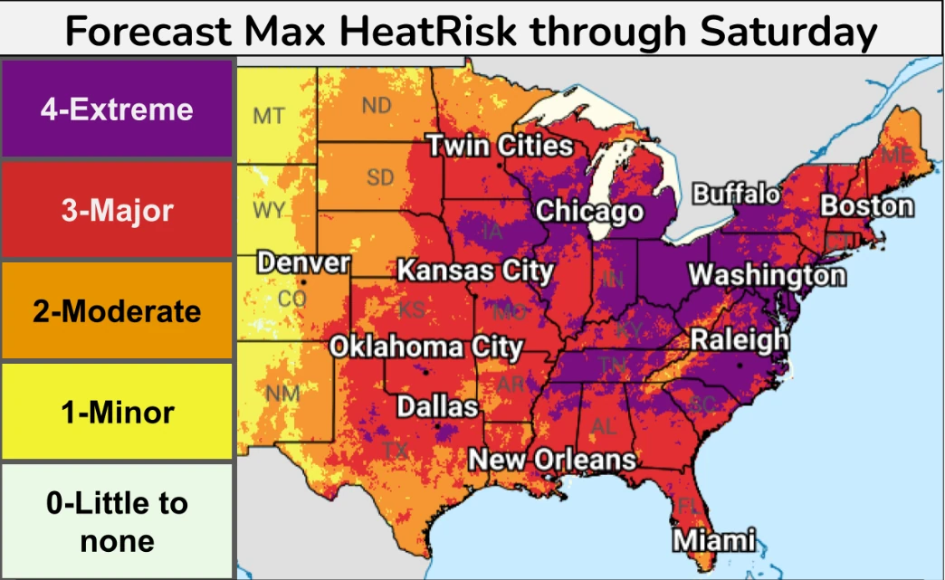
Widespread Major to Extreme HeatRisk is forecast across the Lower Great Lakes, the Mississippi and Ohio valleys, and the Mid-Atlantic through July 4, increasing the likelihood of heat-related health impacts.
Overnight temperatures will remain unusually warm, with lows generally in the low to upper 20s°C (70s°F), including the mid to upper 20s°C (mid to upper 70s°F) in many locations, providing little to no overnight relief.
The combination of prolonged daytime heating and limited nighttime cooling will increase the risk of heat-related illness and may affect anyone without adequate hydration or access to cooling, although vulnerable populations remain at greatest risk.
The dangerous heat is expected to persist through July 4, with elevated heat risk continuing afterward. Moderate to extreme heat risk is forecast across parts of the eastern Plains, Mississippi Valley, Mid-Atlantic, and Southeast on July 6, while slight heat risk expands westward through July 10. Daytime heat index values of 38–41+°C (100–105+°F) and continued warm nights are expected to prolong heat stress.
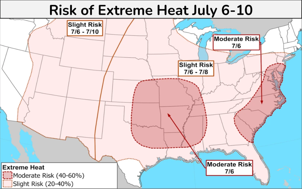
The dangerous heat is expected to persist through the Independence Day holiday, with elevated heat risk continuing into early July across parts of the eastern Plains, Mississippi Valley, Mid-Atlantic, and Southeast.
Residents are urged to limit strenuous outdoor activities during the hottest part of the day, stay hydrated, and seek air-conditioned environments or cooling centers when available.
References:
1 Key messages for late June and early July heatwave – NWS/WPC – June 28, 2026

I am an Assistant Editor and Severe Weather & Science Journalist at The Watchers, specializing in real-time severe weather coverage, geophysical event reporting, and research-driven scientific analysis. You can reach me at rishav(at)watchers(.)news.
Commenting rules and guidelines
We value the thoughts and opinions of our readers and welcome healthy discussions on our website. In order to maintain a respectful and positive community, we ask that all commenters follow these rules.