
Minnesota sets new air pollution record, Superior National Forest reports the worst wildfire conditions in 20 years
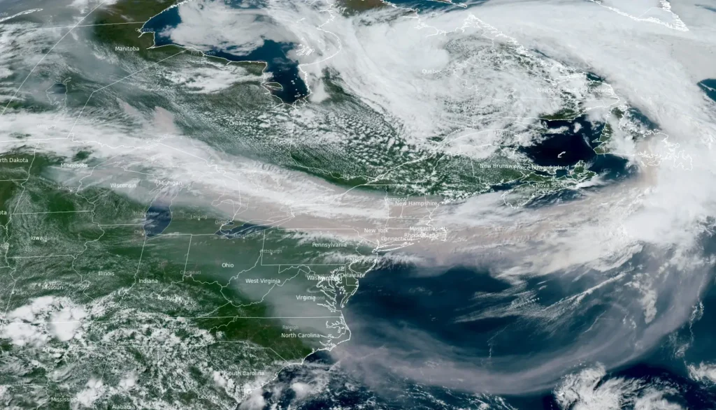
Dense smoke from wildfires burning across Minnesota and parts of southern Canada has severely reduced air quality across much of Minnesota, with pollution levels becoming so high that they exceeded the Minnesota Pollution Control Agency’s routine quality-control limits. The Superior National Forest is experiencing the worst wildfire conditions in 20 years. Officials warn that hazardous smoke, extreme fire behavior, and additional wildfire growth are expected to continue as crews respond to 15 active fires across the Forest.
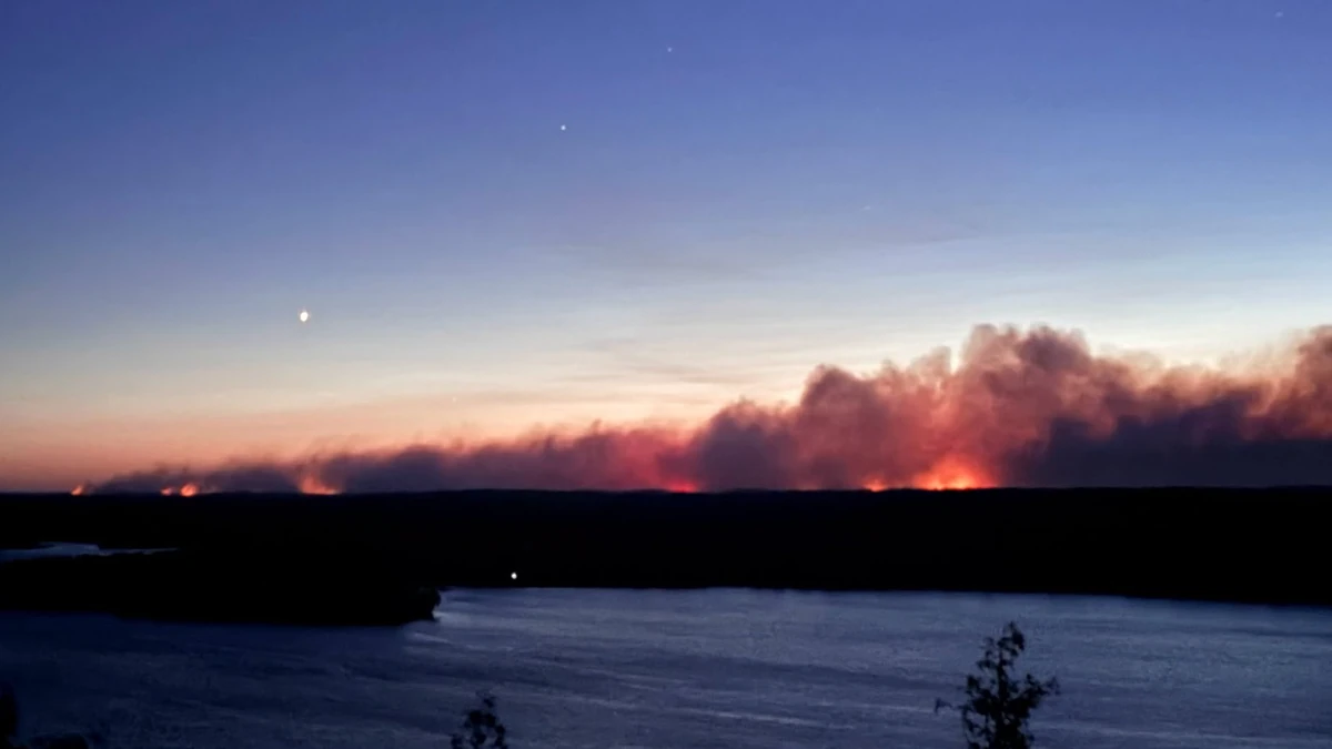
Smoke rising from wildfires in Superior National Forest Minnesota on July 14, 2026. Credit: USFS Superior National Forest
Minnesota is experiencing one of its most severe wildfire smoke events on record, with smoke concentrations becoming so extreme that they exceeded the normal operating range of the Minnesota Pollution Control Agency’s (MPCA) automated quality-control system.
The agency confirmed that its air quality monitors were functioning properly after technicians inspected affected stations and said the unprecedented readings have established a new set of record observations.
The MPCA has issued an Air Quality Alert from 14:00 CDT Wednesday, July 15, through 11:00 CDT on Friday, July 17, covering east central, central, west central, southeast, north central, northwest, and northeast Minnesota, including the Twin Cities metropolitan area.
Air quality is forecast to reach the Maroon Air Quality Index (AQI) category—Hazardous—for central, east central, north central, and northeast Minnesota, while Purple (Very Unhealthy) and Red (Unhealthy) conditions are expected across other parts of the alert area. Heat is expected to exacerbate the health impacts of the smoke, and the agency warned the alert may need to be extended beyond Friday for parts of the state.
The extraordinary smoke concentrations prompted the MPCA’s automated quality-control (QC) system to flag the observations because they were far outside the normal range.
The agency said staff were dispatched to inspect the affected monitoring stations in the Arrowhead region and confirmed the instruments were operating normally.
“Our previous records were readings of 476 in that region. We now have a new list of the top 10 observations that come in at more than 1 000,” the MPCA said.
The most heavily affected areas include Brainerd, Alexandria, Hinckley, St. Cloud, Winona, Moorhead, International Falls, Two Harbors, Hibbing, Ely, Duluth, and the Tribal Nations of Mille Lacs, Prairie Island, Leech Lake, White Earth, Red Lake, Grand Portage, and Fond du Lac.
The smoke is being generated by large wildfires burning across Minnesota’s Arrowhead region and southern Canada. According to the MPCA, very heavy smoke from these fires will continue spreading south through central, northwest, and portions of southeastern Minnesota before a forecast cold front gradually brings cleaner air into the region. Existing smoke, along with additional rounds of dense smoke, is expected to linger through Friday morning.
Fifteen active wildfires are burning across Minnesota’s Superior National Forest following a widespread lightning outbreak, with officials warning that extreme fire behavior, rapid fire growth, hazardous smoke, and deteriorating weather conditions are creating the most widespread fire conditions seen on the forest in more than two decades.
The Minnesota Incident Command Team (MNICS) said significant fire growth occurred overnight into July 15 as a weather front moved through the region, igniting additional fires.
The Superior National Forest currently has 15 active wildfires, including four burning within the Boundary Waters Canoe Area Wilderness (BWCAW).
Several incidents have merged, while multiple fires—including the Bear Trap, Thumb, and Little Knife fires—have crossed the international border from Canada into Minnesota. Officials said the forest is coordinating suppression efforts with Canadian fire agencies as Ontario and Quetico Provincial Park continue to experience extensive wildfire activity.
“The Forest has not experienced these widespread, unprecedented extreme fire conditions in over 20 years,” Minnesota Incident Command System (MNICS) reported in a fact sheet issued on July 15.
The newest major incident is the Little Knife Fire, which crossed into the United States from Ontario on July 15. Heat-detection mapping estimated the fire at approximately 2 428 ha (6 000 acres) on the U.S. side, while the combined fire has burned about 12 140 ha (30 000 acres).
The Thumb Fire has grown to approximately 5 868 ha (14 500 acres) and continues to display active fire behavior in remote terrain after crossing the Canadian border, with aircraft supporting suppression operations on the U.S. side. The Bear Trap Fire has expanded to approximately 5 463 ha (13 500 acres) and is exhibiting extreme fire behavior, including crowning, torching, and spotting, after spreading across the international border.
Meanwhile, the merged Sioux Fire has reached approximately 2 801 ha (6 922 acres), where firefighters continue structure protection amid active wind-driven spotting. The Camp Fire, which has grown to 1 168 ha (2 886 acres), experienced extreme fire behavior and significant overnight growth, prompting evacuations while firefighters focus on structure protection and suppression.
Numerous smaller lightning-caused fires also remain under active management. Firefighters are constructing and strengthening containment lines, conducting mop-up operations, improving access routes, and monitoring fire activity on the Chub, Echo 2, Beaver Tail, Marion Creek, Ridge, Creek, Nine, Camp 5/Duck, Bug Creek, and Coffin fires as conditions allow.
Mandatory evacuations remain in effect across several areas. Lake County has issued a “GO” evacuation order for the Fernberg Corridor from the Garden Lake Bridge to the end of Fernberg Road, with a public shelter established at the Babbitt Municipal Building.
St. Louis County has also issued “GO” evacuation orders for portions of the Echo Trail near the Sioux Fire and “SET” evacuation notices for areas affected by the Marian Creek, Ridge, Beaver Tail, Coffin and Echo 2 fires. Cook County has implemented Ready-Set-Go notifications for portions of the Gunflint Trail area as the Little Knife Fire advances onto U.S. territory.
The Superior National Forest has expanded closure orders within the Boundary Waters Canoe Area Wilderness to protect the public and firefighters. Forest-wide fire restrictions remain in effect, while wilderness permit issuance is being evaluated daily.
Dense wildfire smoke is also affecting firefighting operations. Aircraft continue supporting suppression efforts but may be grounded at times because of poor visibility. Officials reminded the public that drones are prohibited over wildfire incidents because their presence forces firefighting aircraft to suspend operations.
The National Weather Service forecast calls for widespread dense smoke, warm temperatures, and continued poor air quality, with only a slight chance of light rainfall. An Air Quality Alert remains in effect through Thursday, with “Very Unhealthy” smoke conditions expected to settle over Ely and eastern portions of the forest during the evening hours.
The current wildfire outbreak began after a dry thunderstorm moved through the region on July 6, producing abundant lightning but little precipitation. Numerous wildfires were detected the following day, and officials say additional fires continue to emerge as warm and exceptionally dry conditions persist.
The MPCA warned that everyone is at risk during hazardous smoke conditions. In areas forecast to reach the Maroon AQI category, officials advise residents to avoid all outdoor physical activity and remain indoors with the cleanest air possible.
Even in Purple AQI areas, everyone should avoid prolonged or vigorous outdoor activity, while sensitive individuals — including children, older adults, pregnant women, and people with heart or lung disease — should avoid outdoor exertion altogether.
Exposure to wildfire smoke can cause irritated eyes, nose, and throat, coughing, chest tightness, shortness of breath, and may trigger serious cardiovascular or respiratory events, including asthma attacks, heart attacks, and strokes.
References:
1 July 2026 Superior National Forest Wildfires Facts Sheet, – MNIC – July 15, 2026

I am an Assistant Editor and Severe Weather & Science Journalist at The Watchers, specializing in real-time severe weather coverage, geophysical event reporting, and research-driven scientific analysis. You can reach me at rishav(at)watchers(.)news.

Commenting rules and guidelines
We value the thoughts and opinions of our readers and welcome healthy discussions on our website. In order to maintain a respectful and positive community, we ask that all commenters follow these rules.