
Tropical Storm Elida forms off Mexico, forecast to intensify into a hurricane
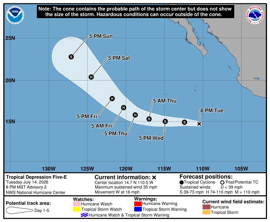
Tropical Depression Five-E formed over the eastern Pacific Ocean south of Baja California, Mexico, on July 14, 2026, and intensified into Tropical Storm Elida at 09:00 UTC on July 15. The National Hurricane Center (NHC) said the system is forecast to steadily strengthen over the next several days and become a hurricane by the night of July 16, with peak winds expected to reach 161 km/h (100 mph) by July 17.
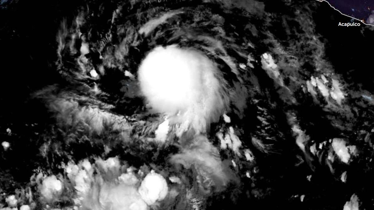
Satellite image of Tropical Depression 5E at 07:30 UTC on July 15, 2026. Credit: NOAA/GOES-19, Zoom Earth The Watchers
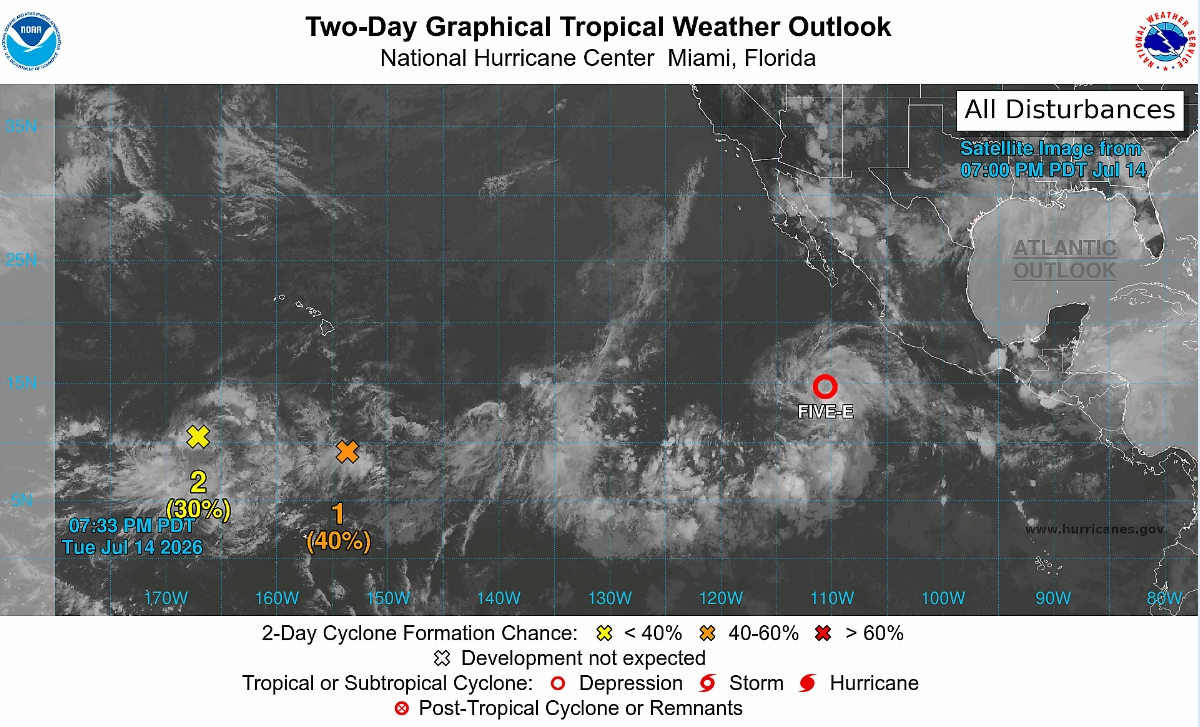
Tropical Depression Five-E formed off the coast of Mexico at 21:00 UTC on July 14, approximately 901 km (560 miles) south of the southern tip of Baja California. One-minute maximum sustained winds were 56 km/h (35 mph), with an estimated minimum central pressure of 1 006 hPa. The system was moving west at 30 km/h (18 mph).
At 09:00 UTC on July 15, the system intensified into a tropical storm and was named Elida. At the time, the center of Elida was located about 910 km (565 miles) SSW of the southern tip of Baja California. It had maximum sustained winds of 65 km/h (40 mph) and was moving west at 24 km/h (15 mph) with minimum central pressure of 1 003 hPa.
The system is forecast to continue moving west through July 15 under the influence of a subtropical ridge positioned to its north. A gradual turn toward the northwest is expected on July 16 as the system slows and a weakness develops in the ridge in response to an approaching upper-level trough.
Environmental conditions remain favorable for strengthening over the next several days, with warm sea-surface temperatures, low vertical wind shear, and abundant moisture.
Steady strengthening is forecast during the next few days, and the system is expected to become a hurricane by the night of July 16. It is forecast to reach a peak intensity of 161 km/h (100 mph) by July 17. Although the probability is low, the possibility of rapid intensification cannot be ruled out, according to the NHC.
References:
1 Tropical Depression Five-E Advisory Number 2 – NOAA/NHC – July 15, 2026
2 Tropical Depression Five-E Advisory Number 1 – NOAA/NHC – July 14, 2026
3 Tropical Depression Five-E Discussion Number 2 – NOAA/NHC – July 15, 2026

I am an Assistant Editor and Severe Weather & Science Journalist at The Watchers, specializing in real-time severe weather coverage, geophysical event reporting, and research-driven scientific analysis. You can reach me at rishav(at)watchers(.)news.

Commenting rules and guidelines
We value the thoughts and opinions of our readers and welcome healthy discussions on our website. In order to maintain a respectful and positive community, we ask that all commenters follow these rules.