
Tropical Storm Douglas forms over the eastern Pacific, forecast to weaken into a remnant low by July 3
Tropical Storm Douglas formed over the eastern North Pacific Ocean at 21:00 UTC on July 1, 2026, and became the fourth named storm of the 2026 eastern Pacific hurricane season. The cyclone is located well west-southwest of the southern tip of Baja California, Mexico, and is expected to remain over open waters while weakening into a post-tropical remnant low by July 3.
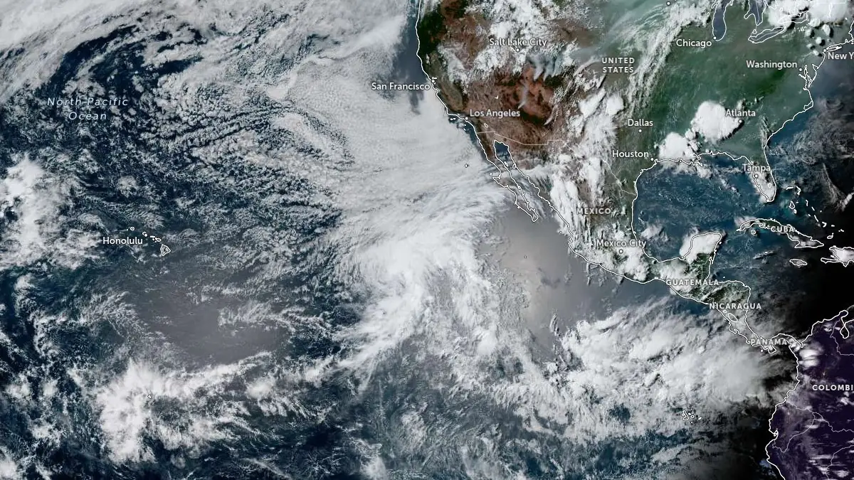
Tropical Storm Douglas at 23:00 UTC on July 1, 2026. Credit: NOAA/GOES-East, Zoom Earth, The Watchers
Tropical Storm Douglas formed over the eastern North Pacific Ocean on July 1, southwest of the southern tip of Baja California, Mexico.
The storm was named by the National Hurricane Center (NHC) at 21:00 UTC (14:00 PDT) on July 1, and is the fourth named storm of the 2026 season Eastern Pacific Hurricane Season.
At that time, the storm was located about 1 960 km (1 220 miles) west-southwest of Baja California, and had 1-minute sustained winds of 65 km/h (40 mph).
By 09:00 UTC, it was located approximately 1 910 km (1 185 miles) west-southwest of the southern tip of Baja California. The storm was moving north at 11 km/h (7 mph) with a minimum central pressure of 1 003 hPa. Tropical-storm-force winds extended up to 150 km (90 miles) from the center.
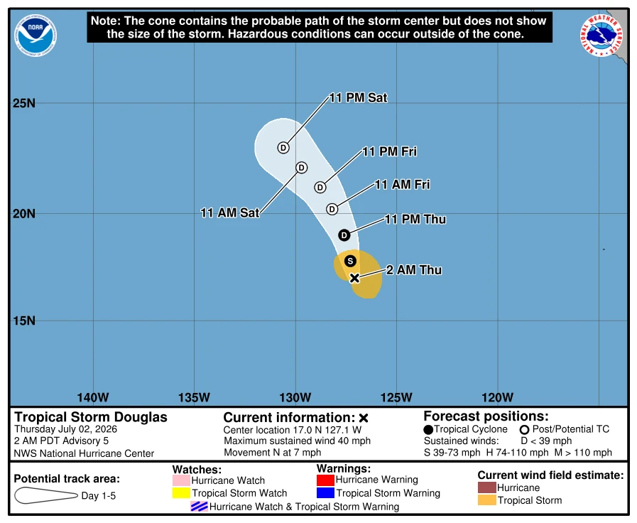
Douglas is forecast to continue generally northward through July 2 before gradually turning northwest and then west as steering currents shift.
Environmental conditions are forecast to become increasingly unfavorable within the next 6 to 12 hours as the cyclone encounters drier mid-level air, stronger vertical wind shear, and cooler sea surface temperatures. Although slight strengthening remains possible in the short term, forecasters expect weakening to begin later on July 2
Douglas is forecast to struggle to maintain organized deep convection during the next 24 to 36 hours and is expected to degenerate into a post-tropical remnant low on July 3 before dissipating over the weekend.
References:
1 Tropical Storm Douglas Advisory Number 5 – NHC – July 2, 2026
2 Tropical Storm Douglas Discussion Number 5 – NHC – July 2, 2026

Rishav Kothari is Editor-in-Chief of The Watchers, where he runs the newsroom and covers earthquakes, volcanoes, severe weather and space weather.
Published in the last 24 hours
- In 1943, a flight instructor in Texas flew a two-seat training plane into the eye of a hurricane because he was curious, then landed and took the base weatherman up for a second pass Epicenter
- A soy sauce maker used fire to guide villagers through Japan’s 1854 tsunami, then funded a seawall that protected most of Hiro in 1946 Epicenter
- In 2013 a landslide fell onto Svínafellsjökull in southeast Iceland, leaving thicker ice at the foot of the slope; that ice is now moving away and the mountainside has shifted 1 to 3 cm. Epicenter
- Kīlauea's north vent threw lava about 660 feet (200 m) high for six hours on 5 November 2026; the summit is now reinflating, with the next episode forecast for 16 to 21 November. Epicenter
