
Study finds weak mantle beneath keeps Southeast Asia moving for decades after major earthquakes
Major earthquakes can continue reshaping Southeast Asia for decades after the shaking stops, according to a study published on July 15, 2026, in Communications Earth & Environment. Researchers found that an unusually weak layer of mantle beneath the Sumatran backarc allows the ground to keep moving long after major earthquakes, a process that could influence future relative sea-level projections and coastal flood risk if left out of existing models.
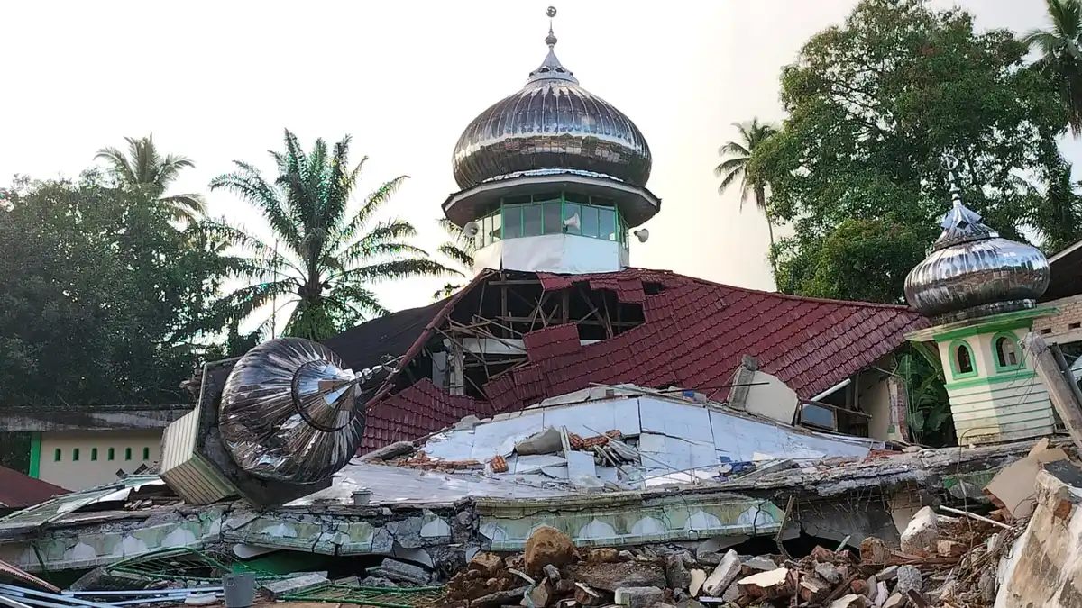
Ruins of the Raya Kajai mosque after the 2022 Sumatra Earthquake. Credit: Fuadi Zikri
Earthquakes may last only minutes, but their effects can continue reshaping Southeast Asia for decades beneath the Earth’s surface, according to an international study led by researchers from Nanyang Technological University (NTU) Singapore.
Using nearly 20 years of Global Navigation Satellite System (GNSS) observations from Singapore, Malaysia and Thailand, the researchers reconstructed how the region continued to deform following some of the largest earthquakes ever recorded. Their findings show that an unusually weak layer of hot rock beneath the Sumatran backarc continues to flow slowly after major earthquakes, allowing the land above to keep moving long after seismic shaking has ended.
The study examined deformation following the M9.2 Sumatra-Andaman earthquake in 2004, the M8.6 Nias-Simeulue earthquake in 2005, the M8.4 Bengkulu earthquake in 2007, and the M8.6 and 8.2 Wharton Basin earthquakes in 2012.
Rather than vertical land sinking providing the clearest evidence, the strongest signal came from long-term horizontal movement. The east-west component of ground motion proved to be the most reliable indicator of how the Earth’s interior responds after major earthquakes, while vertical changes were more difficult to distinguish except after the devastating 2004 event.
The sequence of earthquakes also revealed contrasting patterns. The 2004, 2005 and 2007 megathrust earthquakes produced prolonged westward movement across the region, while the 2012 Wharton Basin strike-slip earthquakes generated eastward motion. Successfully reproducing both patterns using the same Earth model gave researchers confidence that they had correctly identified the properties of the mantle beneath Sumatra.
To understand what was happening deep underground, the team tested multiple computer models representing different structures of the Earth’s interior, including models with varying lithosphere-asthenosphere boundaries. The observations consistently required an unusually weak asthenosphere beneath the Sumatran backarc.
Although this layer is solid rock, it behaves like an extremely viscous fluid over geological timescales. After major earthquakes, it slowly flows, allowing the crust above to continue adjusting for years or even decades.
The researchers estimated the mantle has a viscosity between approximately 2.8 and 8 x 10¹⁸ pascal-seconds, making it about 100 times weaker than a typical upper mantle. This unusually weak layer explains why measurable ground movement continued at locations more than 600 km (370 miles) from the earthquake ruptures.
Lead author Dr. Grace Ng said massive earthquakes trigger slow adjustments deep inside the Earth that continue long after the initial shaking.
“When massive earthquakes strike, they do not just shake the ground for a few minutes,” Ng said. “They set off a slow adjustment deep within the Earth that can continue for years.”
Beyond explaining post-earthquake deformation, the findings also support the theory that buoyancy-driven small-scale thermal convection operates beneath the Sumatran backarc. Scientists have long proposed that slow circulation of unusually hot mantle material keeps the region warmer and mechanically weaker than surrounding parts of the upper mantle. The new observations provide strong geodetic evidence supporting that interpretation.
The research also has practical implications for coastal planning. Relative sea level depends not only on rising oceans caused by climate change but also on changes in land elevation. When land gradually subsides after major earthquakes, local sea levels rise faster relative to the coastline, potentially increasing flood risks.
Senior author Professor Emma Hill said future sea-level projections should account for these long-term geological processes alongside climate-driven changes such as ocean warming and melting ice sheets.
Because similar tectonic settings exist in subduction zones around the world, the researchers say the findings could improve understanding of how great earthquakes reshape landscapes far beyond Southeast Asia. The study shows that long after seismic waves disappear, a slow-moving mantle deep beneath the surface continues to influence how the Earth’s crust evolves and how coastlines may respond in the decades ahead.
References:
1 Ng, G., Feng, L., Hill, E. M., et al. (2026). Weak backarc asthenosphere beneath Sumatra revealed by postseismic deformation. Communications Earth & Environment, 7, Article 03561. https://doi.org/10.1038/s43247-026-03561-5
2 Major earthquakes can affect Southeast Asia sea-level projections: Study – NTU – July 13, 2026

I’m a science journalist and researcher at The Watchers, contributing to the Epicenter edition, where I cover peer-reviewed scientific research and emerging discoveries across Earth and space sciences. With a background in astronomy and a passion for environmental science, I’ve worked in shark and coral conservation in Fiji, conducting reef and shark-behavior research, contributing to mangrove restoration, and earning PADI Open Water and Coral Reef Certifications. I bring a blend of scientific rigor and storytelling to illuminate the discoveries shaping our planet and beyond.

Commenting rules and guidelines
We value the thoughts and opinions of our readers and welcome healthy discussions on our website. In order to maintain a respectful and positive community, we ask that all commenters follow these rules.