
Cyclone Akvan to make landfall between Nellore and Visakhapatnam around noon on November 20, IMD forecasts 120-130 km/h winds gusting to 145
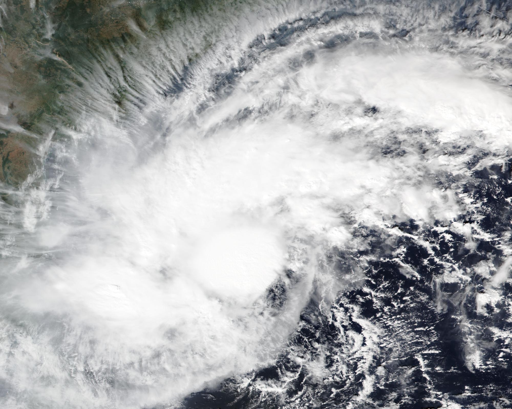
The India Meteorological Department (IMD) forecasts that Cyclone Akvan will cross the Andhra Pradesh and Yanam coasts between Nellore and Visakhapatnam around noon on Friday, November 20, 2026, as a very severe cyclonic storm, with maximum sustained winds of 120 to 130 km/h (75 to 80 mph), gusting to 145 km/h (90 mph). IMD has issued a cyclone alert, an orange message, for the Andhra Pradesh and adjoining south Odisha coasts.
At 02:30 IST (21:00 UTC on November 17) on Wednesday, November 18, Akvan was still classified as a cyclonic storm, centered near 12.6°N, 85.6°E over the central parts of the south and adjoining west-central Bay of Bengal. That placed it about 590 km (365 miles) east of Chennai, 620 km (385 miles) southeast of Machilipatnam, 620 km south-southeast of Visakhapatnam, 650 km (405 miles) northeast of Trincomalee in Sri Lanka and 750 km (465 miles) south of Gopalpur in Odisha. IMD said the storm had moved very slowly north at 3 km/h (about 2 mph) over the previous six hours, with sustained winds of 85 to 95 km/h (53 to 59 mph), gusting to 105 km/h (65 mph). The Regional Specialised Meteorological Centre in New Delhi estimated the central pressure at 1000 hPa in its advisory issued at 22:00 UTC on November 17. The 02:30 IST national bulletin was the latest official warning available at the time of writing.
IMD expects Akvan to intensify into a severe cyclonic storm over the west-central Bay of Bengal around the morning of November 18, then into a very severe cyclonic storm around the evening of November 19, before crossing the coast around noon on November 20. The department’s forecast table places the center near 16.9°N, 82.4°E at 11:30 IST (06:00 UTC) on November 20, still at 120 to 130 km/h, gusting to 145 km/h, then weakens the system over land to a cyclonic storm by 23:30 IST that day and to a depression by 11:30 IST on November 21. Earlier Watchers coverage on November 16, when the system was still a deep depression, cited a landfall window between Nellore and Tuni. Later IMD bulletins, including the latest national bulletin, use Nellore and Visakhapatnam.
Coastal Andhra Pradesh is likely to see isolated heavy rain on November 18, then heavy to very heavy rain at a few places and isolated extremely heavy rainfall of 21 cm (8 inches) or more on November 19 and 20, easing to isolated heavy rain over the north coast on November 21. IMD also warned of isolated heavy to very heavy rain over south coastal Odisha from November 19 to 21, isolated heavy rain over Rayalaseema on November 19 and 20, and isolated heavy to very heavy rain over eastern Telangana on November 20 and 21.
Along and off the Andhra Pradesh and Yanam coasts, IMD forecasts gale winds of 60 to 70 km/h (37 to 43 mph), gusting to 80 km/h (50 mph), from the evening of November 18, rising to 120 to 130 km/h, gusting to 145 km/h, from the night of November 19 until landfall. Seas there are expected to be very rough to high on November 18, high to very high on the morning of November 19, and phenomenal from that evening until landfall, with wave heights of 9 to 14 m (30 to 46 feet) from November 19, rising above 14 m (46 feet) from the night of November 19 until the storm comes ashore.
A storm surge of 0.4 to 1.2 m (1.3 to 3.9 feet) above astronomical tide is very likely to inundate low-lying areas of Prakasam, Bapatla, Krishna, West Godavari, Konaseema, Kakinada and Visakhapatnam districts at landfall. IMD said the peak surge is expected over Bapatla, Krishna, West Godavari and Kakinada from the morning of November 20 until the afternoon, with a surge of 0.3 m (1 foot) likely to continue along and off those districts from the early hours to the evening.
Fishermen have been advised not to venture into the southeast and east-central Bay of Bengal until November 18, the southwest Bay until November 20, the west-central Bay until November 21, and the northwest Bay from November 19 to 21. IMD called for a total suspension of fishing operations in those waters and of offshore and onshore operations, and said coastal hutment dwellers should be moved to safer places, with people in affected areas remaining indoors.
IMD rated its confidence in the current intensity as high and in the current location, forecast track and forecast intensity as moderate. Its New Delhi centre said most models take the system to the Andhra Pradesh coast as a severe cyclonic storm around 00:00 UTC on November 18, but that considerable divergence remains on later movement, further intensification, and the landfall point and time. It added that some models, including ECMWF, weaken the system below cyclonic storm strength before landfall. The official forecast is still for a very severe cyclonic storm at landfall. IMD said the next national bulletin was due at 08:30 IST on November 18.
Featured image: The Bay of Bengal system later named Cyclone Akvan, seen on November 16, 2026, by the VIIRS instrument on NOAA-20. Credit: NASA Worldview / NOAA-20 VIIRS, public domain
Sources: IMD National Bulletin No. 20 (issued 04:00 IST, November 18, based on 02:30 IST), RSMC New Delhi Tropical Cyclone Advisory No. 12 (issued 22:00 UTC, November 17, based on 21:00 UTC)

The Watchers Staff covers earthquakes, volcanoes, severe weather, space weather and other natural events. Published since 2011, The Watchers reports on a changing planet and the science behind it.
Published in the last 24 hours
- CPC posts a slight risk of heavy rain from the Gulf Coast to the Northeast urban corridor November 25-29, and a moderate risk of West Coast wind and Sierra snow on November 25
- Florida's east coast faces a moderate flash flood risk Wednesday through Friday, with 4 to 8 inches of rain forecast and the St. Johns River near Cocoa already in major flood at 17.13 feet
- Radio pulses every 7.9 minutes reveal binary with white dwarf and Sun-like star Epicenter
- Hera begins close survey to explain why DART deflected Dimorphos so strongly Epicenter
