
Tropical Cyclone Xavier reaches Category 2 over Northern Cook Islands, gale warning for Manihiki and Rakahanga
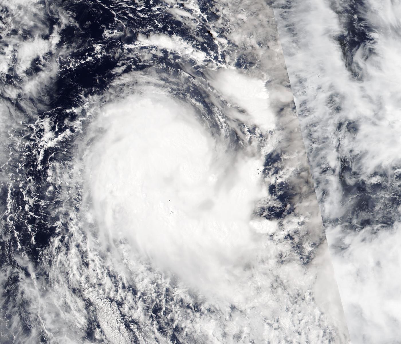
Tropical Cyclone Xavier is strengthening over the Northern Cook Islands, with warnings in force for the atolls of Manihiki and Rakahanga. The official Regional Specialized Meteorological Centre in Nadi already classifies Xavier as a Category 2 system. Earlier advice from the Cook Islands Meteorological Service, cited by RNZ Pacific, warned of damaging gale-force winds of up to 85 km/h (53 mph), with gusts of up to 120 km/h (75 mph), increasing to 95 km/h (60 mph) with gusts to 130 km/h (80 mph) later on Monday night, along with heavy rain and thunderstorms.
Position and strength
Xavier reached Category 1 strength on the night of Sunday, November 15. In a bulletin issued at 11:53 NZDT on November 16, MetService placed it near 8.3°S, 160.1°W at 18:00 UTC on November 15 (07:00 NZDT on November 16), about 230 km (145 miles) west-northwest of Penrhyn Atoll and 220 km (135 miles) north-northeast of Manihiki Atoll, with a central pressure of 995 hPa and maximum sustained winds of 40 knots (75 km/h). MetService said the environment remained marginally favorable and that Xavier could reach Category 2, with sustained winds near the center of 50 knots (95 km/h), overnight on Monday, November 16, then move slowly west-southwest, stay at Category 2, and move away from the Northern Cook Islands over the weekend of November 21 and 22, possibly weakening north of Samoa, though confidence in that later track and intensity is low.
A later analysis from the Fiji Meteorological Service, the official WMO Regional Specialized Meteorological Centre (RSMC) in Nadi, is stronger. In Tropical Disturbance Advisory A07, issued at 07:50 UTC on November 16, RSMC Nadi placed Xavier near 8.3°S, 161.2°W at 06:00 UTC, about 230 km north of Manihiki, with a central pressure of 985 hPa and 10-minute sustained winds of 50 knots (95 km/h), already Category 2, moving west-southwest at 4 knots. It forecasts 75 knots, a severe tropical cyclone, by 06:00 UTC on November 17 and 90 knots by 18:00 UTC on November 17, holding 90 knots at 06:00 UTC on November 18. A later Special Weather Bulletin 12, issued at 11:47 UTC on November 16, placed Xavier near 8.9°S, 161.2°W at 10:00 UTC, about 170 km (105 miles) north of Manihiki, with a central pressure of 983 hPa, still Category 2, and 10-minute sustained winds of about 95 km/h (50 knots) near the center with gusts to 130 km/h, moving south-southwest at about 9 km/h. The bulletin says Xavier is likely to intensify further to a severe tropical cyclone later on November 16, Cook Islands time.
The U.S. Joint Typhoon Warning Center (JTWC), which tracks the system as 04P and uses one-minute average winds, is in closer agreement with RSMC Nadi than with MetService. In its warning No. 3, JTWC placed Xavier near 8.5°S, 161.0°W at 06:00 UTC on November 16, moving west-southwest at 7 km/h (4 knots), with sustained winds of 55 knots (100 km/h) and gusts to 70 knots. JTWC forecasts a peak of 95 knots (175 km/h) by 18:00 UTC on November 17, as the storm drifts slowly south toward about 10°S, 163°W, before weakening from November 18.
Warnings for Manihiki and Rakahanga
The Cook Islands Meteorological Service had a storm warning in force for Manihiki and Rakahanga and had canceled its warning for Penrhyn, RNZ Pacific reported, with the atolls then expected to see gale-force winds of up to 85 km/h with gusts to 120 km/h, increasing to 95 km/h with gusts to 130 km/h later on Monday night. RSMC Nadi’s later Special Weather Bulletin 12, issued at 11:47 UTC on November 16, keeps a gale warning, not a storm warning, for those two atolls at 85 km/h with gusts to 120 km/h, and does not repeat the increase to 95 km/h on the islands. Those 95 km/h winds with gusts to 130 km/h are instead the cyclone’s estimated winds near the center. The same bulletin has a tropical cyclone alert for Pukapuka and Nassau.
Residents have been advised to secure loose items around their homes and properties, and fishermen to stay off the water if conditions are unsafe. The U.S. Embassy in New Zealand said the cyclone is expected to remain in the area until Thursday, November 19, and advised against unnecessary sea travel.
Manihiki and Rakahanga are low-lying coral atolls about 1 300 km (810 miles) north of Rarotonga, the main island of the Cook Islands. Manihiki is known for its black pearl farms in the lagoon.
An early start to the season
The South Pacific tropical cyclone season officially runs from November 1 to April 30. Earth Sciences New Zealand is forecasting elevated cyclone activity in parts of the Pacific this season, PMN News reported.
Strong El Niño events tend to shift South Pacific cyclone activity east, toward the Cook Islands and French Polynesia, where cyclones are rarer in other years. The current El Niño reached +2.0°C on NOAA’s Relative Oceanic Niño Index for August to October, close to the 1997-98 event. During the strong 1997-98 El Niño, Cyclone Martin hit Pukapuka, Manihiki and Rakahanga between October 31 and November 2, 1997. Its storm surge destroyed almost every building on Manihiki, and the storm caused 19 deaths in the Cook Islands.
MetService’s next tropical cyclone bulletin is due by 13:00 NZDT on Tuesday, November 17 (00:00 UTC).
Featured image: Tropical Cyclone Xavier over the Northern Cook Islands on November 15, 2026, seen by the VIIRS instrument on NOAA-20. Credit: NASA Worldview / NOAA-20 VIIRS, public domain
Sources: MetService, RSMC Nadi, JTWC, RNZ Pacific, PMN News, U.S. Embassy in New Zealand

The Watchers Staff covers earthquakes, volcanoes, severe weather, space weather and other natural events. Published since 2011, The Watchers reports on a changing planet and the science behind it.
Published in the last 24 hours
- Bay of Bengal system to become Cyclone Akvan, landfall forecast between Nellore and Tuni on November 20, India
- El Niño floods kill 2 in Guayaquil as 172.8 mm of rain swamps Milagro, Ecuador's toll rises to 14
- Southern Thailand braces for heavy rain, 15 provinces on flood and landslide alert for November 18-22
- Paraná River floods force 4 547 from homes as water tops evacuation levels in 10 Argentine towns
