
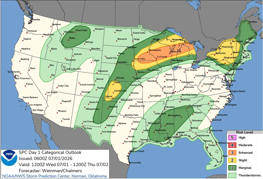
Enhanced Risk issued for severe thunderstorms across Midwest and Upper Great Lakes
Severe thunderstorms will affect portions of the Upper Midwest and Great Lakes through Wednesday, July 1, 2026, with damaging wind gusts of up to 130 km/h (80 mph), isolated large to very large hail and a few tornadoes possible. Parts of the region have been put under an Enhanced Risk of severe thunderstorms through Wednesday, while a Slight Risk extends across portions of the central High Plains and the Northeast.
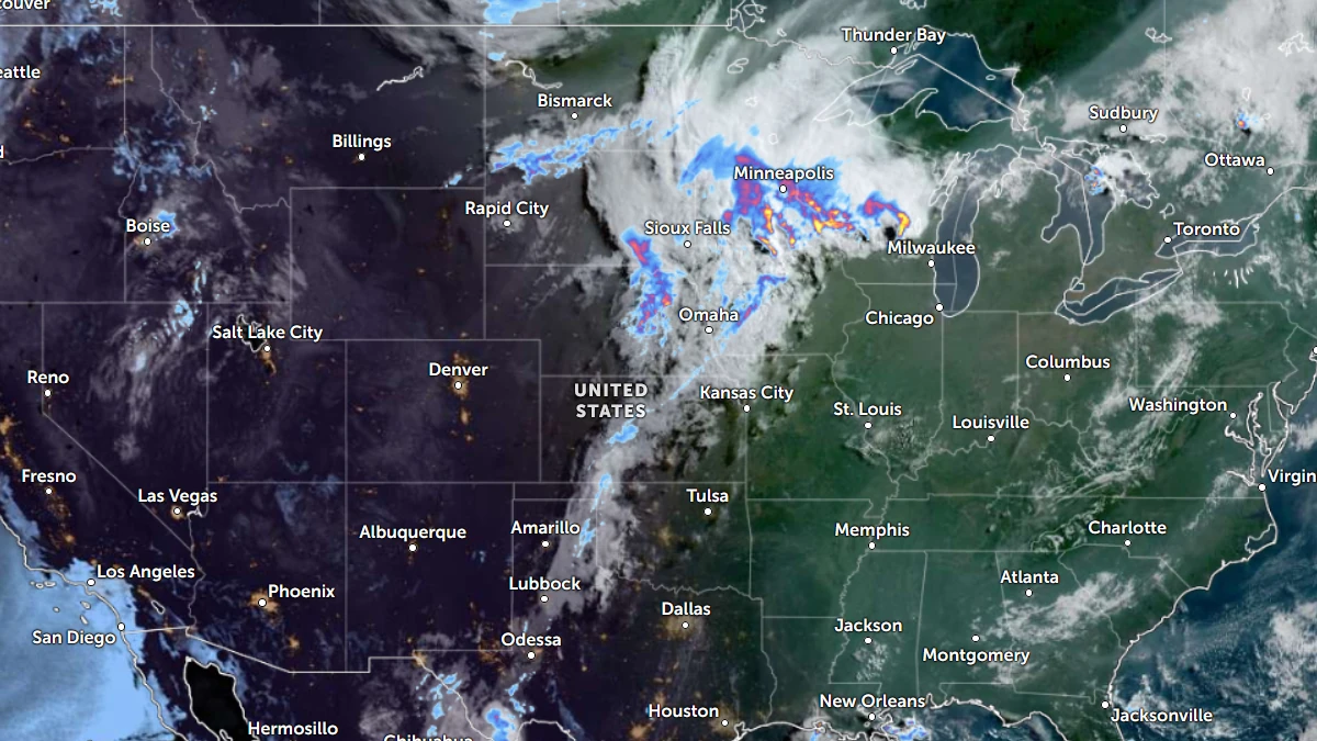
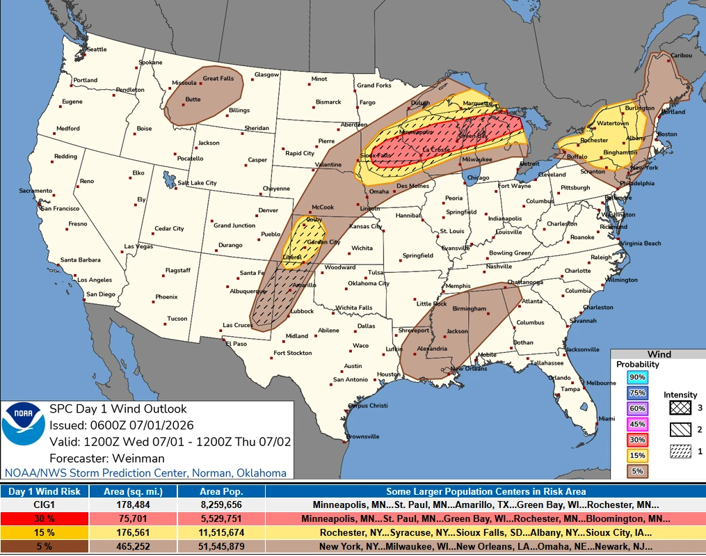
Satellite image of the USA with radar overlay at 12:20 UTC on July 1, 2026. Credit: NOAA/GOES-19, Zoom Earth, The Watchers
The Storm Prediction Center (SPC) has issued an Enhanced Risk of severe thunderstorms for parts of the Midwest and Upper Great Lakes on Wednesday, July 1, with scattered severe storms expected through the day and into the overnight hours.
Damaging straight-line winds are expected to be the main hazard, with some gusts approaching 130 km/h (80 mph). Isolated large to very large hail and a few tornadoes are also possible. A Slight Risk remains in effect for parts of the central High Plains and the Northeast.
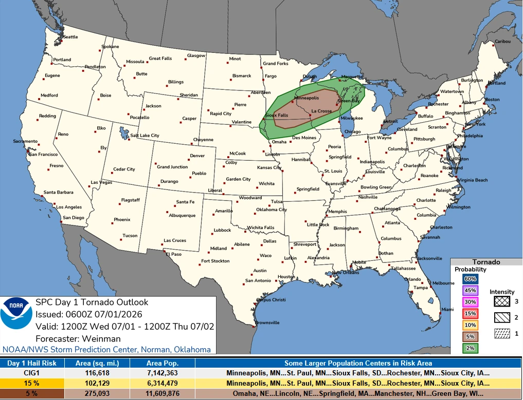
The greatest severe weather threat is forecast across the Upper Midwest and Great Lakes, where strong southwesterly mid-level flow will interact with a stationary front extending eastward from southern Minnesota.
Thunderstorms developing over southern Minnesota during the morning are expected to continue moving east-northeast as daytime heating, abundant low-level moisture, and steep lapse rates increase atmospheric instability.
Combined with effective bulk shear of around 75 km/h (45 mph), these conditions are expected to support both discrete supercells and organized storm clusters capable of producing damaging winds, large to very large hail, and a few tornadoes.
Forecast models indicate a second round of thunderstorms will likely form near southern Minnesota during the afternoon and evening as a strengthening low-level jet increases lift across the region.
The storms are expected to track east-northeast into an increasingly unstable environment,producing widespread damaging winds of up to 130 km/h (80 mph), very large hail, and isolated tornadoes.
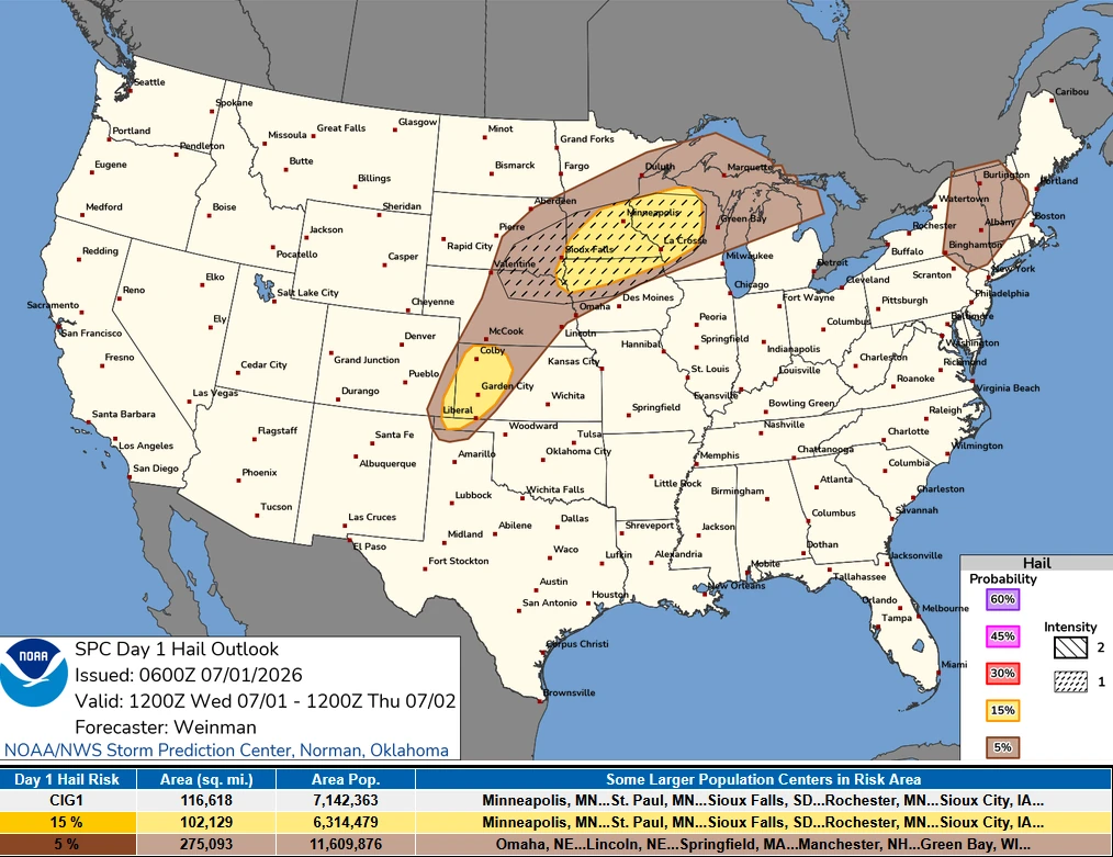
Farther west, severe thunderstorms are expected to develop along a north-south-oriented lee trough and dryline across the central High Plains during the afternoon and evening.
Although deep-layer shear is forecast to remain modest at around 45 to 55 km/h (30 to 35 mph), steep low- and mid-level lapse rates will create a strongly unstable air mass capable of supporting loosely organized storm clusters and isolated supercells producing severe wind gusts and large hail.
Across the Northeast, stronger west-northwesterly flow in the middle levels of the atmosphere will spread over a warm, moist air mass.
While the exact location of storm development remains uncertain, the combination of strong instability and wind profile is expected to support thunderstorms capable of producing damaging wind gusts and isolated hail during the afternoon. Additional storms may continue into the evening and overnight hours.
Farther west, isolated to widely scattered thunderstorms are also expected ahead of a slow-moving mid-level trough crossing the Northwest. Southwesterly mid-level flow of around 75 km/h (45 mph) may support a few organized storm clusters capable of producing severe wind gusts across parts of the northern Rockies and adjacent High Plains.
References:
1 Day 1 Convective Outlook – NOAA/SPC – July 1, 2026

I am an Assistant Editor and Severe Weather & Science Journalist at The Watchers, specializing in real-time severe weather coverage, geophysical event reporting, and research-driven scientific analysis. You can reach me at rishav(at)watchers(.)news.
Commenting rules and guidelines
We value the thoughts and opinions of our readers and welcome healthy discussions on our website. In order to maintain a respectful and positive community, we ask that all commenters follow these rules.