
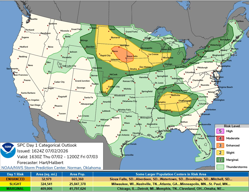
Enhanced Risk of severe thunderstorms issued for eastern South Dakota, southwest Minnesota, and northwest Iowa
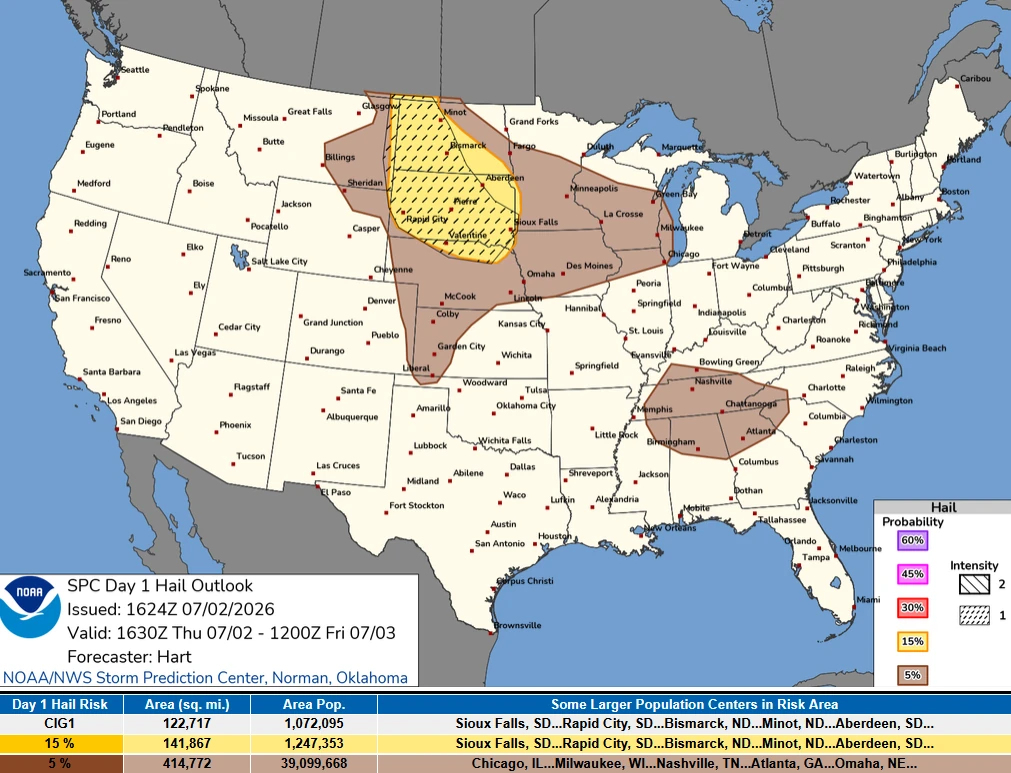
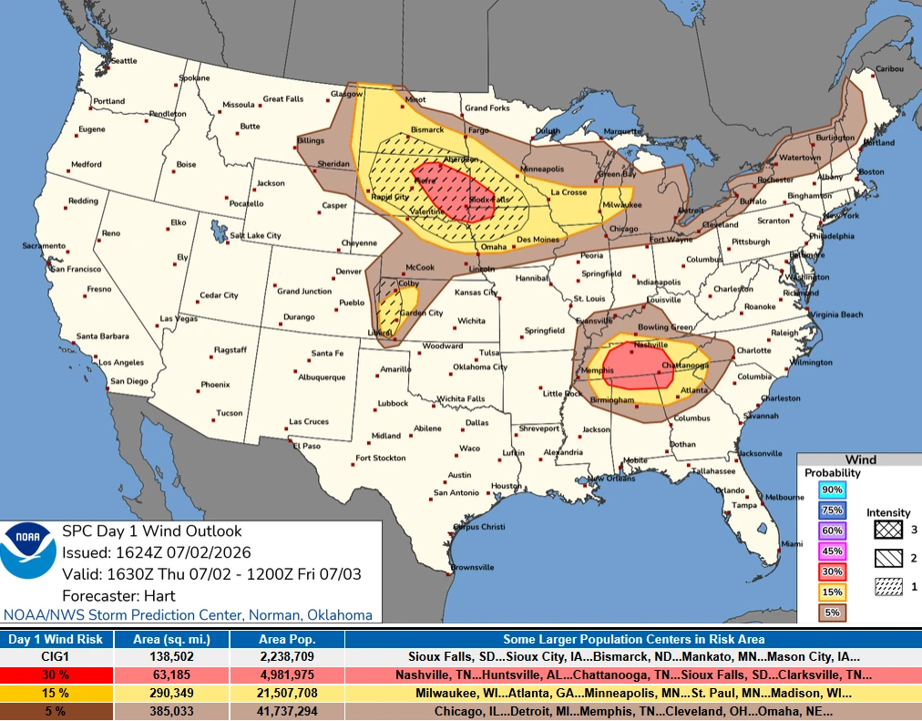
The Storm Prediction Center (SPC) has placed parts of eastern South Dakota, southwest Minnesota and northwest Iowa under an Enhanced Risk of severe thunderstorms through Thursday, July 2, 2026. A broader Slight Risk extends from the Dakotas into the western Great Lakes and includes western Kansas, the Tennessee Valley and the southern Appalachians. Damaging wind gusts and large hail are expected to be the primary severe weather hazards across the affected regions.
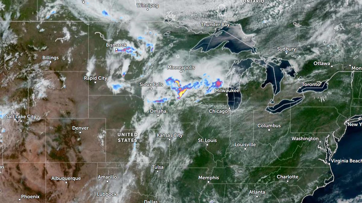
Satellite image of central U.S. and the Midwest with rain radar overlay at 17:30 UTC on July 2, 2026. Credit: NOAA/GOES-19, Zoom Earth, The Watchers
Storm Prediction Center (SPC) has issued an Enhanced Risk of severe thunderstorms for parts of eastern South Dakota, southwest Minnesota, and northwest Iowa on Thursday, July 2, where damaging wind gusts and large hail are expected to pose the primary threats during the afternoon and evening.
A broader Slight Risk extends from the Dakotas into the western Great Lakes, while additional Slight Risk areas encompass western Kansas and parts of the southern Appalachians and Tennessee Valley. The SPC forecasts scattered severe thunderstorms across these regions through tonight.
Several weak and convectively induced shortwave troughs are moving across the northern Plains into the Upper Midwest, according to the SPC.
Combined with widespread moderate afternoon instability and dewpoints in the 16 to 22 °C (60 to lower 70s °F), the environment will support thunderstorm development across a broad area.
However, large-scale forcing remains weak, reducing confidence in the exact evolution and placement of the strongest storms.
Forecasters expect thunderstorms to focus along a boundary extending from southern South Dakota into central Iowa.
Storms that developed over northern Iowa during the morning are forecast to strengthen through the afternoon before tracking toward southern Wisconsin and northern Illinois, where damaging wind gusts and large hail are expected to be the primary hazards.
Additional thunderstorm clusters are forecast to develop along the South Dakota–Nebraska portion of the boundary during the mid to late afternoon, posing a similar threat of large hail and damaging winds.
The SPC outlook also placed western Kansas, the southern Appalachians, and the Tennessee Valley within a Slight Risk of severe thunderstorms.
References:
1 Day 1 Convective Outlook – SPC – July 2, 2026

I am an Assistant Editor and Severe Weather & Science Journalist at The Watchers, specializing in real-time severe weather coverage, geophysical event reporting, and research-driven scientific analysis. You can reach me at rishav(at)watchers(.)news.
Commenting rules and guidelines
We value the thoughts and opinions of our readers and welcome healthy discussions on our website. In order to maintain a respectful and positive community, we ask that all commenters follow these rules.