
Strong M6.2 earthquake hits Halmahera, Indonesia
A strong earthquake registered by the USGS as M6.2 hit Halmahera, Indonesia, at 02:31 UTC on July 3, 2026. The agency is reporting a depth of 121 km (75 miles). EMSC is reporting the same depth and magnitude.
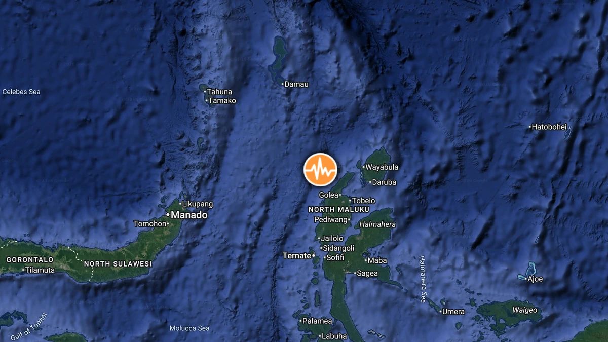
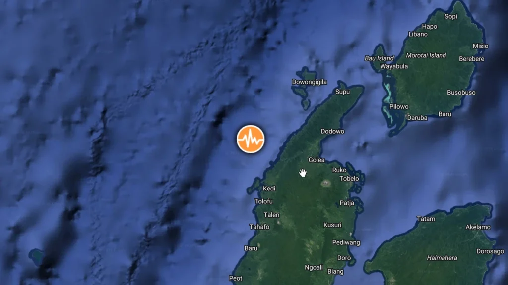
Epicenter of M6.2 earthquake in Halmahera, Indonesia on July 3, 2026. Credit: TW/SAM, Google
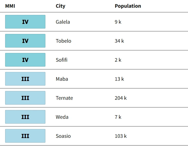
The epicenter was located 59 km (37 miles) W of Tobelo (population 34 150), 115 km (72 miles) N of Ternate (population 205 001), 121 km (75 miles) N of Sofifi (population 36 197), 153 km (95 miles) NW of Maba (population 12 560), and 266 km (166 miles) E of Bitung (population 225 134), Indonesia.
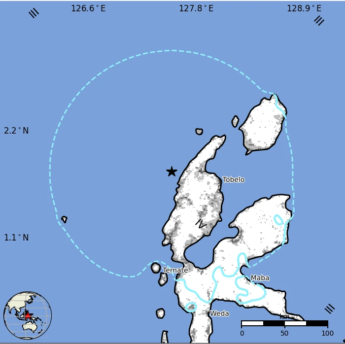
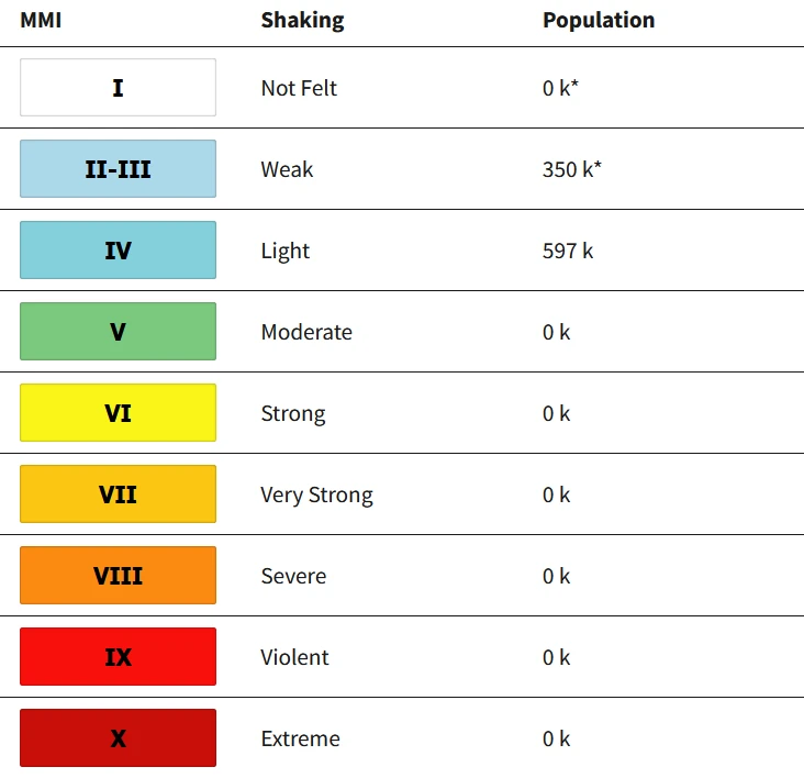
597 000 people are estimated to have felt light shaking, and 350 000 weak.
The USGS issued a Green alert for shaking-related fatalities and economic losses. There is a low likelihood of casualties and damage.
Overall, the population in this region resides in structures that are vulnerable to earthquake shaking, though resistant structures exist. The predominant vulnerable building types are unreinforced brick structures with concrete floors and precast concrete frames with wall construction.
Estimated population exposure to earthquake shaking
Selected cities exposed
Regional seismicity
References:
1 M6.2 earthquake Halmahera, Indonesia – USGS – July 3, 2026
2 M6.2 earthquake Halmahera, Indonesia – EMSC – July 3, 2026

Rishav Kothari is Editor-in-Chief of The Watchers, where he runs the newsroom and covers earthquakes, volcanoes, severe weather and space weather.
