
People who hid under an Oklahoma highway overpass from a 1999 tornado lost fingers, ears and noses, and three people died near or under overpasses that day
Three people died near or under Oklahoma highway overpasses during the May 3, 1999 tornado outbreak under the grouping used by National Weather Service meteorologists in Norman, while people sheltering beneath the Shields Boulevard overpass in Moore suffered severe injuries that included missing fingers, ears and noses. NOAA’s formal Service Assessment attributed two deaths specifically to people seeking shelter under overpasses, with the difference arising from a third Payne County victim who stopped beneath an overpass for shelter but was killed inside his vehicle.
Stroud Oklahoma. Credit: DrunkDriver (public domain), via Wikimedia Commons.
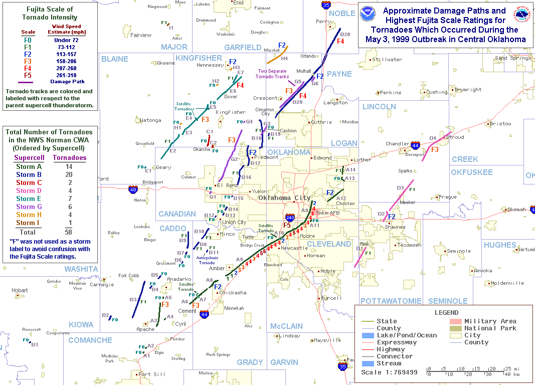
The three fatalities identified by the National Weather Service occurred at the 16th Street overpass over Interstate 44 near Newcastle, the Shields Boulevard overpass over Interstate 35 in Moore, and an Interstate 35 overpass at mile marker 176.5 in rural Payne County. The two Oklahoma City metropolitan-area deaths occurred where the tornado was producing violent F4 or F5 damage, while the Payne County fatality occurred when another tornado crossed the highway at F2 intensity.
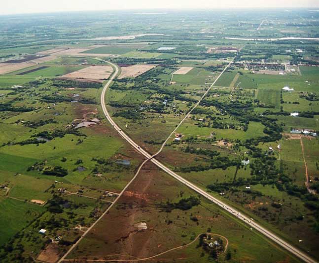
The overpass problem was not confined to one isolated stop. NWS Norman identified seven locations where tornadoes crossed interstate highways in central Oklahoma on May 3. Three of those crossings placed an overpass directly in the tornado path, and one person died at each of those three locations under the broader classification used in the agency’s later presentation.
The Shields Boulevard overpass became the clearest documented example of how seeking shelter beneath a bridge could create risks beyond the exposed people themselves. Motorists began stopping on the shoulder beneath the bridge about 10 to 15 minutes before the tornado reached the location. Once the shoulder filled, vehicles occupied the right traffic lane, then the left lane, until traffic stopped completely.
Brian Hansen of the City of Moore Emergency Management was trying to reach the emergency operations center when the growing traffic jam trapped him three vehicle lengths from the front, directly beneath the overpass. NWS Norman reported that the vehicles were packed so closely that he could not open the door of his truck. He stayed on the floor of the vehicle as the tornado crossed the highway and survived with minor injuries.
By the time the tornado arrived, the stationary line had grown to about 0.4 km (0.25 miles). The people who had stopped beneath the bridge had therefore removed an escape route not only for themselves but also for motorists caught behind them on the interstate.
The physical shelter available beneath Shields Boulevard was also very different from the overpass seen in the widely circulated 1991 Kansas tornado video. NWS photographs show smooth concrete along the embankment and overhead, without girders or support beams that could provide a handhold. The agency estimated that approximately 12 people were beneath the bridge, while stating that the exact number was not known.
One woman was killed at the Shields Boulevard location. Her body was not found until one week after the tornado, and the location where she was recovered had been covered by approximately 1.8 to 2.4 m (6 to 8 feet) of debris immediately after the storm.
The surviving shelter-seekers also suffered injuries that were far more serious than the subsequent public discussion often conveyed. NWS Norman reported compound fractures and shattered bones, missing fingers, missing ears, missing noses and wounds caused by pieces of building debris. All but one of the survivors beneath the bridge were described as seriously injured.
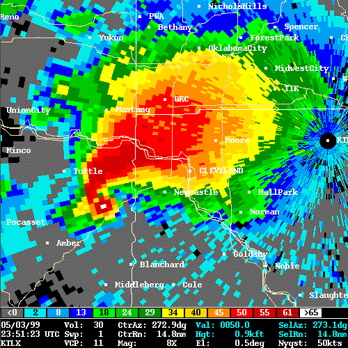
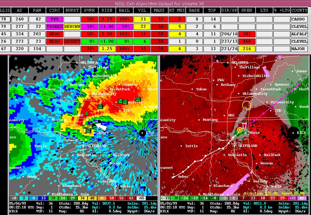
Flying debris was one of the principal hazards. At 00:28 UTC on May 4 (19:28 CDT on May 3), the Twin Lakes KTLX radar showed exceptionally high reflectivity near the tip of the storm’s hook echo. NWS Norman explained that the return included large quantities of debris lofted by the tornado as it crossed developed areas near the highway.
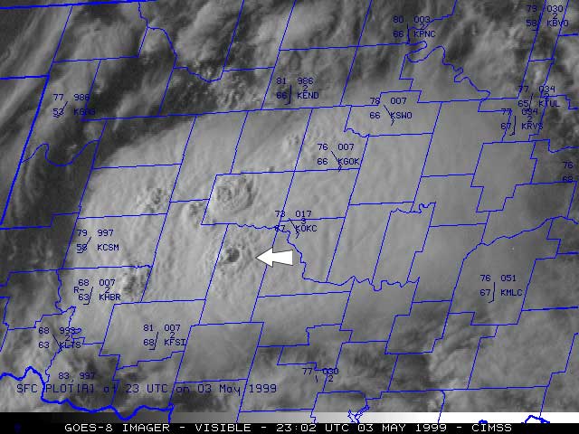
The tornado also demonstrated why choosing one side of an overpass does not ensure protection from the circulation. The storm approached Shields Boulevard from the southwest, but the first strong winds at the bridge arrived from the southeast and entered the west side where people were sheltering. As the vortex passed, the wind direction changed rapidly, exposing the opposite side to the strongest flow.
NWS Norman did not establish a universal “wind tunnel” effect beneath highway overpasses. The authors stated that specific scientific modeling of tornado airflow around overpasses had not been performed and treated acceleration through a narrow opening as a possible effect under some configurations rather than a demonstrated mechanism that applies to every bridge.
The better-supported problems did not depend on that disputed simplification. Wind speed generally increases with height above the immediate ground surface, meaning that climbing an embankment beneath an overpass can move a person into stronger flow. The exposed position also provides little protection from debris, and the direction of tornado winds can change sharply as the circulation passes.
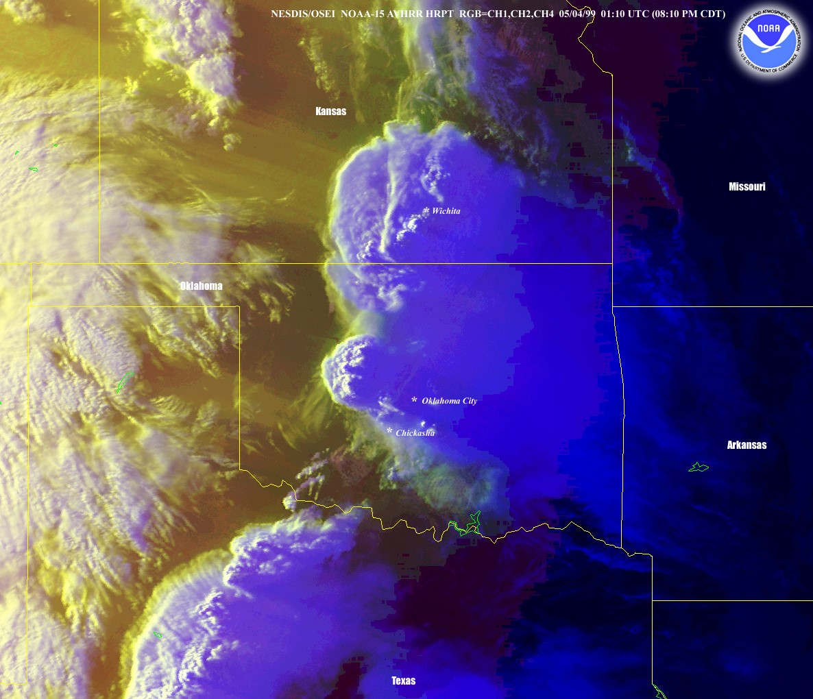
The third fatality in the NWS grouping occurred at Interstate 35 mile marker 176.5 in rural Payne County. A northbound driver stopped beneath an overpass to seek shelter but remained inside his car. When an F2 tornado crossed the highway at that location, the vehicle became airborne and landed upside down on the embankment approximately 27 m (30 yards) from where it had been stopped, killing the occupant.
That death is the reason federal sources can appear to give different overpass totals. NWS Norman said official records classified the Payne County victim as a traffic fatality because he died inside the vehicle. The presentation nevertheless counted him as an “overpass fatality” because he had deliberately stopped beneath the bridge to seek shelter from the tornado.
NOAA’s August 1999 Service Assessment used the narrower category. Finding 10 stated that two deaths were attributed to individuals seeking shelter under highway overpasses and that severe injuries had also been reported among people who used overpasses for shelter. The assessment recommended updating tornado-safety brochures to warn against the practice.
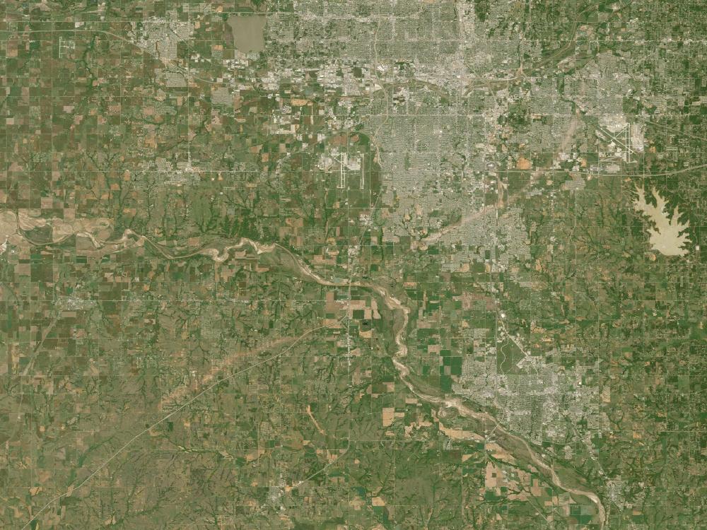
The peer-reviewed casualty study published three years later provides an independent check on that narrower total. Sheryll Brown, Pam Archer, Elizabeth Kruger and Sue Mallonee examined 45 deaths associated with the Oklahoma tornadoes and 645 survivors treated at hospitals. Their detailed analysis focused on 40 direct tornado deaths and 512 directly injured survivors.
Among the fatalities for whom shelter location could be assessed, the researchers identified seven people who died outdoors, including two beneath bridge overpasses. The study therefore aligns with NOAA’s two-death category while the NWS Norman presentation separately explains why it included the Payne County vehicle fatality in a broader three-death grouping.
The decision to seek shelter beneath overpasses did not emerge in isolation. NWS Norman traced much of the modern public perception of overpasses as tornado shelters to a video recorded during the April 26, 1991 tornado outbreak in Kansas. A television crew and other motorists survived beneath an Interstate 35 bridge on the Kansas Turnpike, and the footage subsequently received wide distribution.
The physical construction of that Kansas bridge mattered. NWS photographs show a small crawl space where the underside of the bridge met the embankment and a large girder that could provide a handhold. The Shields Boulevard bridge in Moore had neither feature, and the 1999 tornado passed directly across the structure while producing F4 damage.
The Kansas video nevertheless became a powerful visual example of apparent survival beneath an overpass. NWS Norman later argued that repeated broadcast of such footage could reinforce the behavior even when accompanying narration advised viewers not to imitate it. The May 3 casualties provided evidence that the result seen in one video could not be generalized into a reliable shelter strategy.
The medical evidence from the outbreak also shows why shelter location mattered beyond the overpass cases. Brown and colleagues found that the most frequent causes of nonfatal injury were being struck by flying or falling debris and being picked up or blown by the tornado. Fractures and dislocations, brain injuries and soft-tissue trauma were among the documented injuries.
The authors also found that the proportion of deaths among injured people was higher in mobile homes, apartments and outdoor locations than in houses. Their study drew on hospital records, medical-examiner reports, follow-up questionnaires and community surveys, giving the outbreak one of the more detailed epidemiological records available for a major U.S. tornado disaster at the time.
The paper nevertheless notes an important limitation: its injury total does not include everyone hurt during the disaster. People treated only at emergency triage stations, physician offices or without formal medical care were outside the hospital-based count, and records were incomplete for some patients during the rapid influx of casualties.
The surviving evidence therefore supports a narrower conclusion than the popular “wind tunnel” explanation sometimes attached to the overpass issue. The Oklahoma cases establish severe debris exposure, rapidly changing wind direction, elevated and poorly protected shelter positions, roadway blockage and fatalities at three overpass locations under the NWS behavioral grouping. They do not establish a single airflow mechanism that applies identically to every highway bridge.
The two-versus-three death count is similarly a question of classification rather than an unresolved casualty mystery. NOAA’s formal Service Assessment counted two people killed while seeking shelter beneath highway overpasses. The NWS Norman presentation added the Payne County driver because stopping beneath the bridge was the protective action that placed his vehicle in the tornado’s path.
The lasting scientific and public-safety value of the 1999 cases lies in that combination of behavioral evidence and physical exposure. A dramatic survival video from one unusually constructed bridge had encouraged a simple shelter rule, while the Oklahoma outbreak showed that bridge design, tornado path, debris environment, wind direction, traffic conditions and the shelter-seeker’s exact position can differ radically from one event to another.
References:
1 Brown, S., Archer, P., Kruger, E., & Mallonee, S. (2002). Tornado-related deaths and injuries in Oklahoma due to the 3 May 1999 tornadoes. Weather and Forecasting, 17(3), 343–353. DOI: 10.1175/1520-0434(2002)017<0343:TRDAII>2.0.CO;2
2 Highway Overpasses as Tornado Shelters: Fallout From the 3 May 1999 Oklahoma/Kansas Violent Tornado Outbreak – National Weather Service Forecast Office Norman – originally presented October 15–22, 1999
3 Oklahoma/Southern Kansas Tornado Outbreak of May 3, 1999: Service Assessment – NOAA / National Weather Service – August 1999
4 The Great Plains Tornado Outbreak of May 3–4, 1999 – National Weather Service Forecast Office Norman
5 May 3, 1999 Oklahoma/Kansas Tornado Outbreak – NOAA National Severe Storms Laboratory

I’m a science journalist and researcher at The Watchers, contributing to the Epicenter edition, where I cover peer-reviewed scientific research and emerging discoveries across Earth and space sciences. With a background in astronomy and a passion for environmental science, I’ve worked in shark and coral conservation in Fiji, conducting reef and shark-behavior research, contributing to mangrove restoration, and earning PADI Open Water and Coral Reef Certifications. I bring a blend of scientific rigor and storytelling to illuminate the discoveries shaping our planet and beyond.
Published in the last 24 hours
- Just 12 inches of rushing water can carry away most cars, and more than half of US flood drownings happen to people who drive into flood water Epicenter
- In January 1862, California’s new governor took a rowboat to his own inauguration, after 45 days of storms had turned the Central Valley into a lake up to 300 miles long Epicenter
- People who stayed put through the 2017 hurricanes were more often the ones with flood insurance, a survey of 2,557 Gulf Coast residents found, and the authors suggest the policy may have made the storm feel less dangerous Epicenter
- A Virginia park ranger was struck by lightning seven times and lived, even though three of the strikes set his hair on fire Epicenter
