
Cyclone Akvan crossed the north Andhra Pradesh and south Odisha coasts close to Gopalpur on November 20 with 70-80 km/h winds gusting to 90, and has weakened into a deep depression
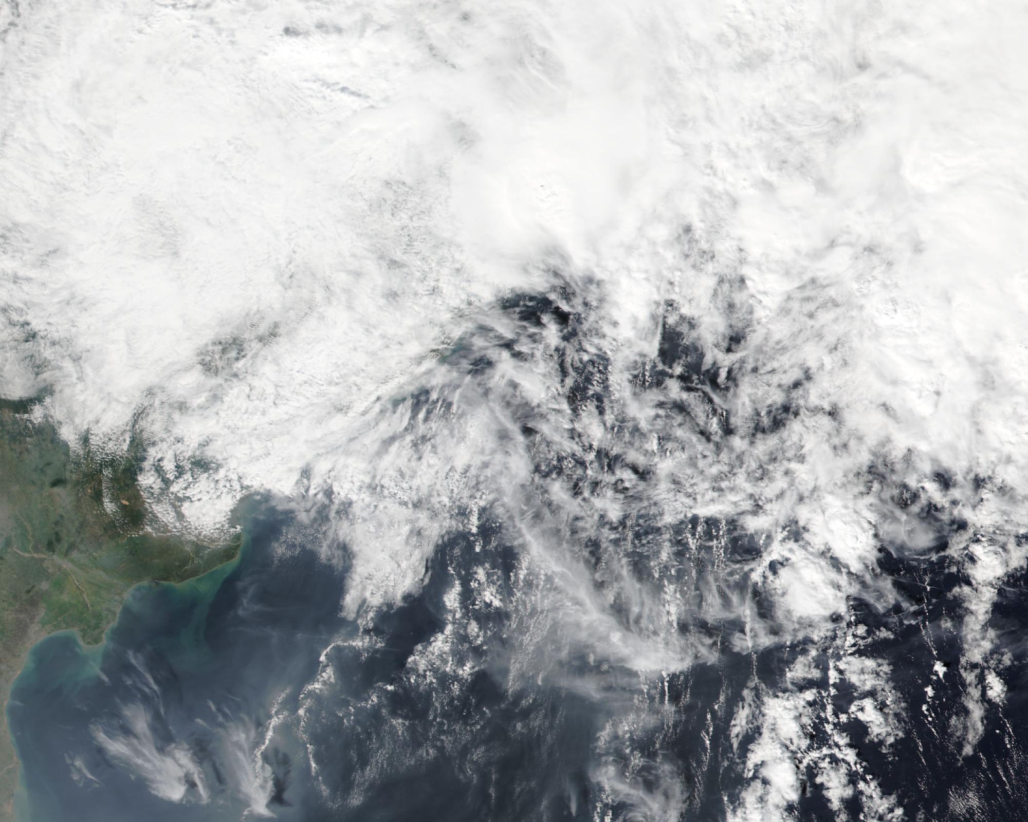
Cyclone Akvan crossed the north Andhra Pradesh and south Odisha coasts close to Gopalpur, near latitude 19.1°N and longitude 84.8°E, between 07:30 and 08:30 IST (02:00 and 03:00 UTC) on Friday, November 20, 2026, with maximum sustained winds of 70 to 80 km/h (43 to 50 mph), gusting to 90 km/h (56 mph), the India Meteorological Department said. By 11:30 IST (06:00 UTC), the storm had weakened into a deep depression over south coastal Odisha, about 40 km (25 miles) north of Gopalpur.
IMD’s National Bulletin No. 38, a post-landfall outlook issued as a red message and based on 08:30 IST observations, placed the center at that hour near 19.2°N, 84.8°E, still a cyclonic storm with winds of 65 to 75 km/h (40 to 47 mph), gusting to 85 km/h (53 mph), about 120 km (75 miles) northeast of Kalingapatnam, 130 km (81 miles) west-southwest of Puri and 230 km (143 miles) northeast of Visakhapatnam. The department said Akvan had earlier weakened from a severe cyclonic storm into a cyclonic storm at 02:30 IST on November 20, then moved north-northwestward at 26 km/h (16 mph) during the six hours before landfall.
National Bulletin No. 39, issued at 13:50 IST and based on 11:30 IST observations, said the system was then centered near 19.6°N, 84.9°E, about 40 km north of Gopalpur, 100 km (62 miles) west-southwest of Puri and 160 km (99 miles) north-northeast of Kalingapatnam, with winds of 55 to 65 km/h (34 to 40 mph), gusting to 75 km/h (47 mph). IMD expects the deep depression to move north-northeastward across Odisha, weaken into a depression during the next six hours and into a well marked low pressure area during the following six hours. The Doppler weather radar at Gopalpur is keeping the system under continuous surveillance.
Earlier Watchers coverage on November 18, based on IMD’s forecast at that time, said Akvan was expected to cross the coast between Nellore and Visakhapatnam around noon on November 20 as a very severe cyclonic storm, with winds of 120 to 130 km/h (75 to 80 mph), gusting to 145 km/h (90 mph). The storm instead came ashore farther north, close to Gopalpur, earlier in the morning and at a lower intensity.
A press release issued at 13:40 IST said extremely heavy rainfall of more than 21 cm (8 inches) had been recorded over Odisha in the 24 hours ending at 08:30 IST on November 20, with very heavy rain of 12 to 20 cm (5 to 8 inches) over coastal Andhra Pradesh and heavy rain of 7 to 11 cm (3 to 4 inches) over Gangetic West Bengal and Tripura. The highest official totals in that period were 21 cm (8 inches) at Patrapur in Odisha, 19 cm (7.5 inches) at Srikakulam in coastal Andhra Pradesh, 9 cm (3.5 inches) at Kalyani in Gangetic West Bengal and 8 cm (3 inches) at Sonamura in Tripura. An hourly update based on 09:30 IST also listed 207 mm (8.1 inches) at Hinjili, 199 mm (7.8 inches) at Chikiti and 190 mm (7.5 inches) at Gopalpur, all in Odisha, and 169 mm (6.6 inches) at Ichchapuram in Andhra Pradesh.
Bulletin No. 39 warned of a moderate flash flood risk over the next 24 hours in parts of Odisha, including Ganjam, Gajapati, Puri, Jagatsinghpur and Kendrapara, and in parts of Gangetic West Bengal and Jharkhand. Gale winds of 60 to 70 km/h (37 to 43 mph), gusting to 80 km/h (50 mph), were still occurring along and off the south Odisha coast and over the northwest Bay of Bengal, and were expected to ease to squally winds of 40 to 50 km/h (25 to 31 mph), gusting to 60 km/h (37 mph), by Friday evening. High seas off south Odisha were forecast to become very rough to rough by evening. Fishermen were advised not to venture into the west-central Bay of Bengal until the night of November 20, or into the northwest Bay until the morning of November 21, with a total suspension of fishing operations in those waters.
The Indian Express reported that the Odisha government had evacuated over 3.72 lakh people from vulnerable places to safe shelters ahead of the storm, and that more than 41 trains were cancelled. The newspaper quoted Odisha Chief Secretary Anu Garg as saying officials had not received reports of any loss of lives or damage to public infrastructure, and that roads were inundated in some urban areas, including Berhampur and Digapahandi in Ganjam, with teams pumping out the water.
Featured image: Cyclone Akvan over the Odisha and north Andhra Pradesh coasts on November 20, 2026, seen by the VIIRS instrument on NOAA-21. Credit: NASA Worldview / NOAA-21 VIIRS, public domain
Sources: IMD National Bulletin No. 38 (based on 08:30 IST, November 20), IMD National Bulletin No. 39 (issued 13:50 IST, based on 11:30 IST), IMD press release (issued 13:40 IST, November 20), IMD Hourly Bulletin No. 11 (issued 10:20 IST, based on 09:30 IST), The Indian Express

The Watchers Staff covers earthquakes, volcanoes, severe weather, space weather and other natural events. Published since 2011, The Watchers reports on a changing planet and the science behind it.
Published in the last 24 hours
- High Risk of excessive rainfall covers Florida’s Space Coast as St. Johns River near Cocoa reaches 5.67 m
- Asteroid 2026 WJ to pass Earth at 1.7 lunar distances at 04:20 UTC on November 22, with 2026 WD following at 4.4 lunar distances on November 23
- A broad low over southeastern Florida and the northwestern Bahamas has a 30 percent chance of subtropical or tropical development within 48 hours and a 50 percent chance within 7 days, the National Hurricane Center says
- A Virginia park ranger was struck by lightning seven times and lived, even though three of the strikes set his hair on fire Epicenter
