
Heavy rainfall and flash flooding forecast across Texas, the Gulf Coast, and the Appalachians
A Slight Risk area for excessive rainfall remains in effect across southeast Texas, the central Gulf Coast, and parts of the Ohio Valley into the central Appalachians where slow-moving thunderstorms may produce flash flooding over saturated ground through May 27. Deep Gulf moisture and a slow-moving weather pattern are forecast to fuel multiple rounds of heavy rain from southeast Texas to the central Appalachians, increasing the risk of flash flooding in vulnerable areas through late week.
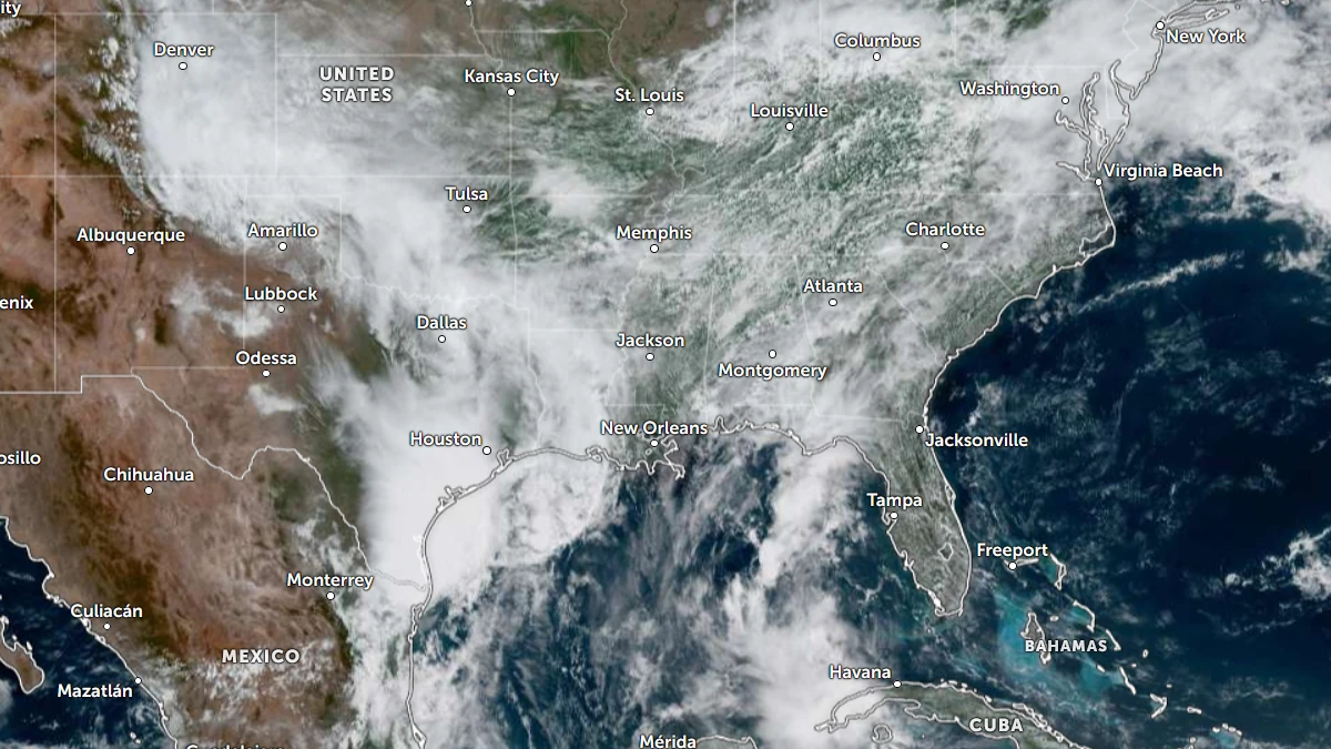
Satellite image of southern and eastern United States at 21:30 UTC on May 27, 2026. Credit: NOAA/GOES-19, Zoom Earth, The Watchers
Repeated thunderstorms are forecast to bring heavy rainfall and flash flooding to parts of southeast Texas, the central Gulf Coast, the Ohio Valley, and the central Appalachians through late week.
The Weather Prediction Center (WPC) placed parts of southeast Texas, Louisiana, Mississippi, and areas from the Ohio Valley into the central Appalachians under a Slight Risk for excessive rainfall on May 27.
Forecasters said slow-moving thunderstorms combined with very humid air from the Gulf of Mexico may lead to repeated heavy rainfall over the same locations.
Rainfall rates may exceed 38 to 50 mm (1.5 to 2 inches) per hour in stronger storms, especially in southeast Texas and parts of the Gulf Coast. Flooding could develop quickly in urban areas, poor-drainage locations, creeks, and low-water crossings.
Southeast Texas remains the area with the greatest flood concern as clusters of thunderstorms continue developing along a slow-moving weather pattern.
Forecasters warned that saturated soils from earlier rainfall may worsen flooding impacts if additional storms repeatedly move across the same areas.
Louisiana, Mississippi, and parts of Alabama may also experience isolated flash flooding where storms continue through the day and overnight hours.
Another corridor of heavy rain is forecast from the Ohio Valley into West Virginia and the central Appalachians. Thunderstorms forming along a stationary boundary may repeatedly affect the same locations, increasing flood risk in valleys, urban areas, steep terrain, and small streams.
The WPC noted that northern West Virginia could experience higher-end localized flash flooding where stronger storms persist.
Meteorologists said the flood threat is increasing because slow-moving storms are interacting with deep tropical moisture and saturated ground conditions. The setup is typical of late-spring heavy rainfall events across the southern and eastern United States.
Additional Flood Watches and Flash Flood warnings may be issued as storms continue through late week. Residents in flood-prone areas should monitor local forecasts from the National Weather Service and avoid driving through flooded roads, especially at night.
References:
1 Short Range Forecast Discussion – NWS/WPC – May 27, 2026
2 Excessive Rainfall Discussion – NWS/WPC – May 27, 2026

I am an Assistant Editor and Severe Weather & Science Journalist at The Watchers, specializing in real-time severe weather coverage, geophysical event reporting, and research-driven scientific analysis. You can reach me at rishav(at)watchers(.)news.
Commenting rules and guidelines
We value the thoughts and opinions of our readers and welcome healthy discussions on our website. In order to maintain a respectful and positive community, we ask that all commenters follow these rules.